
Introduction
Imagine standing atop a mountain, fresh morning air filling your lungs as you gaze upon a sea of clouds, lush greenery, and the majestic Sierra Madre mountain range stretching as far as the eye can see. This is the magic of Mt Daraitan Tanay Rizal, one of the most stunning hiking destinations in the Philippines. Whether you are an adventure seeker looking for your next challenge or a nature lover yearning for a peaceful escape, a Mount Daraitan hike offers an unforgettable experience.
Mt Daraitan Elevation and Trail Difficulty
- Mt Daraitan masl stands at 739 meters above sea level, making it a moderately tall mountain compared to other hiking spots in Rizal.
- Mt Daraitan difficulty is rated 4/9, making it a moderate to challenging trek.
- Mt Daraitan trail consists of steep ascents, thick jungle paths, and rocky terrains that require good balance and endurance.
- Mt Daraitan hike hours average between three to four hours to reach the summit, depending on pacing, while the descent takes around two to three hours.
Although it presents a few challenges, this trek is still achievable for beginners who are physically prepared and mentally determined.
If you are planning to explore one of the best hiking destinations in the Philippines, keep reading for a detailed guide on how to go to Mt Daraitan from Manila, hiking fees, itinerary, and essential travel tips.
Table of Contents
Mt Daraitan Entrance Fees, Guide Fees, and Other Expenses
Planning your hike to Mount Daraitan in Tanay, Rizal requires knowing the essential fees, including entrance, registration, guide services, and other expenses. Below is an updated and detailed breakdown to help you budget and prepare for your trip effectively.
Mt Daraitan Entrance and Registration Fees
Upon arrival, you must register at the Barangay Daraitan Hall, pay an environmental fee, and attend a short briefing about safety, responsible hiking, and Leave No Trace (LNT) principles.
Environmental/Entrance fee: ₱100 per person
Registration fee: ₱20 per person
These fees support trail maintenance and conservation efforts.
Mt Daraitan Guide Fees
Hiring a local guide is mandatory for all hikers to ensure safety and enjoyment on the challenging terrain.
Day Hike Guide Fee: ₱750 per group (good for up to five hikers)
Overnight Hike Guide Fee: ₱1,500 per group
For larger groups, coordinate in advance with Barangay Daraitan, especially during peak weekends.
Camping Fees at Mt Daraitan
Overnight camping is available at the summit or designated campsites near the jump-off point. Campers must bring their own gear.
Camping fee: ₱50 per person
Camping at the summit provides spectacular sunrise views and the famous Mt Daraitan sea of clouds.
Parking Fees
Secure parking is available near the registration site.
Day visitors: ₱100 per vehicle
Overnight visitors: Rates may vary; confirm locally
Transportation and Additional Fees
Visitors may encounter additional transportation expenses during the hike:
Bridge crossing fee (when river level is low and bridge crossing is possible):
Four-wheeled vehicles: ₱100
Three-wheeled vehicles (tricycles): ₱80
Two-wheeled vehicles (motorcycles): ₱50
Tinipak River entrance fee (for hikers doing a traverse hike through Quezon boundary): ₱30 per person
Spelunking (optional): ₱70 per person
Tricycle fare from Barangay Hall to jump-off point: ₱20 per person
Tricycle fare from Barangay Hall to swimming area after hike: ₱30 per person
If the river crossing via raft is necessary (when bridge crossing isn’t possible):
Bamboo raft crossing fee: ₱10 per person
Total Estimated Budget for a Mt Daraitan Day Hike
Here’s a revised budget breakdown for a group of five hikers sharing expenses:
| Expense | Cost per Person | Total (Group of 5) |
|---|---|---|
| Environmental/Entrance fee | ₱100 | ₱500 |
| Registration fee | ₱20 | ₱100 |
| Guide fee (₱750 split among 5 hikers) | ₱150 | ₱750 |
| Bridge or Bamboo raft crossing fee | ₱10-₱20 | ₱50-₱100 |
| Tricycle fare (round trip total) | ₱50 | ₱250 |
| Parking fee (day visit) | ₱20 | ₱100 |
| Food and snacks (optional) | ₱200-₱300 | ₱1,000-₱1,500 |
| Total Estimated Budget per Person | ₱550-₱740 | N/A |
This estimate excludes transportation from Manila to Tanay, Rizal, which typically adds another ₱300-₱500.
Knowing these updated costs helps ensure a hassle-free and enjoyable adventure to Mt Daraitan.

How to Go to Mt Daraitan from Manila (Directions & Transportation)
Traveling to Mt Daraitan Tanay Rizal is a straightforward journey, whether by public transportation or private vehicle. The trip takes approximately three to four hours, depending on traffic conditions and weather.
Below is a detailed guide on how to go to Mt Daraitan from Manila, including the best commuting routes, transportation costs, and alternative travel options.
How to Go to Mt Daraitan via Public Transportation
For those who do not have a private vehicle, public transport is the most affordable and accessible way to reach Mt Daraitan location. While the journey requires multiple transfers, it is relatively easy to follow.
Step 1: Ride a Bus or Van from Manila to Tanay, Rizal
- Where to Ride: Cubao, Starmall (Shaw Blvd.), or Araneta Center Terminal
- Route: Manila to Tanay Public Market
- Estimated Fare: ₱80 – ₱100 per person
- Travel Time: 1.5 to 2 hours
Buses and vans bound for Tanay Rizal are available as early as 4:00 AM, making it convenient for hikers who plan to start their trek early. If you are taking a van, travel time may be slightly shorter due to fewer stops along the way.
Step 2: Ride a Jeepney or Tricycle to Daraitan
- Where to Ride: Tanay Public Market Terminal
- Route: Tanay to Barangay Daraitan (Mt Daraitan registration fee area)
- Estimated Fare: ₱300 per tricycle (good for 4-5 people)
- Travel Time: 45 minutes to 1 hour
Since there are no direct jeepneys to Mt Daraitan trail, visitors must hire a tricycle from Tanay Public Market to Barangay Daraitan. While jeepneys do operate in the area, they are not as frequent, making tricycles the more reliable option.
Step 3: Cross the Daraitan River via Bamboo Raft
- Fee: ₱10 per person
- Ride Duration: 2 minutes
Upon arriving at Barangay Daraitan, visitors must cross the Daraitan River using a bamboo raft since there is no permanent bridge in place. The crossing takes only a few minutes and is a unique part of the Mt Daraitan hike experience.
Step 4: Register and Hire a Guide
- After crossing the river, hikers must register at Barangay Daraitan Hall, where they will pay the Mt Daraitan entrance fee and Mt Daraitan registration fee.
- At this point, visitors will also be assigned a Mt Daraitan tour guide, which is required for safety.
How to Get to Mt Daraitan by Private Vehicle
For travelers with private cars or motorcycles, driving to Mount Daraitan Tanay Rizal is a more convenient and flexible option. The road conditions along the Marilaque Highway (Marikina-Infanta Road) offer scenic views, making the journey enjoyable.
Step 1: Drive from Manila to Tanay, Rizal
- Suggested Route: Marcos Highway or Ortigas Extension
- Estimated Travel Time: 2 to 3 hours (depending on traffic)
- Recommended Navigation Apps: Waze or Google Maps (search for “Barangay Daraitan”)
Most motorists take the Marikina-Infanta Highway (Marilaque), which is known for its smooth roads and breathtaking mountain views.
Step 2: Continue to Barangay Daraitan
- Drive Time: 30 to 45 minutes from Tanay town proper
- The road leading to Barangay Daraitan is partially paved, but expect some rough and bumpy sections as you get closer to the jump-off point.
Step 3: Park Your Vehicle
- Parking Fees:
- ₱100 for day hikers
- ₱100 for overnight hikers
- Parking areas near the Mount Daraitan trail are managed by local communities and are generally safe.
Step 4: Cross the River and Register
- Just like with public commuters, private car owners must cross the river via a bamboo raft before reaching the registration area.
Estimated Travel Time from Manila to Mt Daraitan
| Mode of Transport | Estimated Travel Time |
|---|---|
| Bus/Van + Tricycle + Bamboo Raft | 3.5 to 4.5 hours |
| Private Vehicle + Bamboo Raft | 2.5 to 3.5 hours |
While private transportation is faster, the Mt Daraitan commute is still manageable for those relying on public transport, making it accessible for all types of travelers.
Now that you know how to go to Mt Daraitan from Manila, the next step is planning your itinerary, budget, and what to expect on the hike. Continue reading to find out the best time to hike Mt Daraitan and how to prepare for an unforgettable outdoor adventure.

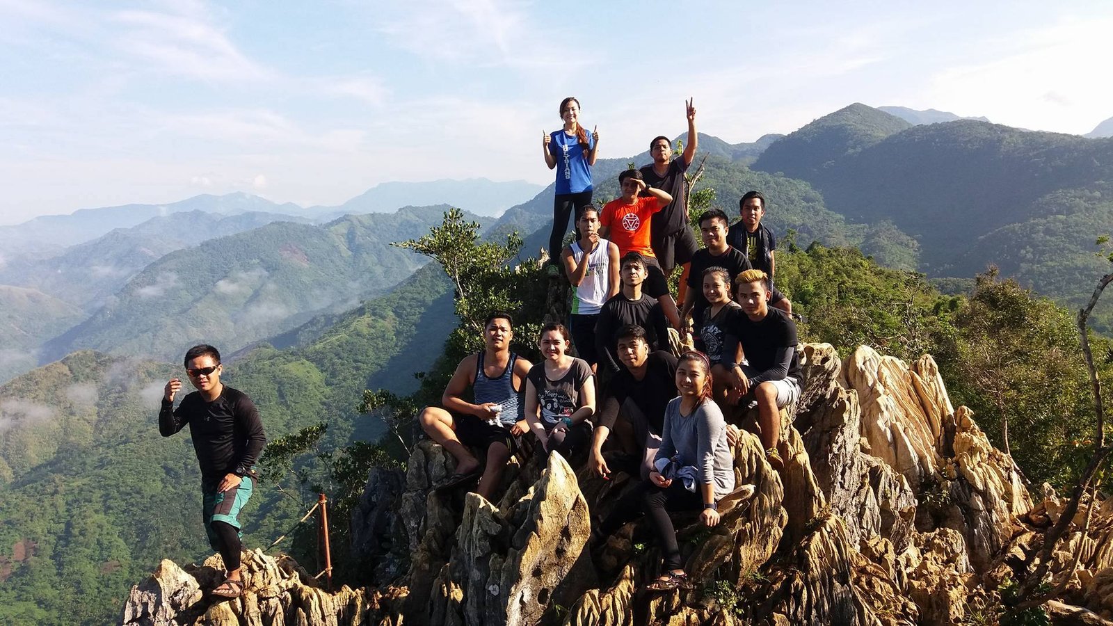
Best Time to Visit Mt Daraitan
Choosing the best time to hike Mount Daraitan is crucial for an enjoyable and safe trekking experience. The weather conditions play a significant role in determining the difficulty of the hike, the quality of views at the Mt Daraitan summit, and the overall hiking experience.
Dry Season (November to May) – Best Time to Hike Mt Daraitan
- Considered the ideal season for hiking.
- Trails are dry and stable, making the hike easier and safer.
- Higher chances of seeing Mount Daraitan sea of clouds at sunrise.
- Comfortable hiking conditions with minimal mud and slippery sections.
- Best months: December to February for cooler temperatures.
Rainy Season (June to October) – Higher Difficulty Level
- Trails become muddy and slippery, increasing the difficulty of the hike.
- Risk of flash floods in some areas, especially near Mt Daraitan Tinipak River.
- Heavy rain can obscure the summit view and make the trail challenging.
- Recommended only for experienced hikers who can handle steep and slippery terrain.
Ideal Time to Start the Mt Daraitan Hike
- Start between 4 AM and 6 AM to maximize your experience.
- Early morning hikes increase your chances of witnessing the sea of clouds.
- Cooler temperatures make the trek more comfortable, especially for beginners.
For the best hiking experience, plan your trip during the dry season, start early, and always check the Mt Daraitan weather forecast before heading out.
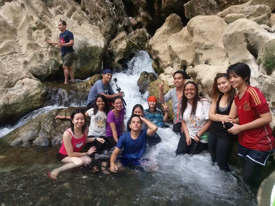
Mt Daraitan Day Hike Itinerary
A well-planned Mount Daraitan itinerary ensures a smooth and enjoyable hiking experience. Whether you are looking for a day hike adventure or an overnight camping experience, having a structured plan will help you manage your time, energy, and resources efficiently.
A day hike is perfect for adventurers who want to experience Mount Daraitan summit and Tinipak River in a single day. Below is a recommended Mt Daraitan day hike itinerary to help you plan your trip:
Sample Day Hike Itinerary
- 12:00 AM – Depart from Manila (bus or private vehicle).
- 3:00 AM – Arrive at Brgy. Daraitan, register, and pay the Mount Daraitan entrance fee.
- 4:00 AM – Start the Mt Daraitan hike.
- 7:00 AM – Reach Mt Daraitan summit, enjoy the Mt Daraitan sea of clouds and take photos.
- 10:00 AM – Start descent toward Tinipak River.
- 12:00 PM – Swim and explore the area.
- 2:00 PM – Return to the jump-off point.
- 4:00 PM – Depart back to Manila.
A Mt Daraitan day hike is ideal for beginners who prefer a challenging but manageable trek without camping overnight.
Mt Daraitan Overnight Hike Itinerary
For those who want to experience camping under the stars, an overnight hike is the best option. Staying overnight allows hikers to witness both the sunset and sunrise from the summit and enjoy a more relaxed trekking experience.
Sample Overnight Camping Itinerary
Day 1
- 10:00 AM – Depart from Manila.
- 1:00 PM – Arrive at Brgy. Daraitan, register, pay the Mt Daraitan entrance fee, and hire a guide.
- 2:00 PM – Start the Mt Daraitan hike.
- 5:00 PM – Arrive at Mt Daraitan summit, set up camp.
- 6:00 PM – Enjoy the sunset view from the summit.
- 7:00 PM – Dinner, bonfire, and stargazing.
Day 2
- 5:00 AM – Wake up early to catch the Mount Daraitan sea of clouds and sunrise.
- 6:30 AM – Start the descent.
- 8:30 AM – Arrive at Tinipak River for swimming and relaxation.
- 10:30 AM – Return to jump-off point.
- 12:00 PM – Depart for Manila.
A Mt Daraitan overnight hike is perfect for those who want to camp, stargaze, and take their time exploring the mountain and river.
Choosing Between a Day Hike and an Overnight Hike
| Hike Type | Best For | Duration | Activities |
|---|---|---|---|
| Day Hike | Hikers with limited time | 6 to 8 hours | Summit hike + Tinipak River |
| Overnight Hike | Adventure seekers | 2 days, 1 night | Summit hike, stargazing, Tinipak River |
If you only have a day, the Mt Daraitan day hike itinerary is the best option. If you want to fully immerse yourself in nature, the Mt Daraitan overnight hike is highly recommended.
Whether you are planning a day hike or an overnight adventure, Mt Daraitan offers a unique and rewarding experience. Now that you know the best time to hike Mt Daraitan and how to create the perfect Mt Daraitan itinerary, continue reading for a detailed guide on hiking difficulty, trail expectations, and essential gear to bring.

Mt Daraitan Difficulty Level: Is It a Challenging Hike?
Mount Daraitan is considered a moderate to difficult hike, with a difficulty rating of 4/9. While it is not the most strenuous hike in the Philippines, it does require endurance, balance, and proper preparation.
For first-time hikers, the trail may seem steep and tiring, but with the right pace and breaks, reaching the Mount Daraitan summit is a rewarding experience.
Hike Duration & Distance
- Average ascent time: 3-4 hours
- Descent time: 2-3 hours
- Total trek distance: Approximately 5.5 kilometers
The total hiking time varies depending on the hiker’s pace, weather conditions, and stopovers. Beginners may take a bit longer, while experienced hikers can summit faster.
What to Expect on the Mt Daraitan Hiking Trail
Trail Features & Terrain
The Mount Daraitan hiking trail consists of:
- Steep ascents – The first half of the hike is mostly uphill. Expect some rocky and uneven paths that require good leg strength.
- Limestone formations – The final approach to the Mt Daraitan summit view features sharp and jagged limestone rocks, making gloves and sturdy shoes highly recommended.
- Forest trails – The trail is covered with lush vegetation, providing shade but also making some sections muddy and slippery after rain.
- Bamboo railings & rope sections – Some parts of the Mt Daraitan hiking trail have bamboo handrails and ropes to assist hikers on steep portions.
Alternative Trail: Tinipak River Side Route
For hikers looking for a less demanding option, an alternative trail through Tinipak River is available. While this trail does not lead to the summit, it offers a scenic and more relaxing route to explore the famous Mt Daraitan Tinipak River.
This side trail is recommended for:
- Families with kids or elderly hikers who prefer an easier walk.
- Those who want to focus on swimming and cave exploration instead of a summit climb.
Whether choosing the main hiking trail to the summit or the alternative Tinipak River route, Mt Daraitan offers a unique and fulfilling outdoor experience for every kind of adventurer.

Things to Bring (Packing List) for Mt Daraitan
Packing the right gear is essential for a safe, comfortable, and enjoyable hike. Below is a complete checklist of what to bring to Mount Daraitan, whether for a day hike or an overnight camping trip.
Required Items
- Valid ID – Needed for registration at the Barangay Daraitan Hall.
- Cash – Bring enough cash for entrance fees, guide fees, and transportation, as ATMs and digital payments are unavailable in the area.
- Extra clothes – A fresh set of clothes for after the hike, especially if you plan to swim at Tinipak River.
Hiking Essentials
- Sturdy hiking shoes – The Mount Daraitan hiking trail has steep and rocky parts, making good grip necessary. Avoid slippers or sandals, as they can be dangerous on uneven terrain.
- Water (at least 2 liters) – Hydration is crucial, as the trail can be physically demanding. There are no water sources along the trail.
- Snacks or packed lunch – Energy bars, sandwiches, and trail mix are ideal for quick energy boosts during the climb.
- Hat and sunglasses – The summit is exposed to direct sunlight, so a cap or hat helps prevent heat exhaustion.
- Sunblock – Essential for sun protection, especially during midday hikes.
- Personal first-aid kit – Includes band-aids, antiseptic wipes, and medications for common hiking concerns like allergies or motion sickness.
- Lightweight raincoat or poncho – If hiking during the rainy season, carrying a raincoat will keep you dry.
Camping Gear (For Overnight Hikers)
If you plan to stay overnight, you will need extra gear to camp comfortably at the Mt Daraitan summit or Tinipak River camping grounds.
- Tent and sleeping bag – There are no rentals available, so hikers must bring their own camping gear.
- Headlamp or flashlight – Essential for navigating Mount Daraitan hiking trails at night.
- Portable stove and cooking equipment – If you prefer cooking at camp, bring lightweight camping cookware.
Additional Essentials
- Gloves – Helpful for gripping rocks on steep sections of the trail.
- Trekking pole – Useful for balance, especially on descents.
- Camera or smartphone – To capture the breathtaking Mt Daraitan summit view.
- Eco-bag for trash – Following the Leave No Trace (LNT) policy, hikers must bring their own trash bags to ensure the trail remains clean.
Proper preparation ensures that your Mt Daraitan hike is safe, enjoyable, and rewarding. Whether it’s your first time climbing Mount Daraitan or you are an experienced hiker, having the right gear and understanding the trail difficulty will make your adventure more comfortable and memorable.
Continue reading for more safety tips, side trips, and additional information to maximize your Mount Daraitan experience.
FAQs About Mt Daraitan
Before planning your hike, you may have a few questions about Mount Daraitan difficulty, hiking duration, and other requirements. Below are some of the most frequently asked questions to help you prepare for your adventure.
How tall is Mt Daraitan?
Mt. Daraitan height is 739 meters above sea level (MASL). It is not the tallest mountain in the Philippines, but its elevation is perfect for a challenging yet rewarding hike.
Is Mt Daraitan for beginners?
Yes, but beginners should expect a moderately challenging hike. The Mt. Daraitan hiking trail has steep ascents and rocky sections, which require stamina and balance. However, with proper pacing and rest breaks, first-time hikers can complete the trek.
If you are a beginner, here are some tips to make your hike easier:
- Train beforehand by doing short hikes or leg-strengthening exercises.
- Wear proper hiking shoes with good grip.
- Start early to avoid the heat and allow more time for rest stops.
- Bring enough water and snacks to keep your energy up.
How long does the hike take?
The Mt Daraitan hike hours depend on individual fitness levels and weather conditions. On average:
- Ascent: 3 to 4 hours
- Descent: 2 to 3 hours
Hikers who are physically fit may reach the Mt Daraitan summit in less than 3 hours, while beginners or those taking frequent breaks may need closer to 4 hours.
Do I need to book in advance?
No, advance booking is not required. However, early arrival is highly recommended, especially on weekends and holidays when Mt Daraitan Tanay Rizal gets crowded.
To avoid long waiting times:
- Arrive at Barangay Daraitan before sunrise (4:00 AM to 5:00 AM).
- Visit on a weekday if you prefer a quieter, less crowded experience.
- If you’re hiking in a large group, call the Barangay Daraitan office ahead of time to check on guide availability.
What are the Mt Daraitan requirements?
Before starting your Mt. Daraitan hike, you need to register at Barangay Daraitan and pay the necessary fees. The basic requirements are:
- Valid ID for registration
- Mt Daraitan registration fee (₱20 per person)
- Mt Daraitan entrance fee (₱100 per person)
- Guide fee (₱500 for a day hike, good for 5 people)
- Environmental fee to support conservation efforts
If you plan to stay overnight, you will also need to pay a camping fee (₱50 per person) and bring your own tent and sleeping gear.
Can I hike Mt Daraitan solo?
No, hiring a mount daraitan tour guide is mandatory, even for solo travelers. Guides are required for safety reasons and to help preserve the Mt Daraitan hiking trail.
Conclusion
Mount Daraitan is more than just a hiking destination—it is a nature retreat, an adventure challenge, and a place to reconnect with the beauty of the Philippines. Whether you are hiking for the first time or returning for another adventure, Mt. Daraitan Tanay Rizal offers a unique and rewarding experience.
Plan Your Mt Daraitan Hike Today
- Gather your hiking buddies and choose between a day hike or an overnight camping trip.
- Prepare your Mt Daraitan packing list and get ready for an unforgettable adventure.
- Share your Mt Daraitan experience in the comments and let others know about this incredible destination.
Now that you have all the information you need, it’s time to lace up your hiking boots, pack your gear, and explore one of Rizal’s most beautiful mountains. Happy hiking!
Tanay Tourism Information & Contact Details
For hikers planning a mount daraitan hike, it’s beneficial to have access to official Tanay tourism resources for accurate information on fees, trail conditions, weather updates, and safety guidelines. The Tanay Tourism Office and the Barangay Daraitan Office manage visitor registrations, hiking permits, and environmental conservation efforts in the area.
Tanay Tourism Office Details
- Office Name: Tanay Municipal Tourism Office
- Location: Second Floor, Tanay Municipal Hall, M. H. del Pilar St., Tanay, Rizal 1980
- Contact Numbers:
- Landline: (02) 8655-1773
- Mobile: 0998-988-1590
- Operating Hours: Monday to Friday, 8:00 AM – 5:00 PM
- Website: tanay.gov.ph
- Facebook Page: facebook.com/tanaytourism

Hi, thanks a lot for the tips here since they were helpful. Just to let you and the other readers know, the fees have already increased as follows (based on what I can remember from our day hike last 23 March 2025):
– Bridge crossing fee for vehicles (if the river is not swollen and thus no need to do bamboo raft crossing to reach the barangay hall for registration): ₱100 for four-wheeled vehicles; I think ₱80 for three-wheeled vehicles and ₱50 for 2-wheeled vehicles.
– Mt Daraitan entrance fee = Environmental fee to support conservation efforts = ₱100 per person
– Day Hike Guide Fee (for every 5 persons): ₱750
– Overnight Hike Guide Fee: ₱1500
– Parking fee for day hike visitors: ₱100
– Tinipak river entrance fee (when doing a traverse hike since that part of the trek is already located in the boundary of Quezon): ₱30; doing spelunking in the nearby cave: ₱70
– Tricycle fare from Barangay Hall to portion of river reserved for swimming for hikers (after hike): ₱30
Hi! Thanks so much for sharing these updated rates and your recent experience from your day hike on March 23, 2025! 😊 This information is super valuable and will definitely help future hikers plan their trip more accurately. It’s great to have firsthand insights from someone who recently visited Mt. Daraitan.
It seems like the fees have indeed increased a bit, especially for the guide services and parking. Good to know about the bridge crossing fee details, too. I’ll update the information accordingly to make sure everyone has the latest details.
Thanks again for sharing and happy hiking on your future adventures!
I’ll add to that.. the trike fare is 100/3 persons.. it was also a fun adventure but you really got to have great stamina and patience! Love your site btw!
Hi there, thanks for the informative post! Would you know if a guide/booking of some sort is needed for a trip to Tinipak River only? Trying to organize a trip to the river but not so sure where to start or who to contact (if any). Any help would be much appreciated! Thank you!