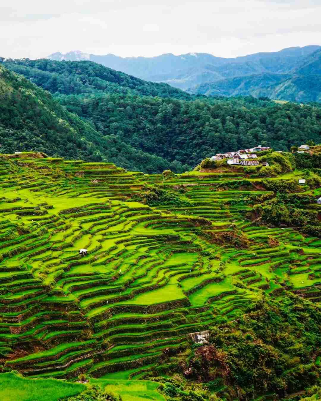
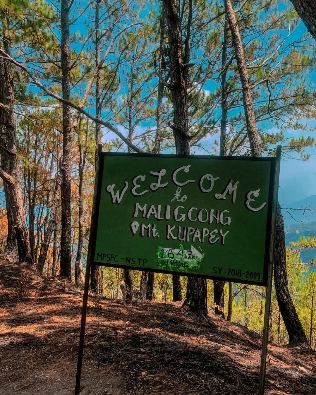
Mt. Kupapey stands at 1,647 MASL above the Maligcong Rice Terraces in Mountain Province. It is rated a minor hike at 3/9 difficulty. That makes it manageable for fit beginners willing to handle the logistics.
Mt. Fato, at 1,438 MASL in the same barangay, is shorter and usually done the same trip as the sunset companion to Kupapey’s sunrise climb. Together, Mt. Kupapey and Mt. Fato form the Cordillera’s most-searched combo hike, and both sit inside a working rice terrace landscape that changes completely depending on the month you arrive.
When I went back to Maligcong in September 2026, having covered 69 of the 82 provinces since 2015, I found three things had changed:
- The on-ground fees had moved.
- The jeepney schedule had shifted slightly.
- The trail into Kupapey was muddier than I remembered.
This guide reflects what is true now, not what was posted in older versions of this article.
The five facts a planner needs before reading further are below.
- Mt. Kupapey sits at 1,647 MASL; Mt. Fato sits at 1,438 MASL. Both are rated 3/9 difficulty and take 1.5 to 2.5 hours to summit from the Maligcong jump-off.
- A local guide is mandatory for both peaks. The Kupapey guide fee is ₱700 per group of up to five; the Fato guide fee is ₱500 per group of up to five.
- The environmental or registration fee is ₱50 to ₱60 per person, collected at the barangay.
- A realistic DIY budget for a 2D1N trip from Manila runs ₱3,140 to ₱4,430 per person, with the overnight bus to Bontoc as the biggest single cost (as of September 26, 2026).
- The best all-around months are May to July for green terraces. January to early March gives flooded mirror paddies. August to early September gives golden fields but carries typhoon-season risk for the Halsema Highway.
Table of Contents
Where exactly are Mt. Kupapey and Mt. Fato?
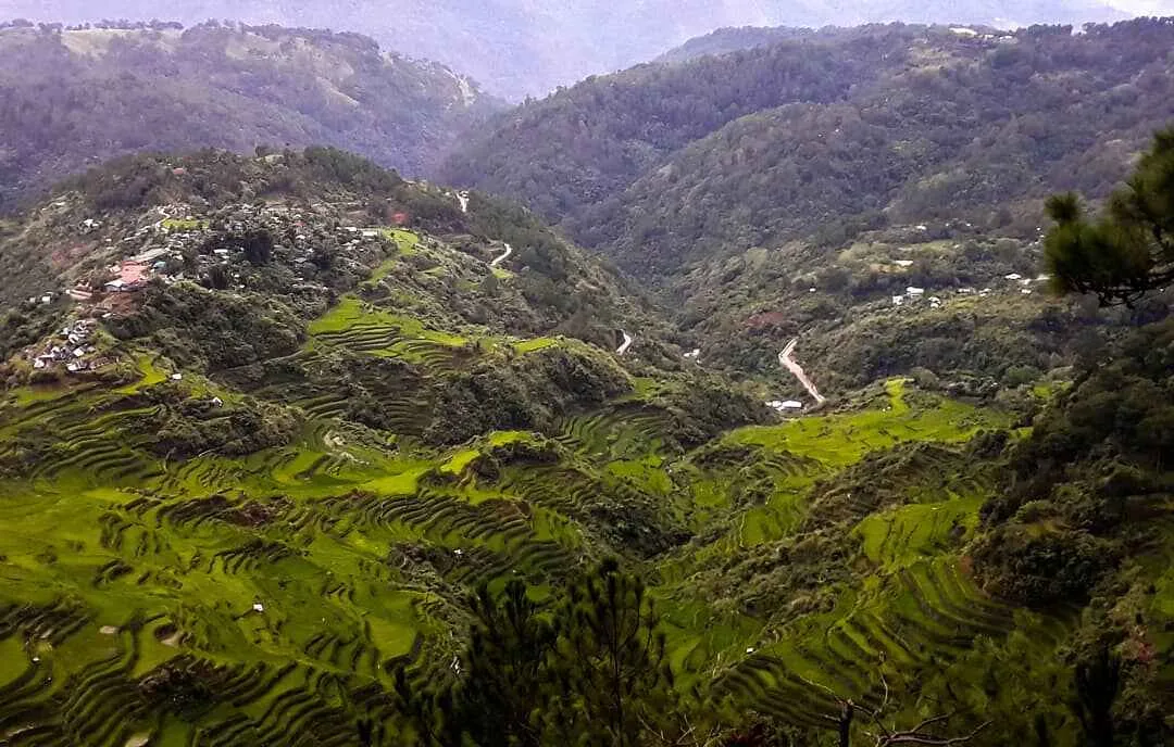
Mt. Kupapey and Mt. Fato are both located in Barangay Maligcong, within the municipality of Bontoc in Mountain Province, Cordillera Administrative Region. The barangay sits roughly 30 minutes by jeepney uphill from the Bontoc town center, at the end of a narrow mountain road above the Chico River valley.
The two peaks frame the Maligcong Rice Terraces from opposite sides. Kupapey is the higher summit to the northeast; Fato sits to the southwest.
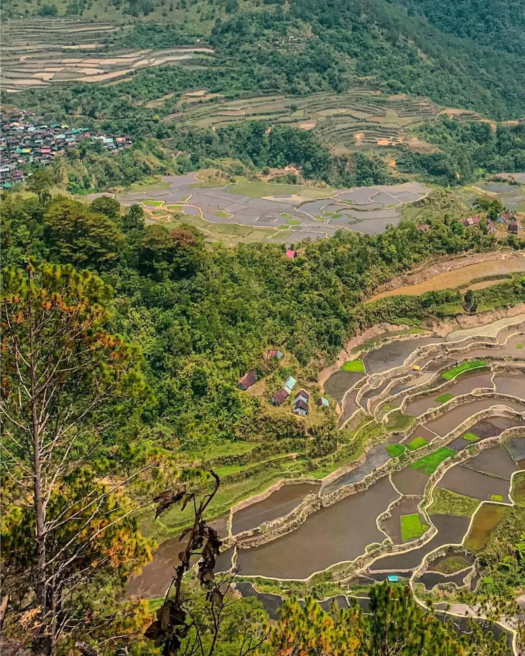
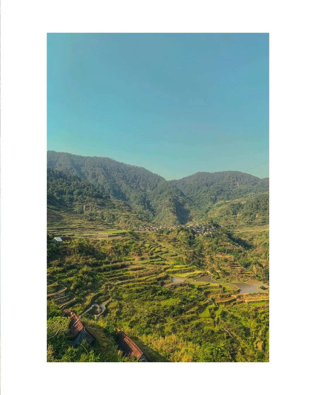
Because both overlook the same terrace system, the view is defined less by the summit itself. What matters most is what is below: thousands of hand-carved stone paddy walls worked by Bontoc families for generations.
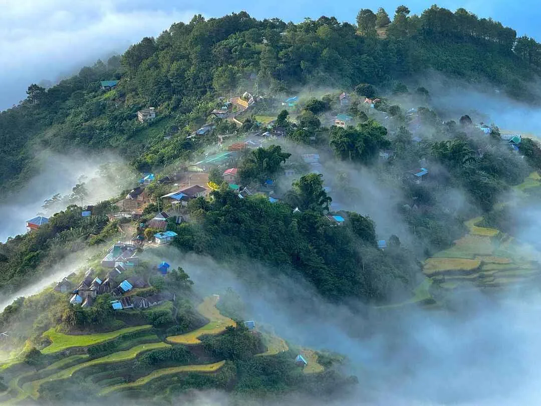
Maligcong is a small village with no ATM and no commercial restaurant. Everything, the guide arrangement, the homestay booking, the registration fee, runs through the barangay and its residents. That self-contained structure is exactly what makes the experience feel different from the more developed Cordillera hike destinations, but it also means you cannot improvise your way up there.
The coordinates most commonly cited for Mt. Kupapey are 16.9319° N, 121.0997° E. Mt. Fato sits to the southwest at roughly 16.9247° N, 121.0935° E. Both summits are accessible from the same homestay cluster in Sitio Favuyan.
How hard is the hike and what are the trail stats?
Both Mt. Kupapey and Mt. Fato are rated 3/9 difficulty, the Philippine hiking community’s standard classification for a minor climb. That rating is accurate for trail technicality, but it undersells how the experience actually feels for someone arriving on an overnight bus with three hours of sleep.
Mt. Kupapey is the harder of the two in practice.
The ascent takes 1.5 to 2.5 hours from the jump-off. It passes through three distinct sections:
- A section of the terraces.
- A shaded forest trail that becomes slick and steep when wet.
- Grassland near the summit.
Because the standard plan is a pre-dawn start timed for sunrise, you are doing the forest section in the dark. On my September 2026 visit, the forest segment after the terraces was noticeably muddier than on earlier trips.
It was worse than anything I have encountered on Mt. Ulap in similar conditions. Trekking poles and gaiters are not optional extras here.
Mt. Fato is shorter at 1 to 2 hours to the summit. The trail opens with a steep staircase, moves through a pine forest, and ends on a rocky viewpoint.
Fato is almost always done as the afternoon or sunset hike on day two, when the light is warmer and the body has already shaken off the early start. The trail surface is firmer than Kupapey’s forest section, though the opening staircase is unforgiving if your knees are already tired.
The trail stats for both peaks are below.
| Mt. Kupapey | Mt. Fato | |
|---|---|---|
| Elevation | 1,647 MASL | 1,438 MASL |
| Difficulty rating | 3/9 | 3/9 |
| Ascent time | 1.5 to 2.5 hours | 1 to 2 hours |
| Best timing | Pre-dawn for sunrise | Afternoon for sunset |
| Trail surface | Muddy forest and grassland | Staircase, pine forest, rocky summit |
The Fato-Kupapey traverse, which connects both summits in a single continuous route, runs 5 to 8 hours and is a different undertaking from doing the two separately on consecutive windows. The traverse is typically done Fato to Kupapey or in reverse, depending on which sunrise or sunset you want to catch first. Ask your guide which direction they recommend for the season, as trail conditions shift the answer.
Overnight camping on either summit is not permitted. Both mountains are done as up-and-back hikes from the homestay in Maligcong, with no campsites on the peaks themselves.
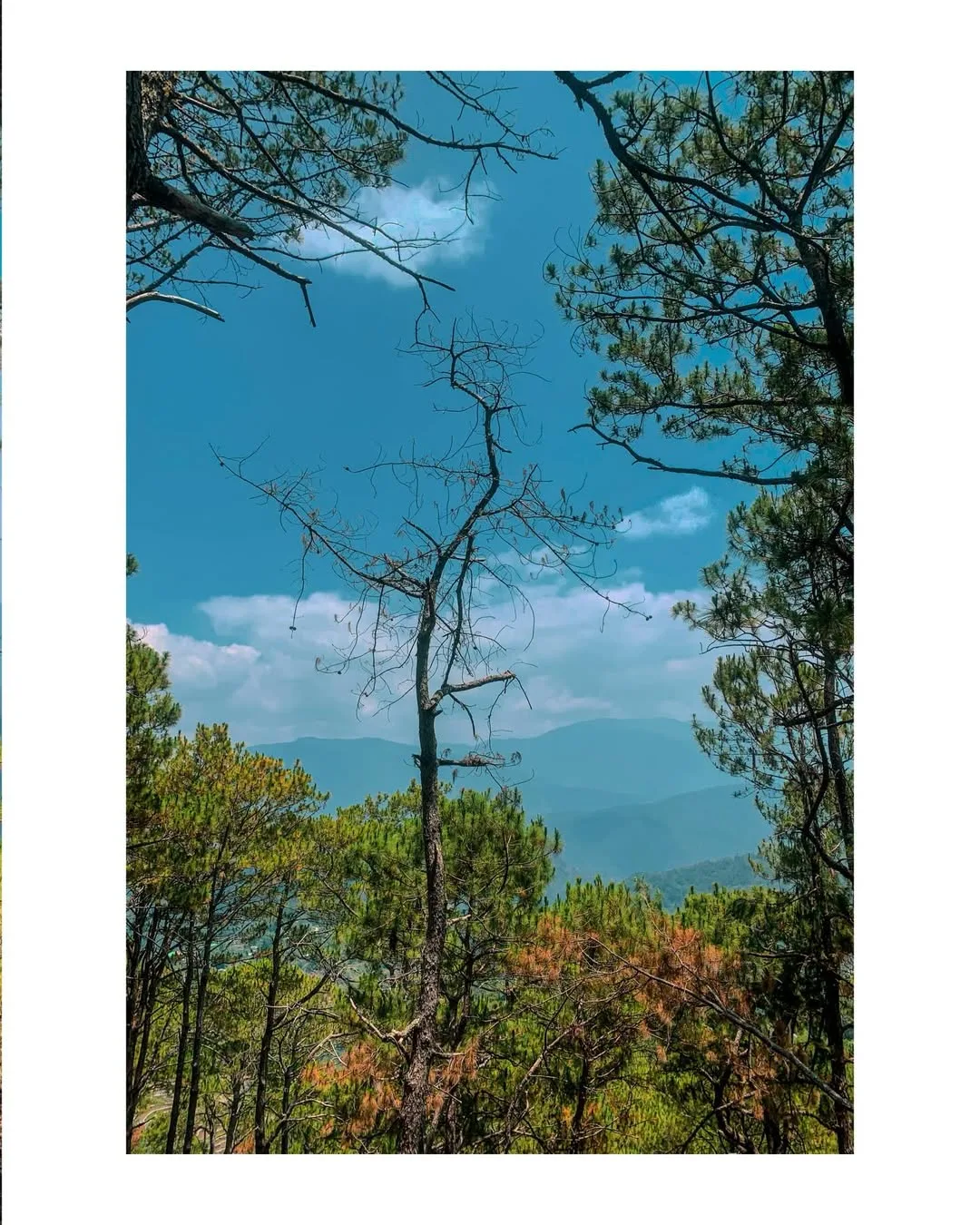
How to get to Maligcong from Manila and Baguio
Getting to Maligcong from Manila is a three-leg journey and the Bontoc-to-Maligcong jeepney is the most fragile part of it.
Leg 1: Manila to Bontoc by overnight bus. The only direct operator on this route is Coda Lines, departing from the HM Transport Terminal at the corner of Monte de Piedad and EDSA in Cubao, Quezon City.
Evening departures run at 8:00 PM, 9:00 PM, 9:30 PM, and 10:30 PM. Travel time is 10 to 12 hours, placing arrival in Bontoc between 7:00 AM and 9:00 AM.
Fares as of September 26, 2026 are tiered by bus class. Bus fares here track diesel prices, so when pump prices move, the rate at the terminal moves with them.
| Class | Seats | Restroom | Fare (one way) |
|---|---|---|---|
| Standard / Semi-Deluxe | 45 seats | No | ₱725 to ₱950 |
| Super Deluxe / VIP | 35 seats | Yes | ₱1,000 to ₱1,377 |
The 10-to-12-hour ride through the mountain passes is long enough that the VIP class is worth the difference. The standard bus has no onboard restroom and rest stops on the Halsema Highway are limited.
Return trips from Bontoc to Manila depart in the mid-to-late afternoon, typically 2:00 PM to 5:00 PM.
Leg 2: Bontoc to Maligcong by jeepney. The jeepney terminal is along Capitol Road, beside the Bontoc public market.
Tricycles from the bus drop-off to the terminal cost ₱15 to ₱20. The jeepney schedule below is what controls the entire trip.
| Route | Morning | Afternoon / Evening |
|---|---|---|
| Bontoc to Maligcong | 8:00 AM, 12:00 PM | 2:00 PM, 4:30 PM, 5:30 PM |
| Maligcong to Bontoc | 6:30 AM, 8:00 AM, 9:00 AM | 2:00 PM, 4:00 PM |
The fare is ₱20 to ₱35 per person and travel time is roughly 30 minutes up a steep, narrow mountain road. Toploading on the jeepney roof is common and gives unobstructed views over the Chico River valley on the way up.
Missing the 5:30 PM last trip means either staying overnight in Bontoc or chartering a private jeepney for roughly ₱700. That one miss wipes out whatever you saved by going DIY, so I treat the Bontoc arrival time as the most important decision of the whole trip.
If your bus lands in Bontoc at 8:30 AM, you have options. If something on the highway delays you past the afternoon, you have a problem.
The Halsema Highway, the primary artery between Baguio and Bontoc, is vulnerable to landslides during the rainy season and typhoon events. The DPWH and the Mountain Province DRRM Office issue road advisories when conditions deteriorate, particularly around kilometer markers 48 and 49 in Atok. Monitor the Mountain Province DRRM Office and the Philippine Information Agency before leaving Manila during June through September.
Coming from Baguio. Travelers connecting from Baguio can take a bus or van to Bontoc directly, bypassing the Manila overnight entirely.
The Baguio-to-Bontoc leg takes roughly 4 to 5 hours via the Halsema Highway. From Bontoc, the jeepney connection to Maligcong is the same regardless of where you started.
Registration, permits, guide fees, and on-ground costs
The registration fee, guide requirement, and payment structure in Maligcong are set by the barangay and the Bontoc LGU, not by individual homestays.
Guide fees are flat per group, not per person.
| Activity | Guide Fee | Group Size |
|---|---|---|
| Mt. Kupapey | ₱700 | Up to 5 persons |
| Mt. Fato | ₱500 | Up to 5 persons |
| Maligcong Terraces Traverse | ₱500 | Up to 5 persons |
| Barangay Mainit Traverse (one-way) | ₱800 to ₱1,000 | Up to 5 persons |
Groups larger than five pay an additional ₱100 per extra person. A solo traveler pays the full flat rate, so per-person cost drops significantly with two or three people.
There is no ATM in Maligcong. Landbank, DBP, and PNB all have branches in Bontoc town center. Withdraw everything before boarding the jeepney, including ₱700 contingency for a private trip.
Homestays are community-standardized at ₱350 to ₱500 per person per night.
The main options in Sitio Favuyan are:
- Suzette’s Homestay (terrace-view balconies, locally sourced Arabica coffee)
- Mavy’s Maligcong Homestay (Starlink for remote workers)
- Chen’s Sacya-An Home (closest to the trail jump-offs)
Vilma’s Homestay, Rowena’s Terraces View Guest Haus, and Dong-Elay’s Homestay also operate. The barangay’s pasa system routes you to a neighbor if your first choice is full.
Meals through your homestay run ₱100 to ₱150 per meal; kitchen use with your own food costs about ₱50. There are no restaurants, so arrange meals before arriving. The carinderias near the Bontoc public market are a good place to fuel up: nilagang baboy ₱60, pancit guisado ₱30, chicken curry ₱60 to ₱65.
The village enforces a 9:00 PM lights-out curfew, which makes the Kupapey sunrise schedule workable:
- Dinner finishes early.
- You sleep by 9:00 PM.
- The guide wakes you at 3:00 or 4:00 AM.
| Expense | Estimated Cost per Person |
|---|---|
| Manila-Bontoc bus, round trip (VIP class) | ₱2,000 to ₱2,754 |
| Bontoc-Maligcong jeepney, round trip | ₱40 to ₱70 |
| Homestay, 1 night | ₱350 to ₱500 |
| Meals (3 homestay meals plus trail snacks) | ₱400 to ₱600 |
| Environmental fee | ₱50 to ₱60 |
| Shared guide fees, Fato plus Kupapey | ₱300 to ₱500 |
| Estimated total | ₱3,140 to ₱4,484 |
The previous version of this article listed a budget floor under ₱2,100, reflecting pre-2023 bus fares. The 2026 VIP round-trip alone runs ₱2,000 to ₱2,754, so that floor is no longer usable. On-ground village costs remain affordable; the bus is where the budget is really going.
For Cordillera hikes easier to reach from Baguio, day hike options from Benguet like Mt. Yangbew give a useful comparison for what a shorter mountain trip in the same region costs and demands.
What do the trails and campsites actually look like?
Mt. Kupapey and Mt. Fato have no campsites on their summits. Overnight stays are in the village homestays, and both peaks are done as up-and-back hikes from Maligcong. If you arrived expecting to pitch a tent on the ridge, that option does not exist here.
The early section is the most visually striking part of the entire hike:
- You are walking alongside active paddy walls in the dark.
- The smell of wet earth and pine comes in from above.
After the terrace section, the trail enters a shaded forest corridor that is consistently the muddiest and steepest stretch. This is where first-timers are surprised. The rating of 3/9 suggests an easy walk.
But the forest section on a wet morning is closer to a scramble than a stroll. The combination of mud and darkness makes trekking poles essential, not just optional.
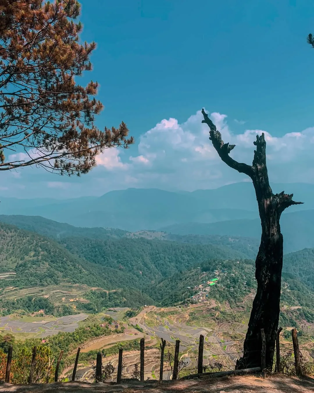
After the forest, the trail opens into grassland and the gradient eases before the final push to the summit. At the top, the view looks back over the entire terrace system with the valley floor below.
When conditions align, the sea of clouds fills the valley and the terraces appear to float above it. That image is what drives most of the photography associated with Mt. Kupapey, and it is not guaranteed on any given morning.
The Fato trail starts with a steep staircase that climbs hard right from the jump-off, transitions into pine forest, and ends on a rocky open summit. The surface is firmer and less muddy than Kupapey’s forest section, which makes the afternoon timing feel appropriate.
The rocky summit on Fato gives a different angle over the terraces than Kupapey does, lower and slightly more intimate. Both summits have a viewpoint, but they do not look identical.
Water sources in the village itself are available, but the Municipal Health Office advises boiling all tap and spring water before drinking. Carry enough treated or bottled water for the ascent and descent, since there are no reliable water points on either trail above the village. For Kupapey, that means filling bottles the night before and packing them for the pre-dawn start.
Cell signal in Maligcong is patchy. Some homestays, particularly Mavy’s, have Starlink.
On the trails, do not count on signal. Pre-download your offline maps before leaving Bontoc, and save the emergency numbers listed in your homestay registration materials before you head up.
For comparison to another Cordillera destination worth benchmarking against, the full guide to mountains across the Philippines covers what trail classifications actually mean in practice across different regions and difficulty bands. Hikers who also enjoy waterfall approaches will find the DIY trail guide to Mt. Kalisungan and Bunga Falls in Laguna useful for planning a contrast trip that pairs a minor climb with a natural pool reward.
Best months to hike and when to see the terraces
The best month to hike Mt. Kupapey depends entirely on what you want the terraces to look like, because the paddies change completely across the agricultural cycle.
Water-filled terraces reflect the sky and surrounding ridgeline in tiered layers, producing the most dramatic and unusual photographs. Temperatures drop to 13°C at night, making the layering requirement more serious than any other month.
May to July: the green phase. By May, rice saplings cover the entire mountainside in dense green. This is the most visually consistent phase and the one most online images were taken during.
July records the highest monthly rainfall, averaging over 484 mm, leaving trails at their muddiest. The views are exceptional but waterproof layers and gaiters are necessary.
August to early September: the golden phase. Fields transition to golden-yellow before harvest, giving spectacular color contrast for photography. August sits at the peak of the southwest monsoon and typhoon season, when the Halsema Highway is most vulnerable.
I was in Maligcong in September 2026, at the tail end of this window, and the highway had already seen several one-lane restrictions earlier that month. The golden phase rewards patience and flexibility but is the worst window for a fixed return ticket.
October to December is the off-season: fields are bare after harvest and the village is at its quietest.
| Phase | Months | What You See | Key Risk |
|---|---|---|---|
| Mirror | Jan to early Mar | Flooded, reflective paddies | 13°C nights, cold pre-dawn starts |
| Green | May to July | Dense green rice saplings | Heavy rain, muddy trails, 484mm+ in July |
| Golden | Aug to early Sep | Yellow-gold mature rice fields | Typhoon season, highway closures |
| Off-season | Oct to Dec | Bare fields after harvest | Least scenic; quieter village |
The clearest single recommendation: May to June for the green phase with manageable rain, or January to February for the mirror phase with serious cold. July and August are for experienced hikers with flexible itineraries.
Sample 2D1N itinerary and what to pack
Day 1
Take an evening bus from Cubao at 8:00 PM, 9:00 PM, or 9:30 PM. Arrive in Bontoc between 7:00 AM and 9:00 AM. Eat breakfast at a carinderia near the public market, withdraw all cash you need for the full trip, and head to the jeepney terminal on Capitol Road.
Take the 12:00 PM or 2:00 PM jeepney to Maligcong. Arrive in Sitio Favuyan, check into your homestay, register at the barangay and pay the environmental fee. Arrange your guides for both mountains.
Rest before the 3:00 PM to 4:00 PM Mt. Fato afternoon hike. The sunset from Fato’s rocky summit looking back over the terraces is a different quality of light than the sunrise, cooler and lower-contrast but equally worth the climb.
Descend and be back in the village well before the 9:00 PM curfew. Dinner at the homestay.
Day 2
Wake at 3:00 AM to 3:30 AM. The guide will knock. Dress in full layers because the pre-dawn air in Maligcong is cold and the forest section holds the chill even longer.
Begin the Kupapey ascent by 4:00 AM to reach the summit before sunrise, typically around 5:30 AM to 6:00 AM depending on your pace. Descend, return to the homestay for breakfast, pack up, and catch a morning jeepney back to Bontoc: the 8:00 AM or 9:00 AM departure from Maligcong.
For another Cordillera minor climb with a similar pre-dawn timing structure but a shorter travel chain from Baguio, Mt. Ulap in Itogon, Benguet is worth reading before you decide which trip to book first. Itogon also has a less-known attraction worth pairing with it: the Mt. Camisong Forest Park and Event venue in Itogon, Benguet is a useful add-on for anyone building a multi-stop Benguet itinerary.
Day hike option. A same-day Mt. Kupapey hike from Manila is possible only if you are already based in Bontoc or Sagada. From Manila, the transit time makes an overnight in Maligcong mandatory for anything resembling a sensible schedule.
What to pack. The Kupapey pre-dawn start in cold months demands thermal layering that many lowland hikers underestimate. The gear list below covers both peaks across all seasons.
- Moisture-wicking base layer
- Insulating mid-layer (fleece or down) for pre-dawn cold, especially January to March
- Waterproof or water-resistant shell jacket
- Trekking pants, not shorts, for the muddy forest section
- Trekking poles (Kupapey forest section is steep and slippery when wet)
- Gaiters for the muddy months (May to July especially)
- Headlamp with spare batteries (the Kupapey pre-dawn start makes this essential, not optional)
- Enough treated water for the full ascent and descent, filled the night before
- Trail snacks and a light meal for the summit
- Cash for all fees and contingencies, withdrawn in Bontoc before the jeepney
Leave anything heavy or unnecessary in your bag at the homestay. Both trails are up-and-back and there is no need to carry camping gear.
Frequently Asked Questions
Is Mt. Kupapey beginner-friendly as a DIY trip?
Mt. Kupapey is manageable for fit beginners on the trail itself. The challenge is logistics: the overnight bus, the tight jeepney schedule in Bontoc, and the pre-dawn start all require planning a first-timer can miss. Budget a buffer day in case you arrive too late for the last jeepney, and treat the Bontoc-to-Maligcong connection as the most important timing decision of the trip.
Is there a daily quota for Mt. Kupapey?
The barangay registration system manages visitor flow, but a strict published daily headcount quota is not fixed the way Mt. Pulag’s NIPAS quota is. Contact the Maligcong barangay hall or your intended homestay directly to confirm current rules, particularly during peak months.
Is Mt. Fato a completely separate hike from Mt. Kupapey?
Mt. Fato and Mt. Kupapey are separate summits with separate guide fees and trail approaches. Most visitors do Fato in the afternoon and Kupapey pre-dawn the next morning. The Fato-Kupapey traverse connects both in a single continuous route of 5 to 8 hours, which is a different undertaking from the standard back-to-back approach.
Can I do the Fato-Kupapey traverse in one day?
Yes, the traverse connects both summits in a single route done in one day. Ask your guide to confirm the current preferred direction, since muddy conditions on one approach can make that direction significantly harder.
What does the heirloom rice farming have to do with a hiking trip?
The terraces are active farming land, not a heritage park. The paddies grow indigenous heirloom varieties including tinawon and unoy, which take five to seven months to mature and are harvested only once a year.
That cycle creates the three visual phases: flooded mirrors, green fields, and golden crops. Walking through active paddies without a guide risks damaging crops representing an entire year’s income, which is partly why the guide rule exists.
Is Maligcong safe for solo hikers?
Maligcong is a small, close-knit village where homestay operators know every guest. Solo hiking without a guide is not recommended: the trail is unmarked in the dark and the guide requirement is enforced. Solo travelers pay the full flat-rate fee, making per-person cost higher than for a group, but the village is safe and welcoming for those who follow community rules.
Does the Halsema Highway close, and what happens to my trip if it does?
The Halsema Highway closes after heavy rain and during typhoons. Closures can last hours or days. This can cut both the Manila and Baguio routes.
The DPWH and Mountain Province DRRM Office post updates on closures. Travel June through September with a flexible return date and do not book a fixed return bus for the day immediately after your hike. The August golden-phase window carries the highest closure risk.
Is Mt. Kupapey worth the trip from Manila?
Mt. Kupapey is worth the trip if you treat it as a cultural destination that happens to involve a hike, not as a mountain that happens to have terraces nearby.
The climb itself is not the hard part. At 3/9, the trail is achievable for anyone who hikes occasionally and is comfortable with an early start. What the trip asks of you is patience with logistics: a ten-to-twelve hour overnight bus, a narrow jeepney window in Bontoc, a cash-only village, and a 3:00 AM wake-up.
If those details feel manageable, the reward is a sunrise over a working rice terrace system. Bontoc families have farmed it for generations using methods that predate the highway connecting them to the rest of the country.
The terraces are not a backdrop. The families still farming heirloom varieties like tinawon face real economic pressure to abandon or convert their paddies.
Guide fees, registration fees, and homestay payments are part of what keeps the system intact. That context changes how the view from the summit reads, and it is worth knowing before you go.
Who should skip this trip:
- Anyone with less than two full days.
- Anyone not comfortable with unpredictable mountain road conditions during the rainy season.
- Anyone expecting to improvise the logistics on arrival.
Maligcong rewards preparation and punishes assumptions.
For a quicker fix when you have only a weekend and want something closer to Manila, the Mt. Sembrano hike difficulty, trail, and itinerary breakdown is a useful read before you decide which trip to book first.
Mt. Kupapey is one of the few hikes in the Philippines where what you see at the summit is inseparable from what the community below is doing to keep it that way. That is what makes it worth the effort, and what makes showing up on time, paying the guide fee, and following the 9:00 PM curfew feel like more than just following the rules.