Mt. Tapulao Quick Facts for the 2026 Season:
Elevation: 2,037 MASL (Highest in Zambales).
Difficulty: 5/9 (Major Climb). Not technical, but physically grueling due to distance (36km back-and-forth).
Jump-off Point: Sitio Dampay, Brgy. Dampay-Salaza, Palauig, Zambales.
Budget (DIY): Approx. ₱2,800 – ₱3,500 per person.
Best Time: November to February (Coolest months).
Key Feature: A unique transition from tropical heat to a Cordillera-like Pine Forest.
Introduction: The “Endless” Stony Road
Mt. Tapulao is defined by a singular, sensory experience: the relentless crunch of loose stones under your boots for 18 kilometers.
It starts as a rhythmic annoyance and evolves into a mental battle. Unlike the organic root systems of Mt. Makiling or the soft grassland slopes of Mt. Pulag, Tapulao offers a geological anomaly. This isn’t just a hiking trail; it is a repurposed Chromite Mining Road carved into the side of the Zambales Mountain Range.
For years, this mountain has been dubbed the “Poor Man’s Pulag” due to its mossy pine forests that mimic Benguet’s scenery without the long travel time to Baguio. However, that nickname is deceptive. With an elevation gain of nearly 1,800 meters starting from sea level, it is physically more demanding than Pulag’s Ambangeg trail.
This 2026 guide for Mt. Tapulao, moves beyond generic travel advice. We dissect the “High Peak” logistics, the updated fee structures, and the critical “Footwear Doctrine”—because on the Chromite Road, your choice of shoes determines whether you finish with a summit photo or a busted sole.
Table of Contents
Essential Pre-Climb Requirements for Mt. Tapulao
As of the 2026 season, there is no strict online reservation system required for Mt. Tapulao, but “walk-ins” must still follow local safety protocols.
While you do not need to fight for limited slots months in advance like the Mt. Pulag website system, the Municipal Tourism Office of Palauig highly recommends coordinating your climb at least 3-5 days prior. This is not merely for bureaucratic red tape; it is a critical safety check. The Zambales Mountain Range occasionally undergoes military operations or “insurgency alerts,” and local officials will deny entry if the area is deemed “hot.”
Contact Information & Registration
To secure your clearance, send a text message (SMS is more reliable than Messenger in this province) to the designated officials. You will need to submit a manifesto listing all team members.
Tourism Officer: Ms. Eliza Badar (Check the Palauig Tourism Facebook page for the latest active mobile number).
Barangay Point Person: Kagawad Alfonso Dalit (Dampay-Salaza LGU).
Insider Tip: Do not rely solely on Facebook Messenger. The signal in Barangay Dampay-Salaza is intermittent. A direct SMS ensures your coordination is logged in the barangay blotter before you arrive.
The Medical Policy Shift
Historically, medical certificates were optional. For 2026, while a “Fit to Climb” certificate is not strictly mandatory for all, it is strongly advised for hikers over 40 or those with history of hypertension.
The Reality Check: The danger on Tapulao isn’t Acute Mountain Sickness (AMS) like in the Cordilleras; it is Heat Stroke. The jump-off point sits at near-sea level, and the first 6 kilometers can hit heat indices of 40°C+ by mid-morning. The local health workers at the registration hall reserve the right to perform a blood pressure check and refuse entry if your reading is dangerously high (e.g., 150/100) due to travel fatigue or caffeine.
How to Get to Mt. Tapulao from Manila (DIY & Private)
The most efficient public transport route is taking a Victory Liner bus bound for Iba or Santa Cruz, which takes approximately 5-6 hours.
Travelers have two primary drop-off points: the main Iba Bus Terminal (for comfort and supplies) or the Salaza Junction (for speed). From either point, the final leg is a 30-45 minute tricycle ride inland to the jump-off point at Sitio Dampay.
Option A: Public Transport (The Commuter’s Guide)
Step 1: The Victory Liner Connection
Head to the Victory Liner terminals in Cubao (Quezon City), Pasay, or Caloocan. The buses plying the Olongapo-Iba-Santa Cruz route run hourly, 24/7.
Insider Tip: If available, book the “First Class” or “Deluxe” bus. The onboard restroom saves you from waiting for 20-minute stopovers in Olongapo or San Fernando, effectively shaving 45 minutes off your total travel time.
Step 2: The Drop-off Decision
Your choice of drop-off dictates your morning logistics. This is a strategic decision based on your group’s preparedness.
| Drop-off Point | Pros | Cons | Best For |
| Iba Terminal | Access to 24/7 fast food (Jollibee/McDo), 7-Eleven, and public markets for fresh meat/vegetables. | Requires backtracking slightly; longer tricycle ride (45-60 mins). | Groups who need to buy heavy supplies or want a proper sit-down breakfast. |
| Salaza Junction | Closest to the mountain; shorter tricycle ride (30 mins). | Pitch black at 3:00 AM; no stores open; desolate and can feel unsafe for solo hikers. | Hikers who are fully packed, self-sufficient, and prioritizing speed. |
Step 3: The Tricycle Ride (The Last Mile)
From the highway, you must hire a tricycle to Barangay Dampay-Salaza. Be prepared for a bone-rattling ride; the road is a mix of concrete and rough gravel.
From Iba Terminal: Expect to pay ₱450 – ₱500 per tricycle (Special Trip). Capacity is usually 3 hikers with full packs.
From Salaza Junction: The rate is cheaper, typically ₱250 – ₱300 per tricycle.
Option B: Private Vehicle (Waze/Google Maps)
Route Navigation
Enter the North Luzon Expressway (NLEX) and connect to SCTEX. Take the road toward the Subic-Tipo Expressway (SFEX). Once you exit Subic, follow the Zambales National Highway north. You will pass through the towns of Castillejos, San Narciso, and Botolan before reaching Palauig.
Look for the signage for “Mt. Tapulao” or “Barangay Dampay-Salaza” on the right side of the highway.
Parking & Security
Secure parking is available at the Barangay Hall / Eco-Center compound.
Parking Fee: ₱50 – ₱100 per vehicle (overnight). The area is guarded, making it safe to leave non-hiking essentials in the car.
The “Sedan vs. SUV” Reality Check
While the road to the jump-off has seen improvements, High Clearance Vehicles (SUVs, Pickups, Vans) are strongly preferred.
Can a sedan make it? Yes, skilled drivers can bring a Vios or Mirage, but you must drive slowly to navigate deep ruts on the unpaved sections. If it has rained recently, the mud can be unforgiving for low-chassis cars.
Practical Takeaway: If you are a solo traveler, the bus to Salaza Junction is the cheapest option, provided you arrive after sunrise. For groups of 4 or more, a private vehicle is not only faster but often cheaper per head when factoring in tricycle costs.
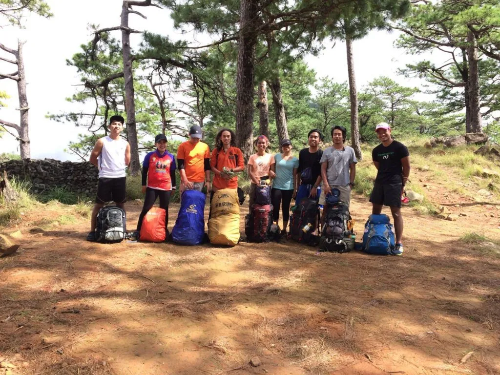
Mt. Tapulao Trail: A 4-Stage “Sufferfest”
The trail to Mt. Tapulao is an 18-kilometer endurance test (one way) divided into four distinct ecological zones, notorious for being 85% repurposed mining road and only 15% traditional forest path.
To underestimate the “Chromite Road” is the most common mistake first-timers make. It is not technical in the sense of rope segments or rock scrambling found in Mt. Guiting-Guiting; rather, it is a test of repetitive impact. You are essentially walking a marathon distance (36km roundtrip) on a surface that shifts from compacted gravel to unstable boulders, forcing your stabilizer muscles to work overtime.
Km 0-6: The Heat Gauntlet (Grassland)
This initial segment is the most physically draining due to extreme solar exposure, with temperatures often exceeding 35°C by mid-morning.
The trek begins on a wide, open fire road flanked by towering Talahib (wild sugarcane) and Cogon grass. There is zero canopy cover here. The compacted white dirt reflects sunlight, creating a “convection oven” effect that dehydrates hikers rapidly.
The Sensory Experience: The heat feels heavy, almost oppressive. Dust kicks up with every step, coating your legs and gear.
The Insider Tip: Start trekking no later than 5:30 AM. Beating the sun to the 6km mark is the single best strategy to conserve energy for the upper slopes.
Gear Hack: ditch the cap and use a trekking umbrella (silver-coated). It lowers your personal ambient temperature by roughly 5-7 degrees.
! Alt Text: Hikers using silver trekking umbrellas to shield against the intense sun on the open grassland trail of Mt Tapulao.
Km 6-12: The Chromite Grind
From the 6km mark, the incline steepens and the road surface deteriorates into loose, fist-sized rocks that define the “Tapulao Sufferfest.”
This is where the “mental game” begins. The scenery remains largely monotonous—secondary growth forest offering sparse shade—while the ground demands constant attention. The rocks here range from golf-ball to bowling-ball size, prone to rolling underfoot. This instability causes “micro-slips,” leading to calf fatigue and potential ankle sprains if you aren’t wearing high-cut boots.
Vital Water Source: At Km 10, you will find a reliable spring piped to the side of the road. This is the “Last Water” before the campsite for many months of the year. Refill everything here. Even if you think you have enough, top up.
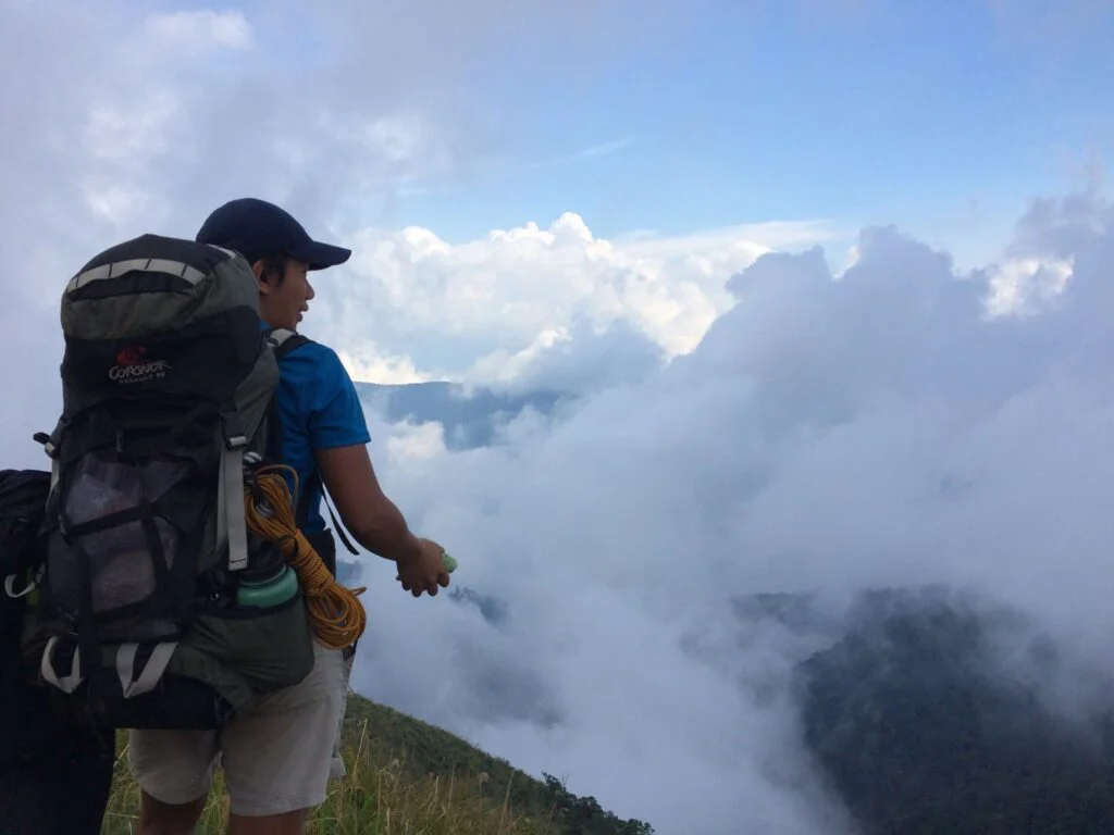
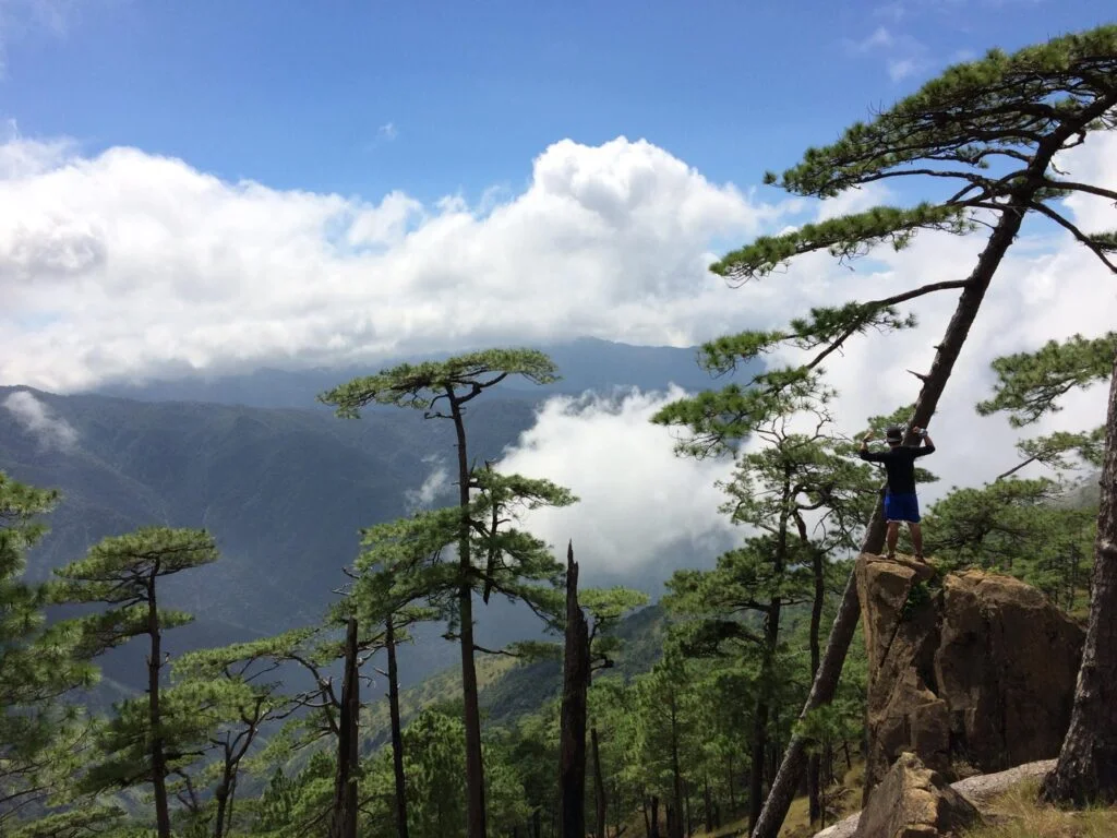
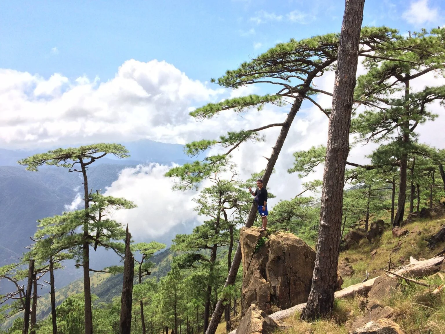
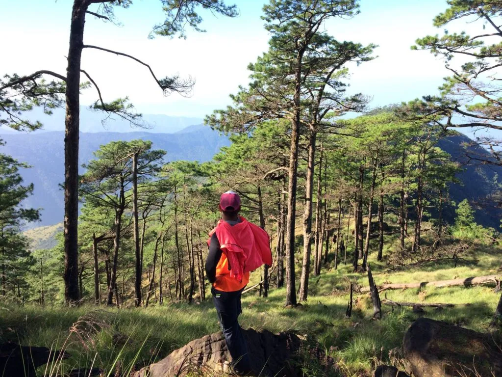
Km 12-16: The Pine Transition
At approximately 1,400 MASL, the humidity breaks abruptly, replaced by the cool air and vanilla-scented breeze of the Sumatran Pine forest.
Entering this zone feels like stepping into a portal to Benguet. The flora shifts to purely Sumatran Pine (Pinus merkusii), a species distinct to Zambales and Mindoro. The trail remains rocky, but layers of dropped pine needles provide a softer cushion, offering relief to battered soles.
The “Baguio” Vibe: The temperature drops to a comfortable 18°C-20°C during the day. Fog often rolls in during the afternoon, creating a moody, cinematic atmosphere perfect for photography.
The Campsite: You will eventually reach “The Bunker” at Km 16. This area serves as the main base camp. Note that the ground is hard-packed earth; a sleeping pad with a high R-value is non-negotiable for warmth and comfort.
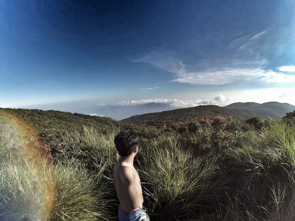
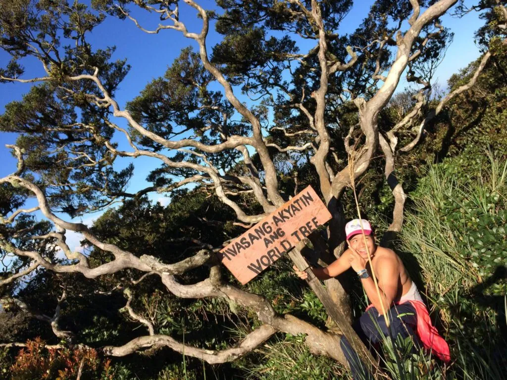
Km 16-18: The Mossy Forest Summit
The final 2 kilometers abandon the mining road entirely, narrowing into a traditional single-track trail through a dense, wet mossy forest.
This is the only “organic” part of the climb. The trees become stunted and gnarled, draped in hanging moss and epiphytes. The path can be slippery and muddy, especially after rain.
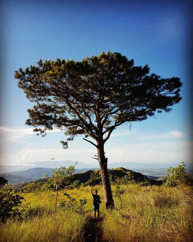
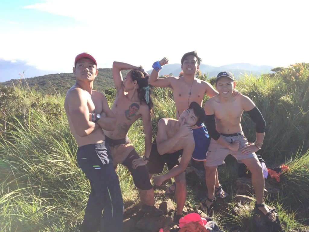
The Summit: The peak itself (2,037 MASL) is marked by the iconic “World Tree,” a solitary pine that has survived countless typhoons. On a clear day, the reward is a 360-degree view: the jagged coastline of the West Philippine Sea to the west and the vast central plains of Tarlac to the east.
Practical Takeaway: Pace yourself. The challenge of Tapulao isn’t the steepness—it’s the relentless distance. Treat the first 12km as a march, not a race.
Mt. Tapulao Itinerary (2 Days 1 Night)
The standard and most recommended itinerary departs Manila at 10:00 PM on Day 0 to ensure hikers are on the trail by 6:00 AM, effectively avoiding the punishing midday heat on the lower slopes.
This “Alpine Start” strategy is non-negotiable for comfort. Starting late means hiking the exposed grassland section when the sun is at its zenith, which significantly increases the risk of heat exhaustion.
Day 0: The Approach
22:00: Departure from Cubao or Pasay via Victory Liner.
The Vibe Check: The bus AC is notoriously cold. Bring a thick jacket or blanket for the ride, even if it’s sweltering outside.
Day 1: The Long Ascent
04:00: Arrival in Iba, Zambales. This is your last chance for civilization. Buy a heavy breakfast and pack lunch (Jollibee or 7-Eleven).
05:00: Tricycle ride to Sitio Dampay. Register at the Barangay Hall, secure your guide, and conduct final gear checks.
06:00: Start Trek. The goal is to reach the forest line before noon.
08:00: Arrival at Km 6. Take a quick 10-minute hydration break.
10:30: Early Lunch at Km 10 Water Source.
Reality Check: This is a vital refill point. If you are cooking dinner at camp, carry an extra 2-3 liters from here.
13:00: Enter the Pine Line (Km 12). The air cools down, and the mood shifts from endurance to enjoyment.
15:30: Arrival at Km 16 (The Bunker). Set up camp.
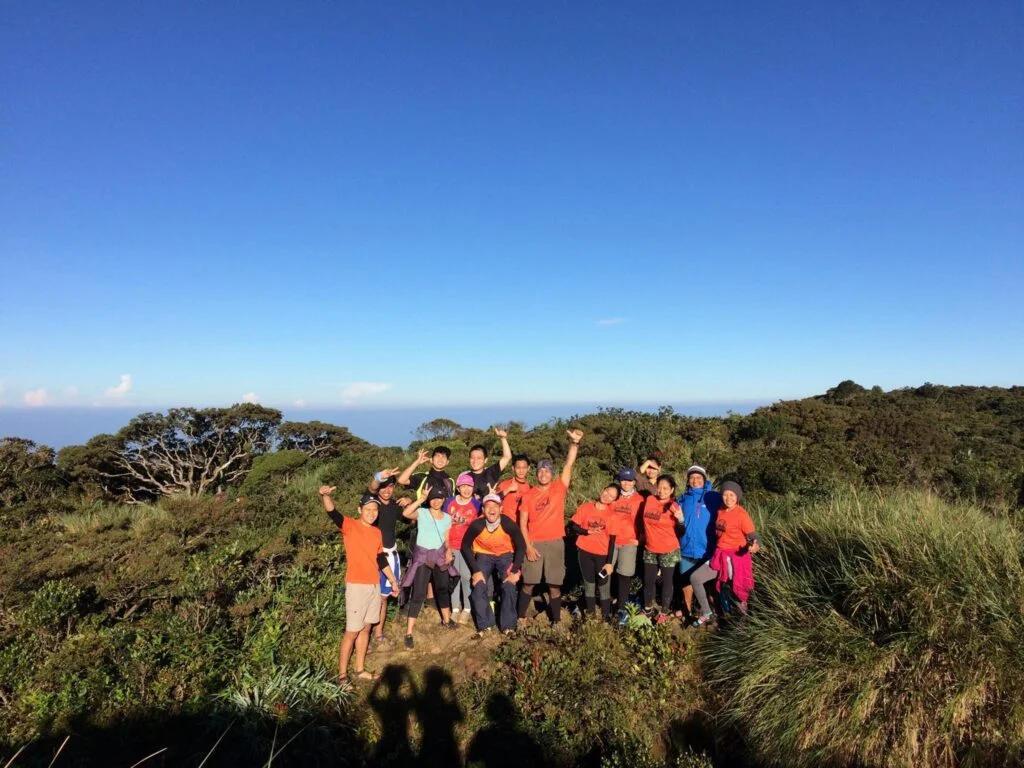
17:00: Sunset viewing. Prepare dinner. Socials.
Note: Quiet hours start at 9:00 PM. Respect other campers.
Day 2: The Summit & Descent
05:00: Wake up. Coffee and light snacks. Leave heavy packs at camp.
06:00: Summit Assault (Km 18). Watch the sunrise illuminate the Zambales range.
07:30: Descent back to Camp. Breakfast. Break Camp.
LNT Reminder: Double-check your campsite for micro-trash (candy wrappers, twist ties).
09:00: Start Descent to Jump-off.
11:30: Lunch on the trail (Km 10 or Km 6).
14:30: Arrival at Sitio Dampay. Log out.
Reward: Showers are available at local houses for a small fee (₱20-₱30). Nothing beats that first cold bath after 2 days of sweat.
16:00: Tricycle back to Iba/Highway.
23:00: Arrival in Manila.
Pro Tip: Day hikes are possible but brutal. To succeed, you must start trekking at 2:00 AM. This “Dayhike Challenge” is strictly for athletes with high endurance conditioning. Do not attempt this as a beginner or with a slow-paced group.
Estimated Budget Breakdown for Mt. Tapulao(2026)
Hikers should prepare a safe budget of ₱2,500 to ₱3,000 for a DIY “joiner” group of 5, while solo travelers should expect to pay upwards of ₱4,000 due to exclusive transport and guide fees.
The single biggest variable in your financial planning is the Guide Fee, which is a fixed rate regardless of group size. Traveling in a “barkada” or joining a configured group significantly lowers the per-head cost by splitting this fixed expense.
Per Person Costs (Group of 5)
Below is a realistic breakdown for an overnight hike, assuming a departure from Metro Manila.
| Expense Item | Estimated Cost (PHP) | Notes |
| Bus Fare (RT Manila-Iba) | ₱1,000 – ₱1,200 | Prices fluctuate based on fuel costs; Regular Aircon vs. Deluxe. |
| Tricycle Transfer (Share) | ₱300 | Roundtrip share (Iba-Dampay-Iba). |
| Ecological/Reg Fee | ₱30 | Standard LGU fee paid at the Barangay Hall. |
| Guide Fee (Overnight) | ₱300 | Based on the standard ₱1,500 fee divided by 5 hikers. |
| Food & Butane | ₱600 | Self-catered meals (4 meals + trail food). |
| Shower/Toiletries | ₱50 | Fee for using bathrooms at local houses post-hike. |
| TOTAL | ~₱2,480 + Contingency | Safe Cash on Hand: ₱3,000 |
The Hidden Costs:
Always carry a “Contingency Fund” of at least ₱500.
Porter Services: If you cannot carry your full pack (approx. 12-15kg), porters are available for roughly ₱1,500 per 15kg (Overnight). This is not included in the standard guide fee.
Tricycle “Night Differential”: If you arrive at the junction between 1:00 AM and 4:00 AM, drivers may ask for a slightly higher rate (e.g., ₱400 instead of ₱300) due to the ungodly hour.
Practical Takeaway: There are no ATMs in Barangay Dampay-Salaza. Withdraw all necessary cash in Manila or at the Iba town proper before heading to the jump-off point.
Side Trip: The Cool Down at Bagsit River
If you have 2-3 hours to spare after your descent, skip the shower queue at the jump-off and head straight to Bagsit River.
Located just a few kilometers from the Mt. Tapulao trailhead in Sitio Dampay, this river is the “Enchanted River” of Zambales. Its defining feature is crystal-clear, turquoise water flowing through massive white boulders. For hikers with battered knees and swollen feet, the freezing mountain water acts as a natural ice bath—perfect for reducing inflammation after the 36-kilometer grind.
Getting There from Tapulao Jump-off
Do not walk. Your legs are already destroyed. While the river is geographically close to the registration area, the route involves a rough, dusty road that is punishing under the afternoon sun.
The Move: Negotiate with a tricycle driver at the Barangay Hall / Eco-Center to take you to the “Bagsit River Parking Area.”
Travel Time: Approx. 15–20 minutes (One way).
Fare: Expect to pay ₱150 – ₱200 per tricycle (Roundtrip/Waiting). Tip: Agree on a pickup time so you don’t get stranded.
Fees & Logistics (2026 Estimates)
Unlike the regulated trekking fees, Bagsit is more casual but has its own costs.
Entrance Fee: ₱50 per head.
Environmental Fee: ₱25 – ₱50 (Sometimes bundled with parking).
Cottage Rental: ₱500 – ₱1,000 (Optional).
Budget Hack: You don’t need a cottage. Just leave your waterproof bags on a dry boulder and swim.
Facilities: Minimal. There are changing rooms, but they often lack lights. Plan to leave before sunset (5:30 PM) as the area has no electricity and can feel eerie in the dark.
The Experience vs. Reality
The Good: The water is shockingly clear and cold. There are deep pools for cliff jumping (ask locals for the safe spots) and shallow areas for just soaking your tired calves.
The Bad: It can get crowded with locals on weekends. The road going there is unpaved and bumpy—expect a “shaker” ride.
Pro Tip: If the main swimming area is crowded, hike upstream for 10 minutes. You will find secluded natural pools that are perfect for a quiet, post-climb decompression.

Vital Tips: Gear, Water & Hazards
Your success on Mt. Tapulao depends entirely on three logistical pillars: rigid footwear, disciplined hydration, and aggressive thermal management.
This is not a hike where “winging it” works. The unique geology and micro-climates of the Zambales Mountain Range punish unprepared hikers with severe foot pain and thermal shock.
The Footwear Doctrine (Critical)
Do not, under any circumstances, wear soft-soled lifestyle shoes like Nike Roshes, Adidas NMDs, or Ultraboosts.
The “Chromite Road” is unforgiving. Unlike the muddy trails of Rizal, the path here is paved with sharp, embedded rocks.
The Physics of Failure: Soft EVA foam soles are designed for pavement; on Tapulao, they deform around the jagged rocks, transferring the impact pressure directly to your metatarsals. By Km 12, this results in “Stone Bruising”—a deep, bone-level pain that makes every step agonizing.
The Solution: You need rigidity. Wear hiking boots with a stiff shank or trail running shoes equipped with a “Rock Plate” (e.g., Salomon X Ultra, Merrell Moab, or Hoka Speedgoat). The hard sole acts as a shield, absorbing the jagged edges so your feet don’t have to.
Water Sources & Hygiene
There are three established water sources on the trail, but reliability at the campsite fluctuates during the dry season.
Km 5 & Km 10: These are piped spring sources located directly on the side of the road. They are reliable year-round. The Km 10 source is your most critical refill point. Top up everything here before the final push to camp.
Km 16 (The Bunker): There is a water source near the campsite, but it is known to trickle or completely dry up during the peak of summer (March to late April). Insider Tip: Ask your guide about the status of the “Bunker Source” while you are still at Km 10. If it’s dry, you must haul your overnight water (an extra 3-4 liters) from Km 10.
Sanitation: There are no toilets on the trail or at the campsite. You must strictly follow Leave No Trace (LNT) principles. Bring a dedicated trekking trowel to dig a “cat hole” at least 6 inches deep for solid waste, and cover it completely. Bring your used toilet paper back down in a ziplock bag.
Temperature Management
You must pack for two contradictory climates: the sweltering tropical lowlands and the freezing high-altitude pine forest.
The Day Grind (35°C+): The lower slopes are an oven. Wear lightweight, white or light-colored Drifit shirts to reflect heat. Arm sleeves are essential to prevent sunburn. A silver-coated trekking umbrella is more effective than a hat here, as it creates portable shade.
The Night Freeze (10°C): Once the sun sets at the 1,800 MASL campsite, the temperature plummets. The wind chill cutting through the pines makes it feel colder than the thermometer reads.
The Reality Check: Hypothermia is a real risk. Do not let your sweat dry on your body. Change into a dry thermal base layer, a fleece jacket, and a windbreaker immediately upon reaching camp. Cotton shirts will freeze you; leave them at home.
Conclusion
Mt. Tapulao is a test of patience, not just leg strength.
It bridges the gap between a punishing tropical hike and a serene high-altitude expedition. The “High Peak” will batter your feet with its endless stony road and test your resolve with its oppressive heat, but the reward is worth every blister.
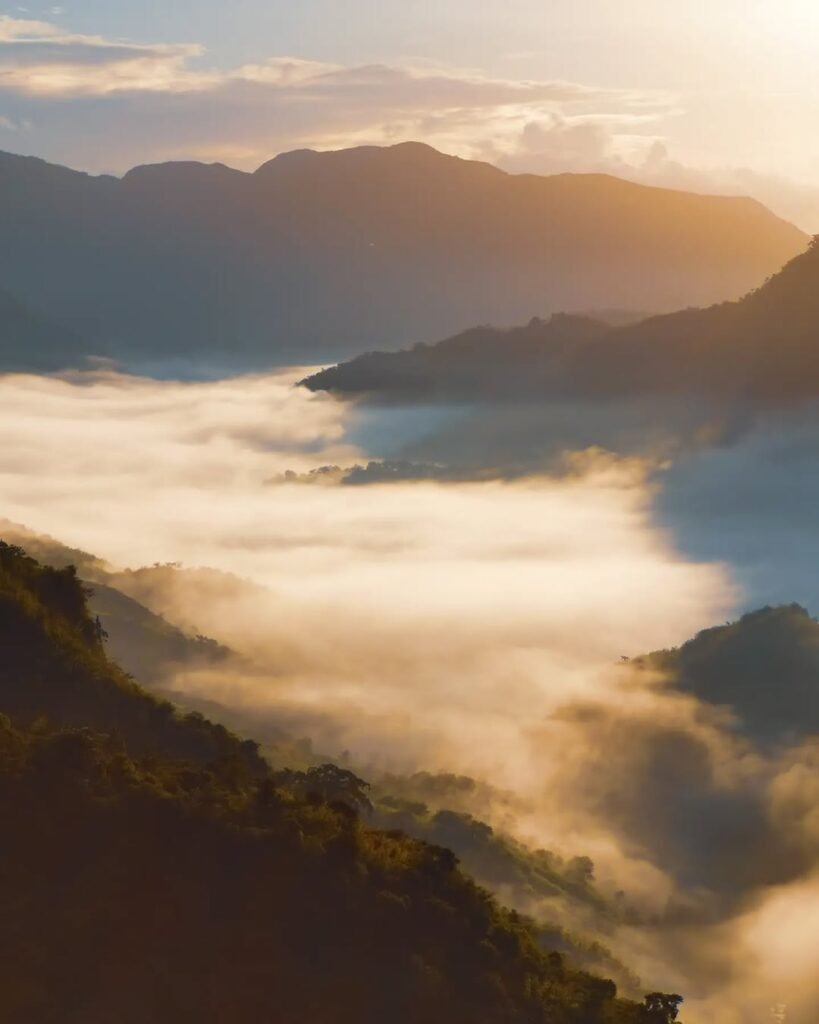
There is a specific magic to waking up under the canopy of ancient Sumatran Pines, watching the sea of clouds roll over the West Philippine Sea, and realizing you walked through fire to get to the ice.
Ready to conquer the High Peak? Share this guide with your hike squad, invest in the right boots, and start training those legs today! The pines are waiting.
Frequently Asked Questions (FAQs) About Mt. Tapulao
1. Is Mt. Tapulao good for beginners?
No. With a 5/9 difficulty rating, the Mt. Tapulao hike in Zambales is considered a major climb. The relentless 36-kilometer roundtrip on a rocky chromite trail requires immense leg endurance and heat tolerance. Beginners should try easier Zambales mountains first before attempting this grueling high-altitude ascent.
2. How many hours does it take to hike Mt. Tapulao?
The Mt. Tapulao trail length is 18 kilometers one way. An average hiker takes 7 to 9 hours to reach the summit campsite from the Palauig jump-off. For a DIY overnight itinerary, expect a 14 to 18-hour total trekking time back and forth, depending on your pace and rest stops.
3. What is the best month to hike Mt. Tapulao?
The best time to hike Mt. Tapulao in Zambales is from late November to February. These cooler months make the exposed 6-kilometer lowland trek much more bearable. Avoid climbing during the peak summer months of April and May, as the extreme heat index on the open trail can cause heatstroke.
4. Can you do a Mt. Tapulao day hike?
Yes, a Mt. Tapulao day hike is possible, but it is strictly for highly conditioned trail runners or elite hikers. You must start trekking from Sitio Dampay by 2:00 AM to avoid the midday sun. Most casual climbers strongly prefer the standard 2 Days 1 Night overnight itinerary for safety.
5. Do I need an advanced reservation for Mt. Tapulao? Unlike Mt. Pulag, strict online reservations are not currently required. However, walk-in hikers are strongly advised to coordinate with the Palauig Tourism Office at least three days prior. This ensures the Zambales mountain is open and safe from sudden weather closures or local security alerts before you travel.
6. How much is the DIY budget for Mt. Tapulao?
For a group of five, a DIY budget for Mt. Tapulao ranges from ₱2,500 to ₱3,000 per person. This covers your roundtrip Victory Liner bus fare, tricycle transfers, ecological fees, food, and your shared local guide fee for the overnight hike. Solo travelers will spend significantly more.
7. What are the best shoes for the Mt. Tapulao trail?
Never wear soft-soled running shoes. Because 85% of the route is an old, rocky chromite mining road, you need rigid footwear. The best shoes for Mt. Tapulao are high-cut hiking boots with a stiff shank or trail runners with a built-in rock plate to prevent severe stone bruising.
8. Are there water sources along the Mt. Tapulao trail?
Yes, there are reliable piped mountain spring water sources at Kilometer 5 and Kilometer 10 of the trail. While there is another water source near the Kilometer 16 bunker campsite, it often dries up during summer. Always refill your bladders completely at the Km 10 mark to be safe.
9. Is there a cell signal at the Mt. Tapulao campsite?
Cellular signal at the Mt. Tapulao campsite is notoriously weak or completely non-existent. You might get intermittent text message reception on the lower slopes facing the Zambales lowlands, but do not expect reliable mobile data for internet access. Inform your family about this dead spot before starting your hike.
10. Is there a side trip near the Mt. Tapulao jump-off?
Yes! After finishing your descent, hire a tricycle from the Sitio Dampay jump-off to Bagsit River. This crystal-clear, icy mountain river is the perfect Zambales side trip to cool down your body and soothe your inflamed leg muscles before taking the long bus ride back to Metro Manila.
Explore More of Zambales
Done conquering the High Peak? Whether you need a relaxing beach to soothe your sore legs or are looking for your next mountain challenge, Zambales has it all. Check out our detailed guides below:
Post-Hike Recovery (Beaches & Islands)
The Closest Paradise: Since you are already in Palauig, don’t miss Magalawa Island: The Starfish Island of Zambales. It’s just a short boat ride away and perfect for a lazy recovery day.
Surf & Chill: If you want a laid-back vibe with good coffee and waves, head straight to Liwliwa Beach: The Ultimate Surfing Capital.
Top Picks: Can’t decide? Browse our list of the 10 Must-Visit Beaches in Zambales.
More Zambales Mountains to Climb
The “Mini Tapulao”: If you loved the pine trees but want a shorter trek combined with a beach, read our Ultimate Guide to Anawangin Cove or Nagsasa Cove DIY Itinerary.
New Hiking Gems: Looking for lesser-known trails? Challenge yourself with Mt. Kapigpiglatan (The Sea of Clouds) or the scenic Mt. Mariglem.
Camping & Nature Trips
The “New Zealand” of Zambales: For a chill camping experience by the water without the grueling hike, check out Mapanuepe Lake: The Sunken Village.
The Full List: Plan your entire year of adventure with our Zambales Ultimate Travel Guide 2025.