Mt. Tapulao is a 2,037 MASL major climb in Palauig, Zambales — the highest peak in Central Luzon — rated 5/9 difficulty and covering 18 kilometers one-way on a rocky former mining road. Overnight is strongly recommended. Budget around ₱2,800–₱3,500 per person for a DIY climb in a group of five.
Mt. Tapulao Quick Guide
| Detail | Info |
|---|---|
| Mountain | Mt. Tapulao (High Peak) |
| Location | Palauig, Zambales |
| Province | Zambales, Central Luzon |
| Elevation | 2,037 MASL |
| Difficulty | 5/9 (Major Climb) |
| Jump-off | Sitio Dampay, Brgy. Dampay-Salaza, Palauig |
| Best Season | November to February |
| Trek Time | 6–12 hours to summit (pace-dependent) |
| Registration | Mandatory at Brgy. Dampay-Salaza Hall |
| Campsite | Km 16 — “The Bunker” |
Table of Contents
Where Is Mt. Tapulao Located?
Mt. Tapulao is the highest and most demanding trekking destination in the Zambales mountain range, located in Palauig, Zambales, Philippines — a day-use or overnight camping destination famed for its extremely long endurance trail, pine and mossy forests, and its status as the highest peak in the province.
It is the tallest mountain in the Central Luzon region, standing at 2,037 meters above sea level (6,683 feet). The Mt. Tapulao location puts it within a 5–6 hour bus ride from Metro Manila, making it a target for peak-baggers across Luzon.
The name “Tapulao” comes from the Zambal word tapolaw, which means “pine trees” — an apt description given the abundance of pines near the summit. Historical accounts also claim that Mt. Tapulao was once a mining site for chromite, and the trail used today follows the remnants of the dirt road bulldozed by mining equipment and vehicles.
For more outdoor options in the province, check out the Zambales Ultimate Travel Guide to plan your full Zambales itinerary around the climb.
How to Get to the Mt. Tapulao Jump-off Point
The Mt. Tapulao jump-off is at Sitio Dampay, Barangay Dampay-Salaza, Palauig, Zambales — and getting there is straightforward with public transport.
By Bus (Recommended):
The most efficient public transport route is taking a Victory Liner bus bound for Iba or Santa Cruz, Zambales, which takes approximately 5–6 hours. Buses depart from Victory Liner terminals in Cubao or Monumento, Caloocan. A night trip (8 PM onward) is better so you arrive in Iba early morning the next day.
From Iba to the Jump-off:
Alight at Iba bus terminal, then hire a tricycle to Dampay-Salaza, which serves as the jump-off point (travel time: 45 minutes to 1 hour). A tricycle rental from Iba to Sitio Dampay costs around ₱450 one-way for 3–4 passengers.
Insider Tip — Take a Trike to Km 6:
This is something most guides skip. From the jump-off registration area, you can ride a trike as far as the Km 6 mark. I did this during my May 2026 climb and it saved at least 90 minutes of road-walking in the early morning heat. Not every tricycle driver offers this, so ask directly when you arrive. That head start before sunrise made the first leg much more manageable.
By Private Vehicle:
Drive via NLEX (North Luzon Expressway) and SCTEX (Subic Clark Tarlac Expressway), then proceed to Iba, Zambales. Make a right turn at the junction in Dampay-Salaza, Palauig, Zambales, then follow through until you reach the trailhead. Travel time is approximately 4 hours by car.
Permits, Fees, and Guide Requirements at Mt. Tapulao
Registration is mandatory for every hiker — there is no way around this, and no online booking system is currently required.
All tourists must register at the official Brgy. Dampay Registration Office. A certified local guide is required for any ascent. All fees — registration, environmental, and guide fee — are paid in cash (Philippine pesos) at the registration center before the trek begins.
Unlike Mt. Pulag, strict online reservations are not currently required. However, walk-in hikers are strongly advised to coordinate with the Palauig Tourism Office at least three days prior to ensure the mountain is open and safe from sudden weather closures or local security alerts.
Current Fees (as of 2026):
| Fee | Amount (PHP) |
|---|---|
| Registration Fee | ₱30 |
| Guide Fee | ₱700–₱1,000 per group (shared) |
| Environmental Fee | Minimal (bundled at registration) |
Fees are paid in cash only. Confirm current rates with the Palauig Municipal Tourism Office before travel, as amounts may be updated. Palauig Municipal Tourism Office
Mandatory coordination is typically done with the Palauig Municipal Tourism Office or the Brgy. Dampay office in advance to secure permits, check current fees, and coordinate transportation.
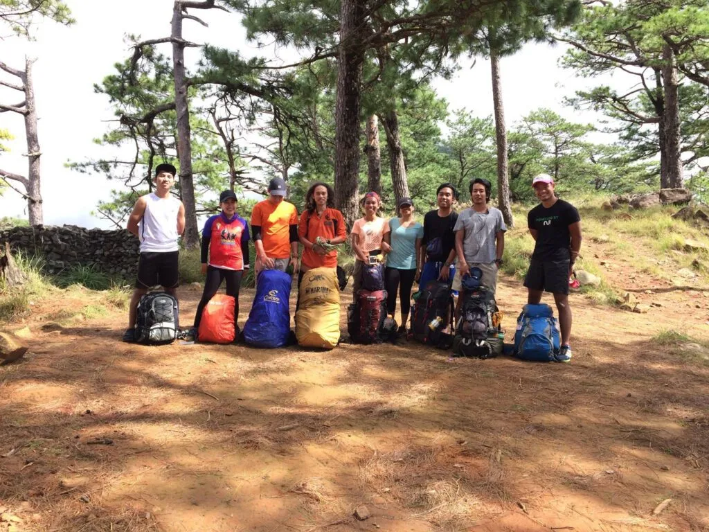
For a group of five, a DIY budget for Mt. Tapulao ranges from ₱2,500 to ₱3,000 per person, covering roundtrip Victory Liner bus fare, tricycle transfers, ecological fees, food, and the shared local guide fee for an overnight hike.
What Is the Mt. Tapulao Trail Like?
The Mt. Tapulao trail is 18 kilometers one-way — and what makes it distinct is not steep technical climbing but sheer, unrelenting distance on a rocky road.
The hike from Palauig, Zambales is notorious for its 18-kilometer trail. At least 85% of the trail is on a wide dirt road dotted with rocks and boulders throughout. The trek starts from a very low altitude of around 100+ MASL, giving it one of the highest altitude gains in the entire country — on par with the Akiki trail of Mt. Pulag.
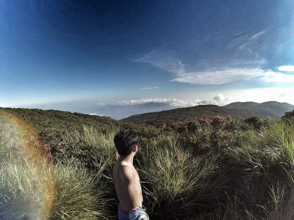
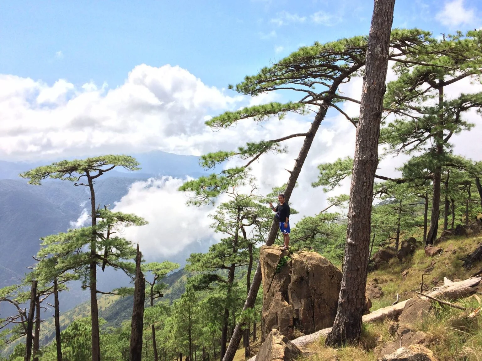
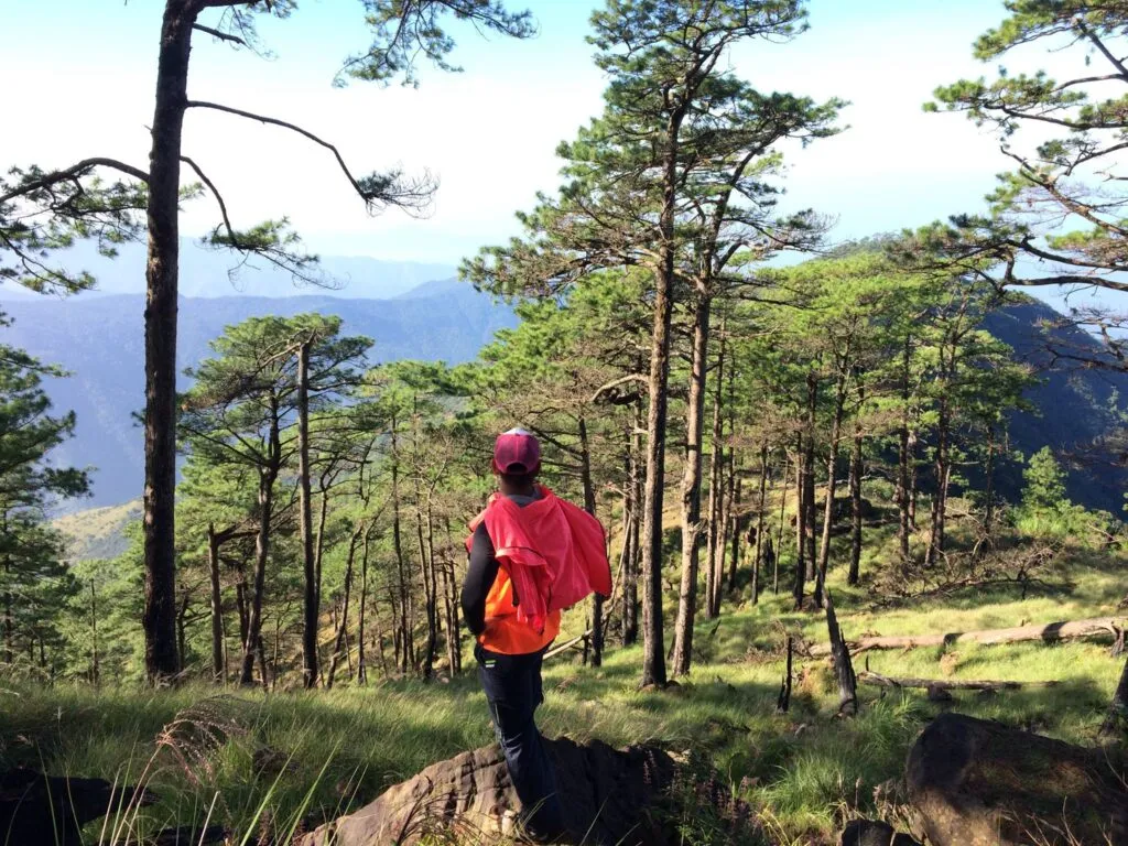
The terrain shifts dramatically across three ecosystems: open cogon grassland on the lower slopes, a pine forest corridor from roughly Km 14 to 16, and a dense mossy forest for the final two kilometers to the summit.
Trail Stage Breakdown (with Per-Stage Difficulty Scores)
- Jump-off to Km 6 — Score: 2/5
Wide, open mining road under full sun. The ground is loose gravel and small rocks. It feels manageable early in the morning, but the sun builds fast. This is where your footwear choice shows — soft soles begin to bruise here.
- Km 6 to Km 10 — Score: 3/5
The road steepens slightly but more importantly, the monotony kicks in. This is the longest psychological battle of the climb. At Km 5 and Km 10, there are piped spring sources located directly on the side of the road — reliable year-round. Fill up completely at Km 10.
- Km 10 to Km 14 — Score: 3/5
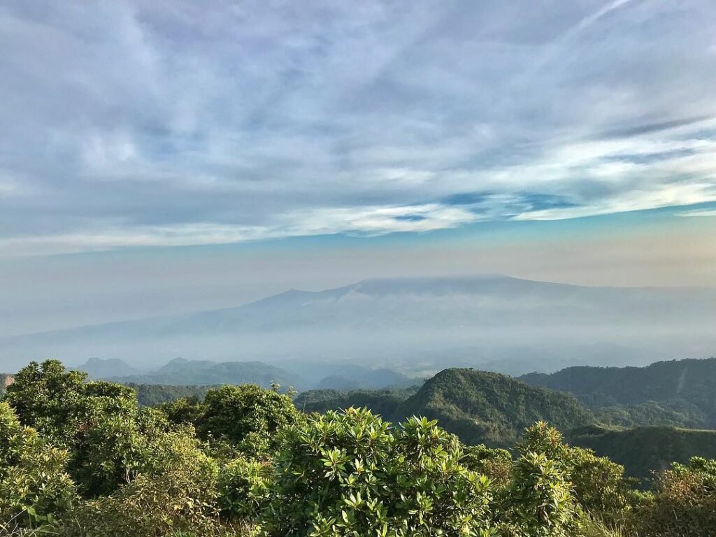
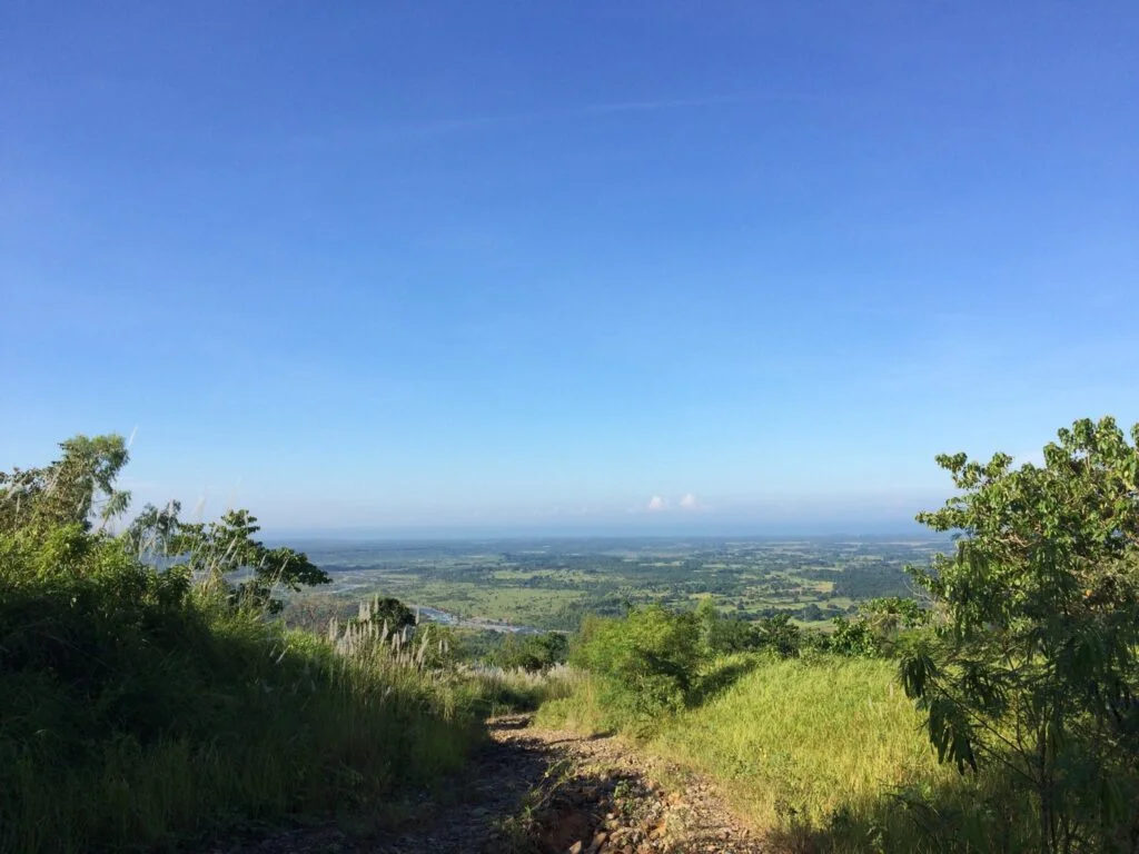
The trail continues on the same rocky road but the views open up. Occasional backward glances afford climbers a view of Palauig and neighboring towns, the Masinloc Power Plant, and the West Philippine Sea. Legs start to feel heavy here. Pace yourself — don’t race this section.
- Km 14 to Km 16 — Score: 2/5 (but emotionally: 5/5)
This is the stretch that stays with you. The pine trees appear. The temperature drops noticeably. After hours on an open, sun-blasted road, the sudden cool and the smell of Sumatran pines hits differently. I walked this section in May 2026 on a clear sunny day, and the contrast from the lower trail was so stark it felt like a different mountain entirely. Upon reaching around the Km 15 mark, Tapulao presents a cold breeze and a sweet view of pine trees above.
- Km 16 (The Bunker) to Summit — Score: 4/5
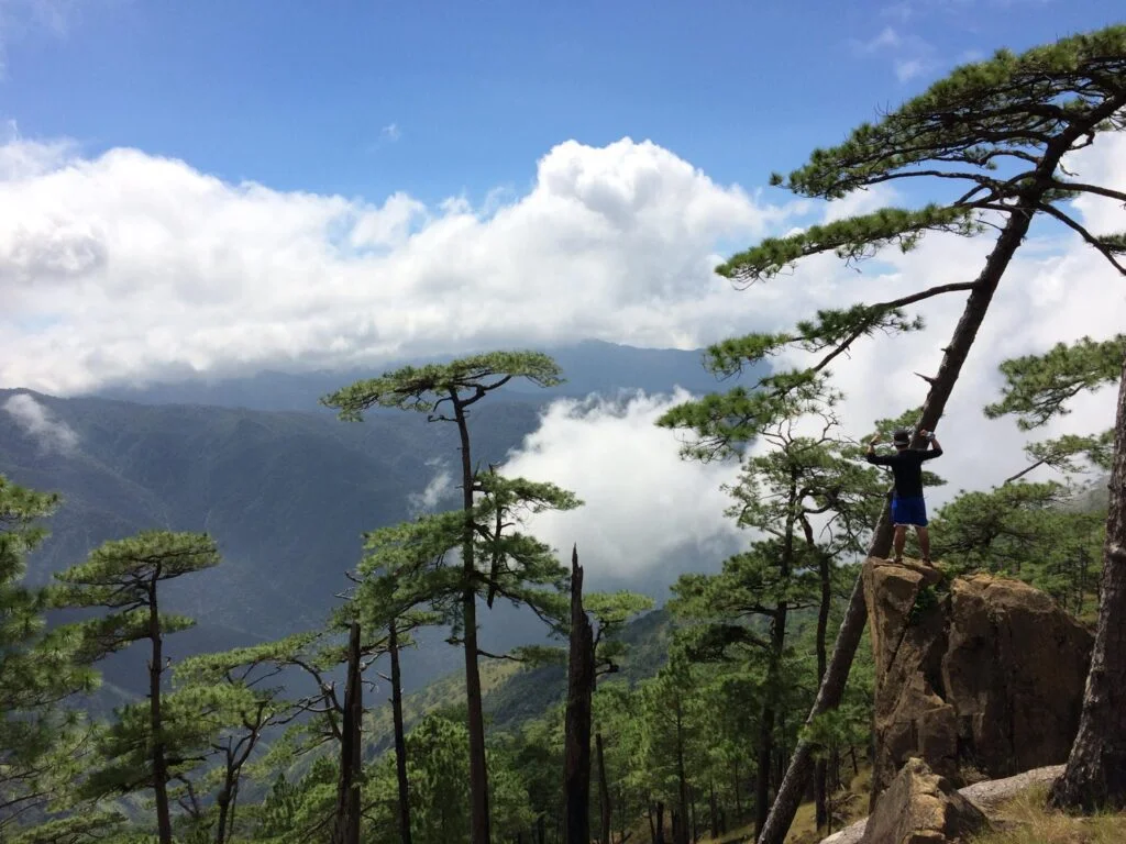
The final 2 kilometers abandon the mining road entirely, narrowing into a traditional single-track trail through a dense, wet mossy forest — the only truly “organic” part of the climb. The trees become stunted and gnarled, draped in hanging moss and epiphytes. The path can be slippery and muddy, especially after rain.
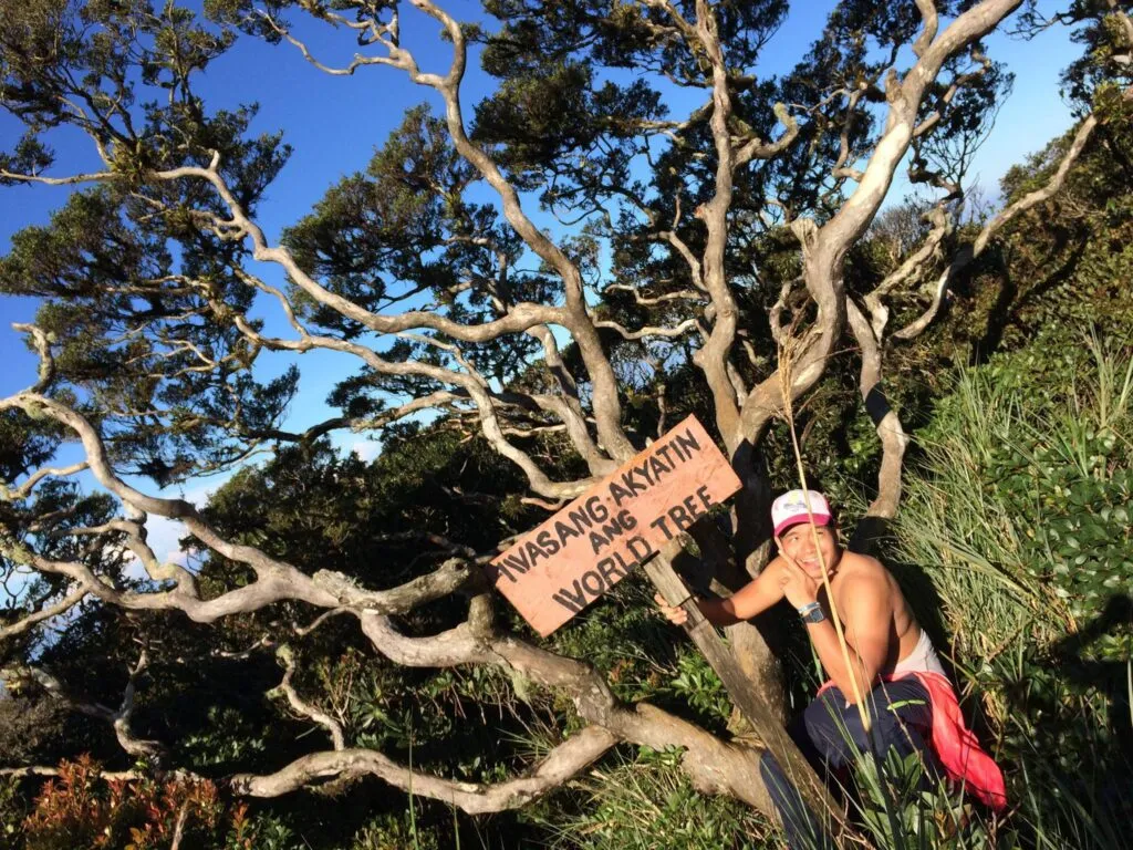
The Summit
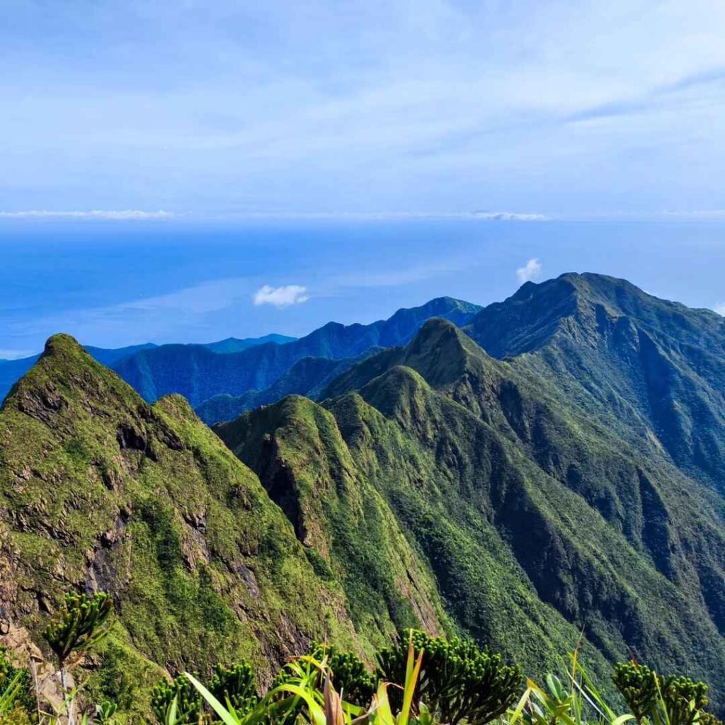
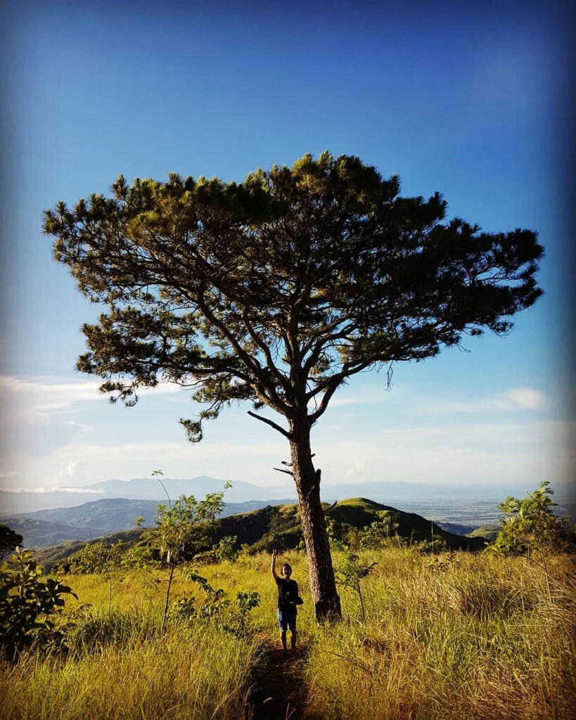
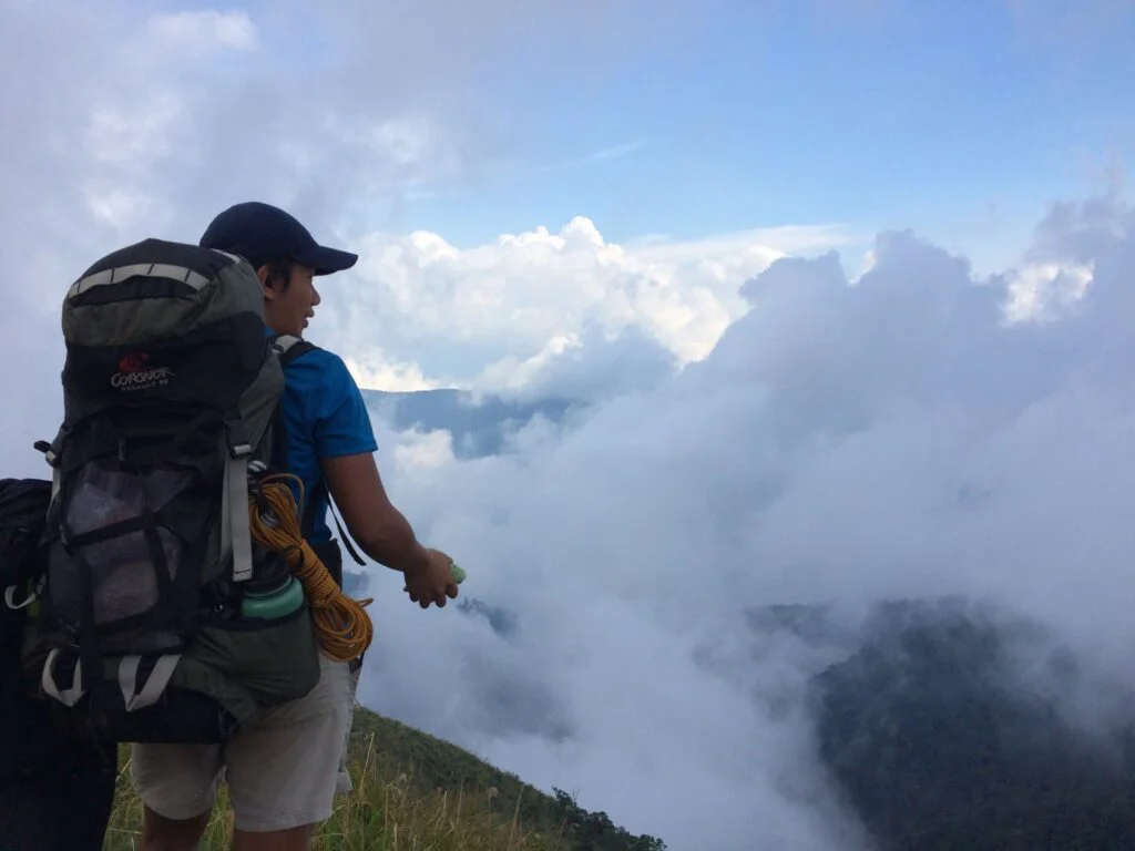
The peak at 2,037 MASL is marked by the iconic “World Tree,” a solitary pine that has survived countless typhoons. On a clear day, the reward is a 360-degree view: the jagged coastline of the West Philippine Sea to the west and the vast central plains of Tarlac to the east.
Note that the summit of Mt. Tapulao only has a small area and can fit around 20–30 people — be there early if you want a good spot.
The Mt. Tapulao Traverse (For Experienced Hikers)
When you hike Mt. Tapulao from the opposite side — starting from Barangay Labney in Mayantoc, Tarlac — and descend via the traditional trail in Palauig, Zambales, you complete the so-called Tapulao Traverse, or “TapTrav.” The traverse is rated Major Climb, Difficulty 8/9, trail class 1–4, and requires 3–4 days to complete. This is strictly for experienced climbers.
For other challenging Zambales climbs nearby, read the Mt. Mariglem Guide and the Mt. Kapigpiglatan DIY Guide.
Is Mt. Tapulao Good for Beginners?
Mt. Tapulao is not suitable for first-time hikers with no prior trail experience.
This mountain is definitely not for beginners — even the back trail hike from the Zambales side is already rated 5/9 and is not recommended for a beginner. The challenge is not technical difficulty but physical endurance over 36 kilometers round-trip.
That said, it is an excellent second or third mountain for someone who has already completed a moderate climb like Mt. Batulao or Talamitam. If you can hold a solid pace for 6–8 hours without stopping, you can handle Tapulao with proper preparation. You can see how it compares to other major Philippine climbs rated 5/9 to 8/9 before committing.
Day Hike vs. Overnight at Mt. Tapulao
Overnight is the right choice for most hikers.
The ideal itinerary to scale Mt. Tapulao is an overnight climb. Doing it as a day hike means 36 kilometers in a single push — possible for fit, fast hikers, but brutal on the knees and not enjoyable for most.
The overnight format lets you reach the Km 16 Bunker campsite on Day 1, rest in the pine forest, then summit at dawn on Day 2. If the day is about surviving the heat, the night is about surviving the cold. Zambales might be a coastal province, but at 1,800 meters, the wind chill is ferocious — temperatures can drop to 10°C or lower.
Day hikers must leave the jump-off by 3:00–4:00 AM maximum to beat the midday heat on the lower slopes and still have daylight for the descent.
Best Time to Climb Mt. Tapulao
November to February is the best window — temperatures are cooler and the risk of rain is lower.
The best time is November to February, during the coolest months. Mt. Tapulao can get very cold, especially at night — but it can also be very hot during the day. In the summer months (March to May), the lower trail becomes punishing under direct sun.
I climbed in May 2026 on a clear, sunny day. The lower section from Km 0 to Km 12 was hot and exposed, but the moment the pine trees appeared at Km 14, everything changed. May is doable — just start before 5:00 AM. Avoid climbing during typhoon season (July to October) as sudden fog and rain make the mossy forest section treacherous.
Budget Breakdown for Climbing Mt. Tapulao
All costs below are based on 2026 pricing for a group of 5 on an overnight DIY climb.
| Expense | Cost (PHP) |
|---|---|
| Victory Liner Bus (Manila–Iba, one-way) | ₱380–₱420 |
| Tricycle (Iba to Dampay-Salaza jump-off) | ₱90–₱150/pax (shared) |
| Trike to Km 6 (optional, highly recommended) | ₱50–₱100/pax |
| Registration Fee | ₱30 |
| Guide Fee (split among 5 pax) | ₱140–₱200/pax |
| Environmental Fee | ₱30–₱50 |
| Tapsilog + Meals at jump-off/Iba | ₱150–₱300 |
| Trail food + snacks (2 days) | ₱300–₱500 |
| Return bus to Manila | ₱380–₱420 |
| Estimated Total (per person, group of 5) | ₱1,500–₱2,500 |
Solo travelers pay significantly more because guide fees are not split. If traveling alone, you will solely shoulder the guide fees and tricycle transfer rates.
A tapsilog breakfast at the jump-off area hit exactly right before the climb in May 2026 — the carinderias near Dampay-Salaza open early for hikers.
What to Pack for Mt. Tapulao
| Item | Essential? |
|---|---|
| High-cut hiking boots (stiff shank) or trail runners with rock plate | |
| 3–4 liters of water capacity (hydration bladder + bottles) | |
| Windbreaker / light rain jacket | |
| Thermal base layer or fleece jacket | |
| Headlamp with extra batteries | |
| Trekking poles | |
| Sleeping bag (rated to 10°C or lower) | |
| High R-value sleeping pad | |
| Sunscreen (SPF 50+) | |
| Sun hat or buff | |
| Trail food / energy gels / electrolytes | |
| Portable water filter or purification tablets | Recommended |
| Trekking umbrella | Optional but useful |
| Cotton clothing |
Never wear soft-soled running shoes. Because 85% of the route is an old, rocky chromite mining road, you need rigid footwear. Soft EVA foam soles deform around the jagged rocks, transferring impact pressure directly to your metatarsals. By Km 12, this results in deep, bone-level pain that makes every step agonizing.
Safety Tips for Climbing Mt. Tapulao
- Start before dawn. The standard itinerary departs Manila at 10:00 PM on Day 0 to ensure hikers are on the trail by 6:00 AM, effectively avoiding the punishing midday heat on the lower slopes.
- Refill water at Km 10 without exception. The Km 10 source is your most critical refill point — top up everything here before the final push to camp. The water source near the Km 16 Bunker campsite often dries up during summer.
- Change out of sweat-soaked clothes at camp. As soon as you stop hiking, strip off your sweat-soaked trekking clothes and change into dry thermals. A fleece jacket, a windbreaker, and a bonnet are non-negotiable.
- Tell someone your itinerary. Signal at the campsite is notoriously weak or completely non-existent at the Mt. Tapulao campsite. Leave a full itinerary with someone not on the climb.
- Bring trekking poles for the descent. The 18-kilometer downhill on loose rock is where most knee injuries happen. Poles reduce the load significantly.
- Coordinate with the Palauig Tourism Office before travel. DENR official website Weather closures do happen, and confirming the mountain is open saves a wasted trip.
What I’d Do Differently Next Time
Go overnight instead of rushing.
I climbed in May 2026 and pushed to make it a long day hike starting very early. I hit the summit and came back, but the descent from the Bunker to the jump-off on tired legs was genuinely unpleasant. The pine forest at Km 14 to 16 is worth spending a night in — waking up there at 4:00 AM for a summit sunrise would be a completely different experience from grinding back down in afternoon heat.
Pack trekking poles even if I think I don’t need them.
I left them behind to save pack weight. By Km 10 on the way down, I regretted that decision specifically. The rocky road descent hits your knees in a way that flat trails never do. Poles would have cut my descent time and saved two days of soreness after.
Eat a proper hot meal in Iba before heading to the jump-off.
The tapsilog at the carinderia near Dampay-Salaza was good, but it was a small portion. A full, calorie-dense breakfast in Iba — before the tricycle ride — would have set me up better for the long first section.
Frequently Asked Questions About Mt. Tapulao
Is Mt. Tapulao a difficult hike for beginners?
Mt. Tapulao is not recommended for first-time hikers. It is rated 5/9 difficulty — not technically demanding, but physically grueling due to its 36-kilometer round-trip distance. Climbers with at least one moderate hike completed (think Batulao, Gulugod Baboy) can attempt it with solid preparation.
Can you do Mt. Tapulao as a day hike?
Yes, but it demands an extremely early start and a strong pace. The trail spans about 18 km one-way, typically completed in 7–9 hours up and approximately 4–5 hours down. Day hikers need to be at the jump-off by 3:00–4:00 AM. Overnight is the smarter choice for most people.
How long does it take to reach the summit of Mt. Tapulao?
The mountain requires 1–2 days and 6–12 hours to reach the summit depending on pace, trail class, and stops. Fit, fast hikers can summit in 6 hours. An average group taking proper rest stops should plan for 8–10 hours.
Do you need a guide to climb Mt. Tapulao?
Yes. All tourists must register at the official Brgy. Dampay Registration Office, and a certified local guide is required for any ascent. This is an LGU rule, not optional. The guide also knows the trail well, which matters in low-visibility conditions near the summit.
What is the best time of year to hike Mt. Tapulao in Zambales?
The best time to climb is November to February during the coolest months. These months give you the best chance of cold summit temperatures, clear skies, and a sea-of-clouds effect at the Bunker campsite. Avoid typhoon season from July to October.
Final Verdict: Should You Climb Mt. Tapulao?
Mt. Tapulao earns a 4 out of 5 for intermediate hikers who have at least two moderate climbs under their belt and are looking for their first true endurance mountain. The 36-kilometer round-trip is the defining challenge — not technical skill — and the pine forest transition from Km 14 to 16 is one of the most visually rewarding stretches on any Luzon trail. If you want a mountain that actually tests your legs and mental patience, Mt. Tapulao delivers completely.
Looking for more Zambales trails to pair with this climb? Read the Coto Mines Zambales Travel Guide and explore the full Zambales Tourist Spots Guide for nearby additions to your trip.


