
Quick Guide Table
| Field | Value |
|---|---|
| Mountain name | Mt. Ulap Eco-Trail |
| Location | Itogon, Benguet, Cordillera Administrative Region |
| Province / municipality / barangay | Benguet, Itogon; jump-off at Barangay Ampucao; exit via Sta. Fe exit landmark |
| Elevation / MASL | 1,846 MASL / 6,056 ft |
| Difficulty level | Beginner-friendly to easy-moderate in technical terms, but exposure, wind, and full-traverse pacing make it feel more serious |
| Trail type | Point-to-point traverse |
| Estimated hiking time | Tourism overview says around 3–5 hours, but I would use more conservative full-day planning because the segmented time windows can stretch longer |
| Estimated distance | Roughly 9.4 km official trail length; third-party GPS tracks may differ |
| Jump-off / registration point | Ampucao Barangay Hall / Barangay Ampucao |
| Best time to hike | November to February for cooler ridges; March to May can still be beautiful but much hotter |
| Day hike or overnight | Commonly dayhiked; overnight suits photographers and slower groups |
| Guide requirement | Mandatory local guide |
| Water source | Do not assume reliable refill; carry full hydration from the start |
| Cell signal | Do not rely on mobile data for safety or navigation; signal can be unstable |
| Beginner-friendliness | Yes for prepared beginners, but not a lazy beginner hike |
| Signature highlights | Gungal Rock, pine ridges, grassland traverse, sea of clouds, sunrise and sunset potential |
Mt. Ulap is best understood as a 9.4 km ridge traverse with three major highlights: Ambanao Paoay, Gungal Rock, and the 1,846 MASL summit. The route starts at Barangay Ampucao and exits toward Sta. Fe, and the current visitor setup is now walk-in, not pre-reservation only.
Is Mt. Ulap Worth Hiking for a DIY Day Trip?
Yes, Mt. Ulap is absolutely worth hiking as a DIY day trip, especially if you want a scenic Benguet ridge hike that feels rewarding without the heavier planning demands of bigger mountain climbs. It is beginner-friendly in a broad sense, but it stops feeling “easy” once you factor in the exposed trail, full traverse, wind, and transport timing.
What makes Mt. Ulap DIY so appealing is the balance. You get Gungal Rock, rolling grassland, pine-lined sections, and the chance of a beautiful sea of clouds, but the logistics are still more manageable than many larger Benguet hikes. For me, that makes it one of the most practical scenic hikes near Baguio.
The real mistake is underestimating the start. If you are commuting from Baguio, the first public jeep at around 7–8 AM can already ruin a sunrise-focused plan.
My honest verdict: Mt. Ulap Benguet is an excellent DIY dayhike, but only if you respect the timing and the full-traverse effort.
Table of Contents
Where Is Mt. Ulap Located and What Makes It Special?
Mt. Ulap is in Itogon, Benguet, with the usual jump-off at Barangay Ampucao and the trail exiting through what hikers commonly call the Sta. Fe exit. If you are searching for the basic Mt. Ulap Location, that is the planning anchor that matters most: Ampucao for registration and start, Sta. Fe for exit logistics.
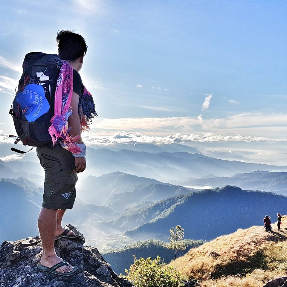
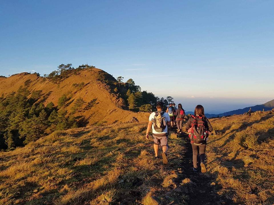
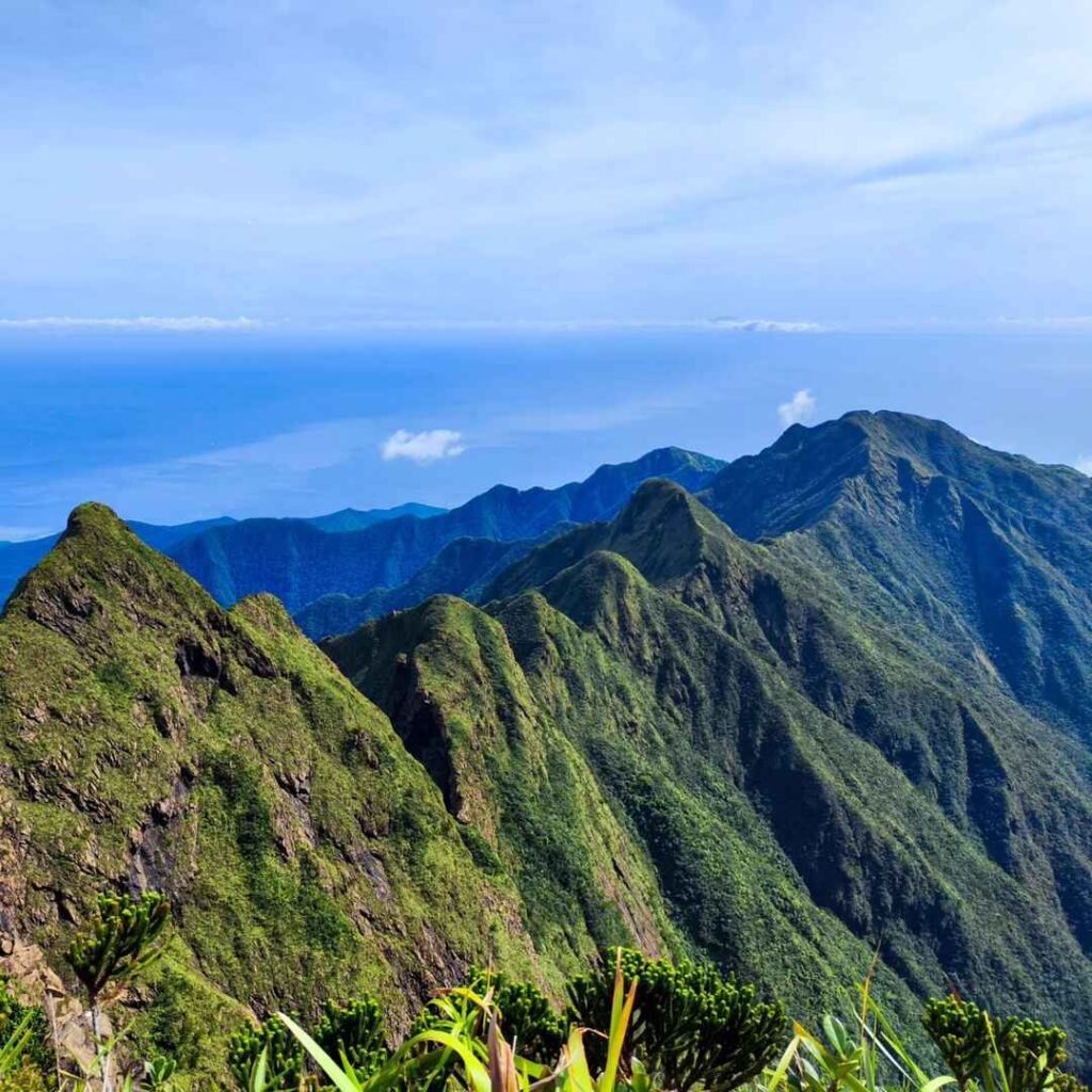
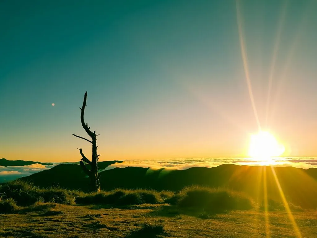
What makes Mt. Ulap Benguet special is that it feels open, scenic, and rewarding without looking or moving like a dense jungle hike. This is a mountain of pine ridges, rolling grassland, open slopes, hanging bridges, burial caves, and wide Cordillera views. Early in the morning, the light can hit the ridges in a way that makes the whole traverse feel crisp and expansive rather than dark or enclosed.
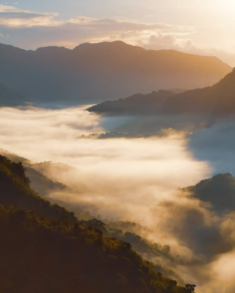
The mountain’s name is tied to the local word for “cloud,” which fits the experience well because Mt. Ulap Sea of clouds is part of what draws people here, especially on cool, clear mornings. But even without that cloud layer, the trail stays visually strong because the landscape is naturally photogenic.
What I like most is that the route feels like a true scenic traverse. It is not jungle-heavy, not overly technical, and not short on viewpoint rewards. That combination is exactly why Mt. Ulap remains one of the most popular hikes in Itogon.
Mt. Ulap Difficulty Level, MASL, KM, and Hiking Time
Mt. Ulap stands at 1,846 MASL and is commonly described as an around 9.4 km traverse, with tourism materials giving a broad hiking time of about 3 to 5 hours. In real hiking conditions, though, it usually feels longer than that once you add registration, pacing, photo stops, weather changes, and the full point-to-point exit.
For quick reference, the core numbers most hikers look for are straightforward. Mt. Ulap MASL is 1,846, and the official trail length is roughly 9.4 km. That gives readers a clean baseline for How many KM is Mt. Ulap and where it sits in Benguet’s more accessible hiking options.
The more useful answer, though, is practical rather than brochure-like. The tourism overview may say 3–5 hours, but the segmented timing already suggests a longer real-world day:
- Jump-off to Ambanao Paoay: around 2–3 hours
- Ambanao Paoay to Gungal Rock: around 1–2 hours
- Gungal Rock to summit: around 1–2 hours
- Summit to Sta. Fe exit: around 1–2 hours
That is why Mt. Ulap Difficulty Level can be underestimated. The trail itself is not highly technical, and many prepared beginners can finish it, but the ridge exposure, sun, wind, and full elapsed time make it more demanding than the stats first suggest.
If you are wondering how many hours to hike Mt. Ulap, I would not treat it like a quick photo trip. Mt. Ulap Traverse is best approached as a full hiking day with realistic pacing, an early start, and enough buffer for stops and descent fatigue.
What Is the Mt. Ulap Trail Like from Ampucao to the Sta. Fe Exit?
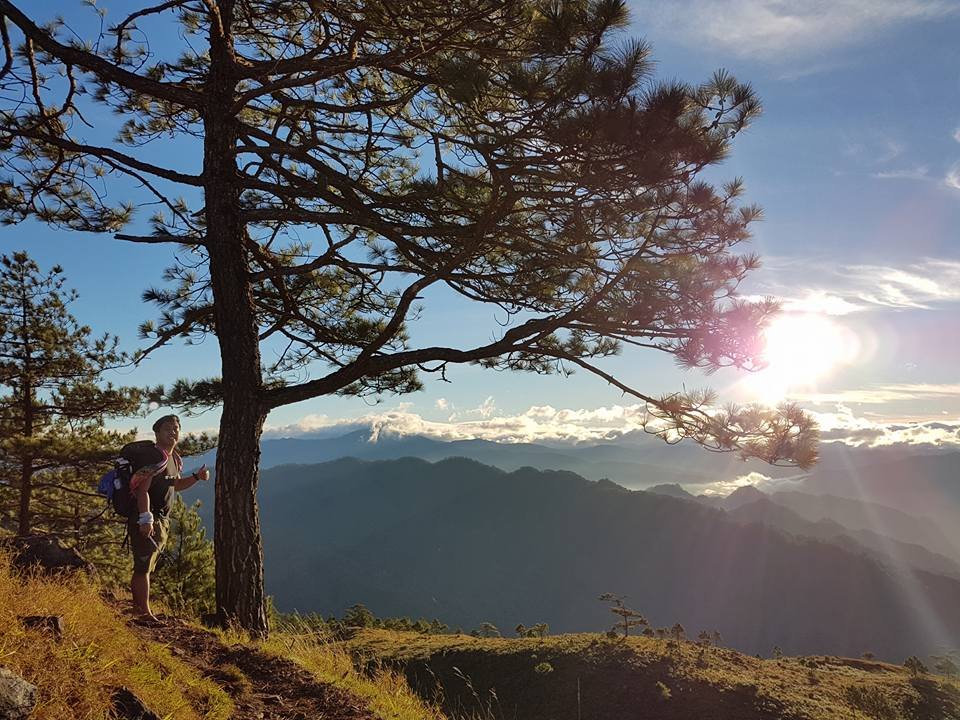
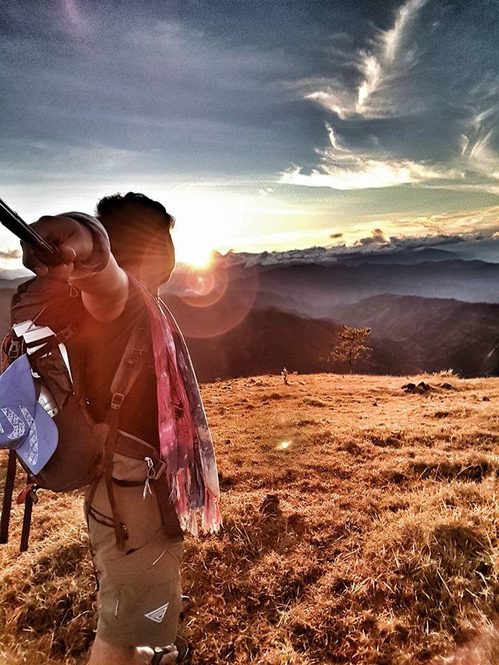
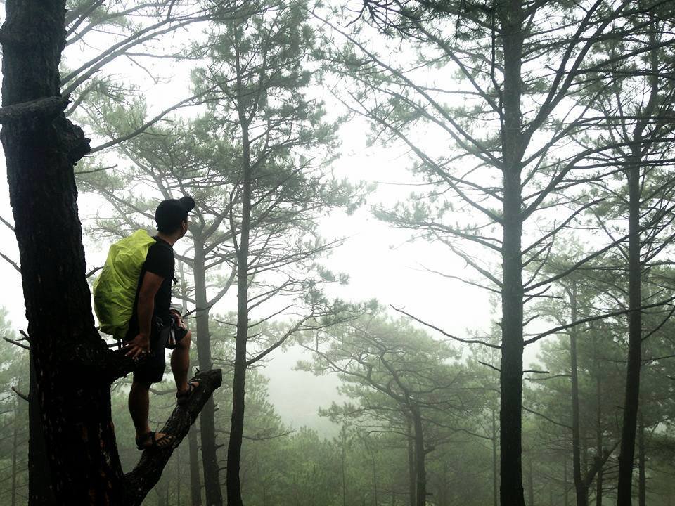
The Mt. Ulap Trail feels open, airy, and constantly visual. When I think of the Mt. Ulap Eco Trail, I think of cold wind in the early hours, long ridgelines opening up as the light gets stronger, and a hike that stays photogenic almost the whole way. It is not a forested crawl. It is an open mountain path that rewards you early, but it also exposes you to heat, wind, and changing visibility.
Jump-off to Ambanao Paoay
From Ampucao, the trail starts with a rolling climb that quickly introduces the character of the mountain. You get a mix of pine ridges and grassland sections, and this is where the exposed slope feel becomes obvious. Shade is not something I would count on all day, so even early on, the trail already tells you to respect pacing, hydration, and weather.
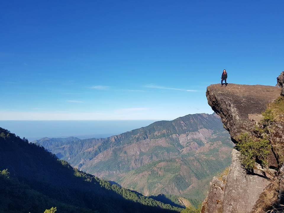
Gungal Rock and why it becomes the busiest photo stop
This is the most famous part of the route for a reason. Gungal Rock is dramatic, iconic, and one of the biggest visual rewards on the mountain. It is also where the trail can feel busiest, especially when hikers line up for photos. Expect that familiar photo queue atmosphere, and keep a little patience and edge awareness because this is not the place to rush for a shot.
Summit to exit
From the summit toward the Sta. Fe exit, the trail keeps delivering views, but this is also where the hike starts to feel longer. The ridgeline remains beautiful, but legs get heavier, the descent starts to matter more, and wind or fog can change the mood fast. That is why the exit matters in planning: Mt. Ulap is not just about reaching the top, but about finishing the full traverse well.
How to Go to Mt. Ulap from Manila
If you are figuring out How to go to Mt. Ulap from manila, the simplest answer is this: go to Baguio first, then transfer to Barangay Ampucao in Itogon, where the Mt. Ulap registration and jump-off process begins. Yes, you can commute all the way, but for a smoother Mt. Ulap DIY plan, it helps to treat Baguio as your staging point and not the mountain itself.
Manila to Baguio by bus
Most hikers heading to Mt. Ulap from Metro Manila pass through Baguio City first. That is the most practical and familiar route, whether you are coming in on a late-night trip or arriving before dawn.
- Look first at Victory Liner, Genesis/JoyBus, and Solid North
- Bus fares vary by operator, boarding point, and class
- A practical working range is:
- Solid North Cubao–Baguio: around ₱600–₱700+
- Solid North PITX–Baguio: around ₱700–₱800+
- Genesis Deluxe: around ₱650–₱730
- JoyBus Executive/Premiere: around ₱850–₱930
- For weekend hikes, I would always check live class fares and departure schedules before locking in the plan
If I were doing this on a budget, I would usually aim for an overnight bus so I could be in Baguio early and still have room to solve the next transfer.
Baguio to Ampucao transfer
From Baguio, the usual public transfer is the Ampucao jeepney from Lakandula Street near Baguio CenterMall.
- Fare is commonly around ₱50 per person
- The first public jeep is often around 7:00 to 8:00 AM
- That timing is the biggest public-transport weakness of this route
This is the part many hikers underestimate. If your goal is an early trail start or a strong sunrise logistics setup, do not rely on the first public jeep from Baguio. It is fine for a standard dayhike, but not ideal for dawn-focused movement.
When private transport makes more sense
Private transport becomes the smarter choice if you want more control over the day.
- Private car is best for groups who want an earlier and cleaner start
- A hired van makes sense for small groups splitting costs
- A taxi from Baguio is the easiest fast transfer, usually at around ₱800+ per ride
My practical take: yes, you can commute to Mt. Ulap from Manila, but Baguio is the real gateway, and your trip quality depends heavily on how you solve the Baguio transfer to Ampucao.
Fees, Registration, Permits, and Guide Requirement at Mt. Ulap
If you are planning a Mt. Ulap DIY hike, the current setup is straightforward: walk-ins are welcome, reservations are not required under the published system, and a mandatory local guide is part of the process. For most adult dayhikers, the fixed on-site cost starts at ₱190 per person before guide share, which already includes the barangay fee, DENR environmental fee, and DENR recreational fee.
Registration model
Everything is handled through in-person registration at the registration area near the jump-off.
- Walk-in registration is currently allowed
- Reservations are not required under the present published setup
- Registration is done on-site, not through a separate online permit portal
- For a standard Mt. Ulap Eco Trail dayhike, this makes planning simpler, but you still need to arrive within the allowed registration window
Registration windows
These cut-offs matter more than many first-timers expect, especially if you are commuting from Baguio.
- Weekday dayhike registration starts: 5:00 AM
- Weekend/holiday dayhike registration starts: 4:00 AM
- Dayhike cut-off: 12:00 noon
- Camping registration starts: 7:00 AM
- Camping cut-off: 2:00 PM
If you arrive late, the problem is not just lost hiking time. You may miss the practical window for a smooth traverse.
fee structure
Here are the base charges to keep in mind:
- Adults 18–59: ₱100
- Age 13–17: ₱20
- Students with valid ID: ₱50
- 12 and below: free
- Senior citizens: free
- DENR environmental fee: ₱30
- DENR recreational fee: ₱60
For an adult hiker, that means:
- ₱100 barangay fee
- ₱30 DENR fee
- ₱60 recreational fee
- Total fixed base cost: ₱190 per person before guide share
Guide System
This is the part you should not overlook. A mandatory local guide is required, and the guide fee is charged per guide group, not per person.
- Dayhike guide fee: ₱800 per guide group
- Overnight guide fee: ₱1,600 per guide group
- Peak season (Oct–Feb): up to 7 hikers per guide
- Lean season (Mar–Sep): up to 5 hikers per guide
In practical terms, the guide fee gets much better when split across a full group. If you are solo or in a small group, your per-person cost rises fast. That is why Mt. Ulap can feel budget-friendly for a complete group, but less cheap for undersized DIY setups.
Official Contacts, Tourism Verification, and the Guide Contact Reality
If you want to verify Mt. Ulap Location, access rules, or organizer legitimacy before your trip, the safest move is to start with official tourism office channels and the public Mt. Ulap Eco Trail contact, not random social posts or unofficial listings. That simple step can save you from bad directions, outdated fee info, or unverified guide offers.
Here are the most useful contacts to keep:
- Itogon Tourism / MTAO
- Mr. Nestor S. Camado Jr. — 09993367522 / 09274940601
- Ms. Claudine B. Imper — 09070324812
- Email: nscjr.mtaodesignate@gmail.com
- Mt. Ulap Eco Trail public contact
- +63 74 637 2189
- mtulap2022@gmail.com
- Benguet Tourism
- (074) 422-2306
- tourism@benguet.gov.ph
One important reality: “contact guide” is not the same as having a clearly published accredited guide roster. From the official public sources, a complete named list of accredited guides is not clearly laid out for easy browsing. Because of that, the safest route is still:
- contact the official tourism office
- contact the official Eco-Trail page
- or accept official on-site guide assignment
My practical advice is simple: if someone messages you offering a guide service for Mt. Ulap, verify through an official contact first. For organizer verification, that extra step is worth it.
DIY vs Joiner Setup — Which Mt. Ulap Trip Style Fits You Best?
If you want the most control over timing, pacing, and spending, Mt. Ulap DIY is usually the better fit. If you want the easiest path with fewer moving parts, a joiner van setup is the more convenient choice. Neither is automatically better. It really depends on whether you value logistics control or convenience more.
For me, DIY works best for hikers who already have a solid plan. It makes the most sense for:
- small groups who can split the guide fee and transport well
- photographers who want more freedom with pace and stops
- travelers already staying in Baguio who can build a cleaner Mt. Ulap Benguet schedule around their own timing
The big advantage of DIY is flexibility. You control your departure, your budget sharing, and how aggressively you want to chase viewpoints or a better weather window. The downside is that you also carry the friction, especially the early transfer problem from Baguio to Ampucao.
A joiner setup works better for:
- solo travelers
- first-timers
- people who do not want to solve the jeep, taxi, or private transfer question on their own
That convenience matters more than many hikers admit. Public joiner rates I have seen usually fall around ₱1,799 to ₱1,999 per head, but that is only a market snapshot, not official mountain pricing. You are paying for smoother coordination, easier transport, and less planning stress.
Choose DIY if you want better control, better budget sharing, and more freedom. Choose joiner if you want the simplest setup with the least planning hassle.
Sample Itinerary for Mt. Ulap
| Time block | Standard DIY dayhike from Baguio | Sunrise-focused DIY / private transfer | 2D1N overnight option |
|---|---|---|---|
| Night before | Stay in Baguio | Stay in Baguio or arrive late from Manila | Overnight bus from Manila or Baguio stay |
| 4:00–5:00 AM | Usually too early for public jeep | Registration possible on weekends/holidays with private transfer | Not needed unless very early camp move |
| 6:00–8:00 AM | Transfer to Ampucao depending on jeep timing | Already on-site or nearly on-site | Register from 7:00 AM onward for camping |
| Registration + orientation | Allow around 40 mins total | Allow around 40 mins total | Allow around 40 mins total |
| Hike start | Mid-morning is realistic for PUJ users | Early dawn to sunrise window | Morning start to camp setup |
| Ambanao Paoay | Use official 2–3 hr window from jump-off | Same | Same |
| Gungal Rock | Add 1–2 hrs | Add 1–2 hrs | Add 1–2 hrs |
| Summit | Add 1–2 hrs | Add 1–2 hrs | Can be split around sunset/sunrise goals |
| Exit to Sta. Fe | Add 1–2 hrs | Add 1–2 hrs | Day 2 descent |
| Return trip | Afternoon exit back to Baguio | Earlier scenic payoff, afternoon return | Return to Baguio after exit |
Build your itinerary around the official registration windows and the published segment estimates, not just the shorter tourism overview. In practical terms, a true sunrise attempt is much easier with private transfer or an overnight setup nearby, because the first public jeep from Baguio is only around 7–8 AM.
Budget Breakdown for a Mt. Ulap DIY Hike
For a standard Mt. Ulap DIY dayhike, the safest baseline is to start with ₱190 per adult for fixed on-site charges, then add your guide share, transport, and food. The total can stay reasonable if you fill your group well, but it climbs fast if you go solo, use a taxi, or book a higher bus class from Manila. In short, group size matters just as much as trail fees.
The first thing I always look at is the split between fixed fees and shared costs. Your fixed adult on-site total is already clear: ₱100 barangay fee + ₱30 DENR environmental fee + ₱60 DENR recreational fee = ₱190 per person. After that, the main variable is the guide.
For a dayhike, the guide fee is ₱800 per guide group:
- In a group of 5, that becomes ₱160 per person
- In a group of 7, that drops to about ₱114 per person
That difference is exactly why Mt. Ulap can feel affordable for a full group and less budget-friendly for a small one.
A realistic sample from Baguio looks like this:
- Group of 5 using public jeep: around ₱450 per person before Manila–Baguio bus
- Group of 7 with private car: around ₱304 per person + parking split, excluding fuel and tolls
Transport can move the total a lot. A Baguio to Ampucao jeep is cheap, but a taxi at around ₱800+ per ride changes the math. The same goes for Manila to Baguio bus fares, which can range from roughly ₱600 to ₱930+ one way depending on operator, boarding point, and class.
If you go overnight, expect extra costs for camping fees, overnight guide rate, and optional porter service. My practical rule is simple: if you want the lowest per-person cost, fill the group first before optimizing anything else.
| Cost item | Working amount | Notes |
|---|---|---|
| Barangay registration fee (adult 18–59) | ₱100 | fixed on-site fee |
| Barangay fee (13–17) | ₱20 | youth rate |
| Barangay fee (student w/ ID) | ₱50 | student ID required |
| Barangay fee (12 and below) | Free | published free tier |
| Barangay fee (senior citizen) | Free | published free tier |
| DENR environmental fee | ₱30 | fixed |
| DENR recreational fee | ₱60 | fixed |
| Dayhike guide fee | ₱800 | mandatory, per guide group |
| Overnight guide fee | ₱1,600 | mandatory for camping setup, per guide group |
| Barangay camping fee | ₱800 | overnight only, per group up to 10 |
| DENR camping payment | ₱200 | overnight only, per group |
| Porter fee one-way | ₱800 | optional; max 15 kg per published note |
| Porter fee two-way | ₱1,200 | optional; overnight or heavier setup |
| Parking fee | ₱100 | private vehicle only, per vehicle |
| Baguio to Ampucao jeep | ₱50 | public PUJ guidance, one way |
| Baguio to Ampucao taxi | around ₱800+ | useful for early start, per ride |
| Manila to Baguio bus | around ₱600–₱930+ one way | class- and operator-dependent working range |
| Food budget | ₱200–₱400 | practical planning allowance |
| Water/snacks | ₱100–₱250 | depends on how much you bring in |
| Joiner market snapshot | around ₱1,799–₱1,999 | not official trail fee; only a market comparison |
| Sample DIY total from Baguio, group of 5 | around ₱450 before Manila-Baguio bus | using published fees + jeep assumption |
| Sample DIY total from Baguio, group of 7 + private car | around ₱304 + parking split | excluding fuel and tolls |
Best Month to Hike Mt. Ulap and When to Expect Sea of Clouds
The Best month to hike Mt. Ulap is usually somewhere between November and February, when mornings are cooler, the ridges feel more comfortable to cross, and the weather is generally better suited for a long exposed traverse. That said, these are also busier months, so better trail conditions often come with more hikers on the mountain.
For planning, I like to think of the year in two practical halves. Peak season runs from October to February, which also matches the published period when guide ratios can go up to 7 hikers per guide. Lean season runs from March to September, when the guide ratio tightens and the mountain can feel hotter, especially once the sun is fully out.
If your goal is a cleaner view and a better shot at Mt. Ulap Sea of clouds, the cooler months usually give you the best overall odds. Early mornings during the dry season can produce beautiful cloud movement over the ridges, but it is important to keep expectations realistic. Sea of clouds is possible, not guaranteed. Even on a well-timed trip, you might get clear skies, thin mist, or nothing dramatic at all.
The other thing to remember is exposure. Mt. Ulap is an open ridge hike, so cool mornings help, but wind, fog, and weather swings still matter. During rainy periods or storm signals, weather closures can happen, and that should always override any scenic goal.
My honest take: go between November and February if you want the best balance of comfort and scenery, but expect more people on the trail.
Safety Reminders, Closures, and What Can Ruin a Mt. Ulap Hike
Yes, Mt. Ulap is generally safe for prepared hikers, but it is not a trail I would treat casually. The biggest risks are usually not extreme terrain, but weather, exposure, poor timing, and bad decisions on an open ridge.
- Treat the status of the Mt. Ulap Trail as conditional, not automatic.
- Closures can happen because of tropical systems, strong rain, public advisories, or unsafe trail conditions
- Do not assume the mountain is open just because you saw old trip posts online
- Verify access within 24 hours before your hike
- Watch the weather closely.
- An exposed ridgeline means strong wind, sudden fog, and fast visibility changes
- Light rain can quickly turn parts of the trail into a slippery descent, especially later in the day
- If there is a storm signal, unstable weather, or heavy rain in Benguet, take that seriously
- Manage your pace early.
- Mt. Ulap is not very technical, but the long traverse can wear people down
- Descent fatigue becomes more noticeable after the scenic sections, especially when legs are already tired
- Be patient at Gungal Rock.
- This is the busiest part of the Mt. Ulap Eco Trail
- Crowd management matters here more than speed
- Wait your turn, watch your footing, and do not force photos in a rushed line
- Double-check these before leaving:
- current trail status
- weather forecast
- registration window
- your transfer plan to Ampucao
- water, traction, and rain protection
What to Wear and Bring for a Mt. Ulap Hike
Essentials
- Trail shoes with good traction because the Mt. Ulap Trail can feel easy in dry weather but much less forgiving on damp or worn sections
- 2 to 3 liters of water because this is an exposed mountain and I would not plan around a reliable refill point
- Headlamp if you are starting early, especially for pre-dawn movement or a sunrise-focused Mt. Ulap DIY setup
- Sun protection: cap or hat, sunscreen, and sunglasses because the open ridges can get bright fast once the sun is up
- Basic first aid kit for small cuts, blisters, headache, or muscle strain
Comfort items
- Light long sleeves or arm sleeves for sun and wind exposure
- Quick-dry shirt and breathable shorts or trekking pants so you stay comfortable on the climb and descent
- Small towel or bandana because sweat builds up quickly on exposed sections
- Snacks or trail food for steady energy on the traverse
Weather-dependent extras
- Windbreaker or light rain layer because early wind can feel cold even when the day later turns warm
- Extra light layer for chilly morning starts
- Dry bag or waterproof pouch to protect your phone, wallet, and electronics if fog or rain rolls in unexpectedly
My practical rule: dress for wind early, sun later, and always carry enough hydration for the full hike

Mt. Ulap vs Mt. Pulag — Which One Fits You Better?
If you are choosing between the two, Mt. Ulap is usually the better pick for a shorter scenic Benguet hike, while Mt. Pulag is the stronger choice if you want a bigger mountain experience and the satisfaction of a more iconic summit. That is the cleanest way to frame Mt. Ulap vs Mt. Pulag without overcomplicating it.
For most beginners, Mt. Ulap feels easier to fit into a real weekend plan. It is more practical for a quick DIY trip, especially if you are already staying in Baguio. The route is shorter in feel, the planning is more compact, and the reward comes quickly through scenic ridges, Gungal Rock, and wide open views. If your goal is a beautiful dayhike without turning it into a major production, Mt. Ulap has the advantage.
Mt. Pulag, on the other hand, usually feels like the bigger commitment. It carries more “big summit” prestige, and for many hikers, that alone makes it the dream objective. The mountain atmosphere also feels more substantial because the trip usually asks for more time, more structure, and more intention.
In terms of beginner comparison, I would say this:
- Mt. Ulap is better for a quick DIY trip, a scenic ridge walk, and a more manageable Benguet hiking choice
- Mt. Pulag is better if you want a larger mountain experience and a more high-profile summit goal
My honest take: choose Mt. Ulap for compact planning and scenic ridges; choose Mt. Pulag for scale and summit prestige.
Mt. Ulap FAQs
What is Mt. Ulap MASL?
Mt. Ulap MASL is 1,846 meters above sea level. That is the elevation most commonly used in official tourism references and is the main benchmark hikers use when comparing it with other Benguet climbs.
How many KM is Mt. Ulap?
The official trail length is commonly cited at around 9.4 km. Actual recorded distances from third-party apps may vary a bit depending on how the route is tracked, but 9.4 km is the clean planning number to use.
How many hours to hike Mt. Ulap?
A short tourism summary may say around 3 to 5 hours, but real hiking days often feel longer because of registration, pacing, rest stops, and the full traverse to the exit. It is better to plan for a fuller hiking day rather than treating it like a quick side trip.
Is Mt. Ulap beginner-friendly?
Yes, it is beginner-friendly for prepared hikers, but it is not a lazy beginner hike. The trail is not highly technical, though the exposed ridges, wind, and full elapsed time can make it feel more demanding than expected.
Is a guide required at Mt. Ulap?
Yes. A mandatory local guide is part of the current visitor setup. That applies to dayhikes and overnight trips, so guide cost should always be part of your budget.
Can I do Mt. Ulap DIY?
Yes, Mt. Ulap DIY is very doable, especially for small groups or travelers already staying in Baguio. The main challenge is not the mountain itself, but solving the early transfer to Ampucao if you want a better start.
How do I go to Mt. Ulap from Baguio?
The common public route is via the Ampucao jeepney from Lakandula Street near Baguio CenterMall. Public jeep fare is often around ₱50, but the first trip at around 7–8 AM can be too late for sunrise-focused plans.
How do I go to Mt. Ulap from Manila?
The usual route is Manila to Baguio by bus, then Baguio to Ampucao by jeep, taxi, or private vehicle. For most hikers, Baguio is the best staging point for the trip.
What is the best month to hike Mt. Ulap?
The Best month to hike Mt. Ulap is usually somewhere between November and February, when mornings are cooler and the exposed ridges feel more comfortable. These months also tend to be busier, so expect more hikers on the trail.
Does Mt. Ulap have sea of clouds?
Yes, Mt. Ulap Sea of clouds is one of the mountain’s best-known attractions, especially on cool mornings. But like any mountain weather event, it is always possible, never guaranteed.
Final Planning Tips Before You Hike Mt. Ulap
- Confirm access and closure status before leaving, ideally within 24 hours of your trip
- Decide early if you are using the public jeep or a private transfer, because that choice affects your entire schedule
- Double-check your group split, since the guide fee becomes much cheaper when shared across a fuller group
- Bring enough water for the full traverse, not just the climb to the photo spots
- Start earlier than you think you need to, especially if you want better weather and less rushed pacing
- Save the official tourism and Eco-Trail contact numbers before travel
- Do not plan around perfect sunrise timing if you are relying on the first public jeep from Baguio
- Treat Mt. Ulap Benguet like a real hike, not just a scenic stop with a short walk in between
Benguet Hiking Guide
- If you want another scenic ridge hike in Itogon after Mt. Ulap, read my Mt. Kotkot hiking guide in Benguet.
- If you are building a longer Benguet itinerary, you can pair this hike with my guide to Lake Tabeo in Kabayan.
- For a more relaxed Benguet side trip, check my Northern Blossom Flower Farm guide in Atok.
- If you are looking for a more demanding Cordillera climb after Mt. Ulap, read my Mt. Ugo Traverse guide.
- For hikers comparing Benguet mountains, I also have a full guide to Mt. Kabunian in Bakun.
- If you want a tougher multi-stage mountain experience, you can read my Mt. Purgatory Traverse guide.
- For another photogenic Cordillera hike, check my guide to Mt. Kupapey and Mt. Fato.

Pingback: The Ultimate Guide To The Top 10 Mountains In The Philippine – BizBackLinks
A highly recommend hike!!