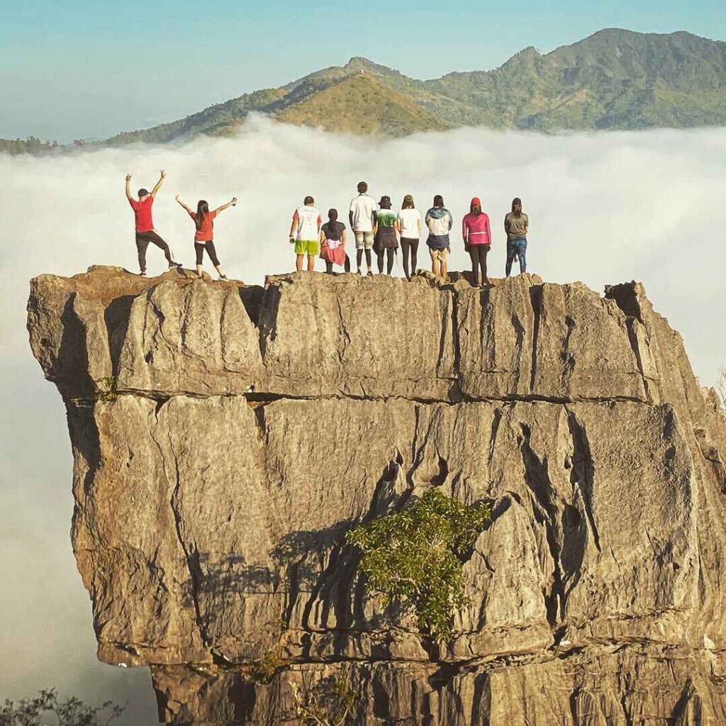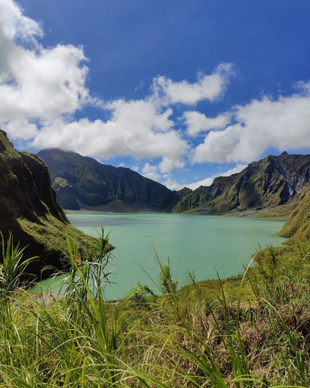
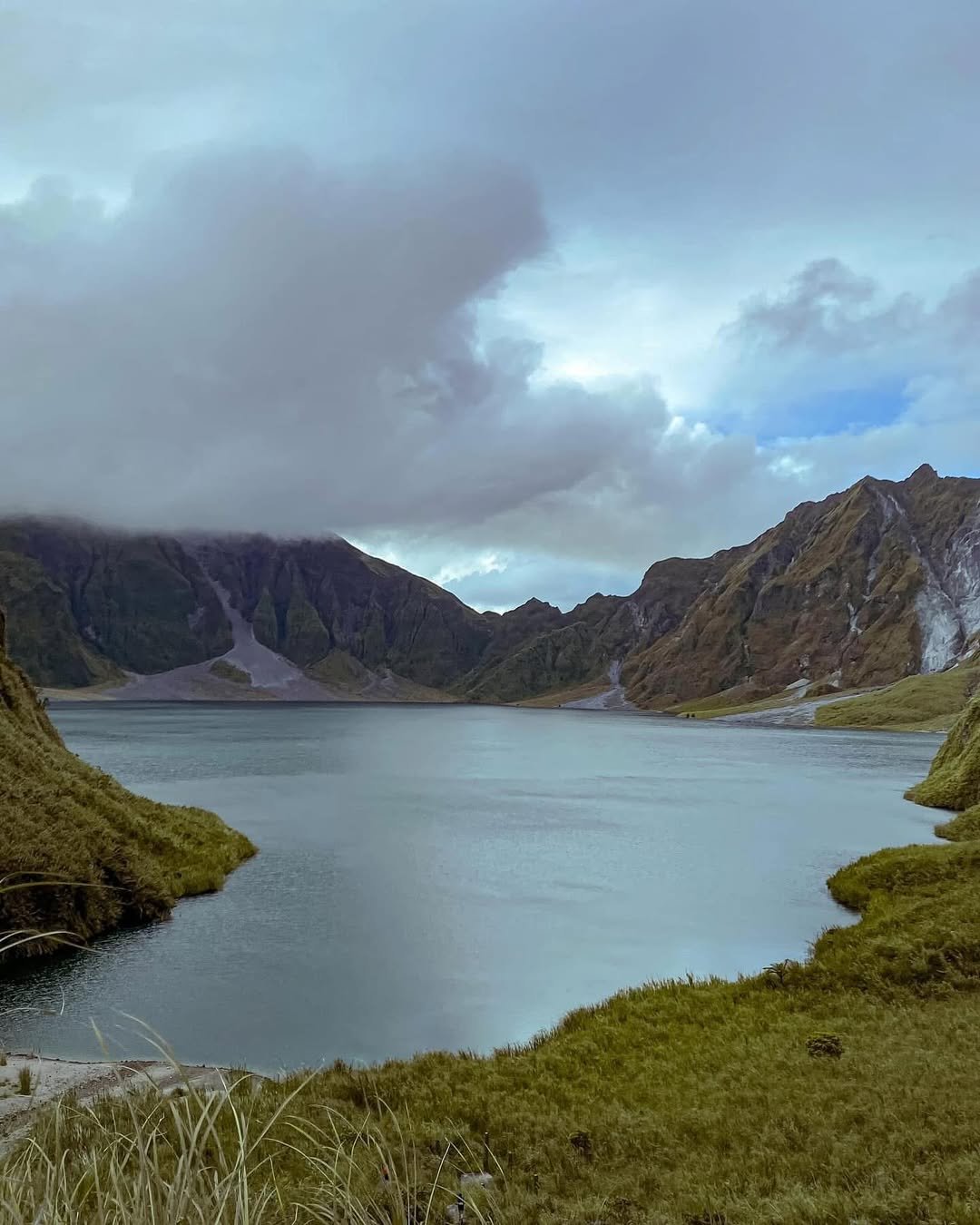
The “Beautiful Disaster”
This Mt. Pinatubo DIY Guide 2026 is your essential handbook for navigating the “Beautiful Disaster” located at the tri-boundary of Zambales, Tarlac, and Pampanga. We cover the mandatory 1-hour 4×4 ride through Crow Valley, the new “dual-fee” structure (Capas + Botolan), and the critical 20-day clearance rule for foreigners. Expect a beginner-friendly (2/9 Difficulty) but heat-intensive hike to the iconic crater lake.
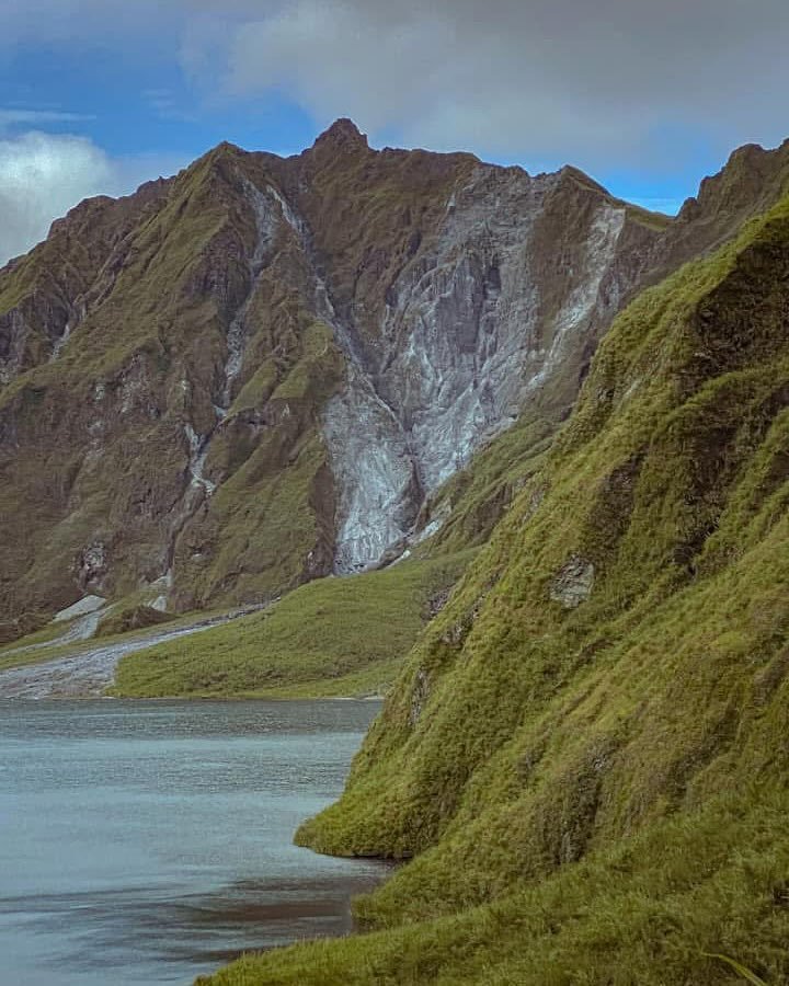
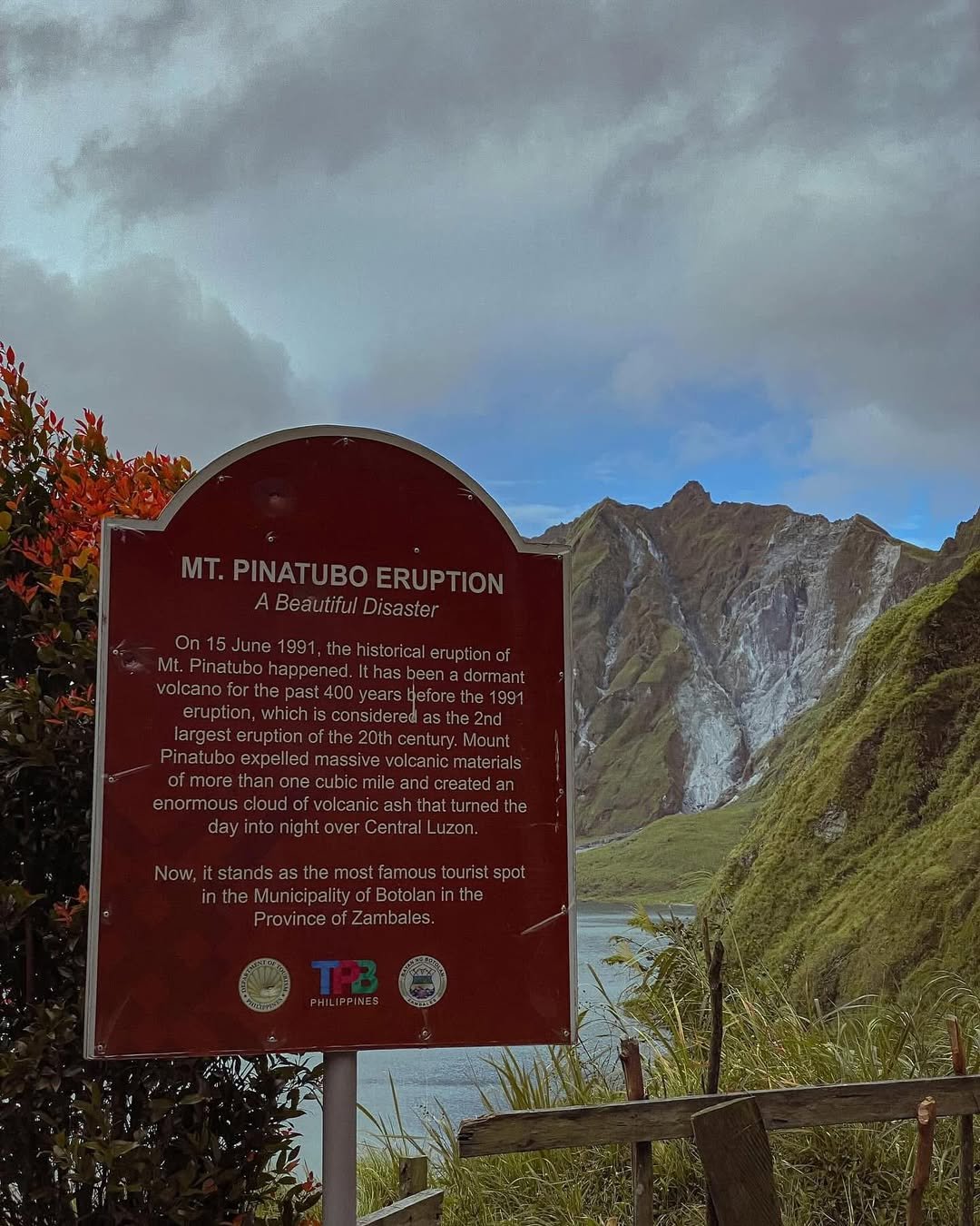
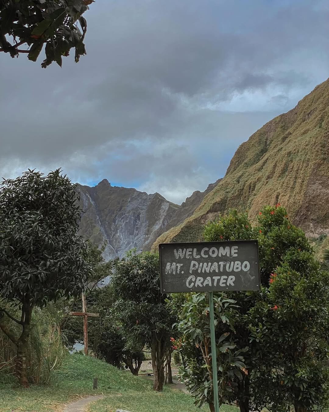
The 1991 eruption didn’t just shear off the mountain’s summit from 1,745 meters to roughly 1,486 MASL; it created a geopolitical anomaly. While the volcano physically sits in Botolan, Zambales, the only viable operational access for us hikers is through Barangay Santa Juliana in Capas, Tarlac. This disconnect between “access” and “asset” is what drives the complex regulations we face this year.
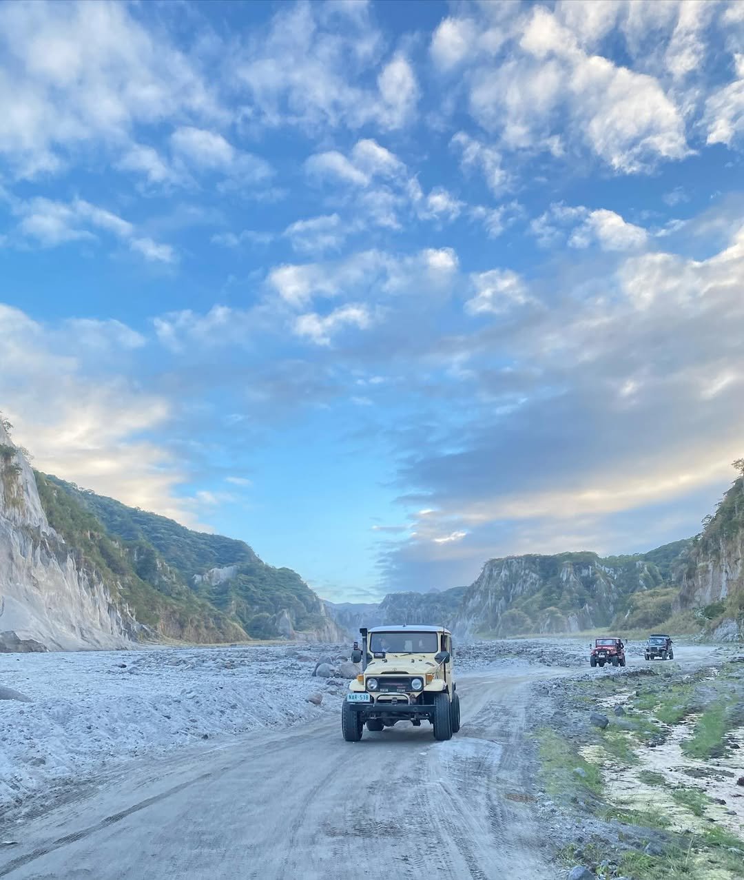
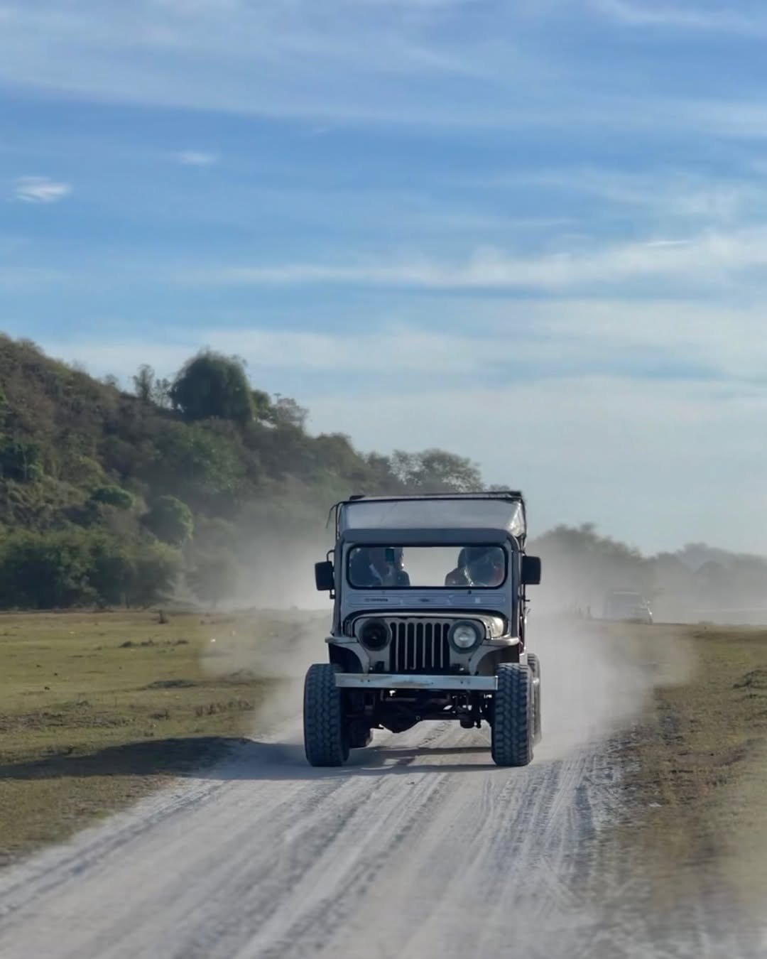
Walking through the canyons feels less like hiking in the tropical Philippines and more like traversing a Martian surface. The “trail” isn’t a fixed path—it’s the dynamic, shifting lahar bed of the O’Donnell River. You will be dwarfed by towering walls of compressed ash and grey sand as your 4×4 jeep navigates the Crow Valley Gunnery Range.
Insider Tip: Don’t let the “Beginner Friendly” rating fool you. While the terrain is flat, the lahar valley acts as a convection oven. By 11:00 AM, the solar reflection off the grey sand makes 32°C feel like 40°C. I highly recommend starting your trek immediately after the 6:00 AM dispatch to beat the midday heat.
For the 2026 operational season, the challenge isn’t the climb; it’s the logistics. From strict blood pressure checks at the Tourism Office to the new “Ancestral Domain” fees, this Mt. Pinatubo itinerary cuts through the confusion to ensure you reach that stunning turquoise water safely and legally.
The Quick Specs: Mt. Pinatubo Profile
Mt. Pinatubo is classified as a Minor Climb with a 2/9 Difficulty rating. The standard route involves a 1-hour 4×4 ride followed by a 1.5 to 2-hour trek (approx. 5.5km to 7km) along the O’Donnell River bed. While the trail is mostly flat, the primary challenge is the severe Heat Index and exposure within the open lahar canyons.
To help you plan your Mt. Pinatubo DIY trip, here are the essential technical specifications for the 2026 season:
| Specification | Details |
| Elevation | ~1,486 MASL (Summit height varies due to erosion) |
| Jump-off Point | Brgy. Santa Juliana, Capas, Tarlac |
| Difficulty Level | 2/9 (Beginner Friendly / “Walk in the Park”) |
| Trail Class | 1-2 (Wide riverbed walking, loose sand, minimal scrambling) |
| Trek Duration | 1.5 – 2 Hours (One Way) from 4×4 Drop-off |
| Total Distance | ~11km – 14km (Round Trip) |
| Best Time | December to May (Dry Season) |
| Limatik Presence | None (Dry Lahar) |
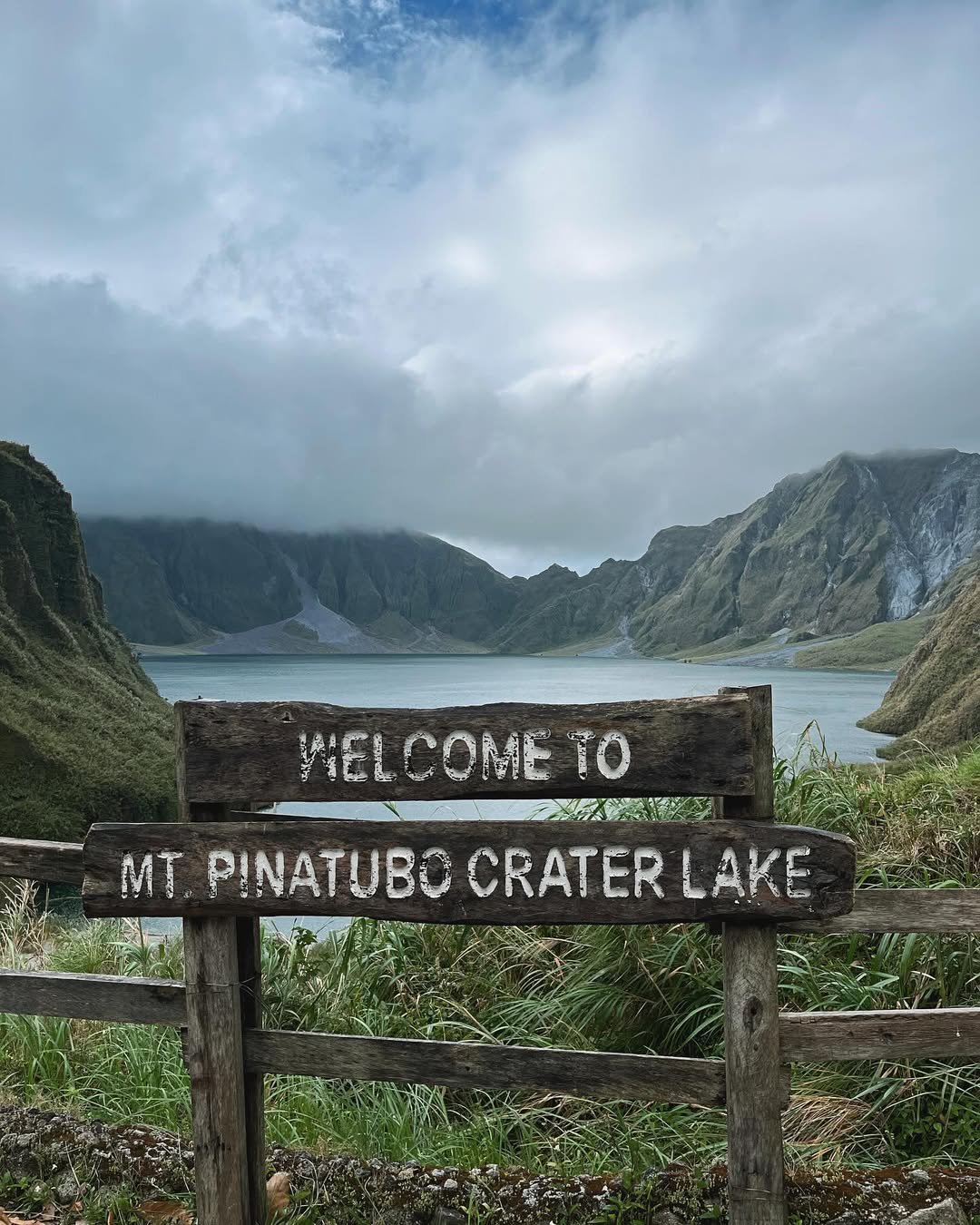
While the Mt. Pinatubo height is listed at 1,486 MASL, don’t expect a traditional summit assault. You are hiking into a caldera, meaning the elevation gain is minimal until the final 20-minute ascent to the crater rim stairs. The terrain is dominated by the O’Donnell River, requiring multiple stream crossings where water levels can range from ankle to calf-deep depending on recent rainfall.
The Mt. Pinatubo difficulty is often underestimated because of the flat terrain. However, I cannot stress this enough: The heat is the real enemy here. The lahar sand reflects sunlight, and the high canyon walls of the Crow Valley Gunnery Range block the wind, often pushing temperatures above 35°C by mid-morning.
Insider Tip: The length of the hike actually changes with the weather. In the peak dry season (Jan-April), the 4×4 jeeps can drive further up the “Skyway,” cutting the trek down to just 1 hour. If you visit during the transition months (June or Nov), the jeeps stop earlier at the “wet season parking,” forcing you to walk the full 2 hours. Always ask your jeep driver about the current drop-off point before you start.
Table of Contents
Pre-Hike Requirements (The “Gatekeepers”)
For 2026, Mt. Pinatubo requirements are strict. Foreign nationals must secure a Philippine Air Force (PAF) Visit Clearance at least 20 days prior to the hike. For health protocols, hikers aged 40-59 undergo a mandatory Blood Pressure (BP) check (max 140/90) at the jump-off, while Seniors (60+) must present a valid “Fit to Hike” Medical Certificate.
The trek to the crater isn’t just a walk in nature; it’s a passage through the Crow Valley Military Reservation. Because this is active military ground used for Balikatan Exercises, the bureaucracy is tighter here than almost any other major mountain in Luzon. Failure to prepare these documents will result in being turned away at the registration counter in Santa Juliana.
For Foreign Nationals: The 20-Day Rule
If you are a non-Filipino passport holder, you cannot simply show up. You are required to obtain a Visit Clearance from the Philippine Air Force (PAF).
Deadline: You must submit your passport bio-page copy at least 20 days before your hike date.
Enforcement: Military personnel check this clearance at the Falcon Gate and Condor Gate checkpoints inside the valley.
Action: Do not attempt a “DIY walk-in” as a foreigner. You must book through an accredited 4×4 operator in Capas who will handle the submission of your documents to the PAF Intelligence Unit.
For Local Hikers: The Health Gates
The Capas Tourism Office implements age-based medical screening to prevent heatstroke and cardiac incidents on the trail.
Minors (7-17 years old): Allowed. Children below 7 are discouraged due to the extreme heat.
Adults (18-39 years old): Generally no restrictions, though a standard waiver is signed.
Adults (40-59 years old): Mandatory Blood Pressure Check. You must pass the screening at the on-site clinic before your tourism fees are accepted. The cut-off is strictly 140/90. If your BP is higher, you will be asked to rest for 30 minutes and re-test. If it remains high, you are disqualified.
Seniors (60+ years old): You must bring a physical Medical Certificate stating you are “Fit to Hike” OR proof of Travel Insurance that explicitly covers outdoor activities. Digital copies are often rejected—bring the paper.
Insider Tip: If you are in the 40-59 age bracket, skip the coffee on the morning of your hike. I’ve seen dozens of fit hikers get held back at the clinic because the combination of caffeine and the stress of the 2:00 AM drive spiked their BP. Drink water, pass the check first, and then have your coffee while waiting for your 4×4 jeep dispatch.
How to Go to Mt. Pinatubo (DIY Logistics)
To get to Mt. Pinatubo via public transport, take a bus bound for Capas, Tarlac City, or Baguio and alight at McDonald’s Capas Junction. From there, hire a tricycle for the 24km ride to Barangay Santa Juliana. For private vehicles, drive north via NLEX and SCTEX, utilizing the New Clark City (NCC) Exit or Capas Exit to reach the Tourism Office.
Navigating the transport logistics is the first hurdle of your Mt. Pinatubo DIY Guide experience. Unlike other mountains where the bus drops you near the trail, Pinatubo has a “last mile” gap that requires patience and negotiation.
Option A: The Commuter Route (Bus + Trike)
Your goal is to reach the Capas Tourism Office before the 7:00 AM cutoff. This means catching a bus from Metro Manila no later than 2:30 AM.
Step 1: Manila to Capas Junction Head to the Victory Liner or Five Star terminals in Cubao or Pasay. Board any bus bound for Tarlac City, Baguio, or Dagupan. Tell the conductor your drop-off is strictly “Capas Junction” or “McDonald’s Capas.”
Travel Time: 2.5 – 3 hours.
Estimated Fare: ₱210 – ₱280 (depending on Regular AC or Deluxe class).
Step 2: The “Last Mile” Gauntlet Upon alighting at McDonald’s Capas, you will be swarmed by tricycle drivers. The jump-off point in Brgy. Santa Juliana is still 20-24 kilometers inland.
Capacity: Strictly 3 passengers per tricycle.
The Cost Reality: This is where friction occurs. The “Tourist Rate” is often quoted at ₱500 – ₱600 per way. If you are a skilled negotiator or speak the local dialect, you might get it down to ₱300 – ₱400.
Insider Tip: Secure your return ride immediately. Finding a tricycle in Santa Juliana at 2:00 PM after your hike is notoriously difficult. I always ask for the driver’s mobile number and agree on a pickup time (usually 1:00 PM or 2:00 PM) before I let them leave in the morning.
Option B: Private Vehicle
For those driving, the route is straightforward and safe. Take NLEX (North Luzon Expressway) northbound and seamlessly transition into SCTEX (Subic-Clark-Tarlac Expressway).
Exit Point: You have two choices. The traditional Capas/Concepcion Exit is reliable, but the modern New Clark City (NCC) Exit often has less traffic and wider roads leading back to the provincial highway.
Waze/Google Maps Pin: Set your destination to “Capas Tourism Office” or “Alvin’s Place” (a popular homestay/parking compound).
Parking: Secure parking is available at the Tourism Office compound or adjacent homestays for a fee of ₱50 – ₱100.
By securing your transport early, you ensure you’re in the first batch of 4×4 jeeps dispatching at dawn, avoiding the worst of the midday heat.
The Trail & 4×4 Experience
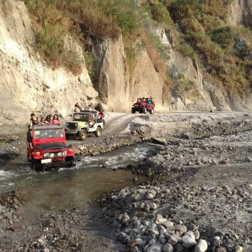
The trail to Mt. Pinatubo begins with a dusty 1-hour 4×4 ride through the Crow Valley Gunnery Range. The hike traverses the O’Donnell River bed, featuring multiple shallow stream crossings and open lahar fields with zero shade. Expect fine silica dust, extreme heat exposure, and unique “toblerone” rock formations along the route.
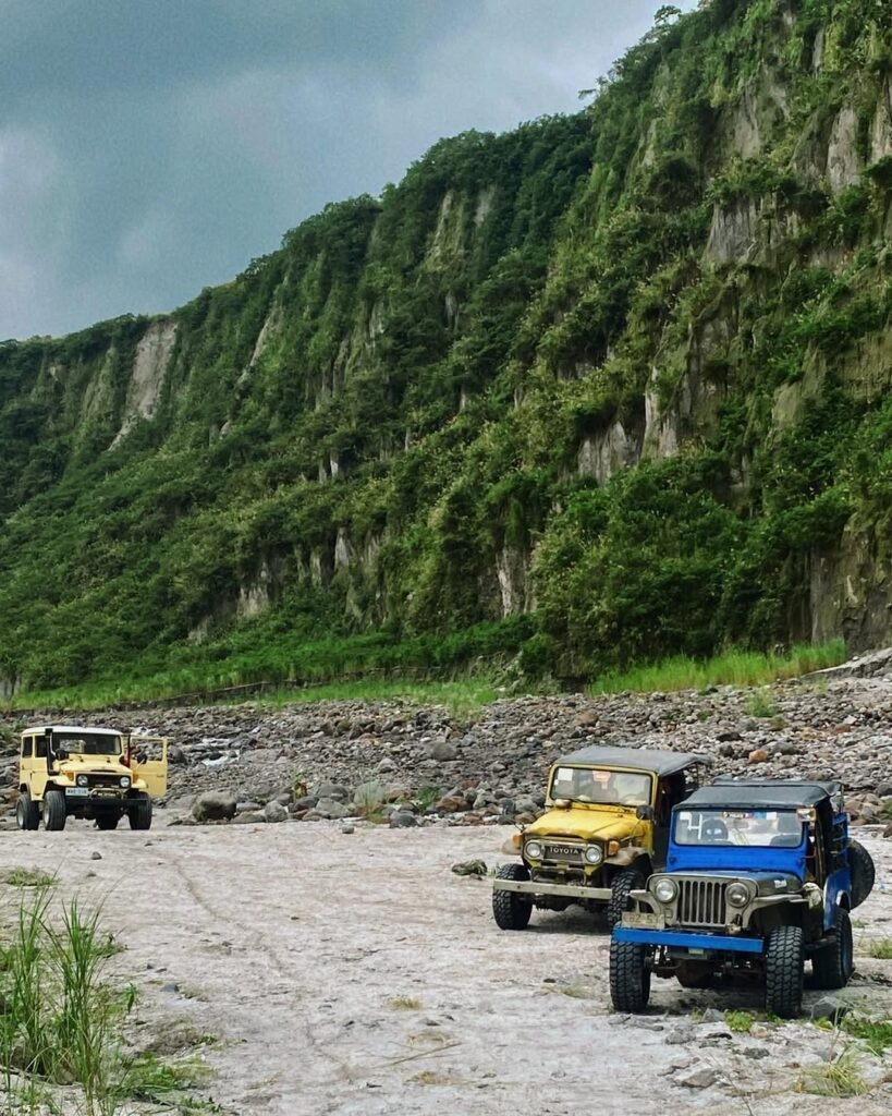
The adventure truly kicks off the moment you board the 4×4 jeep at the Capas satellite office. These modified vintage Willys and Land Cruisers are open-air workhorses designed to handle the shifting sands of the Crow Valley.
The 4×4 Leg: Into the “Moonscape”
Hold on tight. The ride is bumpy, loud, and incredibly dusty. As you enter the military reservation, you’ll be surrounded by grey canyon walls that tower dozens of meters high. About 30 minutes in, the convoy usually stops at the “Toblerone Hills”—conical lahar formations that look like the famous chocolate bar. This is your designated bathroom break (bush toilet style) and photo op.
Insider Tip: Wear sunglasses and a face mask or thick buff immediately. The jeep ahead of you will kick up massive clouds of fine volcanic ash. Without protection, you’ll be tasting grit for the rest of the day.
The Trek: Riverbed Walking
Once the 4×4 drops you off, the Mt. Pinatubo DIY Guide experience shifts to an endurance test against the sun. The trail is technically the bed of the O’Donnell River. You will cross small streams multiple times—there are no bridges, so your footwear will get wet.
Dry Season (Dec-May): The jeeps can push further up the “Skyway,” reducing the hike to a manageable 1.5 hours (approx. 5.5km).
Wet Season (Jun-Nov): The jeeps stop earlier due to soft mud, extending the trek to 2+ hours.
Hazards & Connectivity
Zero Signal: From the moment you pass the military gate, say goodbye to civilization. There is absolutely no signal (Smart or Globe) in the canyon or at the crater. Download your offline maps before leaving Sta. Juliana.
Heat Exhaustion: This is the #1 hazard. The white/grey sand reflects UV rays, cooking you from below and above.
Silica Dust: The dust is abrasive. If you have asthma, an N95 mask is not overkill—it’s a necessity.
Warning: If it rains heavily in the mountains, the O’Donnell River is prone to flash floods. Listen to your local guide; if they say move to high ground, move immediately.
Itinerary Options (2026 Operational Hours)
A standard Mt. Pinatubo itinerary requires arriving at the Capas Tourism Office by 5:00 AM to secure a queue number. The 4×4 jeeps dispatch between 5:30 AM – 6:00 AM, aiming to start the trek by 7:30 AM. Hikers typically reach the crater by 9:30 AM and must begin their descent before noon to avoid the extreme heat of the Crow Valley.
Strict time management is the key to enjoying this hike. The Capas Tourism Office enforces a hard cut-off at 7:00 AM for day tours. If you arrive late, you will likely be turned away, regardless of your reservation.
Option A: The “Red Eye” Day Hike (Manila Origin)
This is the most common Mt. Pinatubo itinerary for weekend warriors. It requires an alpine start from Metro Manila to beat the registration queue.
| Time | Activity |
| 02:00 AM | Assembly in Manila (Cubao/Pasay/Private). |
| 02:30 AM | ETD Manila. Take NLEX -> SCTEX. |
| 05:00 AM | ETA Brgy. Santa Juliana. Secure queue number immediately. |
| 05:15 AM | Breakfast & Mandatory BP Check (for 40+). |
| 06:00 AM | Board 4×4 Jeep. Depart for Crow Valley. |
| 07:00 AM | Stop at “Toblerone Hills” for photos. |
| 07:30 AM | ETA Drop-off Point. Start Trek. |
| 09:30 AM | ETA Crater Lake. Rest, photos, snacks. |
| 11:00 AM | Start Descent. (Strict advice: Leave before noon). |
| 01:00 PM | Back at 4×4 Pick-up Point. |
| 02:30 PM | Back at Jump-off. Shower & Late Lunch. |
| 05:00 PM | ETD Capas. Head back to Manila. |
Insider Tip: The queuing system at the Tourism Office can be chaotic. If you are a group, split up immediately upon arrival. Have one person line up for the cashier/processing while the others (especially those 40+) head straight to the clinic for the BP check. This parallel processing saves you 30 minutes.
Option B: The “Relaxed” Overnight (Sta. Juliana Stay)
Camping at the crater rim is strictly prohibited for safety and environmental reasons. However, staying overnight at a local homestay in Santa Juliana allows you to sleep in and grab the first 4×4 dispatch slot at 5:30 AM.
| Time | Activity |
| Day 1 | Travel to Capas, Tarlac. Check-in at Alvin’s Place or Bognot’s Homestay. |
| 06:00 PM | Dinner at “Happy Streat” or local karenderya. |
| Day 2 | Wake up at 4:30 AM. Walk to Tourism Office (5 min). |
| 05:30 AM | First Batch Dispatch. Beat the crowds & heat. |
| 08:30 AM | ETA Crater Lake (Solo enjoyment before Manila crowds arrive). |
| 12:00 PM | Back at Homestay for Shower/Lunch. |
This option is highly recommended for photographers who want clear skies and fewer people in their shots, or for seniors who want to avoid the stress of a 2:00 AM drive.
Hiking Expenses 2026 (The Budget)
The estimated budget for a Mt. Pinatubo DIY hike in 2026 ranges from ₱2,500 to ₱3,500 per person. This estimate covers the shared 4×4 rental (₱3,000 – ₱3,500 per jeep), the mandatory local guide fee (₱500), and the new “stacked” regulatory fees: the Capas Eco Fee (₱300) plus the additional Botolan Fee (₱400 – ₱700).
If you hiked here years ago, prepare for sticker shock. The cost of entry has increased significantly due to the jurisdictional agreement between Tarlac and Zambales. You are no longer just paying the Capas LGU; you are now also paying the Botolan LGU and the Ancestral Domain share for the Aeta communities.
Here is the detailed Hiking expenses 2026 breakdown based on current rates at the Santa Juliana registration office:
| Cost Item | Rate (PHP) | Notes |
| 4×4 Jeep Rental | ₱3,000 – ₱3,500 | Good for up to 5 pax. Price varies by fuel cost. |
| Local Guide Fee | ₱500 | Per jeep/group of 5. Mandatory. |
| Capas Eco/Cons. Fee | ₱300 | Per head. Paid to Capas Tourism. |
| Botolan Fee | ₱400 – ₱700 | NEW. Per head. Paid to Zambales/IP Community. |
| Shower Fee | ₱50 – ₱100 | At homestays like Alvin’s Place. |
| Parking Fee | ₱50 | Per vehicle. |
| Tricycle (Commuters) | ₱300 – ₱600 | One-way from Capas Junction to Jump-off. |
The “Group of 5” Math
To maximize your budget, you must fill the 4×4 jeep with 5 people. If you are a solo traveler or a couple, the “DIY” route becomes expensive because you shoulder the full vehicle cost.
Scenario: A group of 5 friends will pay approx. ₱700 each for the jeep + guide, plus the ₱700-₱1,000 in individual fees. Total: ~₱1,700 per head (excluding food/transport from Manila).
Solo/Couple: You still pay ₱3,500 for the jeep/guide alone. In this case, joining a “Joiner Tour” (usually ₱2,500 – ₱3,500 all-in) is actually cheaper and less headache.
Insider Tip: Bring hard cash. There are no ATMs in Brgy. Santa Juliana, and the mobile signal is too weak for reliable GCash or Maya transactions at the payment counter. I’ve seen groups delayed by an hour just trying to find a spot with enough signal to send money. Don’t be that group—withdraw everything you need in Capas Town Proper or Manila.
What to Bring (The “Anti-Heat” List)
Essential gear for your Mt. Pinatubo DIY trip includes a thick face mask or buff (for the heavy lahar dust), UV-protective sunglasses, and at least 2 liters of water to combat the extreme heat. Trekking sandals are highly preferred over closed shoes due to the unavoidable river crossings. Don’t forget an umbrella or wide-brimmed hat—there is zero canopy cover.
Packing for this trip is different from a typical mossy forest hike like Mt. Pulag. Here, your enemies are the sun and the sand. The Mt. Pinatubo trail is essentially a desert walk, and your gear must reflect that.
Dust Protection (Crucial):
Footwear:
Hydration:
Sun Protection:
Cash Reserves:
Insider Tip: Pack a small “post-hike kit” with toiletries and a towel, but leave it in your van or at the shower facility at Alvin’s Place. You will come back from the crater covered in a mix of sweat and grey dust. That ₱50 shower before the drive back to Manila is the best money you will spend all day.
Where to Eat & Side Trips
There are no full-service restaurants at the Mt. Pinatubo crater, only local vendors selling snacks and cup noodles at inflated “mountain rates.” For your post-hike reward, head back to the town proper of Capas, Tarlac. We highly recommend “Happy Streat” for affordable barbecue and authentic sisig, or “Tita Sonia’s” for their famous Kapampangan Adobong Matua. Nearby side trips include the therapeutic Puning Hot Spring and the historic Capas National Shrine.
After conquering the heat of the Crow Valley, you deserve a proper meal. However, do not expect a feast at the summit. The view deck only has small stalls selling hard-boiled eggs, drinks, and instant noodles.
Insider Tip: Save your money. A cup of noodles at the crater can cost double what you’d pay in the city. I usually pack a heavy lunch (like adobo with rice) to eat at the designated picnic area overlooking the lake, then splurge on dinner back in town.
The Capas Culinary Scene
You are in Pampanga/Tarlac territory—the Culinary Capital of the Philippines. Do not leave without trying the local specialties.
Happy Streat: Located near the Capas Public Market, this food park comes alive in the late afternoon. It’s perfect for hiking groups looking for variety—from grilled isaw to sizzling platters.
Tita Sonia’s: Famous among locals for their Adobong Matua (old-style adobo). This version uses vinegar, garlic, and fish sauce—no soy sauce—resulting in a dry, savory dish that keeps well.
Authentic Sisig: If you order Sisig here, expect it to be served sizzling hot with zero mayonnaise. Kapampangans take their sisig seriously; adding mayo is considered a culinary crime here.
Worthwhile Side Trips
If you have extra energy or are staying overnight for a 2-day Mt. Pinatubo itinerary, these landmarks are just a short tricycle or van ride away:
Capas National Shrine: Just a few kilometers from the Capas Junction, this memorial marks the end of the infamous Bataan Death March. The towering obelisk (70 meters high) is a solemn reminder of World War II history. Entrance is minimal (approx. ₱20-₱40).
Puning Hot Spring: If your legs are sore, this resort offers a unique sand spa and thermal soaking experience. It utilizes the same lahar landscape but in a luxurious setting. It is pricier (₱3,000+ packages) but offers a relaxing counterpoint to the dusty trek.
Frequently Asked Questions (FAQ)
Swimming in the Mt. Pinatubo crater is strictly prohibited due to toxic water chemistry and safety risks. The hike is beginner-friendly (2/9 difficulty) but requires high heat endurance. Private 4×4 vehicles are generally not allowed; hikers must rent accredited local jeeps at the Sta. Juliana jump-off. There is absolutely no cell signal past the military checkpoint.
To wrap up this Mt. Pinatubo DIY Guide, here are the answers to the most common questions we get from first-timers planning their 2026 trip.
Can we swim in the crater lake?
No. This is the most common misconception. Swimming was banned years ago and is strictly enforced by the Botolan LGU and local guides. The water contains varying levels of sulfur, arsenic, and other volcanic minerals that can be toxic. Additionally, the lake is estimated to be over 600 meters deep with unpredictable currents and no lifeguards on duty. The area is also sacred to the Aeta Mag-Antsi people, and recreational swimming is considered disrespectful.
Insider Tip: Don’t even try to dip your feet for a photo. I’ve seen guides immediately blow their whistles and impose fines on tourists who step past the marker ropes.
Is Mt. Pinatubo beginner-friendly?
Yes, it is classified as a Minor Climb with a 2/9 Difficulty. However, “easy” refers to the incline, not the environment. The trail is mostly flat, sandy walking. The real challenge is the Heat Index, which frequently hits 40°C in the Crow Valley canyons. If you can walk 14km on a flat, hot beach, you can handle this hike. It is an endurance test against the sun, not a test of technical climbing skills.
Can I bring my own 4×4 vehicle?
Generally, no. You cannot drive your personal SUV or pick-up to the crater. You are required to park at Brgy. Santa Juliana and rent the local cooperative’s 4×4 jeeps. This policy ensures the safety of tourists (the local drivers know exactly where the quicksand-like lahar pits are) and protects the livelihood of the community.
Exception: Specialized 4×4 Overland Clubs can sometimes arrange permits for convoys, but this requires months of coordination with the Capas Tourism Office and expensive special permits.
What is the age limit for hikers?
Minimum Age: 7 years old.
Maximum Age: None, but Seniors (60+) are strictly required to present a Medical Certificate indicating they are “Fit to Hike” or a Travel Insurance policy covering outdoor adventure.
Health Gate: Remember, if you are 40-59 years old, you must pass the on-site BP check (Max 140/90).
Is there cell signal on the trail?
None. Prepare for a total digital detox. Your Smart or Globe signal will die approximately 10 minutes into the 4×4 ride near the Falcon Gate. There is no Wi-Fi at the crater. Download your Spotify playlists and offline maps while you are still at the Capas Junction
Conclusion: Leave No Trace
Mt. Pinatubo is the Ancestral Domain of the Aeta Mag-Antsi indigenous people. Visitors are strictly required to follow Leave No Trace (LNT) principles: pack out all trash (including wet wipes and wrappers), respect local customs, and avoid giving candy to children—buy their fresh produce instead. The 2026 Ancestral Domain fees you pay directly contribute to their community welfare.
As we wrap up this Mt. Pinatubo DIY Guide, remember that this mountain is more than just a tourist destination or a backdrop for Instagram photos. It is a living landscape that belongs to the Aeta communities who have stewarded this land long before the 1991 eruption reshaped it. The new “Botolan Fee” and strict regulations are there to ensure they benefit from the influx of tourism.
When you are at the crater or traversing the Crow Valley, please practice strict LNT. There are no garbage trucks that drive up to the 1,486 MASL summit. Every plastic bottle left behind has to be carried down manually by a local guide.
Insider Tip: At the “Toblerone Hills” rest stop, you will meet Aeta families selling fresh bananas, root crops, and souvenirs. Instead of handing out candy or money to the kids (which encourages begging), I always buy a bunch of bananas or kamote to take home. It’s a healthy snack for the drive back to Manila, and it puts money directly into the hands of the locals in a dignified way.
Respect the locals, keep the crater clean, and enjoy the most beautiful disaster in the Philippines. Safe travels on your 2026 adventure!
Explore More: Next Adventures
Done with the “Beautiful Disaster”? Whether you want to cool down at a nearby beach or level up your hiking game, here are our top recommendations to maximize your trip:
For the Aspiring Mountaineer:
Looking for your next easy adventure? Check out our curated list of Beginner-Friendly Hikes & Minor Climbs perfect for your next weekend trip.
Ready to graduate from the flat lahar fields to technical ridges? Challenge yourself with these Major Climb Mountains in the Philippines (Difficulty 5-9).
Maximize Your Zambales Trip:
Since you are already in the province, don’t miss our Zambales Ultimate Travel Guide 2025 for the best places to stay and eat.
Need to wash off the lahar dust? Cool down at these 10 Must-Visit Zambales Beaches.
Explore beyond the volcano with our guide to the 18 Must-Visit Zambales Tourist Spots