Mt. Purgatory Traverse Guide (2026): Route, Difficulty, Fees, Itinerary & How to Get There

mt. purgatory mangisi traverse
📷 jaemrdth

Mt. Purgatory Traverse is a ~26 km, point-to-point multi-peak hike in Bokod, Benguet, rated Difficulty 6/9 and classified as a major climb. Most groups take 10–12 hours to complete the day hike, but a 2D1N setup is more realistic and strongly recommended for a rewarding experience.

Mt. Purgatory Traverse Quick Guide

DetailInformation
MountainMt. Purgatory (also: Mount Purgatory Mangisi)
LocationBokod, Benguet, Cordillera, Philippines
ProvinceBenguet
Highest Elevation2,329 MASL (Mt. Komkompol)
Difficulty6/9 — Major Hike
Jump-offJapas, Bobok-Bisal, Bokod, Benguet
Exit PointBarangay Ekip, Bokod, Benguet
Best SeasonNovember–April
Trek Time10–12+ hours (day hike); 2D1N recommended
Trail Distance~26 km traverse
RegistrationRequired (DENR-UARBRR / Bokod LGU)
Campsite OptionsBangtinen, Mt. Bakian, Mt. Tangbao, Mt. Pack (emergency)

Table of Contents

mt. purgatory mangisi traverse
📷 jaemrdth
mt. purgatory mangisi traverse
📷 jaemrdth

Where Is Mt. Purgatory Traverse Located?

Mt. Purgatory is located in Bokod, Benguet, situated between two of the major Benguet mountains — Mt. Ugo and Mt. Pulag. That geographic sandwiching is actually the key to understanding the trail’s character: you are walking through a high-altitude ridge corridor that feels genuinely remote, even though Baguio City is only about 60 km away.

The traverse falls within the Upper Agno River Basin Resource Reserve (DENR context), and local trekking coordination is tied to the Bokod Municipal Tourism Office. The local Ibaloi and other Cordillera ethnic groups consider this territory part of their ancestral domain, which is why the orientation briefing at the jump-off is not just a formality — it carries cultural weight.

Most hikers call it Mt. Purgatory, but local tourism references may use Mount Purgatory Mangisi, so using both names when coordinating with local contacts is recommended. The route runs from Bobok-Bisal (Japas) in the west to Ekip in the east, passing through the barangays of Pito, Karao, and Poblacion along the way.

As for the name itself — it was named Mt. Purgatory because of its purgatory-like characteristics: coldness, waterlessness, darkness due to thick vegetation, and a feeling of isolation. An American logging-era surveyor coined the name, and it has stuck ever since.


How to Get to the Mt. Purgatory Traverse Jump-off Point

The most practical access chain is Manila → Baguio → Bokod/Japas, then local transfers depending on your registration and orientation setup.

From Manila to Baguio: Take an overnight bus departing from Manila. Common operators serving this route include GenesisSolid North, and Victory Liner. Budget approximately 5–7 hours travel time to Baguio, depending on your departure time and traffic.

From Baguio to Japas jump-off: The distance from Baguio City to the jump-off is approximately 60 km, taking 2–2.5 hours of travel. The earliest Baguio-to-Bokod van departs around 7:00 AM, with a van fare of approximately â‚±250/pax. A habal-habal (motorcycle taxi) from Bokod proper to the Japas jump-off runs an additional â‚±100/pax.

Here is where I have to be honest about the biggest practical headache of this climb: getting a vehicle to the jump-off is not as simple as most guides make it sound. Vans run on a general Baguio–Bokod route, not specifically to Japas. For groups who want to arrive early for a day hike, the most reliable option is booking a dedicated 4×4 monster jeep from Baguio the night before. Lining this up independently — without an existing contact in Baguio — is genuinely hard. This is the #1 logistical challenge of a DIY Mt. Purgatory attempt in 2026. Coordinate with your guide, your organizer, or a Baguio contact first, before you do anything else.

A 4×4 monster jeep ride will depend on the weather conditions and the type of jeep arranged, and it is sometimes possible for the jeepney to drive through the four-kilometer rough trail at the exit end.

mt. purgatory mangisi traverse
📷 jaemrdth
mt. purgatory mangisi traverse
📷 jaemrdth

Permits, Fees, and Guide Requirements at Mt. Purgatory Traverse

A guide is mandatory at Mt. Purgatory and walk-in access without prior coordination is not allowed. Local guides are part of the indigenous Ibaloi community, and there are around 20 local guides in the area for whom this is a major source of livelihood.

Orientation is held at DENR-UARBRR, PAMO, and pre-registration is done via a Google Form on the Bokod Tourism page. Complete this step before your trip date — it determines your guide assignment, orientation slot, and confirmation.

The territory where Mt. Purgatory is situated is part of the Ancestral Domains of multiple ethnic groups of Cordillera and also a protected landscape managed by DENR. As such, all climbers are required to participate in an orientation seminar that lasts approximately 30 minutes.

Current fee estimates (verify locally before your trip):

Fee ItemEstimated Cost (PHP)
LGU Registration Fee₱440/pax
Bunkers/Overnight Shelter Fee₱250/pax
Habal-habal (local motorcycle)₱100/pax
Baguio–Bobok Tourism Van₱250/pax
Guide Fee (overnight, 4 pax)₱2,400
Additional Pax Guide Fee₱600/pax
Porter Fee₱1,500

Note that older blog posts cite registration at ₱100 and guide fees at ₱500/day — these are no longer reliable figures. Recent field reports and LGU signals indicate the guide fee for an overnight group has risen to the range above. Always confirm the exact current fee matrix with the Bokod Municipal Tourism Office before finalizing your budget.


What Is the Mt. Purgatory Traverse Trail Like?

The traverse is a point-to-point route from Japas to Ekip, classified as a major hike at approximately 6/9 difficulty, covering ~26 km in 10–12+ hours for a day hike. The technicality is generally non-technical, making it endurance-driven rather than technical-skills-driven.

The entire trail can be divided into three segments: the initial part through mountain communities, the second through mossy forest, and the third from the last mountain to the exit point through pine forest.

Stage 1 – Japas to Mt. Mangagew (approx. 8 km)

The first part of the Mt. Purgatory Traverse involves an eight-kilometer hike from the Japas jump-off to the summit of Mt. Pack at 2,290 MASL. The trail features pine forests and mountain roads that, had they been established enough, would have enabled jeepneys to pass through.

The trail is a gradual ascent with thick forest cover, so you are protected from direct sun rays on this opening section. Mt. Mangagew (1,705 MASL) is the first peak, roughly 1–1.5 hours from the jump-off. Mt. Mangakew has a mountain community on top with access to electricity and running water — a critical refill point before conditions become more remote beyond this peak.

Stage 2 – Mt. Pack (2,290 MASL) and the Mossy Forest

From Mt. Mangakew, it takes another one to two hours to reach Mt. Pack. Going there is a bit more challenging since you will leave the forest cover on the first part. After about five kilometers, the trail transitions into mossy forest and becomes a bit steep, though well-established throughout.

Mt. Pack sits at 2,290 MASL and is one of the true summits of the traverse. Mt. Pack is particularly interesting because it lies on the borderline of two provinces — Nueva Vizcaya and Benguet — despite being located at Poblacion, Bokod, Benguet. From the flat summit, views open toward both provincial landscapes on a clear day.

Stage 3 – The Mossy Forest to Mt. Purgatory (2,080 MASL)

This is where the Mt. Purgatory trail earns its name — and earns the deepest respect from the hiker. The mossy forest between Mt. Pack and the Mt. Purgatory marker is the longest, most atmospheric, and most physically demanding section of the traverse.

The mossy forest trail looks like a landscape from mystical fairy tales. Feast your eyes on the wonderful flora inside the forest. The trail takes about 3 hours before you reach Mt. Purgatory. Changes in elevation inside the Mossy Forest are minimal. However, the challenge is the low-lying branches and leaves that may scratch or entangle you as you navigate this almost-mystical section.

The Mt. Purgatory marker area has a toilet and camping option but no water source — carry at least 2 liters from Mt. Pack into this section.

Stage 4 – Mt. Bakian, Mt. Tangbao, and Mt. Komkompol

Past Bakian, the alternation of pine and mossy forests continues, and clearings offer the opportunity to glimpse at some of Benguet’s prominent peaks: Mt. Sto. Tomas to the west, Mt. Timbak to the northwest, and the looming presence of Mt. Pulag to the north.

Mt. Komkompol is the highest point of the Mt. Purgatory Traverse Trail at 2,329 MASL. The mountain’s summit provides a magnificent view of Mt. Pulag in Kabayan and nearby Mt. Salingsingan.

There are recent signals that Mt. Komkompol may not always be included in some day-hike offerings and may be more common in overnight routes. Do not assume Komkompol is included in all day hikes — verify locally before paying.

Stage 5 – Descent to Ekip

The final 4–5 kilometers requires walking through a rough road that is almost — but not quite — accessible to jeepneys. This section is deceivingly tough: your legs are already fatigued from the earlier peaks, and the rocky descent can punish ankles and knees. The descent terminates at the Pethal / Agno River area, then exits at the border of Barangay Ekip for log-out.

mt. purgatory mangisi traverse
📷 jaemrdth
mt. purgatory mangisi traverse
📷 jaemrdth

Is Mt. Purgatory Traverse Good for Beginners?

Mt. Purgatory Traverse is not recommended for untrained beginners. It is not suitable for totally untrained beginners. Strong beginners may do it with adequate preparation, but 2D1N is usually the better option. Many day-hike groups take around 10–12+ hours, depending on route version, weather, and pacing.

The honest threshold: you need consistent hiking experience — at least three or four completed major day hikes in the past six months — before attempting this traverse. The cumulative elevation gain of ~1,500 m, the long, flat, but endless mossy forest sections, and the exposed descent combine to create a fatigue load that surprises underprepared hikers. Trekking poles are not optional on this mountain — they are essential.

Intermediate hikers and endurance hikers are the sweet spot for this trail. If you have completed a mountain like Mt. Ulap in Itogon or are building toward something like Mt. Pulag via Ambangeg, Mt. Purgatory fits naturally in that progression.


What to Expect at the Jump-off Town

The jump-off village of Japas in Bobok-Bisal is a small Ibaloi mountain community — not a tourist hub. Expect limited food options, no convenience stores, and no ATM. Eat your full breakfast before arriving; the classic move is a tapsilog meal at an eatery in Bokod proper or along the Baguio–Bokod road before reaching Japas.

The first briefing area for hikers and tourists is the DENR Building at Bobok-Bisal, just before the Japas Jump-off Point. Your guide will be waiting here, and the LGU orientation happens at this same location. Use the time during registration to refill water, redistribute pack weight, and eat your last warm food before the trail begins.

After completing the traverse and logging out, you receive a certificate of completion at the Bokod Municipal Tourism Office — a small but satisfying acknowledgment that you earned a legitimate major hike.

mt. purgatory mangisi traverse
📷 jaemrdth
mt. purgatory mangisi traverse
📷 jaemrdth

Best Time to Climb Mt. Purgatory Traverse

November through April is the recommended climbing season for Mt. Purgatory. The dry season brings stable weather, clearer views from the open ridges, and significantly safer footing on the steep mossy forest sections.

I climbed in May 2026 â€” technically the transition month — and encountered fog and rain for most of the day. The mossy forest was beautiful precisely because of the moisture, but the descent to Ekip was slippery and slow. If your primary goal is views from Mt. Komkompol and the open ridgelines, aim for December through March.

According to local guides, blood leeches appear in the mossy forest when it is raining — a detail most generic guides conveniently skip. During June–November, leech socks are not just suggested, they are necessary. Bring salt or leech repellent regardless of season if you are climbing on any damp day.

The trail itself is open year-round, but the LGU may issue weather advisories or temporary closures during severe typhoon seasons. Always check the Bokod Tourism Facebook page before finalizing a wet-season attempt.


Budget Breakdown for Climbing Mt. Purgatory Traverse

Expense Cost (PHP)
Manila–Baguio bus (one-way) ₱500–₱700
Baguio–Bobok Tourism Van ₱250/pax
Habal-habal to Japas jump-off ₱100/pax
LGU Registration Fee ₱440/pax
Bunkers/Overnight Shelter ₱250/pax
Guide Fee (overnight, 4 pax) ₱2,400 total (≈₱600/pax)
Porter Fee (optional) ₱1,500
Return transport (Ekip–Baguio) ₱300–₱500/pax
Meals (2D1N) ₱500–₱800/pax
Estimated Total (solo/pax in 4-pax group) ~₱3,000–₱4,500/pax

These figures are based on the most recent field reports and LGU signals available. Fees change; always confirm the current fee matrix with Bokod Tourism directly before your trip. Solo climbers and small groups of two pay proportionally more per person for guide fees.

Panoramic ridgeline scene from Panimahawa Ridge, Impasug-ong—rolling grasslands, valleys, and thick clouds above the peaks.
📷 christianverzosa

What to Pack for Mt. Purgatory Traverse

ItemEssential?
Valid ID (for registration)✅ Yes
Trail food (full day calories)✅ Yes
Electrolytes / hydration tabs✅ Yes
Water (min. 3L capacity)✅ Yes
Headlamp + extra batteries✅ Yes
Rain jacket / poncho✅ Yes
Warm layer (fleece or puffy)✅ Yes
Trekking poles✅ Yes
Cap or sun hat✅ Yes
Gloves (thin, for cold ridges)✅ Yes
Personal medications✅ Yes
Power bank✅ Yes
Dry bag / waterproof pack liner✅ Yes
Tent (overnight setup)✅ Yes (2D1N)
Sleeping bag (rated ≤10°C)✅ Yes (2D1N)
Camp clothes + extra socks✅ Yes (2D1N)
Leech socks / saltRecommended
Stove + fuelOptional (verify locally)
GaitersRecommended (wet season)

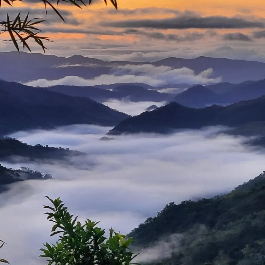
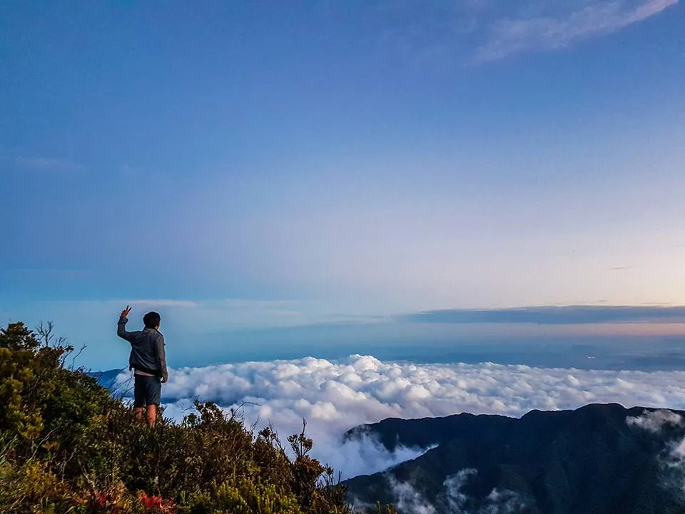
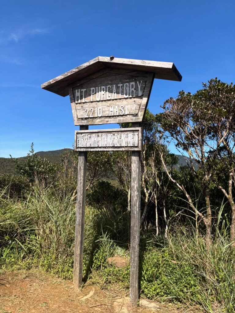
Pack light, but do not skimp on warmth. The Mt. Purgatory MASL range — particularly at Komkompol at 2,329 m — drops to single-digit Celsius temperatures on clear nights and during fog. A wet hiker in a light windbreaker on an exposed ridge at 4 PM is a hypothermia candidate.


Safety Tips for Climbing Mt. Purgatory Traverse

The main risks on the Mt. Purgatory Trail are slips, exhaustion, navigation errors, hypothermia, and lightning on exposed ridges. Each one is manageable with preparation.

  • Start early. Register at 5:00–6:00 AM and begin trekking no later than 7:00 AM for a day hike. Every hour of delay compresses your buffer against darkness.
  • Hydrate aggressively between water sources. Water exists on the route but it is not continuous — treat Mt. Purgatory as an intermittent-water traverse. Some camps have water and toilets, while others may be waterless. Carry a full 3L out of every confirmed water point.
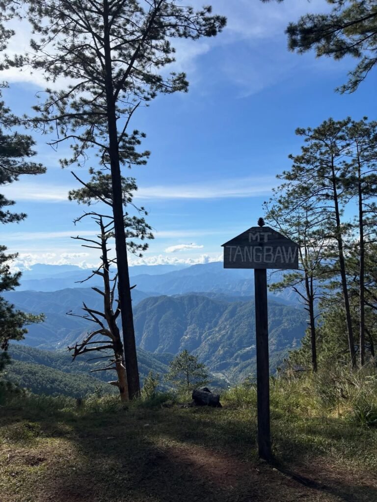
  • Do not leave your guide. Mt. Purgatory is guide-dependent. There are forks and reports of getting lost, especially in later sections near Tangbao. This is not a route to self-navigate using old blog descriptions alone.
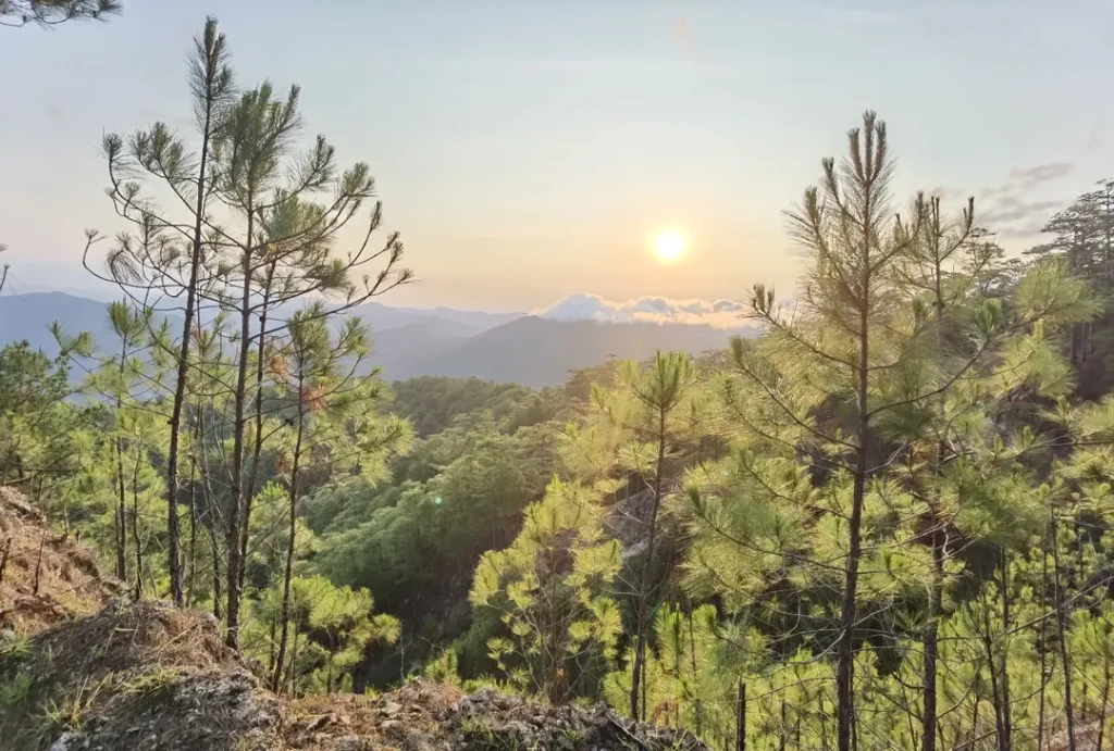
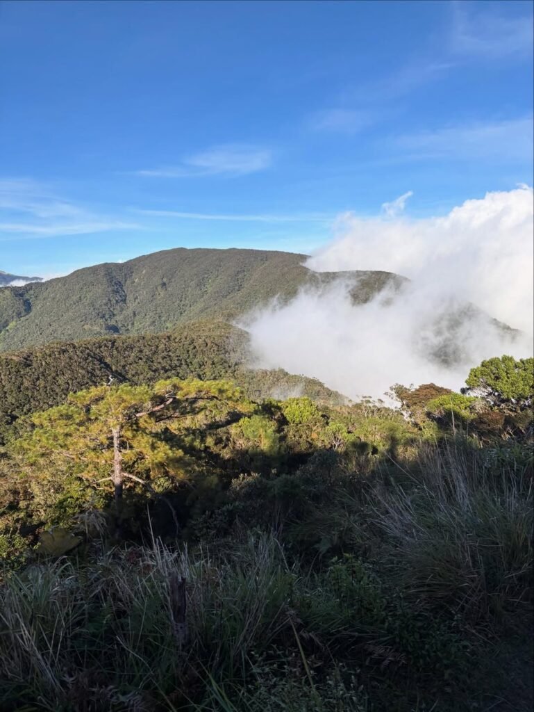
  • Layer up before the mossy forest. The temperature drop between the open pine forest and the enclosed mossy corridor is immediate and significant, especially during fog.
  • Watch your descent pace. The final rough road from Komkompol to Ekip is where many hiking injuries on this trail occur. Fatigue plus loose rock equals turned ankles. The trail is non-technical, but fatigue combined with wet footing can make simple sections feel significantly harder late in the day.
  • Carry a power bank and keep your phone charged. Mobile signal is variable across the traverse. Inform a contact outside the mountain of your expected logout time.

For similar Benguet adventures with a very different challenge profile, Mt. Kotkot in Itogon is worth considering as a comparison hike. For those exploring the wider Cordillera major climb scene, see Major Climb Mountains in the Philippines (Difficulty 5–8).

Close-up landscape of Bukidnon’s grassy ridges near Panimahawa Ridge with thick cloud cover hanging over distant mountains.
📷 christianverzosa

Frequently Asked Questions About Mt. Purgatory Traverse

1. Is Mt. Purgatory a major climb?

Yes. Mt. Purgatory – Mangisi Traverse is officially classified as a Major Climb with a Difficulty of 6/9 and Trail Class 1–3. It requires physical preparation, a mandatory guide, prior LGU registration, and a mandatory orientation before the trek begins.

2. How many peaks does the Mt. Purgatory Traverse cover?

Online write-ups describe Mt. Purgatory as a 5-peak, 6-peak (Hexa), or 7-peak route. The Japas → Ekip traverse is the standard baseline, and the Hexa framing covers Mt. Mangagew, Mt. Pack, Mt. Purgatory, Mt. Bakian, Mt. Tangbao, and Mt. Komkompol — though actual inclusions vary by current local setup. Verify peak count and Komkompol inclusion with your guide before the climb date.

3. Can I do Mt. Purgatory as a DIY hike?

Partial DIY is possible — you can independently book your bus to Baguio, coordinate your own registration via the Bokod Tourism Google Form, and handle your own meals. However, a guide is mandatory and cannot be skipped, and the monster jeep from Baguio to the jump-off requires an existing local contact. Walk-in without pre-coordination is not allowed. For context on how this compares to other DIY-friendly Benguet trails, see the guide to Mt. Kabunian in Bakun.

4. What is the Mt. Purgatory Traverse distance and elevation gain?

The Mt. Purgatory Traverse has a total trail length of approximately 26 km from the Japas jump-off point to Barangay Ekip in Bokod, Benguet. Elevation gain for the traverse is approximately ~1,500 m, with the highest point at 2,329 MASL at Mt. Komkompol.

5. What is the best campsite on the Mt. Purgatory Traverse?

For a 2D1N setup, the Mt. Bakian area is the most recommended overnight camp — it has both water and toilets, and places you in an ideal position to summit Mt. Komkompol on Day 2 morning. The Bangtinen Campsite is an earlier option with water and toilets for groups that started late or need more rest time. The Mt. Purgatory camp area itself has a toilet but no water, making it a rest stop rather than a primary overnight location.


Final Verdict: Should You Climb Mt. Purgatory Traverse?

4.5 out of 5 for intermediate and endurance hikers. Mt. Purgatory delivers one of the most sustained, scenically varied, and genuinely rewarding traverse experiences in all of Benguet — the mossy forest section alone is worth the entire effort. The logistical coordination requirement is real and adds friction for DIY climbers, but if you have a guide contact, a Baguio driver, and a 2D1N setup locked in, this is an unforgettable mountain.

If you are looking for a natural next step after completing Mt. Purgatory Traverse, explore the comparably demanding Mt. Amuyao DIY Traverse (Barlig–Batad 2D1N) or the more technical challenge of Mt. Kimat for a different dimension of Cordillera hiking.

Leave a Comment

Scroll to Top