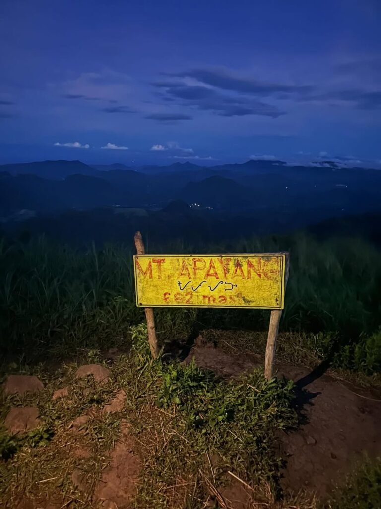
Mt. Apayang is a 662+ MASL minor climb in Nasugbu, Batangas, rated 4/9 difficulty — slightly harder than its neighbor Mt. Talamitam but fully doable for fit beginners in a single day. Most hikers tackle it as a twin hike or traverse with Talamitam, with a total trail time of 6–8 hours from jump-off to exit. It is the rugged northern anchor of the Nasugbu Trilogy, and the summit views of the West Philippine Sea, Pico de Loro, and Mt. Batulao make every sweaty step worth it.
Mt. Apayang Quick Guide
| Detail | Info |
|---|---|
| Mountain | Mt. Apayang |
| Location | Nasugbu, Batangas, Philippines |
| Province | Batangas (CALABARZON) |
| Elevation | 662+ MASL |
| Difficulty | 4/9 (Minor Climb) |
| Jump-off | Sitio Bayabasan, Brgy. Aga, Nasugbu (KM 83) |
| Exit Point (Traverse) | Brgy. Mataas na Pulo (KM 91) |
| Best Season | November – April (dry season) |
| Trek Time | 6–8 hrs (twin hike with Talamitam) |
| Registration | Barangay Aga Hall / Sitio Bayabasan registration desk |
| Campsite | Flat plateau below the summit (informal) |
Table of Contents

Where Is Mt. Apayang Located?
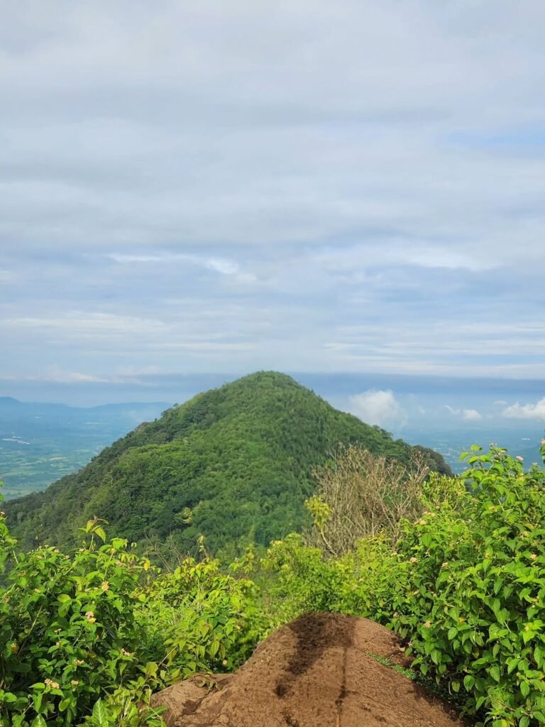
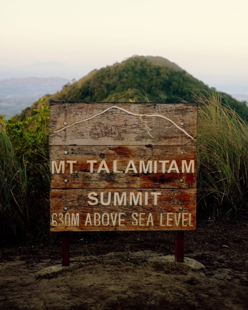
Mt. Apayang is situated in Nasugbu, Batangas, and is known as a twin hike. It sits on the northern end of the Talamitam ridgeline in the municipality of Nasugbu, in the province of Batangas, roughly 2 hours by road from Manila. Situated within the Western Batangas Volcanic Corridor, Apayang stands marginally higher than Talamitam at 662+ MASL.
It forces hikers to deal with razor-sharp cogon grass, steeper rock scrambling, and a more complex logistical loop involving two barangays. It is the rugged northern anchor of the Nasugbu Trilogy, standing tall at 662+ MASL to offer a wilder, less manicured perspective of the province. For context on where Apayang fits among the mountains in the Philippines, it ranks as a Minor Climb with a trail character closer to an intermediate outing than a beginner stroll.
How to Get to the Mt. Apayang Jump-off Point
The main jump-off for Mt. Apayang is Sitio Bayabasan, Barangay Aga, Nasugbu, Batangas — at KM 83 along the Tagaytay-Nasugbu Highway.
By Public Bus (from Manila):
Take a bus (DLTB) from Buendia Bus Terminal bound to Nasugbu, Batangas. Drop off at KM 83 at Sitio Bayabasan. Travel time is approximately 2 hours, fare around ₱129. DLTB buses operate from 4:00 AM to 7:00 PM, giving you a wide departure window to choose from. For a day hike, catch the 4:00 AM or 5:00 AM trip to ensure you start the trail before the heat peaks.
From Tagaytay:
From Olivares in Tagaytay, the ride to the Sitio Bayabasan jump-off takes roughly an hour and a half by bus at ₱65 per person. This is the faster and cheaper option if you are already staying in Tagaytay the night before.
By Private Vehicle:
Drive through Cavitex and straight to Emilio Aguinaldo Highway. You will reach Tagaytay City. Continue along the Tagaytay-Nasugbu Highway until you reach Sitio Bayabasan. Pin “Sitio Bayabasan, Brgy. Aga, Nasugbu” on Waze or Google Maps. Designated parking is available near the registration area for ₱100 (cars) or ₱50 (motorcycles).
For the Traverse Exit at KM 91 (Brgy. Mataas na Pulo):
If you do the Talamitam-to-Apayang traverse, you exit at a different point. The jump-off point for the Apayang-first direction is at Sitio Pasong Kawayan, Barangay Banilad / Mataas na Pulo, Nasugbu, Batangas. From there, tricycles connect you back to the highway to catch a return bus to Manila.
Permits, Fees, and Guide Requirements at Mt. Apayang
Registration is mandatory and done on the day of the hike — no advance booking required.
The command center is the Barangay Aga Hall or the satellite registration desk at Sitio Bayabasan, right at the jump-off point along the highway. Registration Fee: ₱50.00 per head (paid upon arrival). Twin Hike Surcharge: Additional ₱30.00 if crossing over to Mt. Apayang. As of the 2026 hiking season, hiring a local guide is de facto mandatory (₱500–₱800 per group of 1–5 pax).
As of 2026, the “No Guide, No Hike” policy is strictly enforced by the Barangay Aga and Kayrilaw LGUs. Medical certificates are generally not required for day hikes, but hikers must sign a waiver of liability at the registration area.
Walk-ins are allowed, but securing a guide in advance is highly recommended for weekends to ensure availability. You can find guides on Facebook by searching for hiking groups affiliated with Sitio Bayabasan or Barangay Aga, Nasugbu.
Guides here are not just logistics helpers — they navigate the junction between Talamitam and Apayang, which is easy to miss under thick cogon. On my May 2026 climb, our guide made a split-second route correction at the ridge junction that would have cost us an extra 45 minutes. That alone was worth the fee.
What Is the Mt. Apayang Trail Like?
The hike to Mt. Apayang is a Minor Climb with a verified Difficulty Rating of 4/9. While the elevation is only 662+ MASL, the trail class ranges from 1 to 4, featuring open grasslands that heighten the risk of heat exhaustion. It sits a full notch above its neighbor — Mt. Apayang often suffers from “grade inflation” online, with some sources lumping it together with the easier Mt. Talamitam (3/9). However, Apayang demands a distinct Difficulty Rating of 4/9, with noticeably higher physical demand due to the steeper gradients on the northern approach.
Stage 1: Jump-off to the Bamboo Bridge (0–30 min)
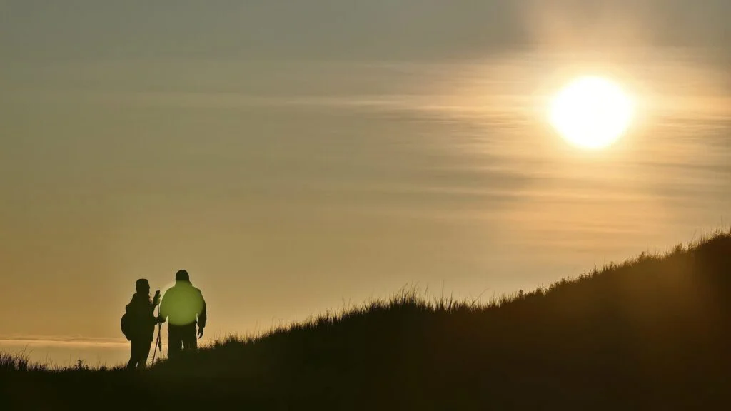
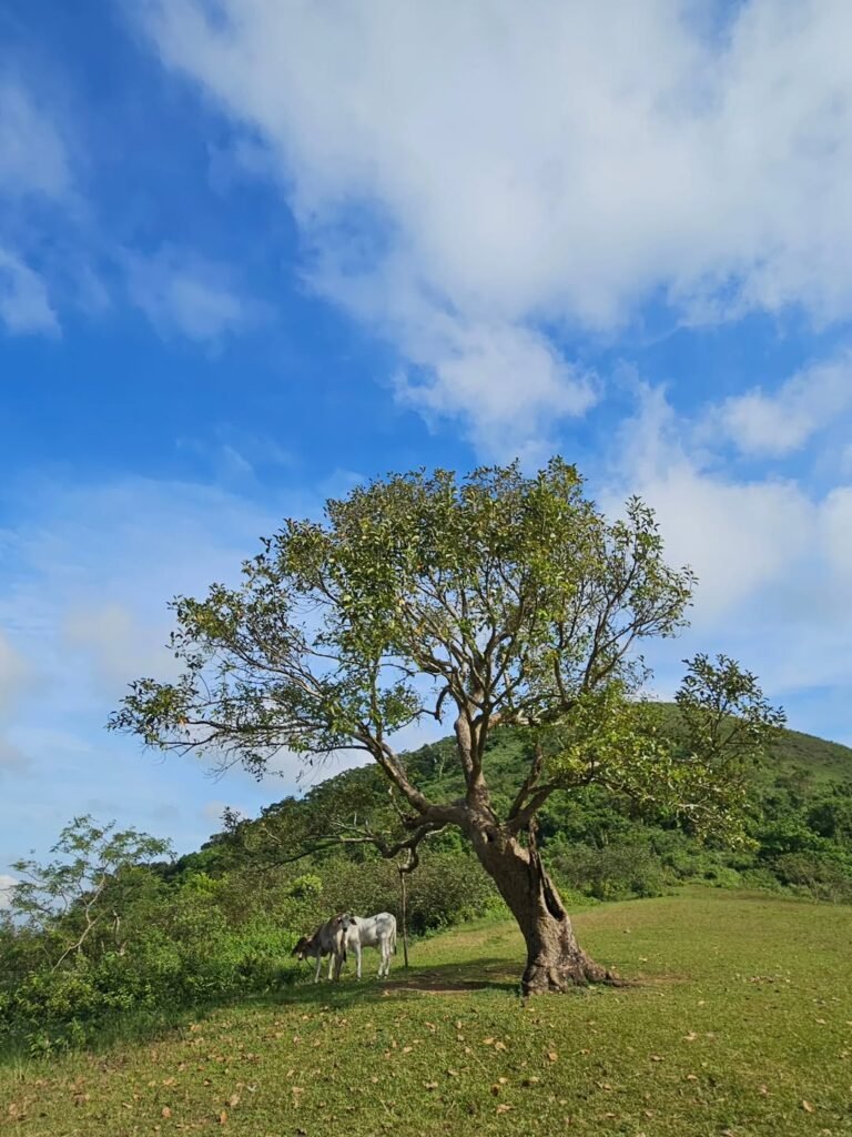
The trail from KM 83 begins as a concrete road descending gently from the highway toward a bamboo bridge at the Galo River. It is still dark as you walk along a concrete road that leads to a river — which is why starting at 5:30–6:00 AM makes sense. The initial stretch is flat and easy, a false signal of what comes next. Cattle graze freely here, and you will share the path with them.
Stage 2: Forest Buffer and Plateau (30–90 min)
Beyond the bridge, the trail enters a shaded woodland section before opening into a broad, flat plateau — the most photogenic rest stop on the mountain. Right after the bridge, you ascend the forested trail until you reach the vast plateau. The plateau extends up to the foot of the summit. Almost anywhere, hikers can set camp (just beware of cow dung).
Stage 3: The Cogon Corridor and Ridge Traverse (90–150 min)
This is where the trail earns its 4/9 rating. The trail is defined by shoulder-height Imperata cylindrica (cogon) and Saccharum spontaneum (talahib) that demand long sleeves and patience. The cogon closes in on both sides of the path — the leaves are razor-edged, and short sleeves mean scratches. There is zero shade during this section. The traverse between Talamitam and Apayang covers gently sloping grass with the path sometimes invisible under the vegetation.
In May 2026, I hit this section at around 9:30 AM. Even with sunscreen, the heat radiating off the dry soil was significant. The wind at the ridge line is strong enough to offset some of it, but do not underestimate the cumulative toll.
Stage 4: The Summit Scramble (Final 20–30 min)
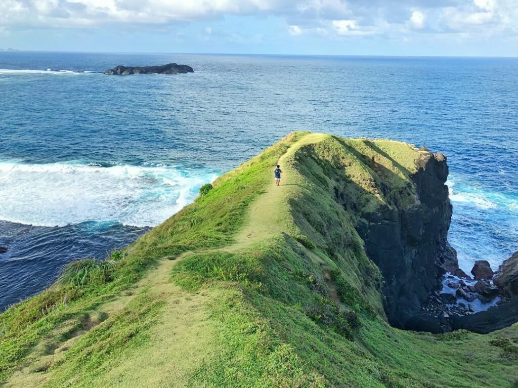
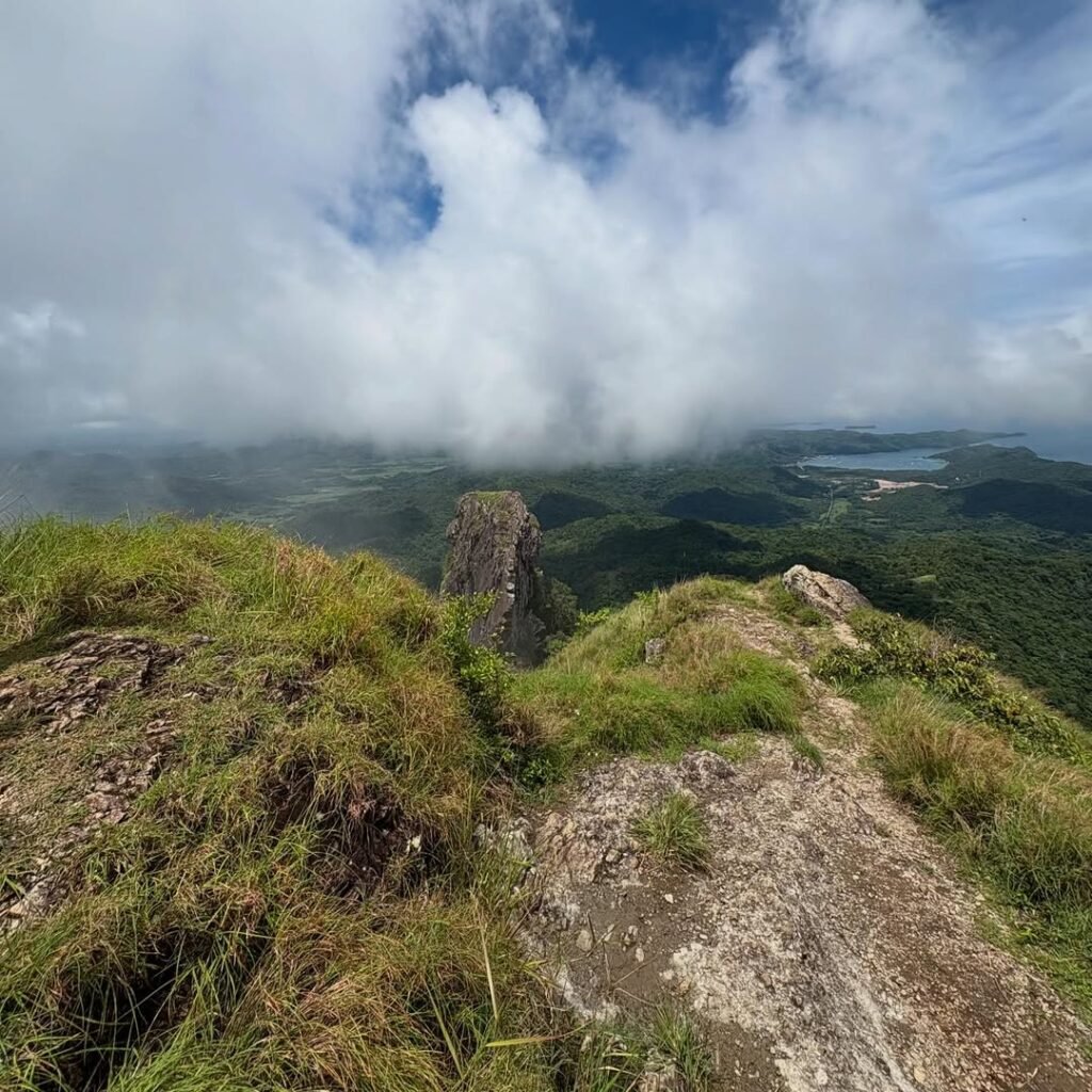
The final assault on Mt. Apayang shifts to Class 3 rock scrambling. The ground changes from dirt to volcanic igneous rock. The summit area is small and rocky, offering a wilder vantage point than Talamitam. Gloves are genuinely helpful here — not as a luxury but as a grip tool. At the top, the exposure is total and the 360-degree view hits immediately.
Stage 5: The Descent to Mataas na Pulo (60–90 min)
The descent immediately following the summit towards Barangay Mataas na Pulo is the technical crux — steep, loose soil that requires “braking” with your trekking poles to prevent slipping. This section surprised me on my climb in May 2026 — it was steeper and more exposed than the ascent. Take it slow; trekking poles are not optional on this stretch. The Galo River crossing at the start can also swell rapidly, potentially stranding hikers after heavy rain, which is another reason to stay on the dry-season schedule.
Recommended Itinerary (Day Hike from Manila)
| Time | Activity |
|---|---|
| 4:00–5:00 AM | Board DLTB bus at Buendia / Pasay |
| 6:00–6:30 AM | Arrive KM 83, register, hire guide |
| 6:30 AM | Start trek |
| 8:00–8:30 AM | Talamitam summit |
| 9:30–10:00 AM | Apayang traverse and summit |
| 10:30–11:30 AM | Descent to Brgy. Mataas na Pulo |
| 12:00 PM | Tricycle to highway, lunch (Batangas Lomi) |
| 2:00–3:00 PM | Return bus to Manila |

Is Mt. Apayang Good for Beginners?
Yes — with one firm condition: you need a baseline fitness level before attempting this specific hike.
It is suitable for “active” beginners — those who jog or hit the gym regularly. However, for a complete couch-to-summit novice, the full circuit is often too exhausting due to the 38°C heat index on the open ridges. If you have zero hiking experience, do Mt. Talamitam as a solo first climb before adding Apayang to your objective. You can check a list of beginner-friendly minor climbs to find the right warm-up before tackling this trail.
Mt. Apayang serves as the perfect “level-up” hike for adventurers who find Mt. Talamitam too gentle. With a verified Difficulty Rating of 4/9 and a technical descent to Mataas na Pulo, it offers a more complete mountaineering experience than its neighbor. For first-timers who are reasonably fit and come prepared with enough water and sun protection, this is a genuinely achievable and rewarding climb.
Best Time to Climb Mt. Apayang
November through April — the Philippine dry season — is the definitive best time to climb Mt. Apayang.
In the dry season (November–May), the risk from trail hazards is minimal. The trails are dusty and hot, but predictable and navigable. Early morning starts between 5:00 and 6:00 AM dramatically reduce the heat impact on the exposed ridgeline.
The soil in Nasugbu is a clay-loam mixture. When wet, it becomes extremely slippery — effectively increasing the difficulty rating to 6/9 due to poor traction. The Galo River crossing at the start can also swell rapidly, potentially stranding hikers. Always check the weather forecast for Batangas before your trip; if there is a Low Pressure Area (LPA), cancel the hike.
During the wet season (June–October), hikers have encountered limatiks (blood leeches) in the damp leaf litter of the Mt. Lantik forest and the bamboo groves connecting to Mt. Apayang. If you hike during these months, bring alcohol spray or wear high socks.
My May 2026 climb hit a weather sweet spot — sunny and consistently windy, which offset the summer heat. The ridgeline wind on the Apayang traverse was strong enough to force a full stop at the summit for a jacket. Bring one regardless of the season.

Budget Breakdown for Climbing Mt. Apayang
This breakdown is for a solo hiker doing the twin Talamitam-Apayang traverse from Manila on a DIY basis.
| Expense | Cost (PHP) |
|---|---|
| Bus fare: Manila (Buendia) to KM 83 (DLTB) | ₱250-₱350 |
| Bus fare: Return (KM 91 / Nasugbu to Manila) | ₱250-₱350 |
| Tricycle to/from highway (Mataas na Pulo exit) | ₱50–₱100 |
| Registration fee (Talamitam) | ₱50 |
| Twin hike surcharge (Apayang) | ₱30 |
| Guide fee (shared per group, solo rate) | ₱500–₱800 |
| Parking (if driving) | ₱100 |
| Layong Bilog River entrance (optional) | ₱20 |
| Food and water (jump-off vendors + Lomi) | ₱150–₱300 |
| Estimated Total (DIY solo) | ₱1400–₱1880 |
The best way to cool down after the scorching Mt. Apayang hike is a dip in Layong Bilog River, located just a short tricycle ride from the Mataas na Pulo exit. The entrance fee is a minimal ₱20.00. Budget for it — you will want it.
For a post-hike meal, I had Batangas Lomi at a carinderia near the highway. A full bowl runs under ₱100 and is exactly the right recovery food after a 7-hour mountain traverse under the sun.
What to Pack for Mt. Apayang
| Item | Essential? |
|---|---|
| 3 liters of water minimum | Yes |
| Trail runners (deep lug, 4mm+) | Yes |
| Trekking poles | Yes (critical for descent) |
| Long-sleeve shirt / UPF top | Yes |
| Trekking pants or leggings (not shorts) | Yes |
| Wide-brim hat or trail cap | Yes |
| Neck gaiter / buff / face cover | Yes |
| Sunscreen (SPF 50+) | Yes |
| Lightweight gloves | Strongly recommended |
| Rain jacket or windbreaker | Yes |
| Headlamp (for pre-dawn starts) | Yes |
| High-energy snacks (trail mix, energy gels) | Yes |
| First aid kit (blister kit, antiseptic) | Yes |
| Trash bag (LNT compliance) | Yes |
If using trail runners, ensure they have deep lugs (4mm+) for the loose soil descent to Mataas na Pulo. A cheap pair of gardening gloves or mechanic gloves is useful for the rocky scrambling section near the summit (Class 3).
The soil on the Apayang descent is loose and crumbly, and when you hit the river, trail runners drain water significantly faster than boots, which effectively become heavy buckets once submerged. Tall cogon grass can be sharp — wearing leggings or trekking pants is better than shorts if you want to avoid scratches.
Don’t forget a face cover or Buff. During the dry months (January–April), the lead hiker kicks up a significant amount of fine volcanic dust. Breathing this in for hours will leave you with a dry cough and irritated throat by the time you reach the Layong Bilog River.
Safety Tips for Climbing Mt. Apayang
Start by 6:00 AM at the absolute latest. To mitigate heat exhaustion, it is critical to start trekking from Sitio Bayabasan by 06:00 AM. This pace places you at the Talamitam summit by 08:30 AM and Mt. Apayang by 10:30 AM, leaving the afternoon free for a refreshing dip at Layong Bilog River.
Bring more water than you think you need. Bring a lot of water as it gets really dry, especially if you hike during the daytime, because of the fewer trees along the trail. Three liters is the minimum; four liters is smarter for solo or slow-paced groups.
Never hike during a Low Pressure Area or active rain. When the clay-loam soil gets wet, it becomes extremely slippery — effectively increasing the difficulty rating to 6/9 due to poor traction.
Stick to Leave No Trace principles. The trail is communal land for the residents of Sitio Bayabasan and Mataas na Pulo. We are guests in their backyard. Strictly adhere to Leave No Trace (LNT) principles: pack out everything you pack in.
Do not skip the guide. In the current regulatory environment of 2026, the Barangay Aga and Kayrilaw LGUs strictly enforce a “No Guide, No Hike” policy. Aside from the legal requirement, the guide genuinely prevents wrong turns on the cogon-choked traverse section between Talamitam and Apayang.
Frequently Asked Questions About Mt. Apayang
1. How do I get to Mt. Apayang from Manila?
Take a DLTB bus from Buendia Bus Terminal bound for Nasugbu, Batangas, and drop off at KM 83 at Sitio Bayabasan. Travel time is approximately 2 hours and the fare is around ₱129–₱180. The registration area is right at the highway; you cannot miss the waiting shed and tarpaulin signs.
2. Is a guide required for Mt. Apayang?
Yes, without exception. As of 2026, the “No Guide, No Hike” policy is strictly enforced by the Barangay Aga and Kayrilaw LGUs. Hiring a local guide is de facto mandatory — ₱500–₱800 per group of 1–5 pax. Guides are available as walk-ins at the registration desk and do not need advance booking on weekdays.
3. Can I hike Mt. Apayang without doing Mt. Talamitam first?
Hikers can choose to traverse the two mountains or just climb up and down Apayang’s trail. They can also choose between going up Apayang first then traversing to Talamitam, or vice-versa. A standalone Apayang hike entering from Brgy. Mataas na Pulo at KM 91 is a valid option, though most hikers prefer the Talamitam-to-Apayang traverse for a more complete experience.
4. What is the summit view like at Mt. Apayang?
Standing on the summit of Mt. Apayang (662 MASL), you are rewarded with a panoramic 360-degree theater: the vast expanse of the West Philippine Sea to the west, the faint outline of the Lubang Islands on the horizon, and the towering caldera rim of Tagaytay to the east. You also get an unobstructed view of the Pico de Loro monolith to the west and the jagged teeth of Mt. Batulao to the southeast.
5. Is Mt. Apayang part of the Nasugbu Trilogy?
Yes. The Nasugbu Trilogy comprises Mt. Lantik, Mt. Talamitam, and Mt. Apayang — a Minor Climb circuit with a 4/9 Difficulty rating located in Nasugbu, Batangas. Completing all three in a single day is possible for fit, well-prepared hikers.
You can read the full Nasugbu Trilogy guide for the complete multi-peak itinerary. Also check out the guide to Mt. Lantik to understand what the third peak adds to the challenge. For those eyeing the next progression after Apayang, the Mt. Marami trail in Cavite is a logical next step.
Final Verdict: Should You Climb Mt. Apayang?
4.5 out of 5 for active beginners and intermediate day hikers who want a trail with genuine character. Mt. Apayang delivers what most beginner hikes in the Philippines lack — real terrain variety, a technical summit scramble, and views that rival mountains three times its elevation. The twin traverse with Talamitam, finished with a bowl of Batangas Lomi and a river dip, is one of the cleanest single-day mountain adventures you can execute from Manila under ₱2,000. Check out more Batangas travel spots to complete your Nasugbu trip.