
Mt. Apo is the highest mountain in the Philippines at 2,954 MASL, and climbing it is a serious, multi-day undertaking — not a day hike. A standard ascent takes 3 days and 2 nights, requires a mandatory guide, advance permits, and solid physical preparation. If you plan carefully and go in the dry season, it is one of the most rewarding climbs in the country.
Mt. Apo Quick Guide
| Detail | Info |
|---|---|
| Mountain | Mt. Apo |
| Location | Mindanao, Philippines |
| Province | Davao del Sur / Cotabato |
| Elevation | 2,954 MASL (9,692 ft) |
| Difficulty | Major Climb — 7/9 to 8/9 |
| Jump-off Points | Sitio Baras/De Sander (Sta. Cruz), Sitio Baruring (Kapatagan), Ilomavis (Kidapawan) |
| Best Season | November to May |
| Trek Time | 3 Days / 2 Nights (standard) |
| Registration | LGU Tourism Office + DENR/PAMB accredited guide or tour organizer |
| Key Campsites | Tinikaran Camp 1, Lake Venado, Camp Gudi-Gudi |
Table of Contents
Where Is Mt. Apo Located?
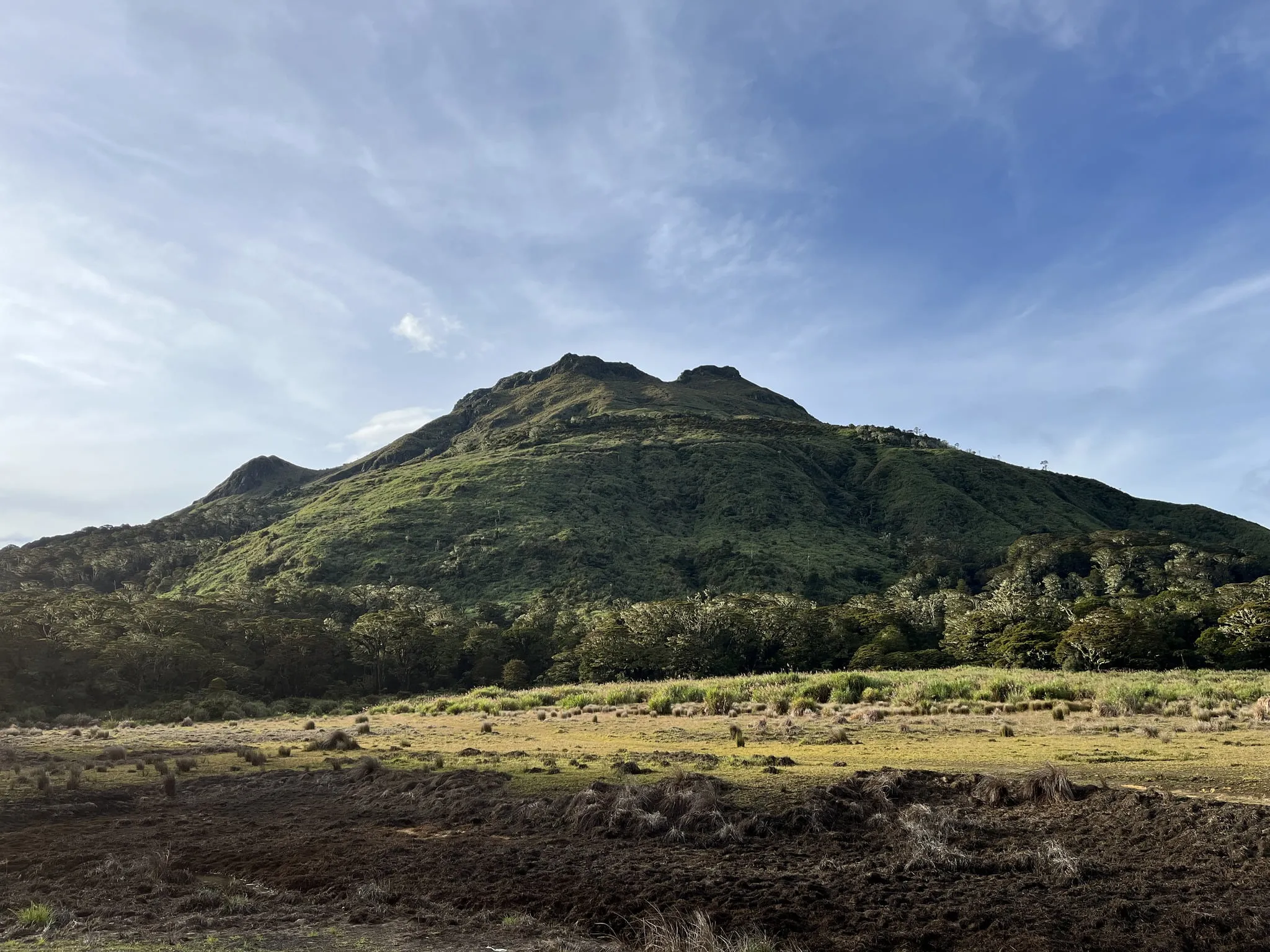
Mt. Apo is the highest mountain peak in the Philippines, with an elevation of 2,954 meters (9,692 ft) above sea level. It is a large solfataric, dormant stratovolcano, part of the Apo-Talomo Mountain Range of Mindanao island.
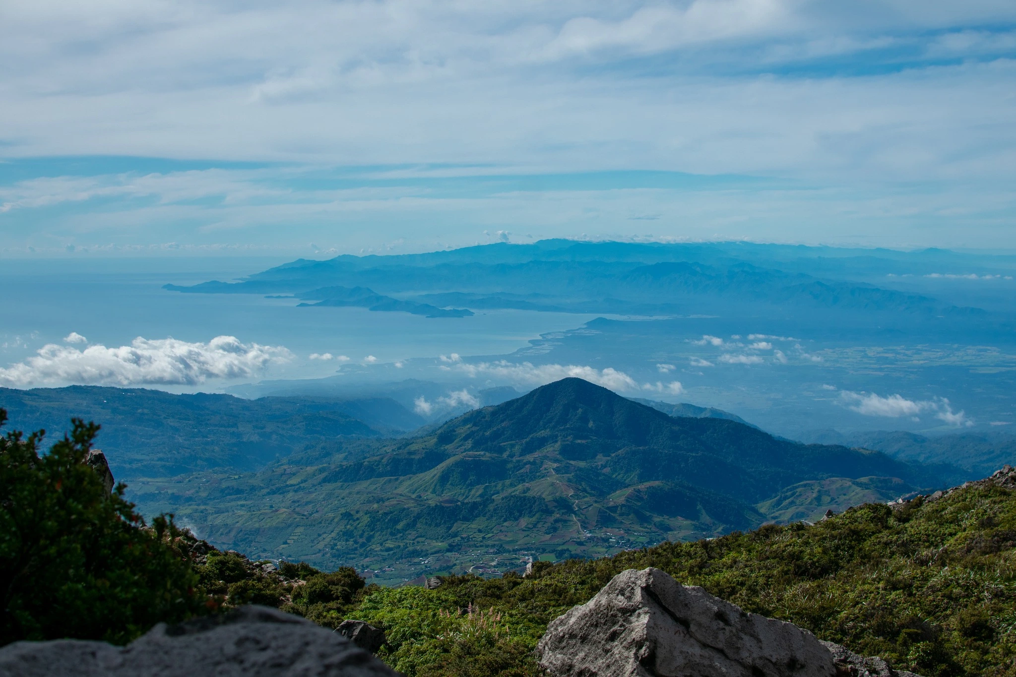
Apo sits on the tripartite border of Davao City, Davao del Sur, and Cotabato; its peak is visible from Davao City 45 kilometers to the northeast and from Digos 25 kilometers to the southeast.
It sits within Mt. Apo Natural Park, a regulated area managed through DENR, PAMB, LGUs, local tourism offices, and indigenous community coordination. This mountain carries deep cultural significance. The massif is considered sacred by indigenous Manobo, Bagobo, Kalagan, and other Lumad groups. The spirit Apo Sandawa is revered as the ancestral guardian spirit, and rituals led by tribal shamans are still practiced before treks.
The name “Apo” (from Apo Sandawa) means “Grandfather” or “Revered Elder” in local Manobo and Kalagan languages. Treat this mountain with the respect that name implies.
For other great mountains in Mindanao worth planning alongside this climb, see the Mindanao travel guide and the full Philippines mountains overview.
How to Get to the Mt. Apo Jump-off Point
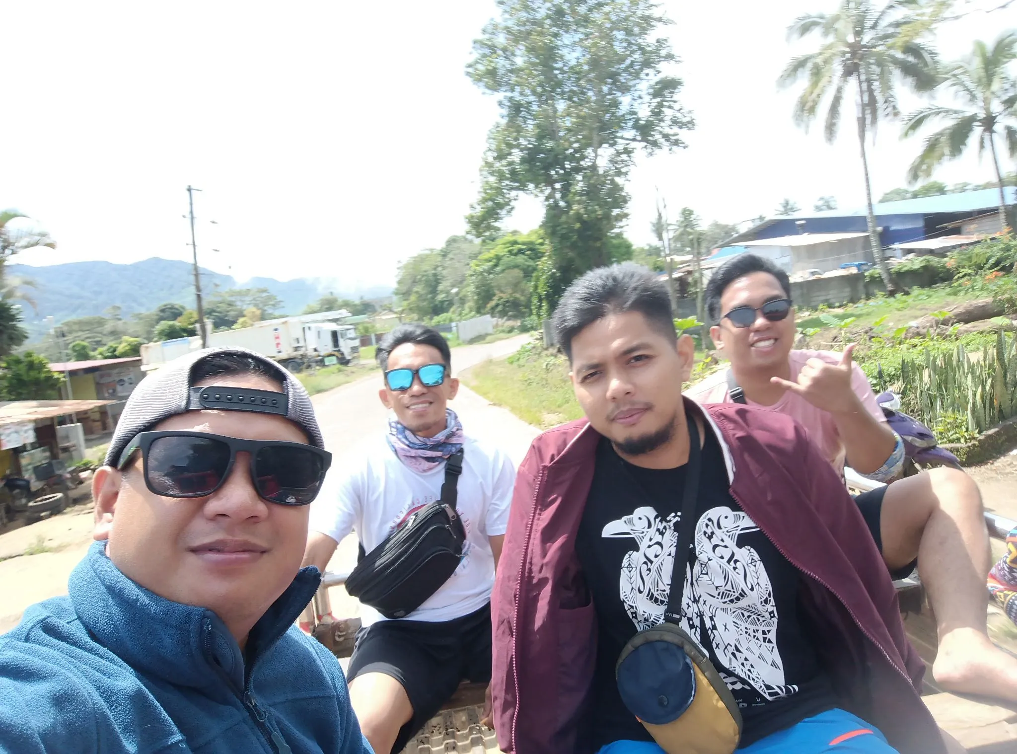
The most common gateway is Davao City, which has direct flights from Manila and Cebu. From Davao, routes differ by trail.
For the Sta. Cruz / Kapatagan trail (Davao del Sur side):
From Davao City, take a 1-hour bus ride to Digos City for roughly ₱120 per person. From Digos, hire a tricycle (around ₱150 per tricycle, fits 3 people) or take a shuttle bus (₱70 per person) to Kapatagan. From Kapatagan, a pickup truck arranged by local operators will take you to the De Sander Powerplant jump-off area.
Expect the total road trip from Davao City to Kapatagan to take roughly 3 hours. If you are on a group package, transport is usually included from Davao City or a pre-arranged meetup point.
For the Kidapawan trail (North Cotabato side):
If you plan to use Kidapawan, coordinate with Kidapawan City Tourism or an accredited local operator because permit rules and logistics can differ from the Davao del Sur side. Buses from Davao to Kidapawan operate from the Ecoland terminal.
Most first-timers book a joiner package with an accredited organizer. This covers transport, permits, guide, porter, and meals in one price. It removes much of the logistical stress, especially for out-of-towners who do not know the area.
Permits, Fees, and Guide Requirements at Mt. Apo
Getting your permits right is non-negotiable — and it is not cheap.
Climbers must secure permission from the local government unit (LGU) and the Department of Environment and Natural Resources (DENR). DENR requires Mount Apo trekkers to hire a tour guide and get a hiking permit. For more demanding trails, park officials may ask you to present a medical certificate or name two recent climbs.
You will also need a signed and stamped medical certificate — make sure to mention it is for a high-altitude hike so the doctor can properly assess your fitness.
Hiker quota: Tourism only allows 50 hikers per day, so slots fill up fast. Management will not entertain walk-in trekkers. Book 6 to 8 weeks in advance during peak season (March to May).
Fees to expect:
Climbing permit: ₱1,500–₱2,000; Environmental fee: ₱200–₱300; Guide fee: ₱1,000–₱1,500 per day (required); Porter fee: ₱800–₱1,000 per day (optional); Camping fee at Lake Venado: ₱200–₱300.
During peak season, the trekking fee can increase — one guide reported it rising to ₱1,800 during high-demand months. Cash is king: porters and small stores on the trail only accept cash. Bring enough small bills.
DENR official website for the most current fee schedules and protected area management advisories.
What Is the Mt. Apo Trail Like?
The Mt. Apo trail is a full 3-day grind: mud, cold, boulders, sulfur, steep descents, wet campsites, and heavy logistics. Here is what each section actually feels like.
Sta. Cruz Trail (Ascent via De Sander / Sitio Baras)
The Sta. Cruz Trail starts at Barangay Sibulan and is known for mossy forest, the Boulder Face, Botoy’s Ridge, sulfur vents, and open volcanic terrain.
Stage 1: Trailhead to Tinikaran Camp 1
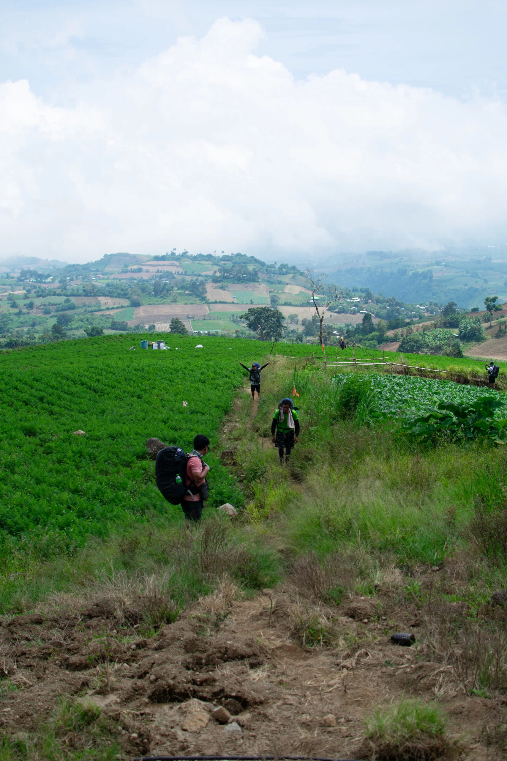
- Difficulty: 3/5 — Long but walkable. Open farm fields give way to increasingly dense jungle. Wet, rooted terrain demands attention.
The trail starts at around 1,141 MASL. The first section passes through open vegetable farms before entering mossy forest. After Sitio Tumpis, the trail becomes steeper. The forest floor turns into a root staircase mixed with wet clay. Every step needs attention because smooth exposed roots are slippery.
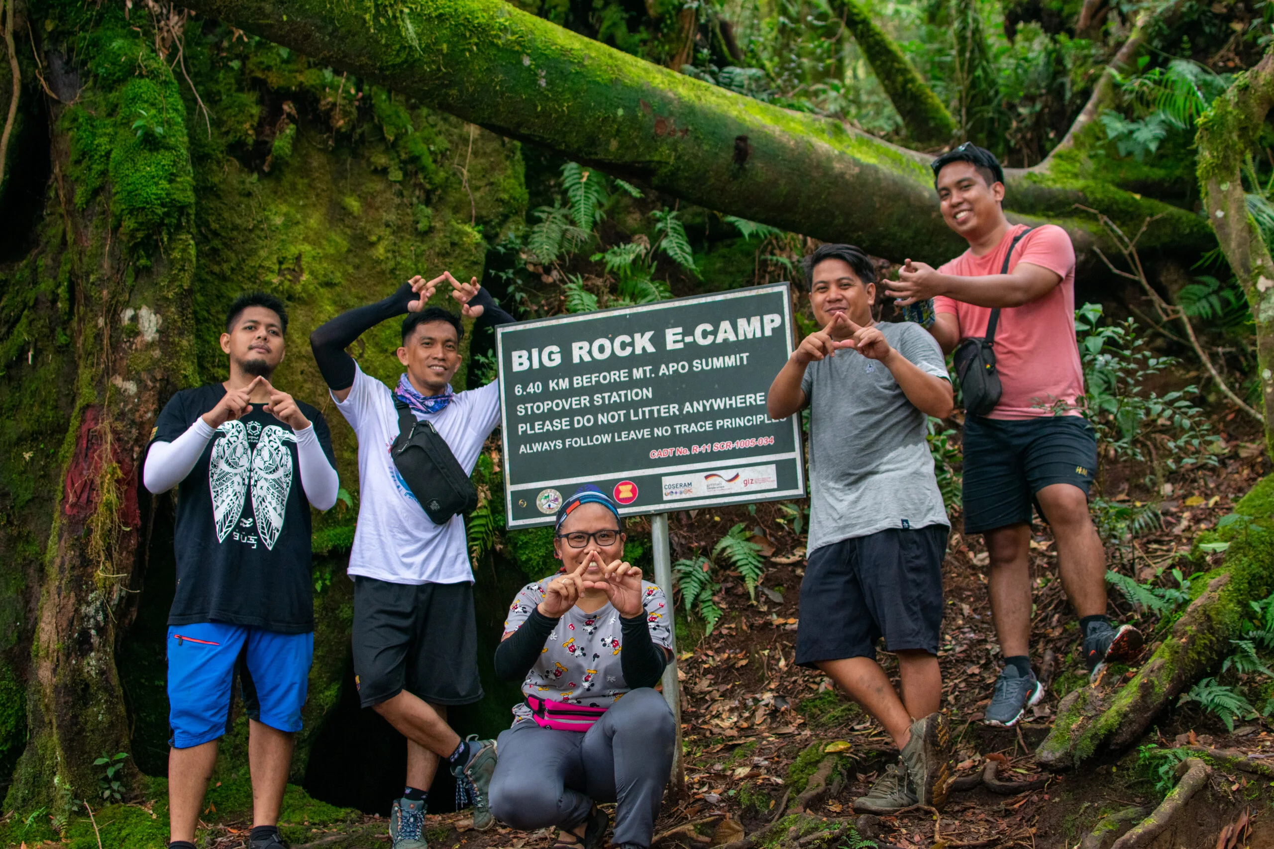
Stage 2: Tinikaran Camp 1 to the Boulder Face and Summit
- Difficulty: 5/5 — The Boulder Face is exposed rock scrambling with sulfur fumes. This is the defining section of the entire climb.
Wake-up at camp is around 1:00 AM, with departure around 2:00 AM. This allows your group to reach the Boulder Face near early morning light.
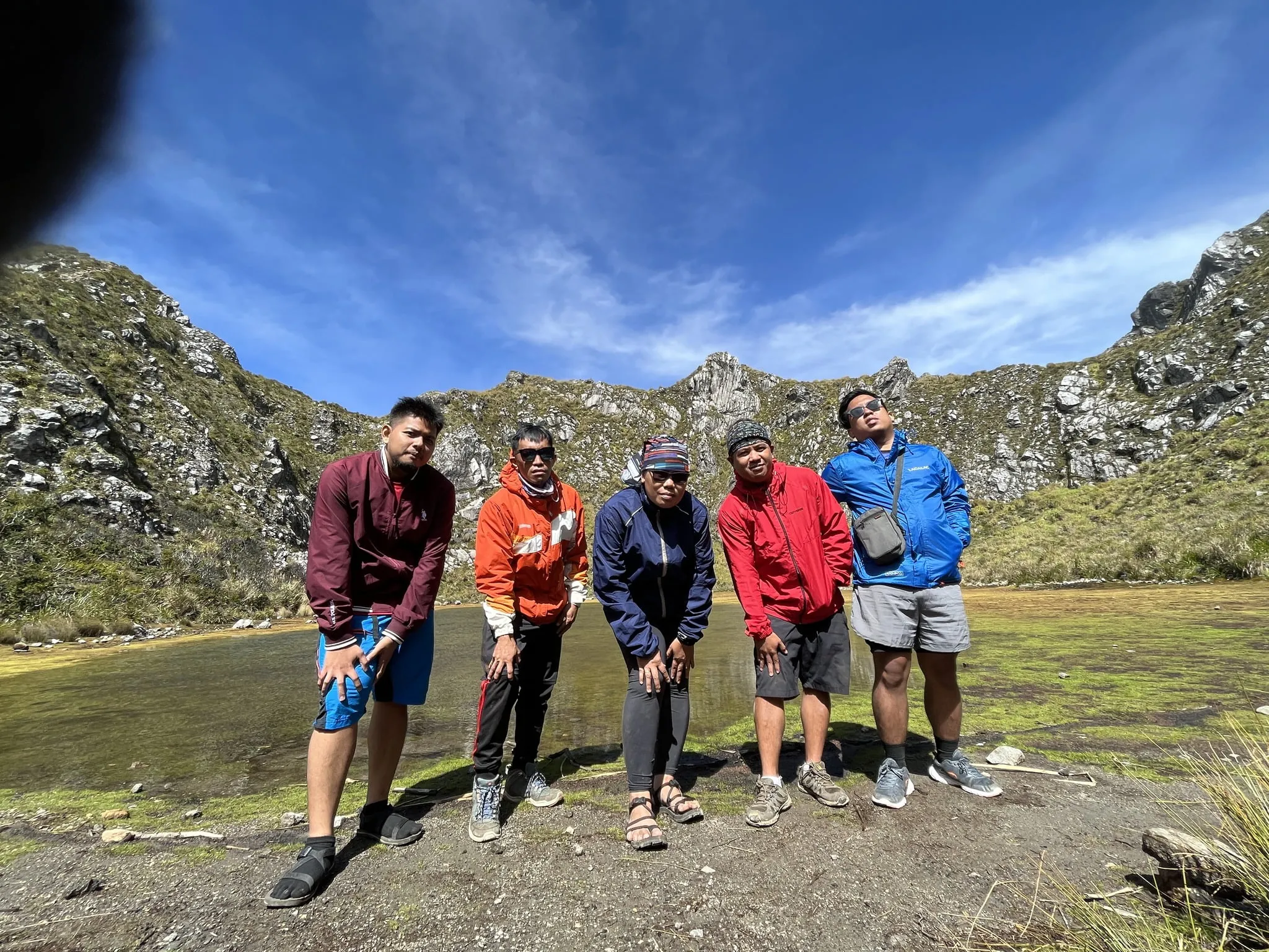
This is the most iconic part of the journey — scrambling up massive white boulders with the smell of sulfur in the air. I climbed this section in April 2026 and the experience was everything people told me it would be, and more. The boulders are enormous, chalky white, and slick in spots from moisture. You use hands and feet. Your headlamp lights up the rock face but not the full scale of it. You do not fully grasp how large the boulder field is until you are halfway through it.
A headgear helps block the smell of sulfuric gas that escapes from the vents in the boulder trail. Keep moving — lingering in the vent zones causes lightheadedness.
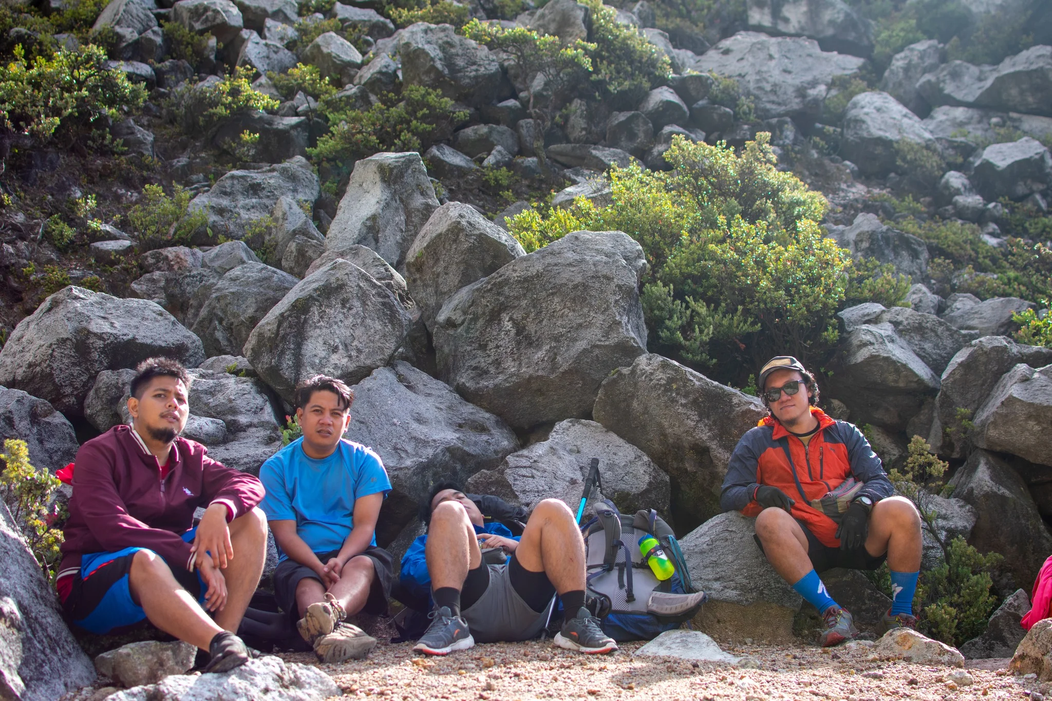
Stage 3: Summit to the Crater and Descent
- Difficulty: 4/5 — The Mt. Apo Crater view from the summit is the payoff. The descent is where most knee problems develop.
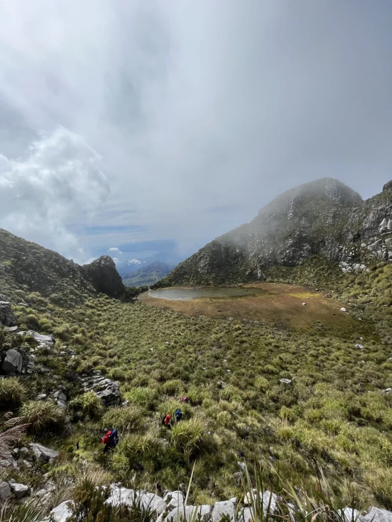
Trail features include mossy rainforests, giant ancient tree roots, the iconic white sulfur Boulder Face, volcanic vents with sulfuric fumes, an 87-degree section, and a 500-meter-wide crater lake.
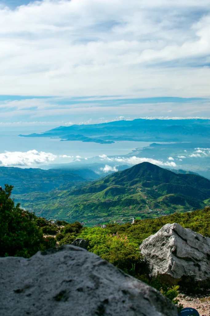
Standing at the summit in April 2026, looking down into the Mt. Apo Crater and out over the Mindanao landscape in every direction, I understood why people do this climb more than once. The crater steams quietly. The air is thin and cold. The view of the surrounding ridges — bare, volcanic, deeply quiet — is unlike anything on the lower trails.
There are three distinct peaks you can reach: Digos Peak, Kapatagan Peak, and Kidapawan Peak, which is the true summit and “Mother Peak.”
Multiple Trails at Mt. Apo: Which One?
The right trail depends on your experience and what you want from the climb.
Mt. Apo Sta. Cruz Trail vs Kapatagan Trail is the most common comparison:
Sta. Cruz is best for the dramatic Boulder Face experience. Kapatagan is more balanced but still difficult. Kidapawan is popular for Lake Venado access.
The Boulder Face on the Sta. Cruz Trail requires scrambling, balance, patience, and confidence on exposed rock. It is not a beginner trail.
The Kidapawan Trail is the next-easiest option. It has a gradual elevation gain and fewer technical sections. Along the way you will see Lake Agco, hot springs, river crossings, lush mossy forests, and Lake Venado.
For first or second-time climbers with solid conditioning, Kapatagan is the most popular recommendation. It still challenges you with the boulder section, but the approach is more forgiving than Sta. Cruz. The traverse route — ascending via Sta. Cruz and exiting via Kapatagan — is the most popular combination among experienced groups.
For more perspective on where Mt. Apo sits in terms of difficulty compared to other major Philippine peaks, check out this guide to major climb mountains in the Philippines.
Best Time to Climb Mt. Apo
November to May is the confirmed climbing window for Mt. Apo.
Mt. Apo usually has an annual closure from June 1 to August 31 for ecological rehabilitation, wildlife recovery, and protected-area management. During this closure, trekking, camping, and tourism activity are generally prohibited.
The dry season from December to May is the best bet. Trails stay firm, and rain will not turn the climb into a slippery slog. Avoid June to November when typhoons and heavy rains flood paths and spike risks.
Expect daytime temperatures around 20–25°C (68–77°F) at the base, dropping to 5–10°C (41–50°F) near the summit. Temperature can drop to 1°C, so prepare appropriate layering with fleece and a wind jacket that can withstand near-freezing conditions.
March to May is peak season. Slots fill earliest, prices rise slightly, and the trails are at their busiest. November to February gives you good weather with fewer crowds — ideal if you can book off peak.
Plan your climb for November to May, but postpone if bad weather hits. Storms make trails slippery and cause mudslides. Your guide or the LGU tourism office has the final say on whether conditions are safe to proceed.
Budget Breakdown for Climbing Mt. Apo
Mt. Apo is not a cheap mountain climb. The cost is higher because of permits, guide and porter systems, cross-LGU coordination, food logistics, camping support, and rugged transport.
| Expense | Estimated Cost (PHP) |
|---|---|
| Trekking / Climbing Permit | ₱1,500–₱2,000 |
| Environmental Fee | ₱200–₱300 |
| Guide Fee (per day, required) | ₱1,000–₱1,500/day |
| Porter Fee (per day, optional) | ₱800–₱1,000/day |
| Exit Fee (if traverse route) | ₱500 |
| Lake Venado Camping Fee | ₱200–₱300 |
| Transport (Davao–trailhead–Davao) | ₱500–₱1,500 |
| Meals (trail food, 3 days) | ₱600–₱1,200 |
| Pre/Post Davao accommodation | ₱500–₱1,500/night |
| Total Estimated Per Person | ₱12,000–₱18,000 |
All fees should be verified locally before your climb date. Rates for guides and permits spike during peak months (March–May). Booking off-peak can save cash but comes with weather trade-offs.
On porter ethics: Hiring a porter supports local communities connected to the mountain. Pay the current going rate without bargaining down. Porters often carry 15–20 kg up the same brutal terrain you are struggling with at a fraction of the weight. The standard daily rate is a minimum, not a ceiling — tipping is appropriate for excellent service. Confirm your porter’s daily rate clearly before the climb starts and pay promptly on each day or at the exit point.
What to Pack for Mt. Apo
| Item | Essential? |
|---|---|
| Trekking boots with ankle support | ✅ Yes |
| Trekking poles | ✅ Yes |
| Sleeping bag rated 0°C or lower | ✅ Yes |
| Thermal base layer + fleece jacket | ✅ Yes |
| Waterproof outer jacket | ✅ Yes |
| Headlamp + extra batteries | ✅ Yes |
| Water bottle / hydration system (2L minimum capacity) | ✅ Yes |
| Water filter or purification tablets | ✅ Yes |
| High-energy trail snacks | ✅ Yes |
| Medical certificate (original + copy) | ✅ Yes |
| Personal first-aid kit | ✅ Yes |
| Trash bags (pack-in, pack-out) | ✅ Yes |
| Trekking umbrella or poncho | ✅ Yes |
| Sunblock + headgear | ✅ Yes |
| Tent (or confirm rental with organizer) | ⚠️ Depends on package |
| Gaiters | 👍 Recommended |
| Trekking gloves | 👍 Recommended |
| Portable camp stove | ⚠️ If not in package |
Water is available at lower elevations from streams and rivers and at Lake Venado campsite at 2,280 MASL. Above the lake, water becomes scarce. While the lake is a water source, purifying or boiling the water is mandatory. Carry at least 2 liters from Tinikaran Camp 1 onward.
Leave No Trace is a critical rule. All waste must be carried out. Guides will strictly enforce this policy to protect the environment.


Safety Tips for Climbing Mt. Apo
Altitude Sickness on Mt. Apo
Acute mountain sickness (AMS) begins at around 2,400 MASL. Mt. Apo’s summit sits 550 meters above that threshold, meaning you spend several hours in AMS-risk territory.
The most common syndrome is AMS, which usually begins within a few hours of ascent and typically consists of headache variably accompanied by loss of appetite, nausea, vomiting, disturbed sleep, fatigue, and dizziness.
On the trail, watch for these signs in yourself and your group:
- Persistent headache not resolved by drinking water
- Nausea or loss of appetite above 2,400 MASL
- Unusual tiredness or confusion
- Difficulty sleeping despite physical exhaustion
Prevention and treatment:
- Ascend slowly, especially after Tinikaran Camp 1. Do not rush the boulder section.
- Proper acclimatization by gradual ascent is the best means of prevention of AMS.
- Taking Acetazolamide (Diamox) has been demonstrated to prevent acute mountain sickness. The recommended dosage for prevention is 125–250mg twice a day, starting a day before the ascent until the end of the climb. Consult a doctor before use.
- Symptoms can be rapidly relieved by descent, and descent is mandatory for the management of potentially fatal syndromes of high-altitude pulmonary and cerebral edema.
If a group member shows signs of HACE (confusion, loss of coordination) or HAPE (severe shortness of breath), descend immediately and contact your guide.
Other Safety Considerations
Apo’s last eruption is unknown, and sulfuric craters spewing toxic fumes can be found on the boulders section on the way to the summit. Do not stop to rest directly over active vents.
The Lake Venado lake basin looks peaceful, but the ground is sponge-like. If rain hits, low flat areas can become waterlogged quickly. Always pitch your tent on elevated ground.
There is no signal at the campsites. Share your itinerary with someone at home before leaving. Your guide is your emergency contact.
What I’d Do Differently Next Time
When I climbed Mt. Apo in April 2026, I made a few decisions I would change on a second attempt.
I would start with a lighter pack. I carried roughly 10 kg, and by the time I hit the Boulder Face at 6 AM, every extra gram felt like a mistake. I could have shaved 2 kg by sending more weight with the porter and trusting the process.
I would budget an extra night. Three days is enough, but barely. We descended on Day 3 on legs that had already given everything on Day 2. A 4D3N itinerary would allow a more relaxed morning at Lake Venado and a far less punishing exit. A 4D3N climb is better for slower pacing, foreign hikers, photographers, or groups wanting more recovery time.
I would give the porter a full tip in advance of Day 3. By the time we reached Sitio Paradise on the Kapatagan exit, our porter had already disappeared ahead of us. The porter had earned every peso and more. Plan the logistics of tipping before the climb ends.
Post-climb recovery note: Plan at least one full rest day in Davao City after exiting. The Kapatagan descent is over 6 hours of continuous, knee-braking downhill. Your calves, knees, and lower back will demand it. Davao has several good hotels near the Ecoland terminal. A hot shower and a full meal do more for recovery than any supplement.
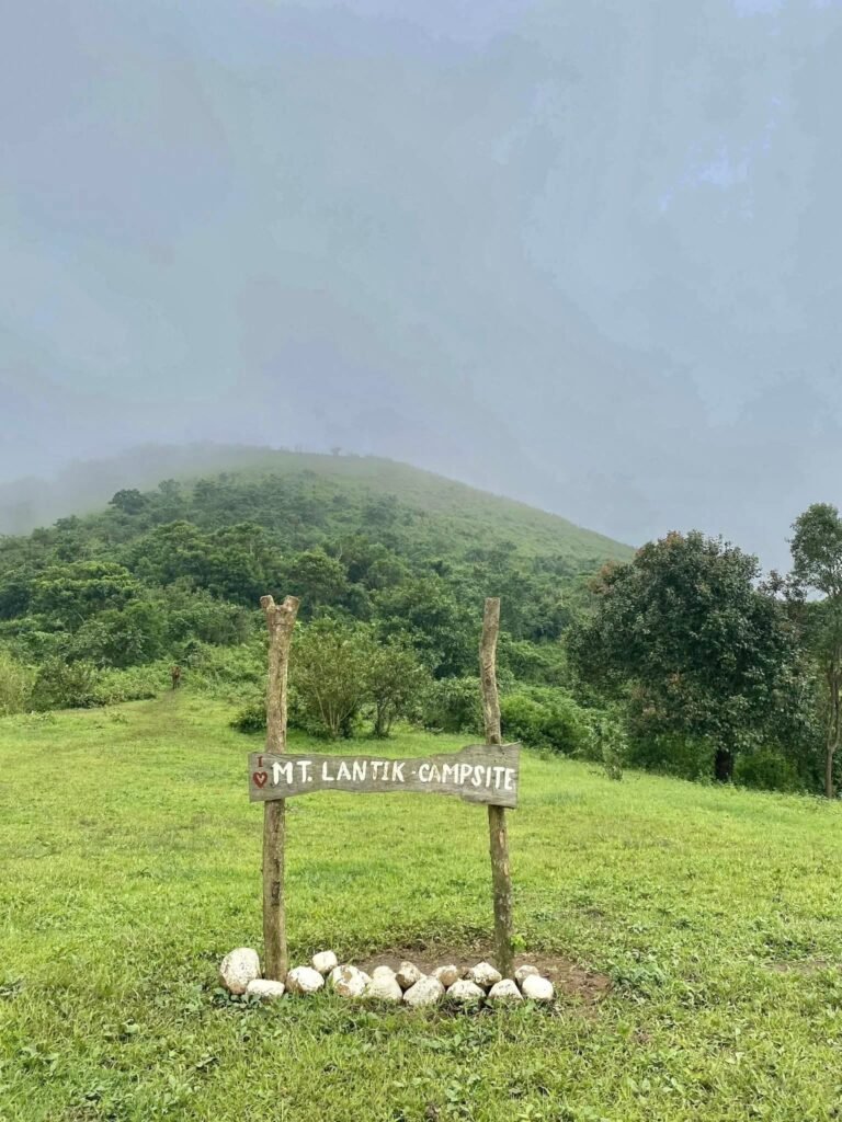
If you want to build up to Mt. Apo with similarly demanding Mindanao climbs, Mt. Dulang-Dulang in Bukidnon is the Philippines’ second-highest peak and an excellent preparation climb. Panimahawa Ridge is another worthy build-up option.
check the Digos City or Kidapawan City tourism offices directly for updated quotas, permit requirements, and trail condition advisories before booking.
Frequently Asked Questions About Mt. Apo
1. What is the Mt. Apo difficulty level for beginners?
Mt. Apo difficulty rates 7–8 out of 9 on the Philippine mountaineering scale. Mt. Apo is an advanced climb. The Sta. Cruz Trail is not recommended for untrained beginners. The Boulder Face requires scrambling, balance, patience, and confidence on exposed rock. If this is your first major climb, complete at least two or three intermediate peaks first and build your endurance before attempting Apo.
2. What is the Mt. Apo MASL and why does altitude matter?
Mt. Apo stands at 2,954 meters (9,692 ft) above sea level. AMS begins at around 2,400 MASL. There are at least thirty mountains in the Philippines above this elevation, including Mt. Pulag and Mt. Apo, so this is a real concern for hikers. Ascend slowly above Tinikaran Camp 1, hydrate well, and descend immediately if serious symptoms appear.
3. Is hiring a porter for the Mt. Apo hike really necessary?
It is optional but strongly recommended. Mt. Apo is already difficult with a light daypack. Carrying a heavy 15–18 kg full pack over the Boulder Face and down the Kapatagan mud trail makes the climb significantly harder. By the time most hikers arrive at camp, their porters have already pitched the tents and boiled hot water. Hiring a porter also supports local communities connected to the mountain.
4. Are there reliable water sources on the Mt. Apo trail?
The water source at Tinikaran Camp 1 is excellent — a pipe tapped into a cold mountain spring about 10 minutes from camp. The water is clear, cold, and has no sulfur taste. Water is also available at lower elevations from streams and rivers and at Lake Venado campsite at 2,280 MASL. Above the lake, water becomes scarce. Always filter or treat before drinking above Tinikaran.
5. What wildlife or protected species might I encounter on the Mt. Apo hike?
Mt. Apo is home to 270 bird species, 100 of them endemic. While Mt. Apo is a sanctuary for the endangered Philippine eagle, sightings are extremely rare. The bird inhabits deep forest zones rarely accessed by hikers. Conservation efforts prioritize protection over tourism encounters. Do not disturb wildlife, do not collect plants, and follow your guide’s instructions near any cultural or sacred sites along the route.
Final Verdict: Should You Climb Mt. Apo?
Mt. Apo rates 5 out of 5 for experienced hikers looking for a genuine physical and cultural challenge — and 3 out of 5 for casual trekkers who are not yet conditioned for multi-day altitude climbs. The Mt. Apo hike is one of the few climbs in the Philippines that earns every superlative given to it: the crater, the boulders, the mossy forest at night, the cold thin air at nearly 3,000 meters — it all delivers. Go prepared, book early, respect the guides and porters who make the summit possible, and this mountain will give you something you will not stop talking about for years.


Pingback: The Ultimate Guide to the Top 10 Mountains in the Philippine – BigBizStuff
Pingback: The Ultimate Guide to the Top 10 Mountains in the Philippine – BizBackLinks
Pingback: The Ultimate Guide to the Top 10 Mountains in the Philippine – BizLinkBuilder
Pingback: The Ultimate Guide to the Top 10 Mountains in the Philippine – SmallBizBlog
Pingback: The Ultimate Guide to the Top 10 Mountains in the Philippine – Small Biz Directory
Pingback: The Ultimate Guide to the Top 10 Mountains in the Philippine – A4Everyone
Pingback: The Ultimate Guide to the Top 10 Mountains in the Philippine – That AI Blog
Pingback: Discover the Best Mountains in the Philippines: Your Ultimate Hiking Guide for 2024 – BizBuildBoom
Thanks for sharing. I read many of your blog posts, cool, your blog is very good.
Great post! If you’re in Davao, don’t miss Mount Apo—it’s the ultimate hiking trail with stunning views and lush scenery. Perfect for adventure seekers like you!
This travel blog is incredibly informative and well-researched, offering valuable tips and insights for both first-time and seasoned travelers. The detailed itineraries and personal experiences make it easy to plan trips with confidence. Anyways, do you have any food recommendation on the nearby area?