Is Mt. Manmanoc Worth Hiking?
Yes, Mt. Manmanoc is worth hiking if you are an experienced hiker looking for a remote, rugged, and locally guided Cordillera climb in Abra. This is not a casual beginner trail or a quick viewpoint stop. It is a serious mountain route where the road access, guide coordination, weather, river crossings, campsite planning, and pacing matter just as much as reaching the summit.
I traveled to Mt. Manmanoc on May 2026 to personally fact-check the important trail and logistics details, and my biggest takeaway is simple: this hike is rewarding, but it demands preparation. The mountain sits in Malibcong, Abra, with the common hiking route connected to Barangay Mataragan as the jump-off and Barangay Pacgued/Pacqued as the exit or traverse area.
Mt. Manmanoc is often associated with Abra’s highest peak identity and is locally connected with the name Mt. Mammanok. It is known for pine forest, mossy forest, river sections, remote community access, and a raw Cordillera mountain atmosphere. But this is not a hike I would recommend to true beginners. If you are searching for a simple Mt. Manmanoc DIY hike, understand that the logistics may be DIY-planned, but the actual climb should still be done with local coordination and a guide.
Mt. Manmanoc Quick Facts
| Category | Details |
|---|---|
| Destination | Mt. Manmanoc |
| Local / alternate names | Mt. Mammanok, Mt. Manmanok, Mount Manmanoc |
| Location | Malibcong, Abra |
| Province | Abra |
| Region | Cordillera Administrative Region |
| Jump-off point | Barangay Mataragan |
| Exit / traverse area | Barangay Pacgued / Pacqued |
| Destination type | Remote Cordillera mountain hike / Abra major climb |
| Mt. Manmanoc MASL | Around 2,024–2,046 MASL |
| Known identity | Often described as Abra’s highest peak / “roof of Abra” |
| Trail type | Remote mountain trail with community access, river/woodland sections, pine forest, mossy forest, and summit/viewpoint areas |
| Difficulty feel | Major or near-major climb; not beginner-friendly |
| Reported difficulty | Older field sources describe it as a major climb with difficulty around 7/9 |
| Trail class | Reported around Trail Class 1–3 in older hiking references |
| Hiking duration | Safer as 2D1N or 3D2N |
| Day hike | Possible only for very strong hikers, but not recommended as the default plan |
| Day-hike reference | A 2025 attempt recorded around 19.55 km, 1,556 m elevation gain, and 11 hours elapsed |
| Best for | Experienced hikers, Cordillera hikers, Abra explorers, photographers, overnight campers |
| Not ideal for | True beginners, solo DIY hikers, hikers with strict schedules, hikers needing reliable signal |
| Water / river notes | River crossings are part of some routes; water depth depends on weather |
| Campsite | Pine forest campsite reported around 1,500–1,600 MASL |
| Summit experience | Weather-dependent; Helipad/viewdeck and mossy summit areas are part of the route experience |
| Best month to hike Mt. Manmanoc | Dry season, especially December to May |
| Main safety concerns | Rough access road, landslide risk, river crossings, fog, cold, night descent, remote evacuation |
| Last major supply base | Bangued, Abra |
| Important reminder | Coordinate with Malibcong Tourism, barangay, and local guides before travel |
Table of Contents

What Is Mt. Manmanoc Known For?
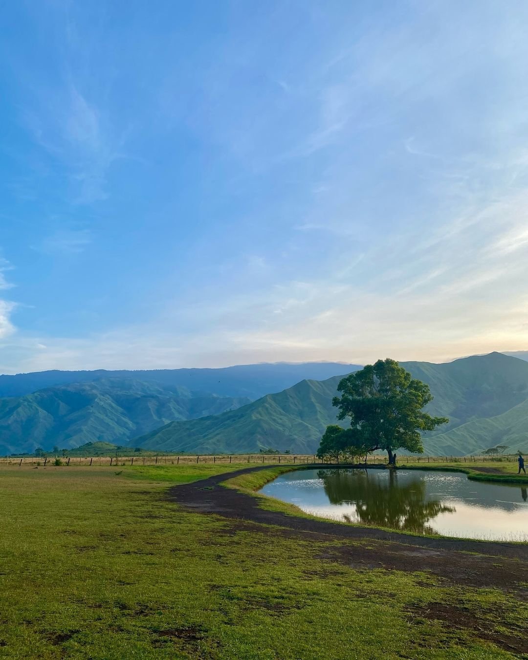
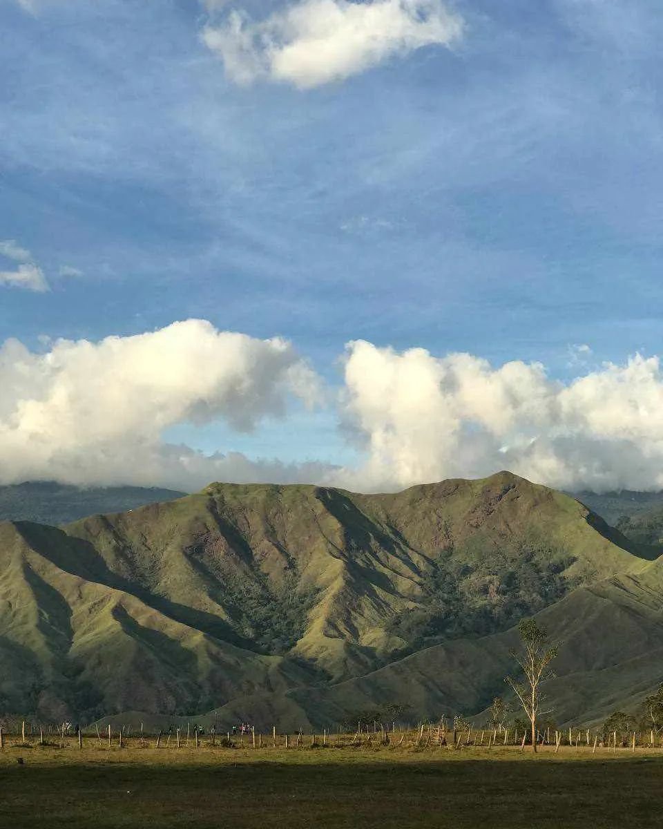
Mt. Manmanoc is known as a remote mountain destination in Malibcong, Abra, often described in hiking circles as one of the serious Cordillera climbs in the province. It is also locally and officially connected with the spelling Mt. Mammanok, while other hikers may search for it as Mt. Manmanok or Mount Manmanoc.
What makes Mt. Manmanoc special is not only its elevation. The mountain is known for:
- Remote Cordillera terrain
- Abra mountain layers
- Pine forest sections
- Mossy forest near the summit area
- River or woodland sections on some routes
- Community-based access through Malibcong
- Barangay Mataragan jump-off
- Barangay Pacgued/Pacqued traverse or exit route
- A raw, expedition-style hiking feel
- The “roof of Abra” or Abra’s highest peak identity
Unlike easier Abra tourist spots, Mt. Manmanoc is not something you visit casually after lunch. The hike requires proper pacing, a local guide, weather awareness, transport planning, and respect for the communities connected to the route.
Where Is Mt. Manmanoc Located?
Mt. Manmanoc is located in Malibcong, Abra, in the Cordillera Administrative Region. The route is commonly connected to Barangay Mataragan as the jump-off and Barangay Pacgued/Pacqued as the exit or traverse area.
For readers asking where is Mt. Manmanoc located, the simplest way to understand the route is:
Manila / Baguio / Vigan → Bangued → Malibcong → Barangay Mataragan → Mt. Manmanoc trail
| Access Hub | Travel Context |
|---|---|
| Manila | Most common starting point for weekend hikers; usually via overnight bus to Bangued |
| Baguio | Practical for hikers already in Northern Luzon or Cordillera |
| Vigan / Candon | Possible Ilocos-side route to Bangued |
| Bangued | Main supply, transport, and coordination base |
| Malibcong | Municipality where Mt. Manmanoc is located |
| Barangay Mataragan | Common jump-off area |
| Barangay Pacgued / Pacqued | Common exit or traverse area |

How Difficult Is Mt. Manmanoc?
The Mt. Manmanoc difficulty level is major or near-major, and it should not be marketed as beginner-friendly. Even if some sections may feel manageable to trained hikers, the full climb becomes difficult because of the long access, rough road, remote location, river crossings, steep pine forest ascent, mossy forest, fog risk, low trail signage, and difficult evacuation.
Mt. Manmanoc is the kind of hike where logistics increase the difficulty. You may already be tired before the trail begins because of the overnight travel to Abra, the Bangued supply run, the long road to Malibcong, and the rough transfer toward Mataragan.
Key difficulty factors include:
- Long overnight land travel before the hike
- Bangued to Malibcong access
- Rough road from Malibcong toward Mataragan
- Remote jump-off with limited backup options
- Mandatory local guide coordination
- Numerous river crossings on some routes
- Steep pine forest ascent
- Mossy forest terrain near the summit
- Confusing trail sections or limited signage
- Cold, fog, wind, and possible no-view summit conditions
- Risk of night trekking if pacing fails
- Difficult evacuation if someone gets injured
Older hiking references classify Mt. Manmanoc as a major climb with a difficulty rating around 7/9 and trail class around 1–3. A day-hike attempt also recorded about 19.55 km, 1,556 meters of elevation gain, and around 11 hours elapsed, with the hiker not recommending it as a day hike.
That detail is important. Mt. Manmanoc may look tempting for strong hikers who want to compress it into one day, but the safer and more realistic recommendation is an overnight climb. A rushed day hike can easily become a night-navigation problem, especially if the group gets delayed by road access, weather, river crossings, or route-finding.
Is Mt. Manmanoc Beginner-Friendly?
No, Mt. Manmanoc is not beginner-friendly in the usual sense. It may be possible for a physically prepared first-time major-climb hiker, but only if that person joins an experienced group with proper local guide coordination.
This is not a mountain I would recommend as a first hike. The access alone can be tiring, and the trail has enough variables to overwhelm hikers who are not used to remote terrain. Beginners may struggle with the long travel, rough road, steep forest ascent, river crossings, campsite conditions, cold, fog, and limited emergency access.
Mt. Manmanoc is better suited for:
- Experienced hikers
- Hikers with overnight climb experience
- Cordillera mountain hikers
- Strong endurance hikers
- Small groups with proper local support
- Photographers who understand weather uncertainty
- Hikers who are comfortable with remote trails and basic camp conditions
You may not enjoy Mt. Manmanoc if you:
- Are a true beginner
- Have no endurance training
- Dislike river crossings
- Need reliable signal
- Have knee or mobility issues
- Are traveling on a strict return schedule
- Expect a developed tourist trail
- Prefer easy hikes with stores, restrooms, and clear signage
What Is the Mt. Manmanoc Trail Experience Actually Like?
The Mt. Manmanoc trail feels raw, remote, and coordination-heavy. It is not a polished mainstream Luzon trail where you simply arrive at a jump-off, pay a fixed fee, and follow a clear trail to the summit.
The experience starts before the hiking begins. The Manila-to-Abra ride already feels like the first endurance test. Bangued becomes the reset point for food, water, cash, and coordination. Then the road toward Malibcong and Mataragan adds another layer of difficulty.
The Road to the Jump-Off
The road to the Mt. Manmanoc jump-off is one of the most important parts of the trip. From Bangued, hikers usually head toward Malibcong Poblacion, then continue to Barangay Mataragan by arranged local transport or monster jeep-style vehicle.
This road section should not be underestimated. Field reports describe the final road access as rough, muddy, and partly unmapped. Older sources also note that the road may not be clearly visible in navigation apps. In practical terms, you need local transport coordination, not just Google Maps.
The road into Malibcong and toward Mataragan can feel more expedition-like than typical Luzon jump-off roads. This is why early departure matters. If your vehicle gets delayed, your entire hiking schedule gets affected.
Hikers should check:
- Road passability
- Weather conditions
- Landslide advisories
- Vehicle availability
- Local transport rates
- Whether the route requires monster jeep or other suitable vehicle
- Current registration flow
- Whether the group must report to tourism, barangay, PNP, or local officials
Registration, Guide Coordination, and Community Entry
Mt. Manmanoc should be treated as a locally guided hike. A local guide is not just helpful here; it is practically necessary. The route passes through remote areas, community spaces, river sections, forest, and summit zones where local knowledge matters.
Published field notes commonly point to Barangay Mataragan as the jump-off and Barangay Pacgued/Pacqued as the traverse exit. 1:2 guide-to-hiker ratio and a guide fee of ₱1,000 for 2 days, but the rate should be treated carefully because guide fees can change.
The local coordination process may include:
- Malibcong Tourism coordination
- Barangay coordination
- Local guide arrangement
- Registration
- Environmental or community fees
- Route confirmation
- Exit route confirmation
- Campsite confirmation
- Weather and river condition check
Because Malibcong is home to Banao, Mabaka, and Gubang communities, the final article should not treat Mt. Manmanoc as just a “hidden gem.” This is a living community landscape. Ask permission before photographing residents, houses, farms, rituals, and community areas.
Early Trail and River Crossings
The early trail can feel warm, rural, and exposed. Depending on the route, hikers may pass community paths, rice-field areas, and river or woodland sections before reaching steeper terrain.
River crossings are one of the most important parts of the Mt. Manmanoc trail. Numerous river crossings, while a day-hike is described around 8–10 shallow river crossings after the early trail. These crossings may feel manageable in good weather, but they can become dangerous after heavy rain.
Bring proper gear for wet sections:
- Hiking shoes with good grip
- River sandals or water shoes if guides confirm water crossings
- Dry bag
- Waterproof phone pouch
- Trekking pole
- Quick-dry clothing
Do not rely on fixed river-depth information. Water level can change quickly after localized rain or thunderstorms. Always follow the local guide’s decision.
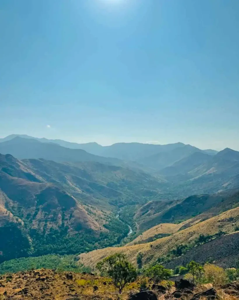
Forest, Steep Sections, and Trail Fatigue
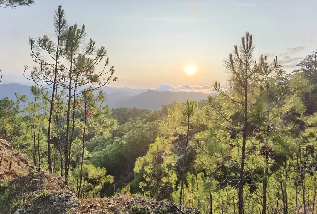
After the lower and river sections, the trail becomes more physically demanding. Mt. Manmanoc has pine forest sections, steep ascent areas, and mossy upper terrain near the summit zone.
The pine forest is one of the strongest visual rewards of the hike. It gives the trail a classic Cordillera mountain atmosphere, but it also introduces fatigue. Some reports mention steep final pushes, slippery terrain, and confusing trail sections, especially when visibility drops or the group gets delayed.
This is where pacing becomes critical. A strong start does not mean a strong finish. If the group moves too fast early, hikers may burn out before camp. If the group moves too slowly, descent or summit timing can become risky.
Expect:
- Heat in lower exposed sections
- Slippery rocks or roots after rain
- Steep pine forest ascent
- Possible mossy forest near the summit area
- Fog and reduced visibility
- Cold or windy conditions near camp
- Mental fatigue from long trail hours
Campsite or Rest Area Experience
Older field reports describe a pine forest campsite around 1,500–1,600 MASL, reached after the steep ascent from the lower sections. The campsite is one of the reasons Mt. Manmanoc works better as an overnight hike than as a rushed day hike.
The campsite atmosphere is part of the appeal. Pine forest camping gives the hike a remote Cordillera feel, but hikers should expect basic conditions. Do not assume there are toilets, running water, stores, tables, or built facilities.
Bring:
- Tent
- Sleeping bag
- Sleeping pad
- Warm layer
- Headlamp
- Trash bag
- Camp food
- Enough water
- Stove or cookset only if allowed
The camp can be cold and windy, especially at night. Prepare for fog, damp gear, and basic mountain comfort. Older accounts mention campfire use, but I do not recommend listing bonfires as allowed unless the barangay or tourism office clearly permits it.
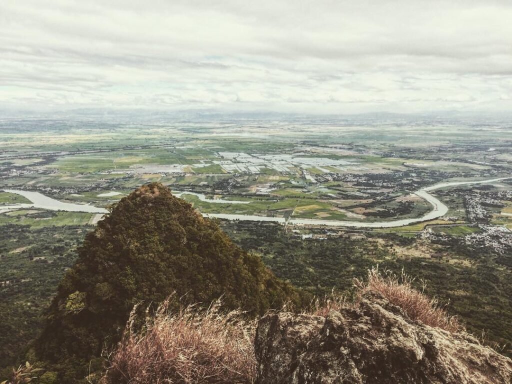
Summit / Viewpoint Experience
The Mt. Manmanoc summit experience is weather-dependent. The mountain is often described around 2,024–2,046 MASL, and hikers search for it as Mt. Manmanoc MASL or Abra’s highest peak. However, the exact elevation should be presented as a range because different references and field recordings vary.
Some reports describe a Helipad or viewdeck area before the summit where hikers can enjoy wide Cordillera views if the weather is clear. The real summit area has been described as mossy, with trees and limited viewpoint value depending on the route and weather.
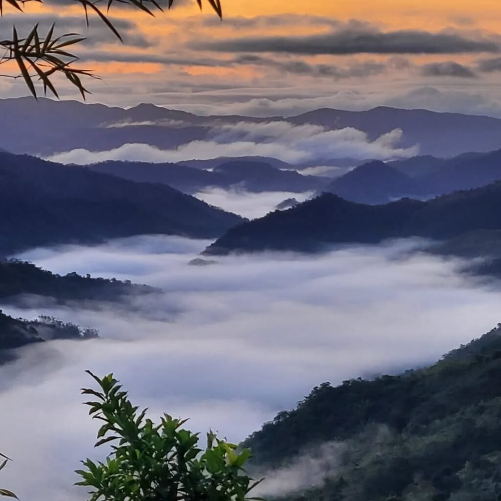
The honest way to frame the summit is this: Mt. Manmanoc can give beautiful mountain layers, sunrise possibilities, foggy forest scenes, and a strong summit atmosphere, but views are never guaranteed.
Sea of clouds may happen, but do not overpromise it. In many Cordillera hikes, fog can make the summit feel more mysterious than scenic. For Mt. Manmanoc, the pine forest, mossy forest, remote access, and community route may be more memorable than the actual summit clearing.
Descent and Exit Route
The descent can be harder than expected. The usual traverse route exits through Barangay Pacgued/Pacqued, while some route variations may use Mataragan return or other local paths depending on the guide’s decision.
This is where many hikers underestimate the climb. After the summit, legs are already tired, packs still have weight, and the trail may be slippery. If the group starts late or gets delayed, the pine forest and descent sections can become difficult in the dark.
Bring a headlamp even if you expect to finish before sunset. Keep enough energy for the exit. Do not treat the descent as automatic.

Best Time to Hike Mt. Manmanoc
The best month to hike Mt. Manmanoc depends on what you want, but the safest general window is the dry season, especially December to May. December to February is usually more comfortable because of cooler conditions, while March to May can be hotter but may offer drier trail conditions.
For Mt. Manmanoc, weather matters because of:
- River crossings
- Muddy access roads
- Landslide-prone areas
- Fog and summit visibility
- Heat exposure in lower sections
- Cold and wind at camp
- Night-descent risk
| Season / Situation | What to Expect | Best Move |
|---|---|---|
| December to February | Cooler hiking conditions, better comfort | Good window, but still check rain and fog |
| March to May | Hotter trail, possible dry crossings | Start early and manage hydration |
| June to November | Rainy/typhoon season risk | Avoid unless cleared by locals |
| After heavy rain | River and landslide risk increases | Do not push the hike |
| Severe thunderstorm forecast | Flash flood, lightning, poor visibility | Reschedule |
| Clear dry window | Better road and river conditions | Best chance for safer hike |
| Photographer schedule | Better with 2D1N or 3D2N | Allow fog and weather buffer |
Always check PAGASA forecasts, Abra/Malibcong advisories, and road updates before traveling. Malibcong barangays have been identified in past advisories as landslide-susceptible during severe weather, so the road and weather check should be treated as part of the hike, not an optional step.

How to Go to Mt. Manmanoc
Manila / Baguio / Vigan → Bangued → Malibcong → Barangay Mataragan → Mt. Manmanoc trail
Manila to Abra
From Manila, take an overnight bus to Bangued, Abra. This is the most common access route for hikers coming from Metro Manila.
The Manila to Bangued trip is often reported around 10–11+ hours, depending on bus operator, traffic, terminal, and road condition. Partas and Viron are commonly associated with Abra-bound routes, and bus fare references often fall around the ₱800–₱900+ range, though fares change.
Suggested flow:
- Take an overnight bus from Manila to Bangued.
- Arrive early in Bangued.
- Eat breakfast and buy supplies.
- Meet your arranged transport.
- Travel to Malibcong Poblacion.
- Coordinate registration and guide requirements.
- Continue to Barangay Mataragan.
- Start the hike with a local guide.
Baguio to Abra
Baguio is a practical access hub for hikers already in Northern Luzon. A Baguio to Bangued route can take around 5–6 hours via the Naguilian–La Union–Ilocos side, depending on schedules and traffic.
Some commute guides list sample fares around ₱312–₱390, but schedules and fares should always be checked before using this route. Baguio is useful if you are coming from Benguet, Mountain Province, or a Cordillera side trip before Abra.
Vigan / Ilocos to Abra
Vigan, Candon, or the Ilocos corridor can also work as an access route to Bangued. Some route data suggests Vigan to Bangued can take around 3+ hours by bus/transfers or about 1 hour by private vehicle, depending on route and traffic.
This is best for hikers who want to pair Mt. Manmanoc with:
- Vigan
- Ilocos Sur
- Tangadan Tunnel
- Candon
- Other Ilocos or Abra road-trip stops
Bangued to Malibcong
Bangued is the last reliable supply base. Do your final food, water, and cash preparation here. Do not assume there will be markets or full resupply options near the mountain route.
Field reports describe Bangued to Malibcong Poblacion as around 2.5 to 3 hours, depending on road condition. Your group should use arranged transport instead of relying on uncertain public options.
Malibcong to Barangay Mataragan
The Malibcong to Mataragan road is the last-mile challenge. Older reports describe it as roughly 20–25 km, with around 2+ hours by rough road or monster jeep. Road condition can be muddy, unpaved, and weather-sensitive.
This is one of the most important parts of the Mt. Manmanoc travel guide because hikers can lose time before the actual climb begins. Arrange your transport early and confirm road passability before leaving Bangued.
Return Trip Tips
Do not make your return schedule too tight. A Mt. Manmanoc itinerary can be delayed by:
- Slow group pacing
- Weather
- River level
- Fog
- Road condition
- Vehicle availability
- Night descent
- Guide decision
- Road closures or landslide risk
If possible, return to Bangued first, rest, eat, clean up, and then take the bus back to Manila or continue to Ilocos.

Mt. Manmanoc Itinerary
The following Mt. Manmanoc itinerary is a planning guide. Adjust based on road condition, weather, guide advice, and group pace.
Manila-Based 2D1N Mt. Manmanoc Itinerary
| Time / Day | Activity | Notes |
|---|---|---|
| Night before | Manila to Bangued by overnight bus | Best for weekend hikers |
| Early Day 1 | Arrive in Bangued | Breakfast, supply run, cash, water, food |
| Morning | Travel to Malibcong Poblacion | Arrange transport ahead |
| Late morning / noon | Registration and guide coordination | Confirm route, fees, weather, river condition |
| Midday / afternoon | Transfer to Barangay Mataragan | Rough road; use local transport |
| Afternoon | Start Mt. Manmanoc hike | Pace carefully |
| Late afternoon | Continue to camp area | Aim to reach before dark |
| Night | Camp in pine forest | Expect cold/wind/basic conditions |
| Early Day 2 | Summit push / viewdeck | Start early for better visibility |
| Morning | Mt. Manmanoc summit area | Views depend on weather |
| Late morning | Descend / break camp | Follow guide decision |
| Afternoon | Exit to Pacgued/Pacqued or assigned route | Keep daylight buffer |
| Evening | Return to Malibcong / Bangued | Depends on transport and road condition |
Bangued-Based Day Hike
A Bangued-based day hike is possible only for highly conditioned hikers with pre-arranged transport and confirmed guide support. I would not recommend this as the default itinerary because it creates time pressure and increases the chance of hiking in the dark.
Fees, Budget, and Expected Expenses
A realistic Mt. Manmanoc budget should be group-based because transport and guide costs are easier to divide among hikers. Exact costs can change, so use this as a practical planning snapshot.
| Expense | Budget Note |
|---|---|
| Manila to Bangued bus | Around ₱800–₱900+ based on common listings, but check updated fare |
| Baguio to Bangued bus | Around ₱312–₱390 in some commute references, but check updated fare |
| Vigan / Candon to Bangued | Rough route estimates vary around ₱100–₱600 depending operator and transfer |
| Bangued to Malibcong transport | Arrange locally; rate depends on vehicle and group |
| Malibcong to Mataragan monster jeep / local transport | Required for many groups; confirm current rate |
| Guide fee | Older report: ₱1,000 for 2 days; confirm updated rate |
| Guide ratio | Reported 1:2 guide-to-hiker ratio |
| Registration fee | Confirm with tourism/barangay |
| Environmental fee | Confirm with tourism/barangay |
| Camping fee | Confirm if applicable |
| Porter fee | Confirm availability and rate |
| Food | Buy in Bangued |
| Water / purification | Bring treatment system and enough carrying capacity |
| Pre/post-hike lodging | Optional but useful |
| Emergency buffer | Strongly recommended |

What to Wear and Bring for Mt. Manmanoc
Pack for a remote Cordillera hike with river crossings, steep forest ascent, possible fog, cold camp, and night movement risk.
Bring:
- Hiking shoes with aggressive grip
- River sandals or water shoes if the route includes wet crossings
- Quick-dry hiking clothes
- Rain jacket or shell
- Fleece or warm layer
- Headlamp with extra batteries
- Trekking pole
- Dry bag
- Waterproof phone pouch
- Offline map or GPX backup
- Power bank
- 2–3 liters water capacity, adjusted after guide advice
- Water filter or purification tablets
- Trail food
- Packed meals
- First-aid kit
- Personal medicine
- Emergency blanket
- Whistle
- Lighter
- Insect repellent
- Optional leech socks if current conditions suggest leeches
- Sunscreen
- Trash bag
- Tent for overnight
- Sleeping bag
- Sleeping pad
- Cookset only if allowed and needed
The most important gear lessons for Mt. Manmanoc are simple: protect your feet, waterproof your gear, bring enough light, prepare for cold, and do not underestimate water.
Water Sources, Food, and Camp Logistics
Bangued should be treated as the final reliable supply point. Buy food, water, cooking needs, batteries, and emergency snacks before leaving town. Do not rely on stores along the mountain route.
Water planning depends on the final route used. Some routes have river and woodland water sources, and older itineraries mark a trail water source before the campsite ascent. However, water availability should always be confirmed with guides before hiking.
General water rules:
- Carry enough water from the jump-off.
- Refill only where guides confirm it is safe.
- Treat or filter all natural water.
- Do not drink directly from rivers or streams.
- Bring a dry bag for extra clothes and electronics.
- Carry emergency water capacity for camp.
- Do not assume the campsite has water.
Food rules:
- Bring packed meals.
- Bring trail snacks.
- Bring emergency calories.
- Pack out all trash.
- Confirm if cooking is allowed.
- Do not make bonfires unless explicitly allowed.
- Do not wash soap or shampoo directly in rivers or water sources.

Nearby Places to Pair with Mt. Manmanoc
Mt. Manmanoc can be paired with other Abra tourist spots, but only if your schedule has enough buffer. Do not overload your itinerary because the hike and road access can be tiring.
| Nearby Place | Why It Pairs Well | Best Timing | Caveat |
|---|---|---|---|
| Bangued | Main base for food, cash, transport, and recovery | Before or after the hike | Check lodging and bus schedule |
| Malibcong local stops | Adds cultural and nature context | Only if allowed locally | Respect community rules |
| Kaparkan Falls | Iconic Abra seasonal destination | Separate day | Seasonal and road-dependent |
| Apao Rolling Hills | Scenic Abra landscape side trip | Before or after hike | Verify road access |
| Cassamata Hill / Victoria Park | Easy Bangued side trip | After hike | Good recovery stop |
| Abra River viewpoints | Good road-trip and photo context | Before or after hike | Avoid during flood advisories |
| Tangadan Tunnel | Useful if coming via Ilocos | Road-trip route | Verify road condition |
| Vigan | Good Ilocos add-on after Abra | After hike | Adds travel time |
If you are building a larger Northern Luzon route, Bangued and Vigan are the most practical pairings. If you want a deeper Abra itinerary, Kaparkan Falls and Apao Rolling Hills are strong options, but they need separate access checks.
Mistakes to Avoid When Hiking Mt. Manmanoc
Avoid these common mistakes:
- Treating Mt. Manmanoc like a casual beginner hike
- Planning it as a walk-in DIY climb
- Not coordinating with local guides early
- Underestimating the road to Mataragan
- Depending only on Google Maps or Waze
- Not checking road and weather conditions
- Hiking after heavy rain
- Underestimating river crossings
- Bringing poor footwear
- Not waterproofing gear
- Packing too heavy
- Not bringing enough water capacity
- Not treating natural water
- Forgetting warm layers for camp
- Forgetting a headlamp
- Expecting reliable mobile signal
- Expecting guaranteed sea of clouds
- Ignoring descent time
- Booking a tight return trip
- Not budgeting for private local transport
- Leaving trash
- Disrespecting local communities
- Flying drones without permission
The biggest mistake is assuming the difficulty starts only on the trail. For Mt. Manmanoc, the challenge starts with the logistics.
Final Verdict: Is Mt. Manmanoc Worth It?
Yes, Mt. Manmanoc is worth it if you are prepared for a remote, rugged, and locally guided Abra mountain climb. It has the ingredients that experienced hikers look for: long approach, rough road access, community-based trail entry, river sections, pine forest, mossy forest, campsite atmosphere, summit uncertainty, and a strong Cordillera feel.
But it is not for everyone. Mt. Manmanoc is not beginner-friendly, not ideal for solo DIY hikers, not easy to access, and not something to squeeze into a rushed day hike unless you are highly trained and already have the right local setup.
My honest recommendation is to plan it as a 2D1N hike, or 3D2N if you want more buffer for road delays, photography, weather, and recovery. Use Bangued as your supply base, coordinate with Malibcong and local guides, prepare for river and weather conditions, and respect the communities connected to the mountain.
If you come prepared, Mt. Manmanoc can be one of the most rewarding Abra hiking experiences. If you come unprepared, it can quickly feel too remote, too tiring, and too risky.
Frequently Asked Questions About Mt. Manmanoc
Is Mt. Manmanoc worth hiking?
Yes, Mt. Manmanoc is worth hiking for experienced hikers who want a remote Abra and Cordillera mountain experience. It has pine forest, mossy sections, river crossings, and a strong expedition feel. It is not ideal for casual beginners because the road access, weather, and trail logistics are demanding.
Where is Mt. Manmanoc located?
Mt. Manmanoc is located in Malibcong, Abra, in the Cordillera Administrative Region. The route is commonly connected to Barangay Mataragan as the jump-off and Barangay Pacgued/Pacqued as the exit or traverse area.
How high is Mt. Manmanoc?
The Mt. Manmanoc MASL is commonly listed around 2,024–2,046 meters above sea level. It is often associated with Abra’s highest peak identity, but the exact elevation should be presented as a range because field readings and older reports vary.
How difficult is Mt. Manmanoc?
The Mt. Manmanoc difficulty level is major or near-major. The challenge comes from long travel, rough last-mile access, river crossings, steep pine forest ascent, mossy terrain, possible fog, limited signage, and difficult emergency access. It is not a beginner-friendly hike.
Is Mt. Manmanoc beginner-friendly?
No, Mt. Manmanoc is not beginner-friendly. It is better for experienced hikers or physically prepared hikers joining a strong group with local guide support. Beginners may struggle with the travel fatigue, river crossings, steep trail, camp conditions, and remote evacuation challenges.
How do you get to Mt. Manmanoc from Manila?
To get to Mt. Manmanoc from Manila, take an overnight bus to Bangued, Abra. From Bangued, arrange transport to Malibcong, coordinate with local officials and guides, then continue to Barangay Mataragan, the common Mt. Manmanoc jump-off.
How do you get to Mt. Manmanoc from Baguio?
From Baguio, travel to Bangued, Abra, usually through the La Union–Ilocos corridor. From Bangued, continue to Malibcong and Barangay Mataragan by arranged local transport. Baguio works best for hikers already in Northern Luzon.
How do you get to Mt. Manmanoc from Vigan?
From Vigan, travel toward Bangued, Abra, then continue to Malibcong and Barangay Mataragan. This route is useful if you are pairing Mt. Manmanoc with an Ilocos side trip, but schedules and transfers should be checked before travel.
Where is the Mt. Manmanoc jump-off?
The common Mt. Manmanoc jump-off is Barangay Mataragan, Malibcong, Abra. The traverse route is commonly associated with Barangay Pacgued/Pacqued as the exit. Hikers should still confirm the current registration and route flow with local guides before travel.
Do you need a guide for Mt. Manmanoc?
Yes, hikers should hire a local guide for Mt. Manmanoc. The trail is remote, route-finding can be confusing, river conditions change, and local coordination is important. Older field information mentions a 1:2 guide-to-hiker ratio, but updated fees should be confirmed locally.
How long is the Mt. Manmanoc hike?
The safer Mt. Manmanoc hike duration is 2 to 3 days. Older field sources list around 6–8 hours to the summit, while a 2025 day-hike attempt recorded around 19.55 km, 1,556 m elevation gain, and 11 hours elapsed.
Is Mt. Manmanoc better as a day hike or overnight hike?
Mt. Manmanoc is better as an overnight hike. A 2D1N or 3D2N itinerary gives more realistic pacing, safer weather margins, and better campsite/summit timing. A day hike is possible for very strong hikers, but it is not recommended as the default plan.
Are there river crossings in Mt. Manmanoc?
Yes, river crossings are part of some Mt. Manmanoc routes. Older and recent field reports mention numerous crossings, including around 8–10 shallow crossings in one 2025 day-hike route. Conditions can change after rain, so follow guide advice before crossing.
Is there a campsite in Mt. Manmanoc?
Yes, Mt. Manmanoc has a pine forest campsite commonly reported around 1,500–1,600 MASL. Conditions are basic, and hikers should confirm current campsite rules, water access, capacity, cooking rules, and fire restrictions before the climb.
What is the best time to hike Mt. Manmanoc?
The best time to hike Mt. Manmanoc is during the dry season, especially December to May. December to February is cooler, while March to May can be hotter. Avoid hiking after heavy rain, during typhoons, or when road and landslide advisories are active.
What should I bring to Mt. Manmanoc?
Bring hiking shoes with grip, river sandals if needed, rain jacket, warm layer, headlamp, dry bag, waterproof phone pouch, power bank, water filter, trail food, first-aid kit, emergency blanket, tent, sleeping bag, sleeping pad, and enough water capacity for the route.
How much is the budget for Mt. Manmanoc?
The Mt. Manmanoc budget depends on group size, transport setup, guide fees, registration fees, camping fees, food, and whether you stay overnight in Bangued. Manila to Bangued bus fares are often around ₱800–₱900+, but local transport and guide costs must be checked before travel.
What nearby places can you visit with Mt. Manmanoc?
Nearby places you can pair with Mt. Manmanoc include Bangued, Malibcong local stops, Kaparkan Falls, Apao Rolling Hills, Cassamata Hill or Victoria Park, Abra River viewpoints, Tangadan Tunnel, and Vigan if you are taking the Ilocos route.
Related Abra, Ilocos, and Hiking Guides
Planning a Mt. Manmanoc hike is easier when you connect it with nearby Abra destinations and similar mountain guides. Since this climb starts with long land travel, rough road access, and serious trail preparation, these related Lakbay Pinas guides can help you build a safer and more complete Northern Luzon itinerary.
For a wider view of the province, read my guide to the best Abra tourist spots and itinerary. This is useful if you want to pair Mt. Manmanoc with easier side trips around Bangued, Malibcong, and other Abra destinations after the hike.
If you want another iconic Abra nature trip, check my Kaparkan Falls Abra travel guide. Kaparkan Falls is a strong add-on for travelers who want to explore more of Abra, but it is seasonal and road-dependent, so always verify local access before adding it to your itinerary.
For hikers coming from the Ilocos side, my Aw-Asen Falls in Sigay, Ilocos Sur DIY guide can help you plan a wider Ilocos–Abra route. It works well if you are entering or exiting through Vigan, Candon, or nearby Ilocos Sur towns.
If you are looking for another challenging mountain route in Northern Luzon, read my Mt. Baruyen hiking guide. It is a good comparison point for hikers who enjoy remote trails, scenic ridges, and less-commercialized mountain routes.