
1. Quick Facts: Mt. Ulap at a Glance
Mt. Ulap stands at 1,846 MASL and carries a difficulty rating of 3/9, making it a “Minor Climb” suitable for beginners with good cardio. The traverse typically takes 4 to 6 hours. Budget-wise, prepare roughly ₱1,200 for a solo DIY trip, or around ₱700 per head if sharing costs in a group of 5+.
Before you book your bus tickets, here is the technical profile of the mountain. If you are looking for an even easier, family-friendly hike nearby, check out the Mt. Camisong Forest Park which is also in Itogon.
| Feature | Details |
| Location | Itogon, Benguet |
| Jump-off Point | Barangay Ampucao (Registration Area) |
| Exit Point | Barangay Sta. Fe (Wash-up Area) |
| Max Elevation | 1,846 MASL (Meters Above Sea Level) |
| Difficulty Level | 3/9 (Minor Climb, Beginner Friendly) |
| Trail Class | 1-3 (Established trails with some steep slopes) |
| Limatik (Leeches) | None / Negligible (Dry Pine Forest) |
| Mobile Signal | Strong (Globe/Smart accessible at peaks) |
Introduction
They call it the “Mini Mt. Ugo” for a reason. You get the same sweeping pine ridges, open grasslands, and cool Cordillera air, but you don’t need a grueling 10-hour bus ride or the multi-day commitment required for its “big brother,” the Mt. Ugo Traverse.
Located in Itogon, Benguet, Mt. Ulap has rightfully earned its reputation as the most Instagrammable mountain in the Philippines today. Unlike the mossy, challenging trails of Mt. Amuyao, Ulap offers open skies and a relaxing alpine vibe that appeals to both seasoned mountaineers and first-timers.
But don’t let the scenic photos completely fool you. This isn’t just a casual walk in the park; it is a legitimate ridge traverse. You will start your assault at Barangay Ampucao and exit roughly 9 kilometers away at Barangay Sta. Fe.
In this updated Mt. Ulap DIY Guide 2026, I’ll walk you through the logistics, the actual Mt. Ulap difficulty (hint: the descent is harder than the climb), and how to navigate the crowds at Gungal Rock. Whether you are chasing the sunrise or just escaping the Manila heat, this guide covers every peso and step.
Editor’s Note: While the stats say “Minor Climb,” do not underestimate the exposure. There is very little shade on the ridge. I’ve seen hikers bonk not from the steepness, but from dehydration caused by the combination of cold wind and harsh UV rays.
Table of Contents
2. How to Go to Mt. Ulap (Manila to Ampucao)
The most efficient route is to take a night bus (Genesis JoyBus or Victory Liner) from Cubao to Baguio City (4–6 hours). From Baguio, proceed to the jeepney terminal near Center Mall or Jollibee Magsaysay. Take the “Ampucao” jeep (₱30–₱50) directly to the registration hall. Total travel time is approximately 6–7 hours.
Step 1: Manila to Baguio City
For the 2026 season, your best bet is to book a trip departing Manila between 10:00 PM and 12:00 AM. This schedule gets you into Baguio by 3:00 AM or 4:00 AM, allowing you to grab a hot coffee and be first in line for the jeepneys without rushing.
I’ve broken down the two best options below so you can decide between speed and budget:
| Bus Line | Class | Fare (Est.) | Pros & Cons |
| Genesis JoyBus | Premier | ₱760 | Best for Sleep. 2×1 lazy-boy seats, restroom, non-stop via TPLEX. |
| Victory Liner | First Class | ₱800 | Reliable. 2×1 seating, restroom on board, fewer stops. |
| Victory / Genesis | Regular Aircon | ₱485 – ₱496 | Budget Friendly. Standard 2×2 seating, but makes frequent stops. |
Personally, I always shell out the extra cash for the JoyBus Premier. The legroom is massive, and sleeping straight through the 4-hour drive means I have enough energy for the assault later that morning.
Step 2: Baguio City to Ampucao (Jump-off)
Once you arrive in Baguio, navigating to the local terminal can be tricky because there are several transport hubs. You need to head specifically to the area near Baguio Center Mall and Jollibee Magsaysay (along Lakandula Street).
Look for the jeepneys with signage reading “Baguio Plaza – Ampucao” or “Baguio – Samoyao.”
First Trip: Generally departs at 6:00 AM.
Frequency: Every 30 minutes or when full.
Fare: Approximately ₱30.00 – ₱50.00 per head.
Warning: If you are chasing a sunrise hike, the 6:00 AM jeepney will be too late. For groups of 4, I suggest hiring a taxi for a “contract price” of ₱300 – ₱500. I’ve done this to leave the city at 4:30 AM, which gets you to the trail just as the light starts to break.
[INSERT PHOTO: A clear photo of the “Baguio – Ampucao” jeepney signage to help readers identify the right vehicle]
3. Mt. UIap Hiking Trail: What to Expect
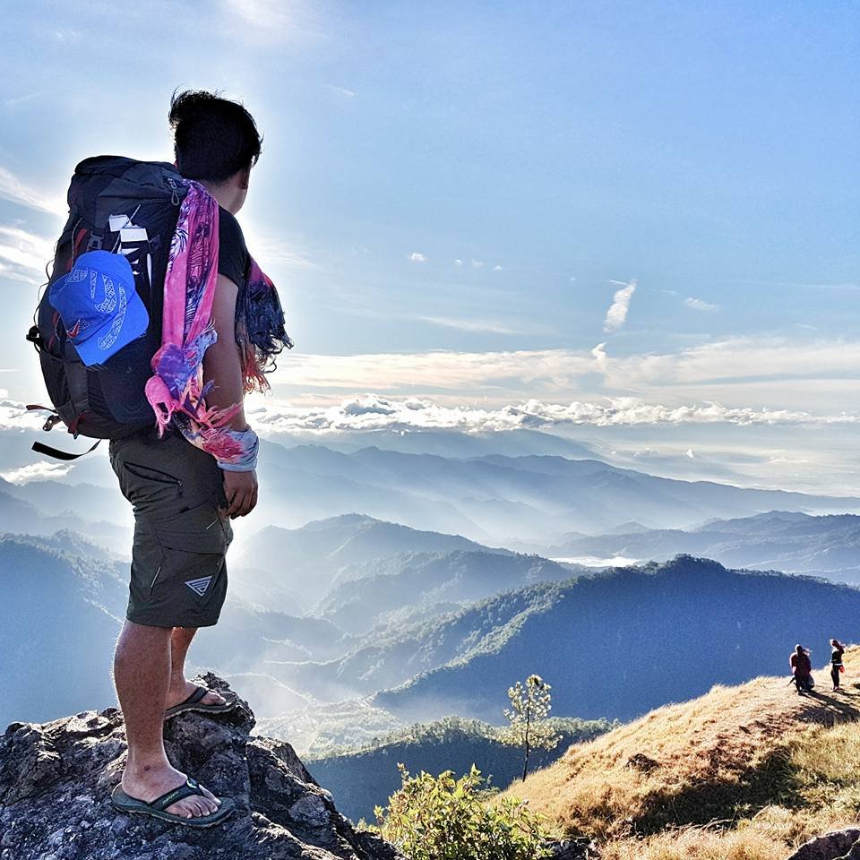
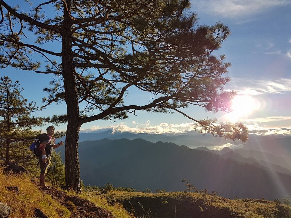
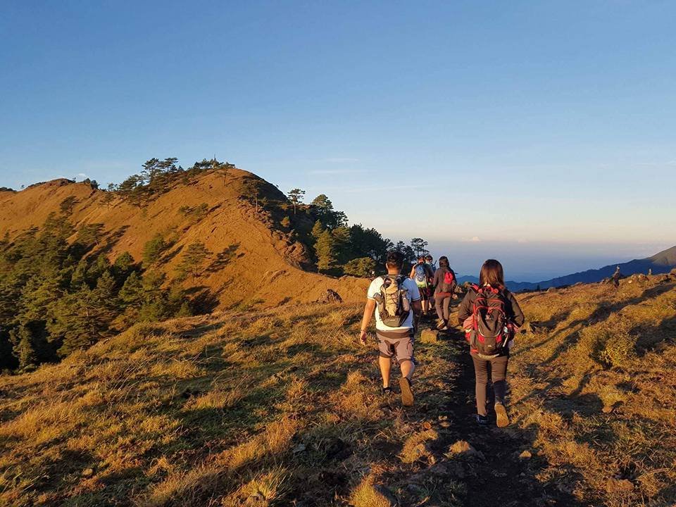
The Mt. Ulap trail is a 9.4-kilometer traverse defined by three distinct peaks: the rolling grasslands of Ambanao Paoay, the cliff-edge drama of Gungal Rock, and the main Summit at 1,846 MASL. The terrain alternates between cool pine forests and exposed ridges, ending with a steep, technical descent on red clay to Barangay Sta. Fe.
Segment 1: The Ascent to Ambanao Paoay (Peak 1)
The hike begins at the Ampucao Barangay Hall, but don’t expect a grueling assault right away. The first leg is a gradual warm-up through a mix of concrete rough roads and shaded pine trails, eventually opening up to Ambanao Paoay at 1,788 MASL.
This is often called the “New Zealand” of the Cordilleras. You are greeted by rolling green hills, free-grazing cows, and scattered pine trees that frame the horizon. It’s incredibly scenic and relatively easy on the lungs—comparable to the gentle slopes of Mt. Kupapey and Mt. Fato in Maligcong.
Look to your left, and you’ll see the massive, grey terraced earth of the Philex Mines. The contrast between the lush green ridge you are standing on and the industrial mining operation below is striking.
[INSERT PHOTO: Me standing in the open grassland area with pine trees and cattle in the background]
Segment 2: The Ridge & Gungal Rock (Peak 2)
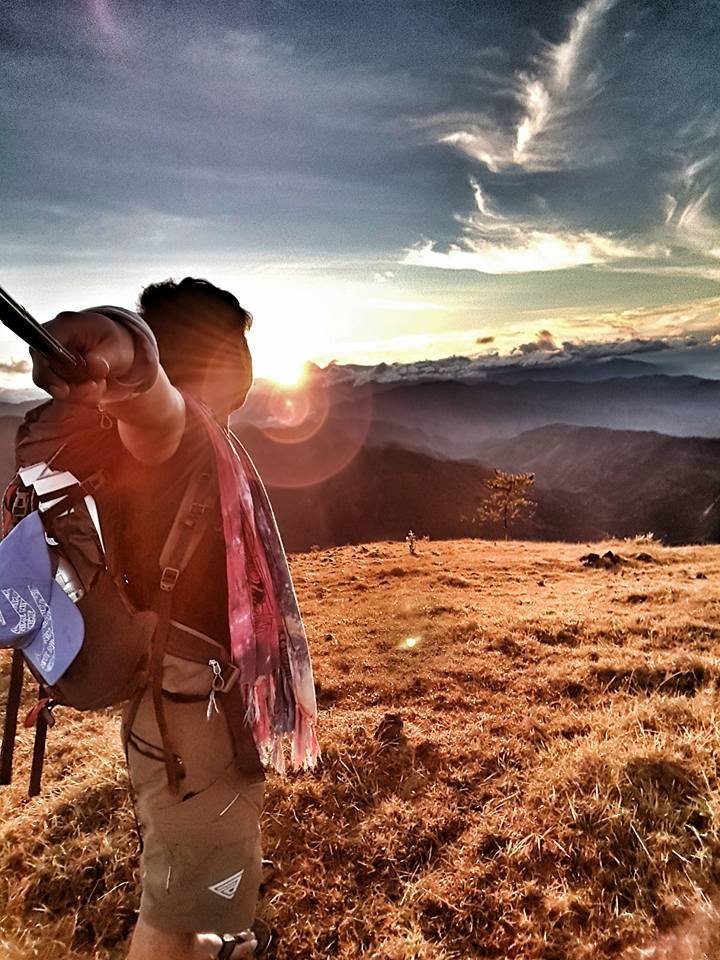
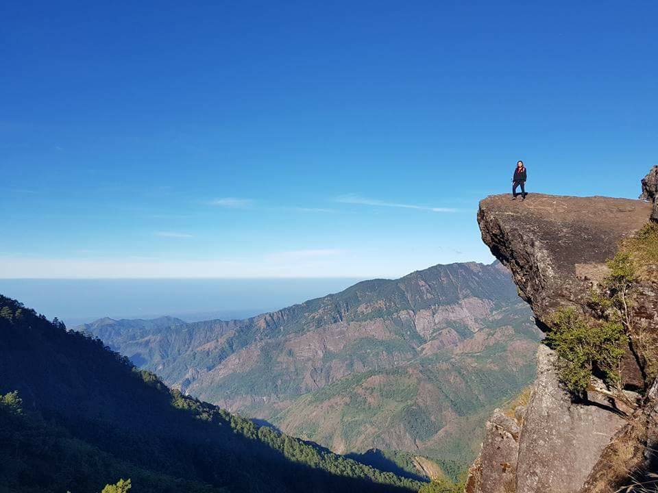
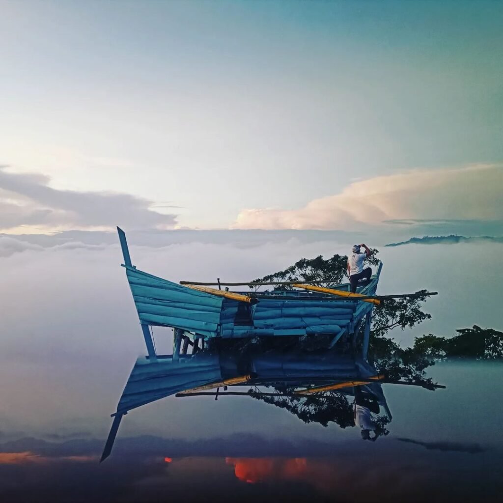
Continuing along the ridge, you will reach the trail’s crown jewel: Gungal Rock (1,814 MASL). This is the slab of rock that juts out over the abyss, famous for those “edge of the world” photos.
The Reality: Expect a queue. On weekends, I have waited 30 minutes to an hour in a queue just to get a 2-minute photo window on the rock.
Safety Warning: The wind gusts on this exposed ridge can hit 15 mph or higher. There are no safety rails, and a slip would be fatal. If the wind is howling, I strongly advise skipping the “edge” pose—it’s not worth the risk.
Segment 3: The Summit & The Descent (Sta. Fe)
After a final push to the Mt. Ulap Summit (1,846 MASL), the real physical challenge begins. The descent to Barangay Sta. Fe is deceptively brutal.
Unlike the gradual ascent, this path drops sharply. The trail is composed of loose Red Clay Soil, which becomes like grease if it rained the night before or if there is heavy morning dew. My knees were definitely shaking by the time I reached the bottom.
Refuel Stop: Halfway down, look out for the 7-Evelyn Store. Buying a cold soda or coconut water here is a lifesaver for the final leg.
The Finish: The trail terminates at a series of Hanging Bridges crossing the river tributaries. They are scenic but sway significantly, so hold the cables tight!
Editor’s Note: Do not underestimate the descent. Even if you have strong cardio, the constant braking force on the steep clay can ruin your knees. I highly recommend bringing at least one trekking pole for this section.
4. Sample Itinerary (2026)
For a day hike, aim for the “Dawn Patrol” schedule: arrive in Baguio by 3:00 AM to start trekking by 5:30 AM, ensuring you catch the sunrise and beat the midday heat. For overnight campers, target a 2:00 PM arrival in Baguio to buy fresh produce at the Public Market before heading to the campsite for sunset.
Choosing your schedule depends entirely on your goal. If you have more time and want to explore further north, you could even head to the Banaue Rice Terraces after your hike. But for a focused Ulap trip, here are the two most efficient itineraries:
The Comparison: Dawn Patrol vs. The Stargazer
| Time | Day Hike (Dawn Patrol) | Overnight Camp (The Stargazer) |
| 03:00 AM | Arrive Victory Liner/JoyBus Baguio | (Sleep in Manila/Transit) |
| 04:00 AM | Taxi to Ampucao (₱300-500 contract) | (Sleep in Manila/Transit) |
| 05:00 AM | Register / Secure Guide | (Sleep/Transit) |
| 05:30 AM | Start Trek (Catch Sunrise) | (Sleep/Transit) |
| 08:30 AM | Gungal Rock Photo Ops | (Travel to Baguio) |
| 11:00 AM | Start Descent (Stop at 7-Evelyn) | (Travel to Baguio) |
| 01:30 PM | Sta. Fe Exit / Wash Up | Arrive Baguio City / Buy Supplies |
| 02:30 PM | Jeep back to Baguio | Jeep to Ampucao (₱50) |
| 04:30 PM | Late Lunch at Good Taste | Register / Hike to Ambanao Paoay |
| 06:00 PM | Bus to Manila | Set Camp / Cook Dinner / Socials |
My Personal Warning: If you choose the Day Hike, do not underestimate the fatigue. You are essentially doing a 6-hour hike on zero sleep if you take the night bus. I highly recommend booking a JoyBus Premier (₱760) so you can actually sleep horizontally during the transit.
5. Budget Breakdown
Expect to spend approximately ₱1,200 to ₱1,500 for a DIY solo day hike, or around ₱700 to ₱900 per person if you travel in a group of 5 or more. Your major expenses will be the roundtrip bus fare from Manila (approx. ₱1,000–₱1,500) and the fixed Guide Fee (₱600 per group).
Budgeting for Mt. Ulap is straightforward, but the final cost leans heavily on whether you are hiking alone or bringing a squad. Here is the breakdown based on 2026 rates:
| Expense Item | Est. Cost (PHP) | Notes |
| Bus Fare (RT) | ₱1,000 – ₱1,600 | Victory Liner / JoyBus (Cubao to Baguio & back) |
| Jeep Fare (RT) | ₱100 | Baguio to Ampucao (₱50/way) |
| Registration Fee | ₱100 | Paid at Ampucao Barangay Hall |
| Guide Fee | ₱600 | Day Hike Rate (Good for 1–7 pax) |
| Shower Fee | ₱20 – ₱50 | Paid at exit point (Sta. Fe) |
| Food/Snacks | ₱300 | Packed lunch + Good Taste dinner |
The “Solo Traveler Tax”
The tricky part of this budget is the Guide Fee. The ₱600 fee is a fixed rate per group (1 to 7 hikers).
If you hike solo, you shoulder that entire ₱600 alone. However, if you bring 6 friends, your share drops to just ₱85 each.
My Pro-Tip: If you are flying solo but want to save cash, hang out near the Ampucao jeepney terminal or the registration area. I often spot other solo hikers or small couples there and ask to merge groups to split the guide fee. It saves me ₱500 instantly—enough for a massive buttered chicken dinner later.
6. Important Requirements & Cultural Rules
No online reservation is required for DIY hikers in 2026; walk-ins are fully accepted at the Ampucao Barangay Hall. However, you must strictly adhere to the “Leave No Trace” policy (bring your own trash bag) and the “Zero Open Defecation” ordinance. Most importantly, respect the Pong-Ol Burial Caves—entry is strictly prohibited.
Registration Process
Unlike Mt. Pulag which often requires months of advance booking and medical certificates, Mt. Ulap remains accessible to impulsive travelers. You simply walk into the Ampucao Barangay Hall on the day of your hike.
The Procedure: You will fill out a manifest form with your emergency contact details.
The Payment: Pay the ₱100 Registration Fee and the ₱30 DENR Fee directly to the treasurer.
Guide Assignment: The local association will assign the next available guide to your group immediately.
Note: If you are organizing a massive event or a group larger than 15 people, I highly suggest emailing ampucaoblgu.itogon@gmail.com beforehand to ensure there are enough guides available.
Cultural Heritage: The Pong-Ol Burial Caves
Midway through the descent to Sta. Fe, you will pass the Pong-Ol Burial Caves. These rock shelters hold the wooden coffins and skeletal remains of the Ibaloi ancestors.
This is not a tourist attraction to explore; it is a sacred mausoleum. Similar to the hanging coffins in Sagada, Mountain Province, these sites demand absolute reverence.
The Rule: Do not enter the caves, touch the coffins, or remove any rocks.
The Respect: You may take photos from the designated trail path, but keep your voice down. I have seen guides reprimand loud hikers here—don’t be that person.
Environmental Protocols (LNT & ZOD)
The Municipality of Itogon strictly enforces a “Zero Open Defecation” (ZOD) policy.
Toilet Situation: There are NO toilets on the ridge or at the campsite. You must use the facilities at the Ampucao Jump-off or wait until the Sta. Fe Exit.
Trash Policy: There are absolutely no trash bins along the 9.4km trail. I always carry a separate Ziploc bag for my wrappers and wet wipes. If you pack it in, you must pack it out.
7. “What I Wish I Knew”
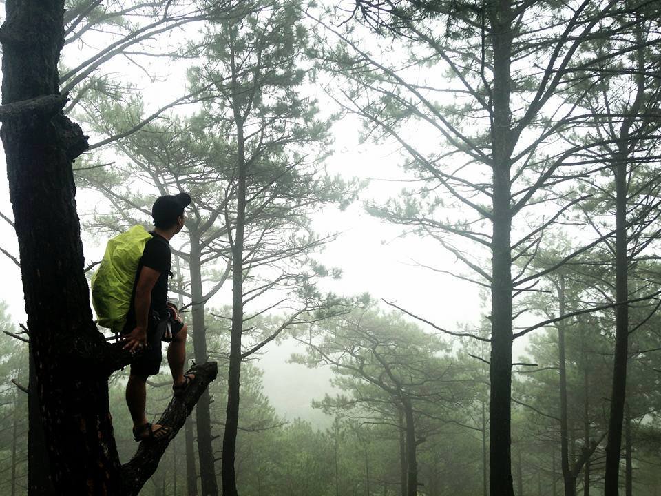
The cold air at 1,846 MASL masks extreme UV radiation, so sunscreen is mandatory even on cloudy days. The descent to Sta. Fe is significantly steeper and more painful than the ascent; bring trekking poles to save your knees. Also, standard running shoes are dangerous on loose pine needles—wear trail runners with deep lugs.
After hiking this mountain multiple times, here are the non-obvious realities that usually catch first-timers off guard.
The False Sense of Cold
The temperature on the ridge can dip to 14°C, especially with the wind chill. Because you don’t feel “hot,” you won’t realize you are roasting. I learned this the hard way when I woke up the next day with a severe sunburn on my neck and nose.
-
The Science: At 1,800 MASL, the atmosphere is thinner, and UV radiation is much stronger than in Manila. Apply SPF 50 liberally.
The “Killer” Descent to Sta. Fe
Most guides focus on the climb, but the descent is the real enemy. The drop from the summit to the Sta. Fe exit involves losing hundreds of meters of elevation rapidly on hard-packed Red Clay.
-
The Pain Point: The braking force required on these steep slopes puts immense pressure on your knees (patellofemoral load).
-
The Fix: Bring a pair of trekking poles. They act as extra legs and take about 20-30% of the weight off your joints.
Shoe Choice: Traction is King
Do not wear your flat-soled gym trainers or lifestyle sneakers (like Stan Smiths/Vans).
-
The Hazard: The pine forest floor is covered in dried pine needles which act like ball bearings. I have watched countless hikers in smooth-soled shoes slip and slide uncontrollably.
-
The Gear: You need trail running shoes with aggressive lugs (at least 4mm – 5mm depth) to bite into the loose soil.
The Toilet Situation
This is a strict “Zero Open Defecation” zone.
-
The Reality: There are zero restrooms from the moment you leave the Ampucao Barangay Hall until you reach the Sta. Fe wash-up area 6 hours later.
-
The Advice: Do your business at the jump-off point, and manage your fluid intake so you don’t find yourself in an emergency on the open ridge.

8. FAQ: Mt. Ulap Hiking
No, you generally do not need a reservation for DIY hikes; walk-ins are accepted daily at Ampucao. The trail is free of leeches (Limatik) due to the dry pine ecosystem. While beginner-friendly (3/9 difficulty), it requires endurance for the 9.4km distance. Mobile signal (Smart/Globe) is available at the peaks, and solo hikers are welcome but must pay the full ₱600 guide fee.
Here are the rapid-fire answers to the most common questions I get in my inbox about the 2026 season.
1. Do I need a reservation for Mt. Ulap in 2026?
Generally, No. Unlike Mt. Pulag, the Ampucao Barangay Hall accepts walk-in hikers every day of the week. You just show up, fill out the form, and get a guide.
The Exception: If you are leading a large event or a group of 15+ people, you should coordinate beforehand via their official email: ampucaoblgu.itogon@gmail.com.
2. Are there leeches (Limatik) in Mt. Ulap?
No. You can leave the alcohol spray at home.
The Science: Limatik thrive in moist, mossy forests like Mt. Makiling or Mt. Halcon. Mt. Ulap is dominated by Benguet Pine (Pinus kesiya) and open grasslands, creating a dry forest floor where leeches cannot survive.
3. Is Mt. Ulap good for beginners?
Yes, but with a catch. It is rated Difficulty 3/9, which technically means “Minor Climb.”
The Pain Point: “Minor” does not mean “Easy.” You will still be walking for 4 to 6 hours over 9.4 kilometers. If you live a sedentary lifestyle, your legs will cramp on the assault to Ambanao Paoay. Do some jogging for two weeks prior.
4. Is there a mobile signal on the trail?
Yes, but it is spotty.
The Coverage: You will have strong 4G/5G signal for both Smart and Globe at high points like Gungal Rock (1,814 MASL) and the Summit (1,846 MASL).
The Dead Spots: Expect zero coverage in the deep valleys and during the descent to Sta. Fe.
5. Can I hike Mt. Ulap alone?
Absolutely. Solo hiking is fully allowed.
The Cost: The main downside is financial. You cannot split the ₱600 Guide Fee, so you must pay it in full yourself.
My Tip: Arrive early at the Jeepney Terminal near Baguio Center Mall and ask other solo hikers or pairs if they want to merge groups to split the bill.

Pingback: The Ultimate Guide To The Top 10 Mountains In The Philippine – BizBackLinks
A highly recommend hike!!