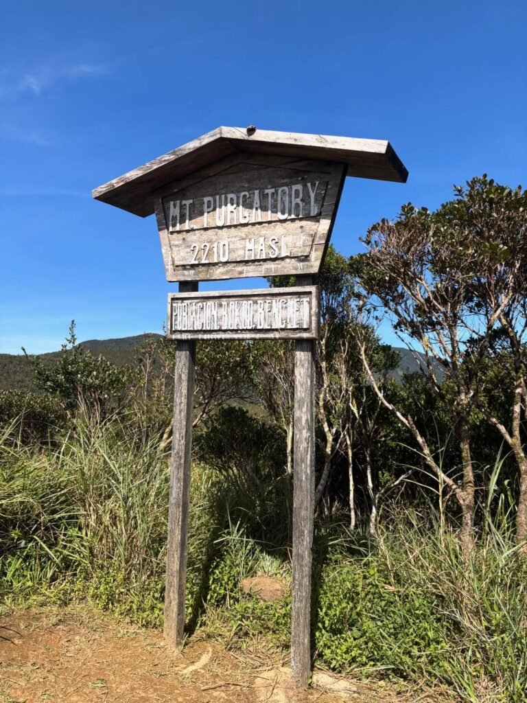
Mt. Purgatory, also known as the Purgatory-Mangisi Traverse, is one of Benguet’s most scenic long hikes—but it’s also one of the easiest to misjudge if you rely only on photos. The mossy forest sections look gentle, but this is a major endurance hike where distance, pacing, and weather matter more than technical trail skills.
I treat Mt. Purgatory as a research-first climb, not a walk-in hike. Route inclusions, fees, and local requirements can change, so anything operational (fees, route coverage, transport timing, required documents) should be VERIFY LOCALLY before your trip.
Planning Accuracy Note (Read Before You Book)
This guide separates:
Stable facts: location, terrain profile, difficulty character, route style
Volatile details: fee matrix, Komkompol inclusion, booking flow, transport timing, cutoff rules
I mark uncertain or fast-changing items as VERIFY LOCALLY so you can plan safely and avoid outdated assumptions.
Quick Stats (Mt. Purgatory / Purgatory-Mangisi Traverse)
Location: Bokod, Benguet, Philippines
Common Name: Mt. Purgatory
Local/official naming often used: Mount Purgatory Mangisi
Trail Type (main guide version): Traverse / point-to-point (Japas → Ekip)
Difficulty: Major hike (commonly around 6/9 local PH hiking scale)
Distance: ~26 km traverse (route-version dependent)
Duration: 10–12+ hours day hike (pace/weather dependent); 2D1N is more realistic for many groups
Technicality: Generally non-technical; endurance-driven
Guide Requirement: Mandatory (based on current research signals)
Walk-in: No / pre-coordination required (VERIFY LOCALLY)
Best Season (practical window): Nov–Apr
Water: Intermittent / campsite-linked (not continuous)
Important Note: Peak count and route inclusions vary (5/6/7-peak versions exist)
Table of Contents


What is Mt. Purgatory Traverse and where is it located?
Mt. Purgatory is a multi-peak hiking route in Bokod, Benguet known for its mossy forest, long traverse profile, and endurance-heavy day. Most hikers call it Mt. Purgatory, but local tourism references may use Mount Purgatory Mangisi, so I recommend using both names when coordinating with local contacts.
The route is commonly associated with:
Bobok-Bisal (Japas) – usual jump-off area
Pito
Ekip – usual exit point
Karao
Poblacion – municipal center / coordination area
It is also widely associated with the Upper Agno River Basin Resource Reserve (DENR context), and local trekking coordination is tied to Bokod Municipal Tourism Office and ABADEG (Association of Bokod Adventure Eco-Guides).
The biggest confusion for first-timers is not location—it’s route version. Different posts and organizers describe different peak counts and inclusions, so route clarity matters before you commit.
How many peaks are included in Mt. Purgatory Traverse?
The short answer: it depends on the current route version being offered. Online write-ups describe Mt. Purgatory as a 5-peak, 6-peak (Hexa), or 7-peak route.
For this guide, I use the Japas → Ekip traverse as the baseline and explain it using a Hexa framing, while noting that actual inclusions may vary by current local setup.
Commonly cited Hexa sequence
Mt. Mangagew
Mt. Pack
Mt. Purgatory (marker/area)
Mt. Bakian
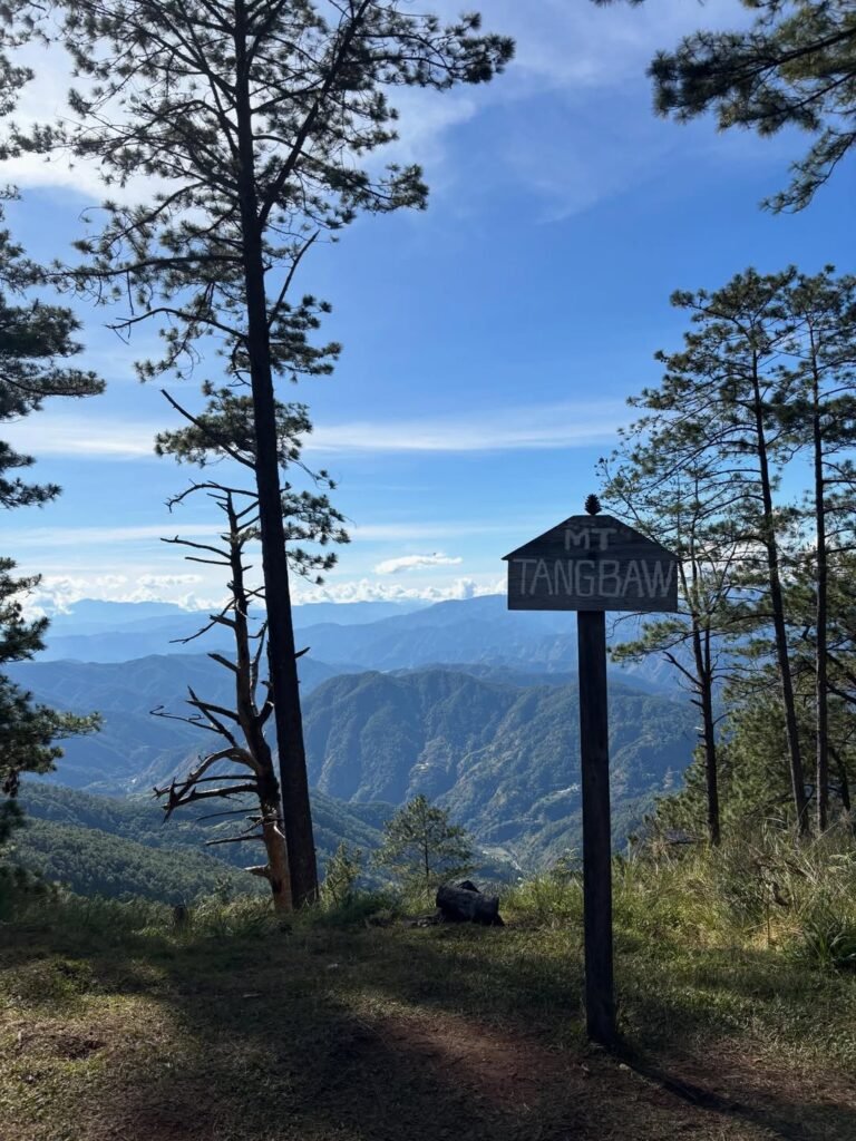
Mt. Tangbao
Mt. Komkompol
exit to Ekip
7-peak versions
Some versions add Mt. Tinengan, which is why you’ll see 6-peak and 7-peak versions online.
Route Clarifier (Important)
Guide baseline in this article: Japas → Ekip traverse, Hexa framing
Peak count online may vary: 5 / 6 / 7
Why it matters: Organizers and guides may offer different route coverage depending on current policy, season, or trip format
High-impact route warning
There are recent signals that Mt. Komkompol may not always be included in some day-hike offerings (and may be more common in overnight routes).
Do not assume Komkompol is included in all day hikes — VERIFY LOCALLY before paying.
If I were booking, I’d ask this directly:
“Ano po exact peak sequence ng route ngayon, and included pa ba si Komkompol sa day hike?”
How hard is Mt. Purgatory and is it beginner-friendly?
Mt. Purgatory is best treated as a major hike and is commonly described around 6/9 in local PH hiking scales. It is usually non-technical, but don’t mistake that for easy. The real challenge is the combination of distance, long moving hours, cumulative fatigue, and changing weather.
Why Mt. Purgatory feels hard
Long route (commonly ~26 km traverse)
Long moving time (10–12+ hours for many day-hike groups)
Sustained early climbs that can drain legs too soon
Weather shifts (heat early, cold/wet later)
Steep descents toward Ekip that punish knees
Endurance management matters more than trail “technicality”
Is it beginner-friendly?
Totally untrained beginners: No
Strong beginners with recent long hikes: Possible, but I’d recommend 2D1N
Intermediate hikers: Better fit
Who this hike suits best
Hikers with endurance from long hikes/major climbs
Joiners who can follow pacing discipline
Groups okay with adjusting plans if weather shifts
Hikers who enjoy long scenic traverses over technical climbing


How long is the hike and how many kilometers is the traverse?
Most references place the Mt. Purgatory traverse at around ~26 km, with many day-hike groups taking 10–12+ hours depending on route version, weather, and pacing. I’d plan conservatively because fog, mud, and group pace differences can stretch the day.
Working route figures (planning baseline)
Traverse distance: ~26 km
Out-and-back via Ekip reference: ~24.1 km
Elevation gain: around ~1,500 m class depending on route/device (VERIFY LOCALLY with current GPX/guide track)
Out-and-back gain reference: ~1,599 m
Time expectations
Day hike (Hexa framing): ~10–12+ hours
2D1N: very realistic and often more enjoyable for most groups
A recent overnight pacing example in your research cited around:
~9 hours to Tangbao bunkers (Day 1)
~2 hours to Ekip (Day 2)
Treat that as a route-planning reference, not a guaranteed pace.
What is the best route for Mt. Purgatory—Japas to Ekip or Ekip to Japas?
For most hikers, the easiest route to plan is the point-to-point traverse from Japas (Bobok-Bisal) to Ekip. It’s the clearest route to explain and usually easier to coordinate with local registration/orientation and exit pickup.
Recommended route for this guide
Japas (Bobok-Bisal) → Ekip traverse
Other route types you may see
Reverse traverse: Ekip → Japas (more challenge-oriented framing)
Out-and-back via Ekip: ~24.1 km reference
“Circuit” in older write-ups (use caution unless someone can clearly explain the current route line / GPX)
Practical advice before booking
Confirm:
exact route version
peak sequence included
day hike vs overnight differences
jump-off and exit logistics
current restrictions/closures
Route naming and inclusions can change by current local setup. VERIFY LOCALLY.
How do you get to the Mt. Purgatory jump-off from Manila?
The most practical access chain is usually Manila → Baguio → Bokod/Japas, then local transfers depending on your registration/orientation setup. Mt. Purgatory is not a simple walk-in climb, so transport planning should be synced with your guide or tourism contact.
Manila to Baguio
Baguio is the usual staging hub. Common bus operators often mentioned include:
Genesis
Solid North
Victory Liner
Schedules can change, so exact departures are VERIFY LOCALLY.
Baguio to Bokod / Japas area
Based on your research:
earliest van may leave around ~7:00 AM from Dangwa Terminal (VERIFY LOCALLY)
travel time around ~2 hours (VERIFY LOCALLY)
Older references also mention negotiated local rides (motorcycle/tricycle), so your final transport chain may vary.
Jeepney timing (limited evidence)
A Dangwa-related snippet suggests rough windows like:
arrival around 7–8 AM
departure around 11 AM–12 PM
Use this as a clue only, not a fixed schedule. VERIFY LOCALLY.
Private car notes
Road conditions are described as mixed:
some cemented sections
some unpaved/dirt sections
Because vehicle suitability isn’t consistently documented in official sources, the safest approach is:
confirm road condition and parking with local contacts
confirm if local transfer is still needed
do not assume sedan access to your exact reporting point without local confirmation
Common planning pain points
Baguio–Bokod transport timing can be limited/variable
schedules may change without notice
no walk-in assumption
orientation + local transfer adds time before actual trekking starts


Can you walk in, or do you need to pre-register?
Mt. Purgatory should be treated as a pre-coordinated hike, not a walk-in climb. Based on your research pack, advance coordination is required, guides are mandatory, and registration/orientation is part of the process before the trek begins.
Current planning rule (high-confidence from your pack)
No advanced coordination = no climbing
No walk-in climbers (VERIFY LOCALLY for exact implementation wording)
Guides are mandatory
Who handles booking/coordination?
The process appears tied to:
ABADEG(official/deputized local guides and porters)
Orientation step
A recent field report mentioned:
registration + orientation at “Bobok Tourism” (~1 hour) — field-report naming, VERIFY LOCALLY
short habal-habal transfer to jump-off afterward
Even if the office name/location varies, the orientation step itself is important enough to include in your planning buffer.
What permits, documents, and guide requirements do you need?
Most groups should prepare IDs, registration requirements, and a confirmed guide arrangement before the climb. A Health Certificate is mentioned in a recent field report, but because it’s not clearly confirmed in all official-style references from your pack, it remains VERIFY LOCALLY.
Documents and requirements (current signals)
Valid ID
Registration form (research notes suggest 2 copies)
Guide arrangement (mandatory)
Health Certificate — VERIFY LOCALLY
Guide and porter requirements
Guides are mandatory
Guide/porter operations are tied to the local system (ABADEG)
Porters are available, but rates and setup vary
Capacity / group-size note
A summarized rules reference in your pack suggests the trail may be designed to handle around ~50 people including guides/porters for longer treks. Treat this as operational guidance, not a guaranteed booking cap. VERIFY LOCALLY.
Payment method (important but unclear)
Payment method standards are not clearly established in your current pack. Assume cash-first, then confirm if digital options (like GCash) are accepted.
What to ask local contacts before paying
What route version is available on my date (5/6/7 peaks)?
Included ba si Komkompol sa day hike?
What is the current fee matrix (all fees)?
What documents are required (Health Certificate needed?)
What is the reporting time, orientation location, and transport setup?
How much does Mt. Purgatory cost in 2026? (Mobile-Friendly Fee Reference)
Mt. Purgatory costs vary depending on route version, group size, day hike vs overnight setup, and whether you hire a porter or arranged transport. Since these fee references come from mixed sources, use this section to estimate your budget, then request the current official fee matrix before paying.
Important Fee Note
These amounts are planning references, not guaranteed current rates. Always VERIFY LOCALLY for your exact date.
1) Legacy Published Fee Table (Use for Fee Categories Only)
These are useful for identifying fee types, but the amounts are likely outdated.
| Fee Item | Amount | Source | Confidence | Notes |
|---|---|---|---|---|
| Registration (Local) | ₱100/head | Legacy published table | Low | Likely outdated |
| Registration (Foreign) | ₱150/head | Legacy published table | Low | Likely outdated |
| Camping Fee | ₱20/head/night | Legacy published table | Low | Likely changed |
| Guide Fee (Legacy) | ₱500/day | Legacy published table | Low | Historical reference only |
| Porter Fee (Legacy) | ₱500/day | Legacy published table | Low | Historical reference only |
Status: All items above are VERIFY LOCALLY.
2) Newer LGU Fee Signals (Stronger but Still Needs Confirmation)
These are stronger than the legacy fees, but still need confirmation for your exact trip date and route setup.
| Fee Item | Amount | Source | Confidence | Notes |
|---|---|---|---|---|
| Guide Fee | ₱1,000/day | 2024 LGU snippet signal | Medium | Confirm current implementation |
| Porter Fee | ₱1,000/day | 2024 LGU snippet signal | Medium | Confirm current implementation |
Status: Both items are VERIFY LOCALLY.
3) Recent Field-Report Costs (Useful for Budgeting, Unofficial)
These are very useful for real-world budgeting, especially for joiners and private groups, but they are still unofficial and route/setup dependent.
| Fee Item | Amount | Source | Confidence | Notes |
|---|---|---|---|---|
| LGU / Local Fees | ₱440/pax | 2025–2026 field report | Medium | Useful baseline |
| Overnight Guide Fee | ₱2,400 (4:1) + ₱600/additional pax | 2025–2026 field report | Medium | Route/setup dependent |
| Porter (Optional) | ₱1,500 | 2025–2026 field report | Medium | Confirm inclusions |
| Bunkers Fee | ₱250/pax | 2025–2026 field report | Medium | Overnight-dependent |
| Habal-habal to Jump-off | ₱100/pax | 2025–2026 field report | Medium | Pickup point dependent |
| Baguio → Bobok Tourism Van Fare | ₱250/pax | 2025–2026 field report | Medium | Timing/setup dependent |
Status: All items above are VERIFY LOCALLY.
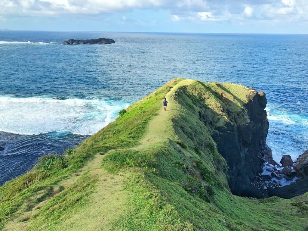
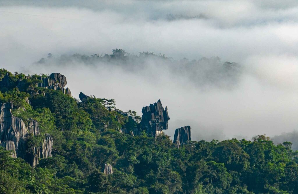
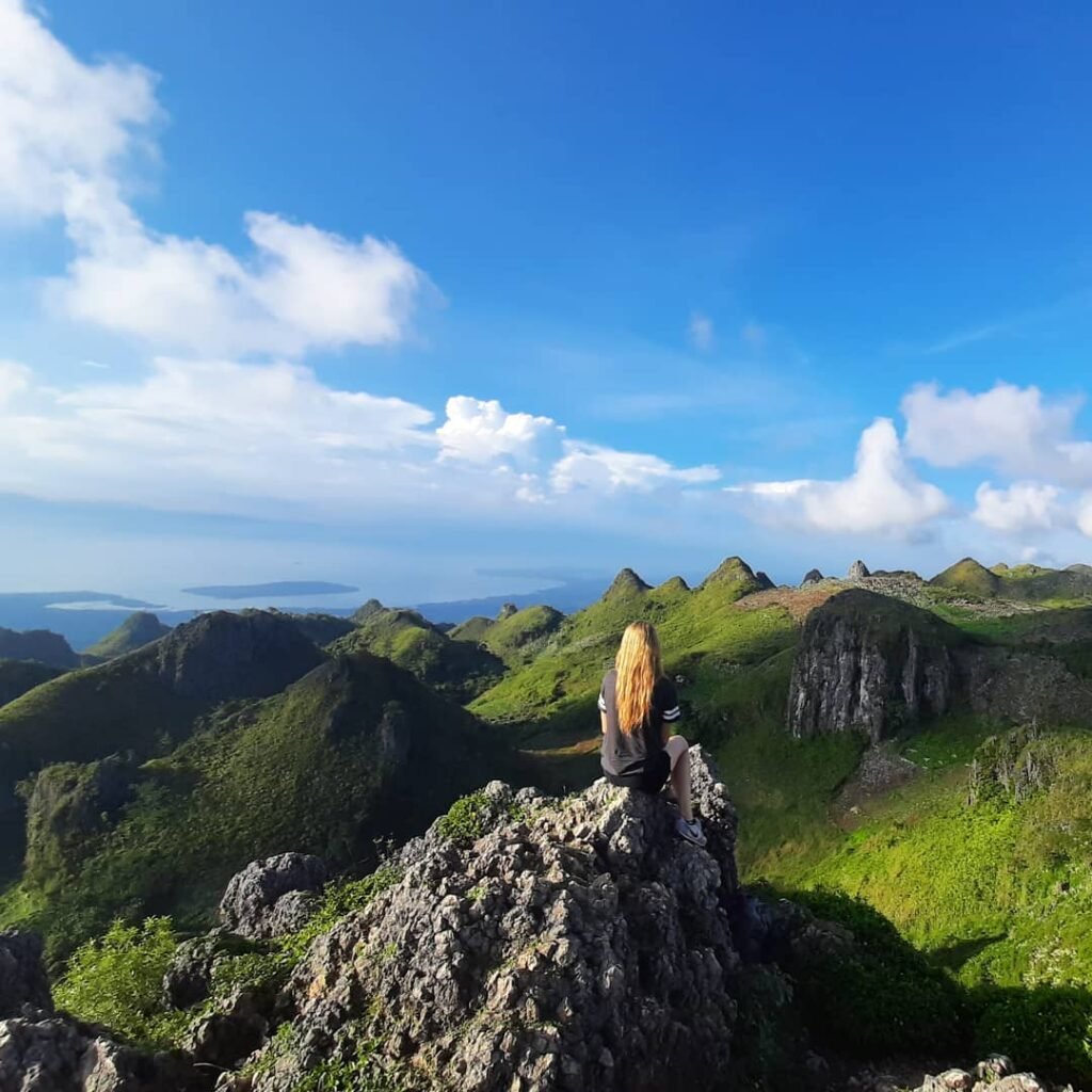
What is the trail profile and what should you expect on the route?
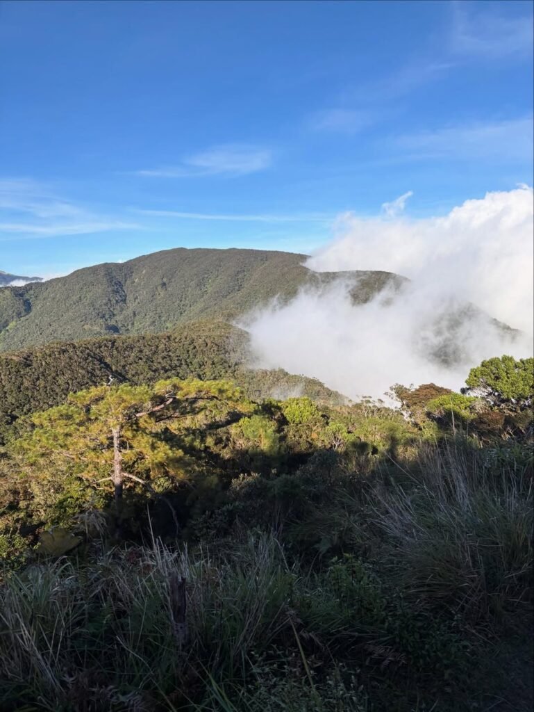
Mt. Purgatory is an endurance route, not a technical climb. You’ll move through changing terrain—pine forest, mossy forest, open sections, and long descents—and the trail feels very different depending on weather.
Overall terrain profile
Pine forest
Early dirt-road approach/assault
Mossy forest (signature section)
Open/grassland ridge and camp zones
Muddy/slippery footing in wet weather
Steep descents toward Ekip
Technicality
It’s generally described as non-technical:
no consistent reports of mandatory rope sections
no commonly cited scrambling requirements
But “non-technical” does not mean easy. Fatigue + wet footing can make simple sections feel harder late in the day.
Practical route feel by segment
Japas / early approach: easy to start too fast; control pacing
Mangagew → Pack: endurance starts to show
Purgatory mossy sections: scenic but fog can reduce visibility
Bakian / Tangbao zone: important for water/camp/weather decisions
Komkompol segment (if included): route-version dependent — VERIFY LOCALLY
Descent to Ekip: knee-heavy and fatigue-sensitive
Navigation reality
I classify Mt. Purgatory as guide-dependent. Your research notes mention forks and reports of getting lost, especially in later sections and near Tangbao. This is not a route I’d self-navigate using old blog descriptions alone.
Where are the water sources and campsites on Mt. Purgatory?
Water exists on the route, but it is not continuous, so I treat Mt. Purgatory as an intermittent-water traverse. Some camps have water and toilets, while others may be waterless.
Water planning rules
Don’t assume stream access anytime
Refill only at guide-confirmed reliable points
Confirm your campsite and water status before departure
Ask about seasonal reliability (VERIFY LOCALLY)
Camps / areas mentioned in your research
Bangtinen Campsite (Pito): water + toilets (reported)
Mt. Tangbao: water + toilets + fire-mound mentions (reported)
Mt. Purgatory camp option: toilets + fire mounds; waterless (reported)
Mt. Pack (emergency option): limited tents, no water (reported)
Mt. Bakian area: water + toilets (reported)
Ekip school grounds: alternate/emergency context; specifics less clear
Camp rules (safe phrasing)
controlled fire use only
use designated fire mounds/rings if allowed
follow guide/site rules
practice Leave No Trace
avoid bonfires unless clearly allowed (VERIFY LOCALLY)
Signal and charging
Mobile signal: variable by segment and network
Charging: unclear in your current pack; assume limited to none on-trail and bring a power bank
What is the best time to hike Mt. Purgatory and what weather risks should you expect?
The most practical hiking window is generally November to April, when mud risk is lower. But Cordillera weather is still unpredictable, so even dry-season climbs can involve fog, wind, cold, and rain.
Best season (practical window)
Nov–Apr
Higher mud-risk months
broadly June–November
dirt roads and mossy sections become much more slippery
Weather factors that change the hike
Heat early in some sections
Cold/wet later in mossy/higher areas
Wind exposure in open ridges/camps
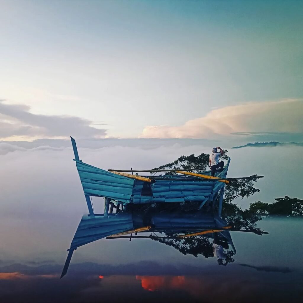
Fog (common and part of the “Purgatory” experience)
Lightning risk on open ridges/high points
Lightning rule (non-negotiable)
If thunder starts, descend from exposed sections immediately and follow your guide’s call.
Closure/rehab notes
Your research mentions possible rainy-season rehabilitation/regeneration closures and typhoon/special holiday closures. Policies may change, so always VERIFY LOCALLY before finalizing travel.

What should you pack for Mt. Purgatory (day hike vs overnight)?
Pack for endurance + weather changes, not just scenery. Mt. Purgatory can start warm and turn cold/wet later, so I prioritize layers, lighting, and water planning.
Day hike essentials
ID / required documents
trail food + electrolytes
enough water capacity (confirm refill points)
headlamp (even for day hike)
rain jacket / waterproof layer
extra shirt + light warm layer
cap / sun protection
gloves (helpful in cold/wet conditions)
trekking poles (very useful on descents)
personal meds / blister care
power bank
dry bag / ziplocks
Overnight add-ons
tent/sleep setup (if not included)
sleeping bag/quilt for cold/windy camp conditions
camp clothes (dry set)
extra socks
hygiene kit / tissue / waste bag
meal setup if self-managed
stove/fuel only if allowed (VERIFY LOCALLY)
larger water capacity depending on campsite water status
Footwear note
Prioritize traction and comfort. Long descents + wet roots/mud expose weak footwear choices fast.
What safety reminders and turnaround rules should hikers follow?
Mt. Purgatory safety is mostly about decision-making: pacing, weather timing, and respecting guide calls. Because the route is long and conditions can shift fast, turnaround discipline matters more than forcing a full peak list.
Core safety reminders
Start early and pace conservatively
Don’t race the early segments
Follow guide instructions strictly
Respect turnaround calls even if a peak is “near”
Stay grouped in fog/forked sections
Move efficiently during breaks
Main risks to manage
slips (mud, roots, moss/lichen)
exhaustion and bonking
navigation confusion in fog
hypothermia risk (wet + wind + cold)
lightning on exposed sections
poor late-day decisions due to fatigue
Turnaround logic (practical)
No clearly confirmed official cutoff is in your current pack, so the safest approach is a guide-led turnaround system based on:
slow pacing
deteriorating weather
reaching key sections too late
hiker condition
Your research also mentions guide practice around avoiding certain later sections after dark—another reason to respect turnaround calls.
What is a realistic Mt. Purgatory itinerary (day hike vs 2D1N)?
Mt. Purgatory can be done as a day hike, but 2D1N is often the safer and more realistic setup for many groups, especially first-timers. I prefer itineraries that protect pacing and weather flexibility.
Choose a day hike if:
your group is strong and experienced
everyone has major-hike endurance
weather is favorable
route coverage is clearly confirmed
your team can maintain disciplined pacing
Choose 2D1N if:
it’s your first Mt. Purgatory attempt
your group has mixed fitness levels
you want weather flexibility
you want safer pacing and a better overall experience
Important: Day hike vs overnight route coverage may differ (including Komkompol inclusion). VERIFY LOCALLY.
Sample Day Hike Itinerary (planning template only)
03:00–05:00 – Travel / assembly / final coordination
05:00–06:00 – Registration + orientation (varies)
06:00–07:00 – Transfer to jump-off + prep
07:00 – Start trek
Morning–afternoon – Multi-peak traverse with pacing and weather checks
Late afternoon–evening – Exit to Ekip (timing varies widely)
Sample 2D1N Itinerary (recommended for many groups)
Day 1: Travel / registration / orientation → transfer to jump-off → trek → camp at designated area (often Tangbao or another approved campsite) → water refill if available
Day 2: Early camp break → continue remaining route → exit via Ekip → pickup/return transport
Why 2D1N works better for many hikers
less pressure to rush
better weather flexibility
safer pacing for mixed groups
lower risk of a late, exhausted descent

What is a sample Mt. Purgatory budget for solo, joiner, and group hikers?
Mt. Purgatory budgets vary mainly because guide and transport costs are shared differently depending on group size and setup. The safest method is to separate fixed/local charges from shared costs, then add a contingency buffer.
Budgeting method I use
LGU/local/registration fees
Guide fee share
Porter fee share (optional)
Camp/bunkers fees (overnight)
Local transfers
Long-haul transport (Manila/Baguio)
Food + personal expenses
Contingency (10–20%)
Manual budget formula (per pax)
Estimated Per-Pax Total = (local fees + guide share + porter share + camp fees + local transfers + long-haul transport + food/personal) + contingency
Sample planning scenarios (VERIFY LOCALLY)
Joiner (overnight, shared setup)
LGU/local fees: ₱440
guide share: depends on group size
bunkers fee: ~₱250
habal-habal: ~₱100
Baguio → local transport: ~₱250
food/personal: variable
Small private group (4 pax overnight; field-report style)
Guide fee: ₱2,400 (4:1) + ₱600/additional pax if applicable
Porter (optional): ₱1,500
LGU/local fees: ₱440/pax
bunkers fee: ₱250/pax
habal-habal: ₱100/pax
Baguio → Bobok Tourism van: ₱250/pax
food + gear + contingency: extra
Solo traveler
Mt. Purgatory is not ideal as a “true solo” setup because local coordination and guide requirements still apply. If you’re traveling alone, the practical options are:
join an organized climb, or
join/form a shared-cost private group
Contingency buffer (don’t skip)
Add 10–20% for transport changes, added local transfer, weather delays, or route/fee changes.
Who is Mt. Purgatory best for and who should skip it for now?
Mt. Purgatory is best for hikers with an endurance base who want a scenic Cordillera traverse with mossy forest sections and multi-peak progression. It’s less suitable for totally untrained beginners or groups that underestimate weather and trail time.
Best for
Intermediate hikers
Fit joiners with prior long hikes
Groups choosing 2D1N
Hikers who enjoy endurance routes over technical climbing
Possible with prep
Strong beginners with training and recent long hikes
Groups with disciplined pacing and weather-ready gear
Hikers willing to adjust expectations/turn around if needed
Better to skip for now if
this is your first serious hike and you haven’t trained
your group expects a chill day hike
you lack rain/cold gear
you won’t follow strict guide calls
What should you verify locally before your Mt. Purgatory trip?
Before locking transport, budget, and itinerary, verify current route coverage and local requirements directly with Bokod tourism and/or accredited guides. This is the most important step in planning Mt. Purgatory well.
Final pre-trip verification checklist
Route version (5/6/7 peaks)
Day hike vs overnight route coverage
Komkompol inclusion
Current fee matrix (registration/LGU/guide/porter/camp)
Required documents (especially Health Certificate — VERIFY LOCALLY)
Booking lead time / pre-registration process
Orientation location and reporting time
Payment methods
Baguio → Bokod transport timing / pickup setup
Private car parking + road suitability
Cutoff/turnaround rules
Closure/weather advisories
If I only had time to verify three things, I’d prioritize:
route inclusions
fee matrix
booking process/contact flow
FAQs about Mt. Purgatory Traverse (Bokod, Benguet)
Is Mt. Purgatory a major hike?
Yes. It is commonly treated as a major hike and often rated around 6/9 in local PH hiking scales.
Is Mt. Purgatory beginner-friendly?
Not for totally untrained beginners. Strong beginners may do it with preparation, but 2D1N is usually the better option.
How many hours is Mt. Purgatory Traverse?
Many day-hike groups take around 10–12+ hours, depending on route version, weather, and pacing.
How many kilometers is Mt. Purgatory?
The commonly cited traverse distance is around ~26 km, with some out-and-back references around ~24.1 km.
Can I hike Mt. Purgatory without a guide?
Based on your research, no. Guides are treated as mandatory and local coordination is part of the process.
Is there water on the trail?
Yes, but it is intermittent, not continuous. Plan refills around confirmed water points and campsites.
Is camping required?
Not always. Day hikes are possible, but 2D1N is often more realistic for many groups.
What month is best for Mt. Purgatory?
Generally November to April for lower mud risk, though weather can still change quickly.
Is Komkompol included in the day hike?
It may vary by current local route offering. VERIFY LOCALLY before finalizing plans.
Can I do it DIY from Manila?
You can plan your own Manila transport, but it is not a simple walk-in DIY hike. You still need advance coordination, guide arrangement, and local logistics planning.
Final Notes Before You Go
Mt. Purgatory rewards preparation more than speed. Clear route expectations, conservative pacing, weather readiness, and honest fitness assessment will make your experience much better than trying to force a peak list or copy a fast itinerary. Verify the current local rules before departure, and you’ll enjoy the mossy forest and long traverse for what they are: challenging, beautiful, and worth planning right.
Related Hiking Guides and Benguet Trips
If you’re planning Mt. Purgatory, these guides can help you compare difficulty, build your hiking progression, or add a Benguet side trip.
More Benguet Hiking Guides
Mt. Kotkot Hiking Guide (Benguet / Itogon Traverse) – A good comparison if you’re exploring more Benguet trails and want another mountain route with different terrain and pacing demands.
Bakun Trio Hike Guide (Itinerary, Expenses, Difficulty Level) – Helpful if you’re planning a bigger Cordillera hiking trip and want to compare multi-day effort, budgeting, and route planning.
Benguet Side Trip / Recovery Option
Guide to Lake Tabeo in Kabayan, Benguet (2025) – Great as a calmer Benguet side trip idea before or after a demanding hike like Mt. Purgatory.
Difficulty & Progression Guides
Major Climb Mountains in the Philippines (Difficulty 5–8) – Use this to compare Mt. Purgatory with other major hikes and choose your next climb based on difficulty and endurance demands.
Beginner-Friendly Hikes / Minor Climb Mountains – If you’re building hiking fitness first (or recommending options to friends), this is a useful progression list before tackling longer major hikes.