Masungi Georeserve is a protected karst landscape in Baras, Rizal, offering guided trail experiences through dramatic limestone formations, rope bridges, and old-growth forest. Reservations are mandatory, and the experience is unlike any standard hike in the region. If you are leaving Manila for a single-day outdoor adventure that combines light physical challenge with genuine conservation value, this is it.
Masungi Georeserve Quick Guide
| Detail | Info |
|---|---|
| Mountain/Site | Masungi Georeserve |
| Location | Baras, Rizal Province |
| Province | Rizal |
| Elevation | Approximately 400–600 m above sea level |
| Difficulty | Easy to Moderate |
| Jump-off Point | KM 47, Marcos Highway, Baras, Rizal |
| Best Season | November to May (dry season) |
| Trek Time | 3–5 hours depending on trail chosen |
| Registration | Online reservation required via Masungi Georeserve website |
| Campsite | No overnight camping for standard visitors |
Table of Contents
Where Is Masungi Georeserve Located?
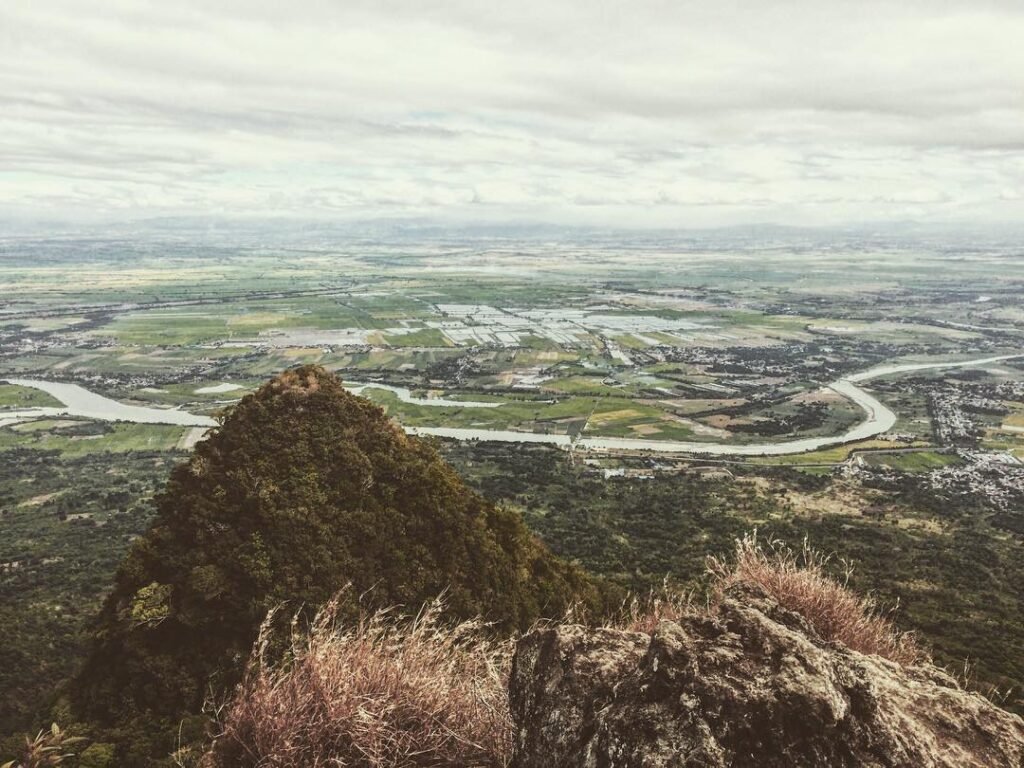
Masungi Georeserve sits in Baras, Rizal Province, on the western slopes of the Sierra Madre mountain range. It falls within a protected watershed that supplies water to Metro Manila and several Rizal towns. The reserve is roughly 60 kilometers east of Manila, accessible via Marcos Highway (also called the Marikina–Infanta Highway).
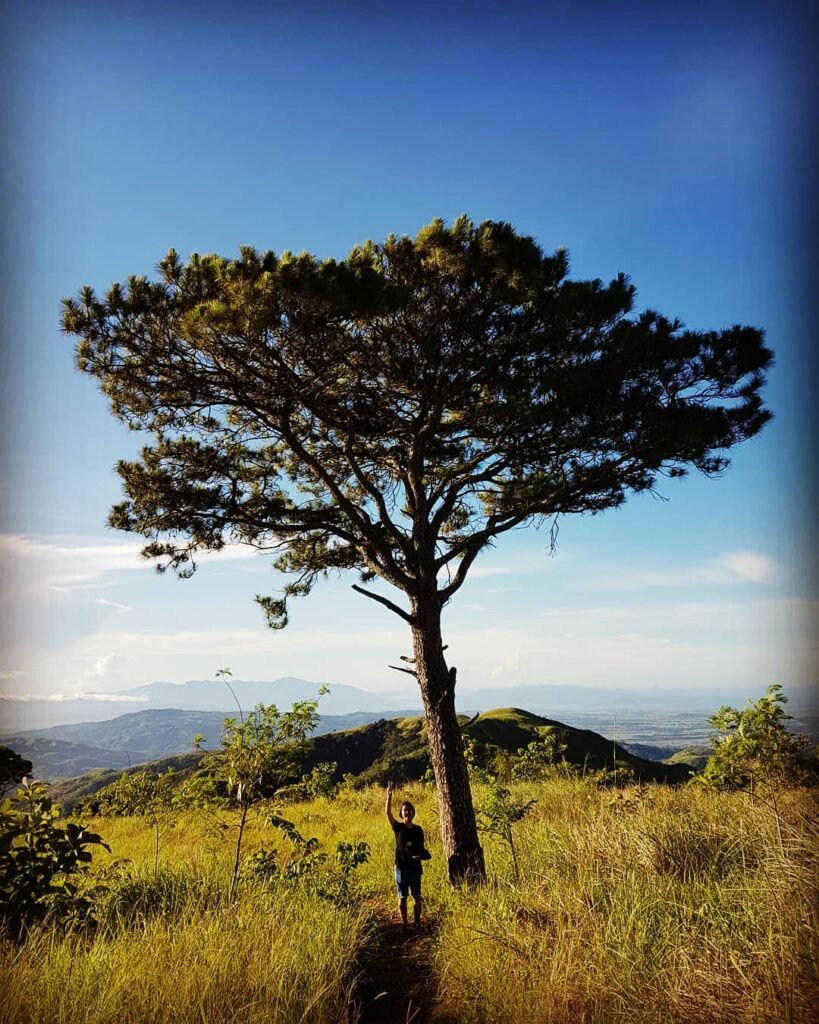
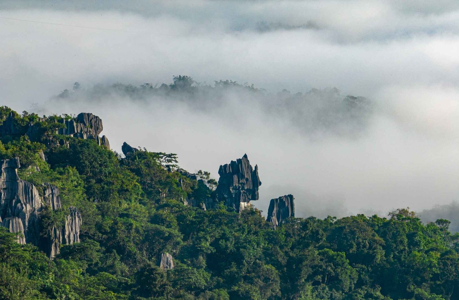
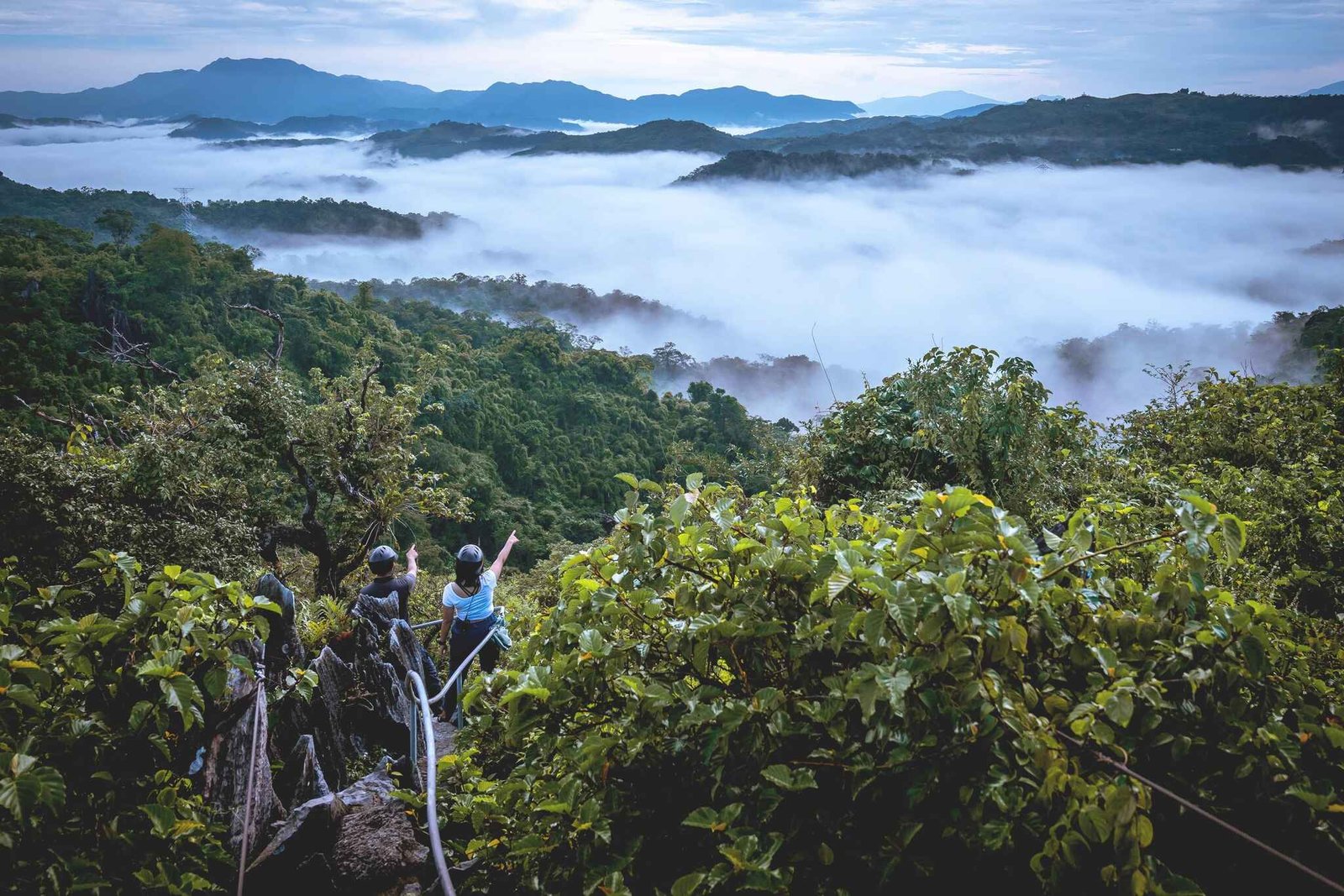
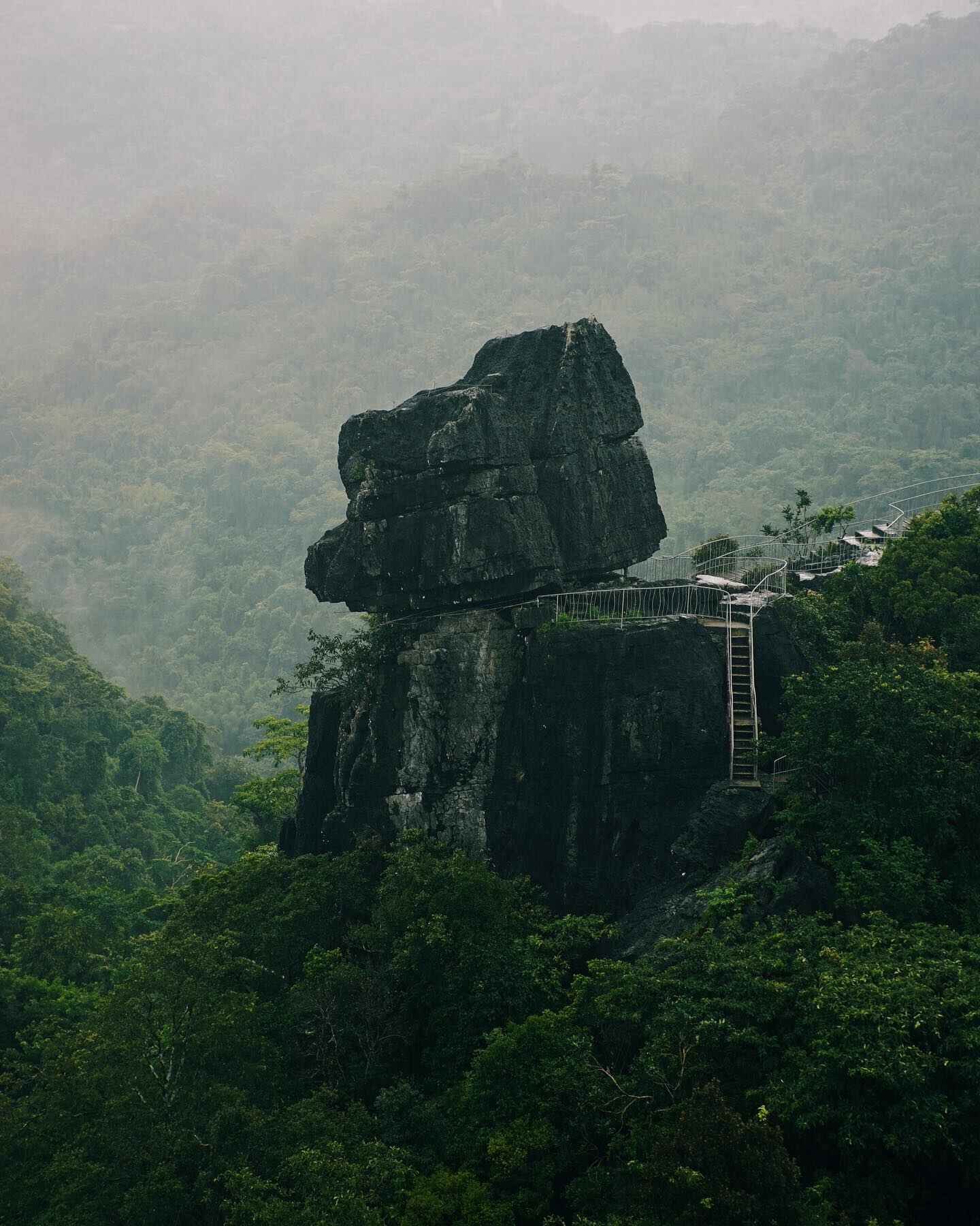
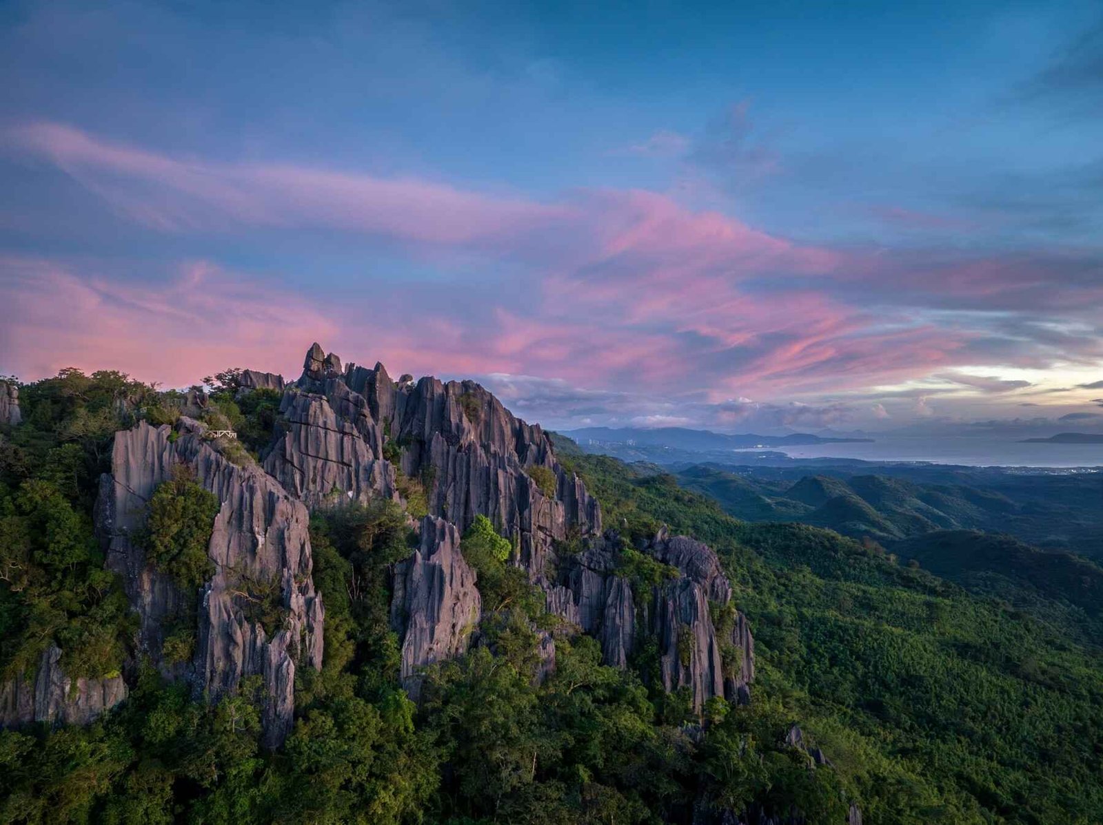
The karst terrain here is the real story. Limestone rock formations jut out of dense tropical forest at unexpected angles — some formations are taller than three-story buildings. The reserve itself covers hundreds of hectares of recovering forest, much of it reforested by the stewards of the Masungi Georeserve Foundation since the 1990s. This is not a mountain summit hike. It is a curated, guided experience through a living conservation area.
How to Get to the Masungi Georeserve Jump-off Point
The jump-off point is at KM 47 on Marcos Highway in Baras, Rizal — a well-known landmark among Rizal day-trippers. Most visitors from Metro Manila follow the same route: Marikina → Antipolo → Tanay → Baras, staying on the highway the entire way.
By private car or motorcycle, the drive from Manila takes roughly 1.5 to 2 hours depending on traffic. Parking is available on-site. Leave early — by 5:30 to 6:00 AM — to beat Marcos Highway traffic, especially on weekends. Late arrivals risk missing their assigned trail slot.
By public transport, take a jeepney or UV Express from Cubao, Quezon City, bound for Tanay or Infanta. Tell the driver you are going to the Masungi Georeserve stop at KM 47. Tricycles from nearby towns can also bring you the last stretch if needed. Always confirm current jeepney terminal locations before travel, as routes change.
If you are already exploring the area, Masungi pairs well with other Rizal destinations. You can check out this guide to Pililla Wind Farm if you want to extend your Baras-Tanay day trip, or browse 14 top Tanay tourist spots for more options nearby.
Permits, Fees, and Guide Requirements at Masungi Georeserve
A confirmed reservation is mandatory. There are no walk-ins at Masungi Georeserve. The reserve operates on a strict pre-booking system to control visitor numbers and protect the ecosystem. Attempting to show up without a booking will result in being turned away at the gate.
Reservations are made through the official Masungi Georeserve website. The booking system — sometimes referred to as the Sapot web platform — requires you to select a date, trail, and time slot before paying. The Masungi Georeserve Sapot web platform experience is straightforward: choose your trail, complete payment, and receive a confirmation. Keep that confirmation on your phone or printed — the staff check it at the entrance.
Trail fees cover guide services, which are included in the package. You will not explore the trail alone. Every group moves with an assigned ranger-guide who manages pacing, ensures safety, and gives context about the forest and formations. There are no separate guide fees on top of the trail fee.
Beyond the trail fee, bring extra cash for food and drinks if the in-house refreshment options are open on your visit date. Photography inside the reserve is allowed for personal use with standard camera equipment. Commercial or drone photography requires separate permits. There are no locker fees for small personal bags, but leave bulky luggage in your vehicle.
Masungi Georeserve official website for current fees and reservations
What Is the Masungi Georeserve Trail Like?
The Two Trails: Discovery Trail vs. Legacy Trail
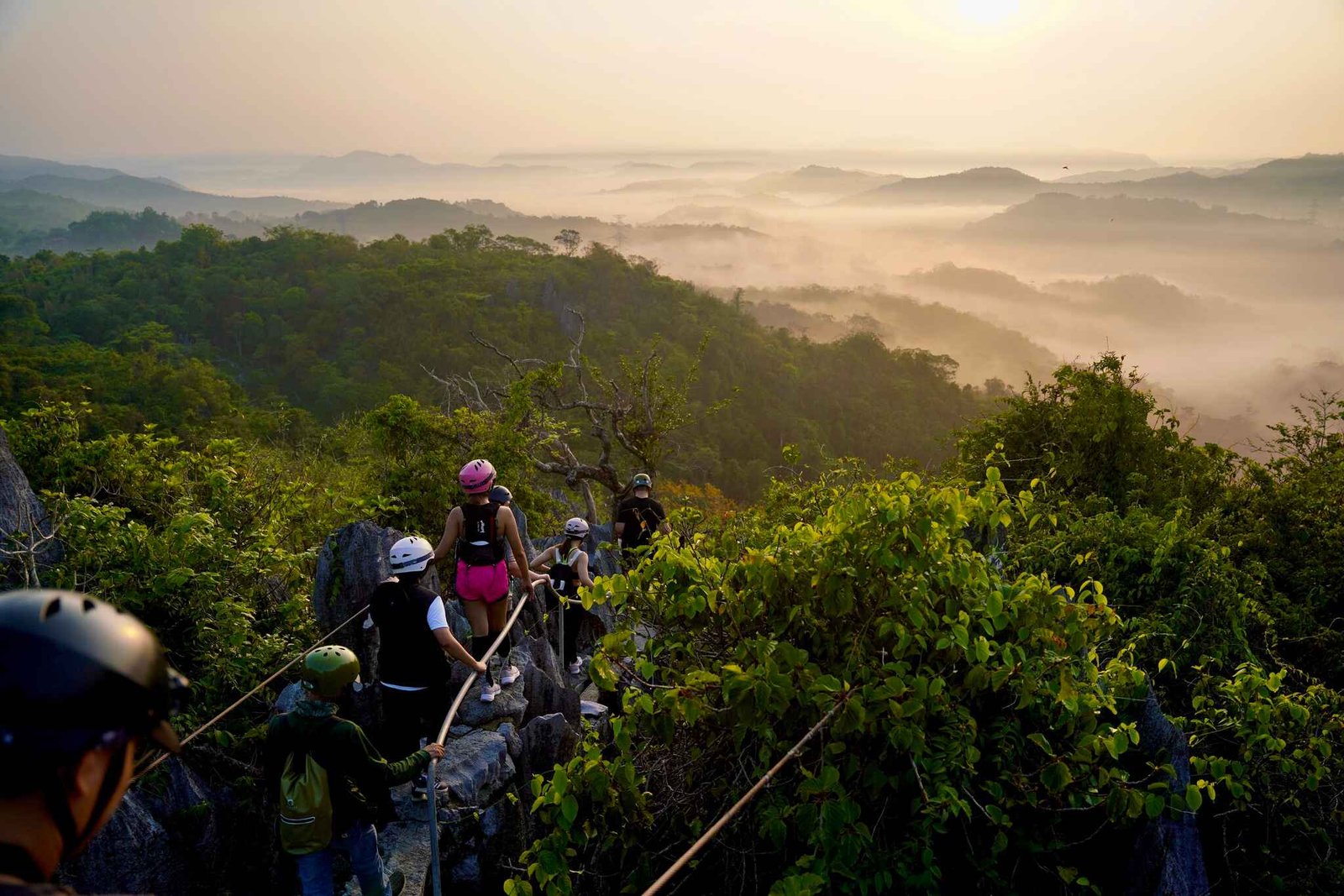
Masungi Georeserve offers two main trail options, and choosing between them matters. The Discovery Trail (also called the Bakas Trail) is shorter and designed for beginners or those with limited time. The Legacy Trail is longer, more demanding, and passes through more diverse terrain, including older-growth forest sections and more dramatic rock formations.
When comparing the Masungi Georeserve Discovery Trail vs Legacy Trail, the Discovery Trail is the better starting point for first-timers. It introduces you to the karst landscape without overwhelming you physically. The Legacy Trail builds on that and adds elevation gain, more rope-assisted sections, and longer stretches between rest stops.
Stage-by-Stage Trail Difficulty
Here is how the trail breaks down, with difficulty scores from 1 (easy) to 5 (hardest):
- Registration to Forest Entrance — Difficulty: 1/5. Flat, well-maintained path; minimal exertion, good for warming up.
- First Limestone Section — Difficulty: 2/5. Gentle scrambling over low karst outcrops; footing is grippy but watch your step on wet rock.
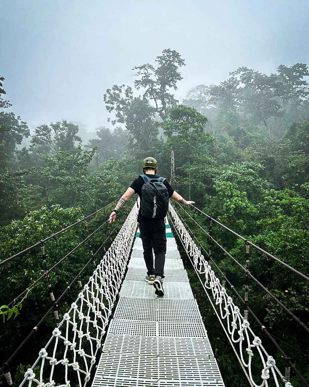
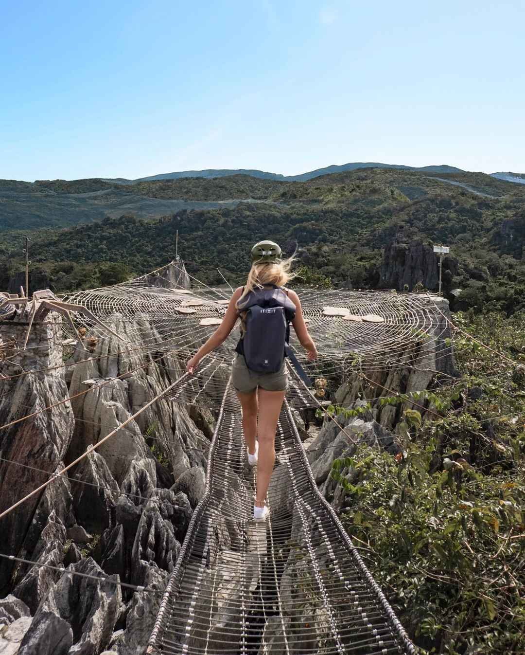
- Rope Bridge Crossings — Difficulty: 2/5. Narrow suspension bridges require balance and slow movement; not technically hard, just mentally engaging.
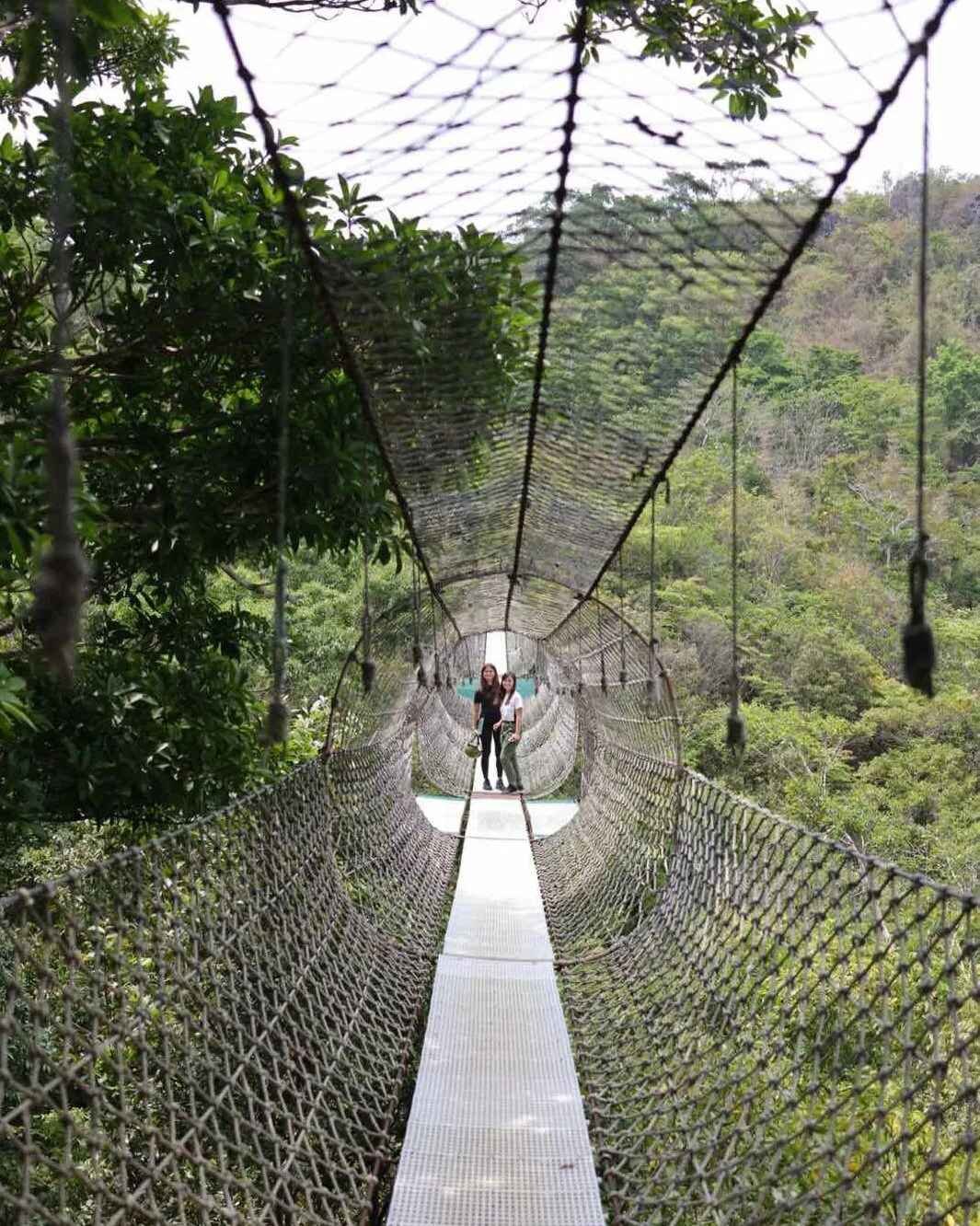
- The Sapot Web — Difficulty: 3/5. A large hammock-style rope net stretched between tree trunks above the forest floor; you crawl across it horizontally, which tests both confidence and core stability. This was the single most memorable moment of my June 2026 visit — sunny skies above and the forest below through the net gaps.
- Upper Karst Section (Legacy Trail) — Difficulty: 3/5. Steeper paths, longer between breaks; this is where fitness matters more.
- Descent — Difficulty: 2/5. Well-managed with ropes and steps; knees feel it on the way down.
What the Trail Actually Looks Like
The forest here is not just a backdrop. In June, the rainy season had barely started, and the canopy was thick and loud with birds. The limestone formations have names, and your guide will explain each one. Some are recognizable shapes — arched cavities, vertical spires, flat platforms used as rest points.
The trail surface alternates between packed earth, exposed root networks, and bare limestone. All three demand different foot placement. You will not find long stretches of flat, easy walking. Every section asks for some degree of attention.
What Other Guides Get Wrong About Masungi Georeserve
Most guides describe it as a “hike.” It is not, in the traditional sense. You are not summiting a peak. You are walking through a managed conservation area on a defined circuit with a guide and other visitors. Treating it like a free-roam trail hike will set your expectations wrong.
Most guides skip the difficulty variation within the trail. The rope and net sections are genuinely challenging for visitors who have never done anything similar — not because of strength, but because of the unfamiliar body mechanics. First-timers, budget extra mental energy for those sections.
Most guides ignore the seasonal mud factor. In the wet season (June to October), the exposed limestone and root sections become noticeably slippery. The trail is still open, but grip on your shoes matters twice as much. Guides in June moved our group slower in spots where the rock had a thin film of moisture from the previous day’s rain, even though our visit itself was sunny.
Is Masungi Georeserve Good for Beginners?
Yes — the Discovery Trail is well-suited for beginners with a basic level of fitness. The trail is guided, the hazards are managed, and the pace is set by the ranger. You do not need prior hiking experience to complete it.
That said, a few considerations matter. Anyone with a fear of heights should know that the rope bridges and Sapot Web sections involve exposure — not dangerous, but not ignorable either. Visitors with knee or joint issues will find the descent manageable but should bring knee support. For older or mobility-limited visitors, the Discovery Trail is more accessible than the Legacy Trail, though no part of the reserve is wheelchair-accessible due to the natural terrain.
Children are generally allowed with accompanying adults, but the Sapot Web section has a minimum age restriction — confirm the current requirement when booking. This is a good destination for beginner hikers looking for a first trail experience that offers more than just a dirt path.
Best Time to Climb Masungi Georeserve
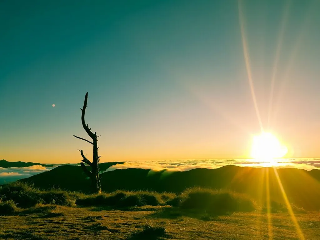
The dry season — November through May — gives the best trail conditions. Rock is drier, footing is safer, and clear-weather views from the upper sections are longer. December through February brings the coolest temperatures, which makes the physical sections easier to handle.
The wet season (June to October) does not close the reserve, but trail conditions change. Slippery limestone, higher humidity, and afternoon thunderstorms are real factors. My June 2026 visit landed on a clear, sunny day — lucky, because the week before had heavy rain and the guides mentioned slower group pacing as a result.
For those interested in the sea of clouds in nearby Tanay, combining that pre-dawn experience with a mid-morning Masungi slot is possible if you book both in advance.
Avoid peak holiday weekends (Holy Week, long weekends in June and August, Christmas week) if you dislike crowds. Slots fill weeks in advance during those periods.
Budget Breakdown for Climbing Masungi Georeserve
| Expense | Cost (PHP) |
|---|---|
| Trail fee (Discovery Trail, per person) | Confirm on official site |
| Trail fee (Legacy Trail, per person) | Confirm on official site |
| Transport from Manila (jeepney + tricycle) | ₱100–₱200 one way |
| Transport from Manila (private car fuel estimate) | ₱500–₱800 round trip |
| Food and water (bring your own recommended) | ₱200–₱400 |
| Photography permit (commercial/drone) | Inquire at booking |
| Estimated total (public transport) | ₱1,000–₱1,500 |
| Estimated total (private vehicle) | ₱1,500–₱2,500 |
What to Pack for Masungi Georeserve
| Item | Essential? |
|---|---|
| Closed-toe shoes with grip (trail runners or hiking shoes) | Yes |
| Light moisture-wicking shirt | Yes |
| Quick-dry shorts or pants | Yes |
| Rain jacket or poncho | Yes (wet season), Recommended (dry season) |
| At least 1.5 liters of water | Yes |
| Sunscreen | Yes |
| Insect repellent | Yes |
| Snacks or packed meal | Yes |
| Small backpack (max 10L) | Yes |
| Gloves (for rope sections) | Recommended |
| Trekking poles | Not needed, may hinder rope sections |
| Camera or phone | Yes |
| Printed or digital reservation confirmation | Yes |
On footwear: This is the one item worth spending on. The combination of wet limestone, exposed roots, and rope sections punishes bad shoes immediately. Flat-soled sandals or fashion sneakers will cause slipping. Trail runners with rubber lugs are ideal. I wore standard hiking shoes with a solid rubber outsole and had no traction issues even on the slightly wet June rock.
On clothing: Light and breathable wins. Long sleeves help with sun on open sections and with minor scrapes on the rock sections. Avoid anything you would hate getting muddy.
Safety Tips for Climbing Masungi Georeserve
Follow your guide at all times. The ranger-guides are not just escorts — they actively manage group safety on the rope bridges, the Sapot Web, and the steep sections. When a guide says stop, stop.
- Do not rush the rope and net sections. Confidence is more important than speed. One slow, deliberate move beats two fast ones on the Sapot Web.
- Tell your guide about any health conditions before you start. Heart conditions, vertigo, joint problems — all relevant. The guide adjusts pacing and can offer alternatives where possible.
- Stay hydrated before you feel thirsty. Humidity inside the forest is high even on sunny days. Drink steadily, not all at once.
- Do not stray from the marked trail. Unmarked sections of the reserve are unmanaged and unsafe.
- Check weather the morning of your visit. If a typhoon signal is in effect for Rizal Province, the reserve will close. The booking team sends cancellation notices, but always check independently.
PAGASA weather forecast for Rizal Province
Wildlife and Endemic Species: What to Watch For on the Trail
Masungi’s recovering forest is more biodiverse than most visitors expect. Most people are focused on the rock formations and miss the wildlife signs around them. Bring binoculars if you have them.
Birds are the most visible fauna. Philippine bulbuls, sunbirds, and kingfisher species move through the canopy, especially in the early morning. The first hour after gate opening is the best window for birdwatching before trail noise builds. Colasisi (Philippine hanging parrots) are sometimes spotted in fruiting trees along the upper Legacy Trail section.
Reptiles are common but shy. Monitor lizards have been spotted near the creek crossings. Small skinks move across exposed limestone surfaces. Do not approach or handle any wildlife.
Fireflies appear along the forest’s edge sections during the early wet season evenings, particularly in May and June. The reserve’s DENR official website on watershed protection has documented the site’s ecological recovery, which includes returning firefly populations. If you want a dedicated firefly experience, ask the Masungi team about any guided evening programs — availability is limited and must be arranged during the booking process.
If you enjoy wildlife-rich trails in Rizal, the Mt. Tagapo hike on Talim Islandis another option worth exploring, and Nagpatong Rock Formation in Tanay offers a similar mix of geology and forest terrain nearby.
Frequently Asked Questions About Masungi Georeserve
Is Masungi Georeserve suitable for beginners or people with no hiking experience?
Yes. The Discovery Trail is designed for people without prior hiking experience. The trail is guided, the pace is managed by the ranger, and the physical demands are moderate. The rope sections are the most unfamiliar element, but guides assist. If you can walk at a steady pace for three to four hours, you can complete the Discovery Trail.
How far in advance do you need to book a reservation at Masungi Georeserve?
Book as early as possible — ideally two to four weeks in advance for weekend slots. During peak periods like Holy Week or long weekends, slots fill more than a month ahead. Weekday slots have more availability, but the reserve is popular year-round. Do not leave booking to the last week and expect your preferred date.
Are walk-ins allowed at Masungi Georeserve?
No. Walk-ins are strictly not allowed. You must have a confirmed, paid reservation before you arrive. Visitors without a booking are turned away at the gate regardless of circumstances. There is no standby list or day-of ticket purchase.
What is the minimum group size required to visit Masungi Georeserve?
The reserve typically requires a minimum group size for trail reservations. Solo visitors and small groups may need to join scheduled group slots. Check the current minimum on the official booking page when making your reservation, as the policy is subject to change.
Are children allowed on the trails at Masungi Georeserve?
Children are allowed with adult supervision, but age and size restrictions apply to specific sections — particularly the Sapot Web rope net. Confirm the minimum age requirement for your child at the time of booking. The reserve staff are clear about which sections younger children can join and which they may need to skip or wait through.
Final Verdict: Should You Climb Masungi Georeserve?
Masungi Georeserve earns 5 out of 5 for day-trippers from Manila who want a structured, guided outdoor experience that goes beyond a standard trail. The combination of karst geology, genuine forest, engineered rope structures like the Sapot Web, and a conservation-focused operation makes this unlike anything else in Rizal Province. Book ahead, bring the right shoes, and go early — this one delivers on every count.