

Is Mt. Isarog Worth Visiting?
Yes, Mt. Isarog is worth visiting, but you need to choose the right kind of trip. The summit hike is a serious 5/9 major climb best for prepared hikers, while Malabsay Falls is the easier nature escape for families, casual travelers, and waterfall lovers visiting Naga City.
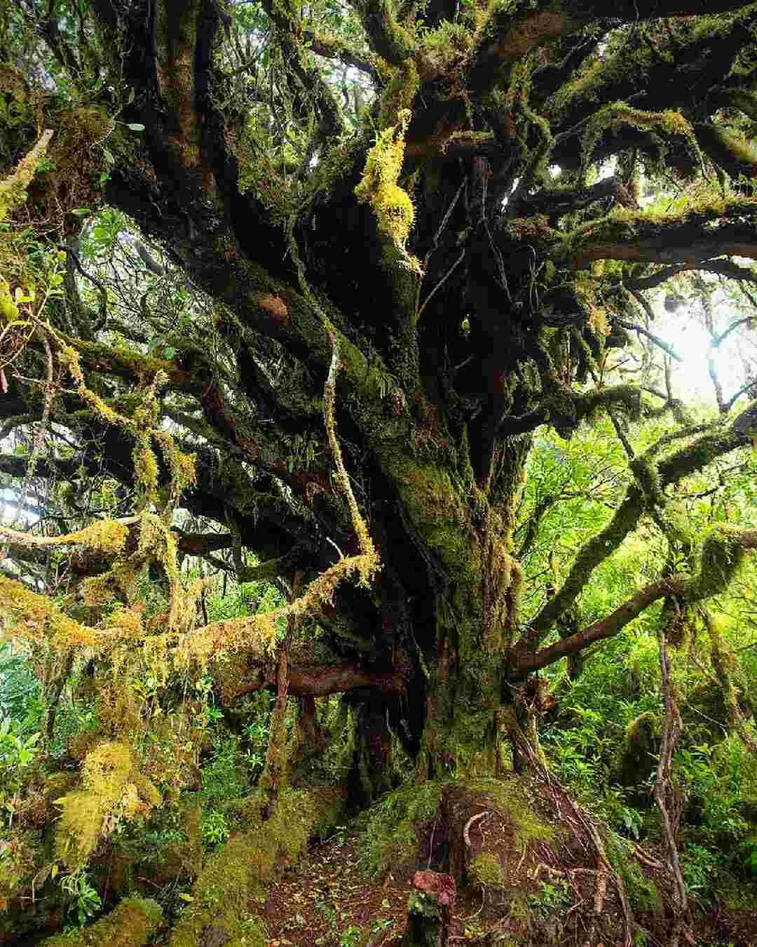
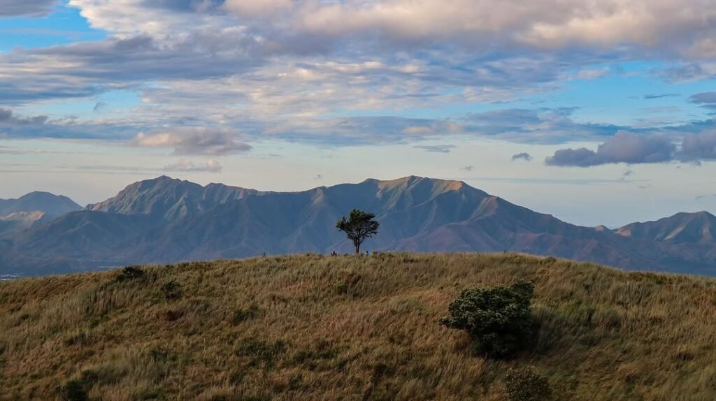
When I visited Mt. Isarog in April 2026, the biggest thing I learned was that this mountain should not be described as just one destination. It has two very different experiences. One is the 2D1N Mt. Isarog summit hike via Panicuason Trail, with mud, limatik, mossy forest, steep sections, Camp 4, and a summit push toward Patag-Patag Peak or the crater rim. The other is the more accessible Malabsay Falls / Panicuason nature trip, which lets you experience Mt. Isarog Natural Park without committing to the summit.
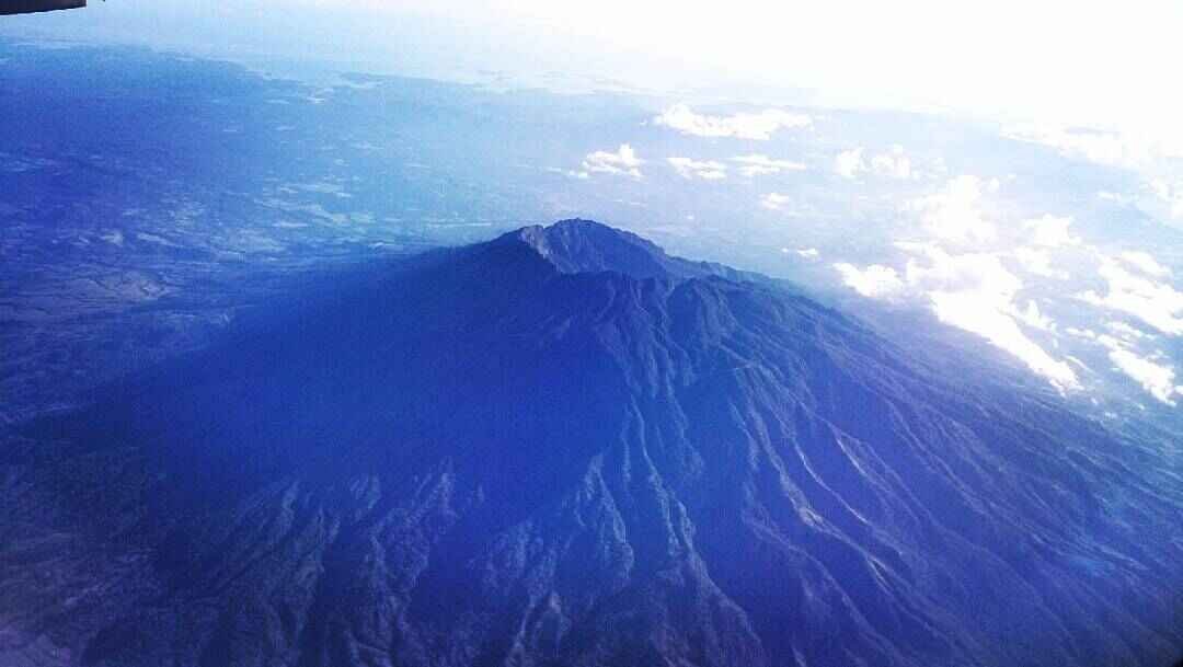
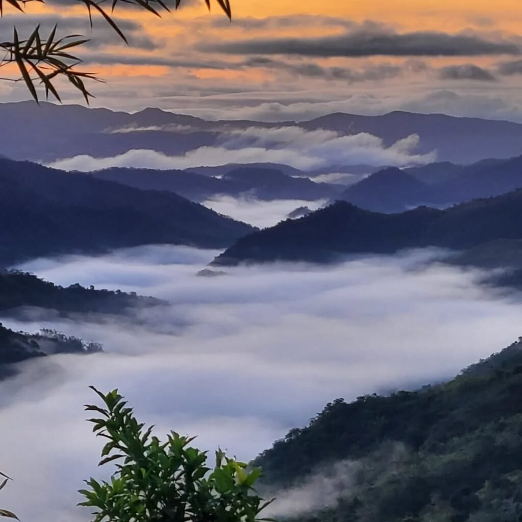
Mt. Isarog is not only a mountain hike. It is also a protected natural park with waterfalls, forest trails, hot spring areas, biodiversity, and nature attractions near Naga City. Protected Planet lists Mt. Isarog Natural Park as a protected area, while UP’s volcano profile identifies Mt. Isarog as a stratovolcano in Camarines Sur.
Mt. Isarog Quick Guide
Mt. Isarog is a stratovolcano and protected natural park in Camarines Sur, with Naga City as the main gateway. Most travelers use Barangay Panicuason as the jump-off for either the summit trail or Malabsay Falls.
| Detail | Mt. Isarog Travel Info |
|---|---|
| Location | Camarines Sur, Bicol Region |
| Main gateway | Naga City |
| Main jump-off | Barangay Panicuason |
| Protected area | Mt. Isarog Natural Park |
| Mountain type | Stratovolcano |
| Elevation | Commonly listed around 1,966 MASL; UP profile lists 1,972 MASL |
| Last known eruption | 3500 BCE ± 125 years |
| Summit trail | Panicuason Trail |
| Difficulty level | Major climb, 5/9 |
| Standard summit format | 2D1N overnight climb |
| Main camp | Camp 4 |
| Summit target | Patag-Patag Peak / crater rim area |
| Casual option | Malabsay Falls |
| Best season | February to late May |
| Main warning | Check trail status, weather, guide availability, and DENR/LGU advisories |
UP’s volcano profile lists Isarog as a stratovolcano in the Bicol Volcanic Arc, with a highest peak of 1,972 MASL and last known eruption at 3500 BCE ± 125 years.
Table of Contents

What Is Mt. Isarog?
Mt. Isarog is both a mountain-volcano and a protected natural park. This is why hikers, waterfall lovers, families, and Naga City visitors can all search for Mt. Isarog but need very different travel plans.
For mountaineers, Mt. Isarog usually means the Panicuason summit hike, a muddy and forested major climb. For casual travelers, it usually means Malabsay Falls, forest scenery, cold water, and a quick nature escape from Naga.
Searchers often ask: Is Mt. Isarog active or inactive? The safest answer is that Mt. Isarog is listed in volcano references as an active stratovolcano, but its last known eruption is prehistoric. For travelers, the more practical concerns are trail status, weather, permit rules, and park access.
Where Is Mt. Isarog Located in Camarines Sur?
Mt. Isarog is located in Camarines Sur in the Bicol Region of Luzon. The easiest base for most travelers is Naga City, then a local transfer to Barangay Panicuason.
Important access areas and nearby LGUs include:
- Naga City
- Barangay Panicuason
- Pili
- Ocampo
- Tigaon
- Goa
- Calabanga
- Consocep Mountain Resort area
For DIY travelers, the simplest route is:
Naga City → Panicuason → DENR / Mt. Isarog access area
If you are already in Naga City, Mt. Isarog is one of the easiest nature trips to add to your itinerary. You can pair it with Peñafrancia Basilica, Naga food spots, Panicuason hot springs, Camsur Watersports Complex, or a longer Camarines Sur route.
Why Did I Visit Mt. Isarog?
I visited Mt. Isarog because I wanted to experience one of the most important mountains in Camarines Sur beyond the usual city attractions. It is close enough to Naga to be accessible, but the summit trail is rugged enough to demand real hiking preparation.
What stood out was the contrast. The summit side feels like a real mountaineering objective. The Malabsay side feels like a nature day trip that more people can realistically enjoy.
That is why I would not simply call Mt. Isarog beginner-friendly or difficult. Malabsay Falls is beginner-friendly in distance. The Mt. Isarog summit hike is a 5/9 major climb.
Is Mt. Isarog Open for Hiking or Nature Trips?
Mt. Isarog may be open, but you should always check current advisories before going. Both the Panicuason Trail and Malabsay Falls can close due to extreme weather, unsafe trail conditions, or LGU/DENR advisories.
Naga City Tourism has posted advisories showing that Mt. Isarog Panicuason Trail and Malabsay Falls can temporarily close during extreme weather conditions, so never rely only on old blogs or outdated social media comments.
Before visiting, verify:
- Current Panicuason Trail status
- Malabsay Falls access
- Weather condition
- DENR / PAMB / LGU advisory
- Guide availability
- Registration and permit process
- Waterfall swimming condition
- Transport availability from Panicuason back to Naga
For the summit, I would not recommend walk-in planning. Secure the permit, guide, and weather clearance first.
What Should You Know Before Visiting Mt. Isarog?
The most important thing to know is that Mt. Isarog has strict planning differences between the summit hike and the waterfall visit. The summit requires a guide and permit, while Malabsay Falls is shorter but still needs safety awareness.
| What to Check | Why It Matters |
|---|---|
| Trail status | Panicuason Trail may close during unsafe weather |
| Falls access | Malabsay Falls can close after heavy rain |
| Permit process | MyNaga / ITPO process may change |
| Guide availability | Required for the summit hike |
| Opening hours | Malabsay cutoff must be confirmed |
| Transport | Late return from Panicuason can be difficult |
| Fees | VERIFY LOCALLY before travel |
| Drone rules | Protected area rules may restrict drone use |
| Waste rules | Pack-in, pack-out discipline is expected |
For unstable details, mark them as VERIFY LOCALLY and confirm with Naga City Tourism, Naga City ITPO, DENR / PASu, Mt. Isarog Natural Park management, or local guides.

What Is the Difference Between Mt. Isarog Summit Hike and Malabsay Falls?
The Mt. Isarog summit hike is a difficult overnight climb, while Malabsay Falls is a short waterfall and nature park visit. These two trips should not be planned the same way.
| Option | Best For | Difficulty |
|---|---|---|
| Mt. Isarog summit hike | Experienced hikers | Major climb, 5/9 |
| Malabsay Falls | Families, casual travelers, waterfall lovers | Easy to moderate |
| Panicuason hot spring areas | Families, post-hike recovery | Easy |
| Nabuntulan Falls | Waterfall chasers | VERIFY LOCALLY |
| Consocep area | Nature side trip from Tigaon side | VERIFY LOCALLY |
The summit hike requires endurance, permits, guide coordination, overnight gear, and comfort with mud and leeches. Malabsay Falls is shorter, easier, and better for visitors who simply want a nature escape near Naga City.
Can You Visit Mt. Isarog Without Hiking to the Summit?
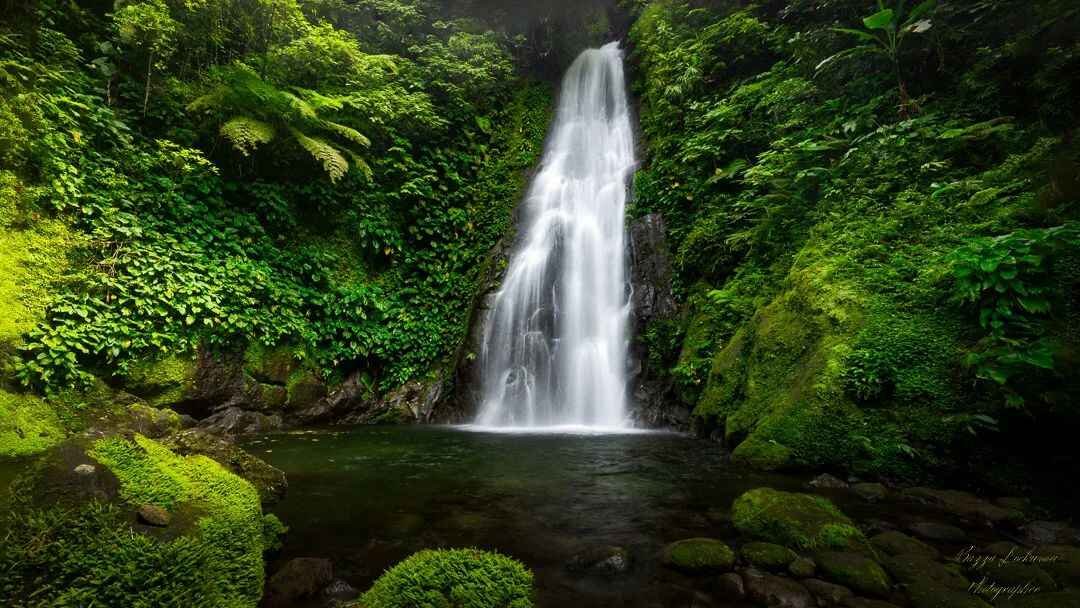
Yes, you can visit Mt. Isarog without hiking to the summit. The best option is Malabsay Falls in Panicuason, which gives you a real Mt. Isarog Natural Park experience without the 2D1N climb.
Malabsay Falls is one of Naga City’s popular natural attractions and is located in Panicuason, within the boundaries of Mt. Isarog Natural Park.
This is the route I would recommend for:
- Families
- First-time Naga visitors
- Casual travelers
- Waterfall lovers
- Non-hikers
- Travelers with only half a day to spare
The walk to the falls is short, but the trail and rocks can be slippery. It is beginner-friendly in distance, not risk-free.

What Is the Difference Between Mt. Isarog Summit Hike and Malabsay Falls?
The Mt. Isarog summit hike is a difficult overnight climb, while Malabsay Falls is a short waterfall and nature park visit. These two trips should not be planned the same way.
| Option | Best For | Difficulty |
|---|---|---|
| Mt. Isarog summit hike | Experienced hikers | Major climb, 5/9 |
| Malabsay Falls | Families, casual travelers, waterfall lovers | Easy to moderate |
| Panicuason hot spring areas | Families, post-hike recovery | Easy |
| Nabuntulan Falls | Waterfall chasers | VERIFY LOCALLY |
| Consocep area | Nature side trip from Tigaon side | VERIFY LOCALLY |
The summit hike requires endurance, permits, guide coordination, overnight gear, and comfort with mud and leeches. Malabsay Falls is shorter, easier, and better for visitors who simply want a nature escape near Naga City.
Can You Visit Mt. Isarog Without Hiking to the Summit?
Yes, you can visit Mt. Isarog without hiking to the summit. The best option is Malabsay Falls in Panicuason, which gives you a real Mt. Isarog Natural Park experience without the 2D1N climb.
Malabsay Falls is one of Naga City’s popular natural attractions and is located in Panicuason, within the boundaries of Mt. Isarog Natural Park.
This is the route I would recommend for:
- Families
- First-time Naga visitors
- Casual travelers
- Waterfall lovers
- Non-hikers
- Travelers with only half a day to spare
The walk to the falls is short, but the trail and rocks can be slippery. It is beginner-friendly in distance, not risk-free.
What Can You Do Around Mt. Isarog Natural Park?
Around Mt. Isarog Natural Park, you can hike, visit waterfalls, explore forest trails, enjoy hot spring areas, and use Panicuason as a nature escape from Naga City.
Things to do include:
- Visit Malabsay Falls
- Hike the Panicuason Trail if open and permitted
- Explore forest trails with proper guidance
- Check nearby waterfalls such as Nabuntulan Falls if access is allowed
- Try Panicuason hot spring areas
- Do nature photography
- Look for birds and forest life
- Pair the trip with Naga City attractions
- Extend to Consocep, Ocampo, Pili, or Caramoan
For most visitors, Malabsay Falls is the easiest way to experience Mt. Isarog. For hikers, the summit is possible only with proper preparation, local guide coordination, and safe weather.
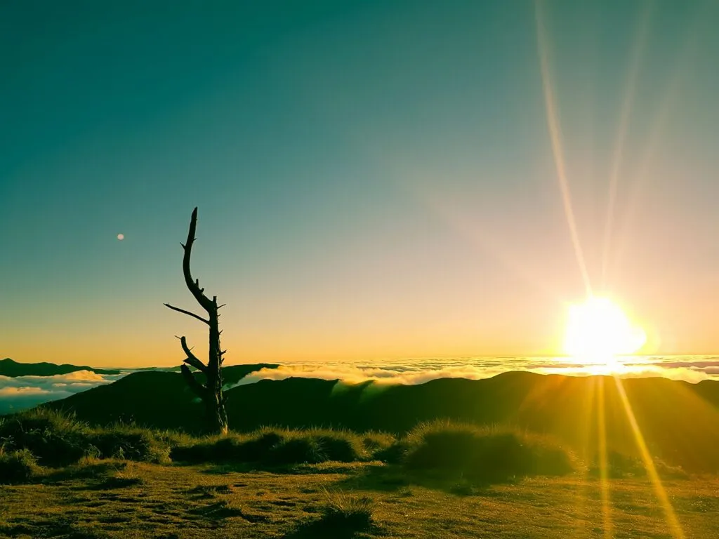
Can You Hike to the Mt. Isarog Summit?
Yes, you can hike to the Mt. Isarog summit when the trail is open, but it is a regulated 2D1N climb. It should not be treated as a casual day hike.
The standard route is via Panicuason Trail. Hikers usually establish Camp 4 as basecamp, then start early for the summit assault toward Patag-Patag Peak / crater rim area.
| Detail | Mt. Isarog Summit Hike |
|---|---|
| Trail | Panicuason Trail |
| Difficulty | 5/9 major climb |
| Estimated ascent | 8–10 hours |
| Standard format | 2D1N overnight hike |
| Basecamp | Camp 4 |
| Summit target | Patag-Patag Peak / crater rim |
| Terrain | Muddy, slippery, forested |
| Hazards | Limatik, lipa, rattan, fog, steep trail |
| Beginner suitability | Not recommended for casual beginners |
Naga City’s official permit page supports the regulated climb structure and lists the required fees, guide ratio, porter fee, and permit process.

What Permits, Registration, and Guides Are Needed?
The Mt. Isarog summit hike requires a permit, assigned guide, registration, and proper documents. Permit acquisition should be done ahead of time through Naga City channels.
| Requirement | Current Working Detail |
|---|---|
| Permit | Required for summit hike |
| Processing | MyNaga app or Naga City ITPO |
| Office | Naga City Hall Complex / proper city office |
| Documents | Application form, valid government ID, waiver |
| Minors | Parental consent required |
| Guide | Mandatory |
| Guide ratio | 1 guide per 5 hikers |
| Hiker cap | Maximum 20 hikers at a time |
| Porter | Optional |
| Porter load limit | 15 kg |
| Standard summit trip | 2 days |
Mt. Isarog Fees to Verify Locally
| Fee | Working Amount |
|---|---|
| Climbing permit | ₱100-200/day Filipino |
| Climbing permit | ₱500-800/day foreigner |
| Entrance fee | ₱10 Filipino |
| Entrance fee | ₱50 foreigner |
| Guide fee | ₱1,000-1500/day |
| Porter fee | ₱1,000-1500/day |
| Porter load limit | 15 kg |
| Guide ratio | 1 guide per 5 hikers |
What Is Malabsay Falls Like?
Malabsay Falls is the most accessible Mt. Isarog nature experience for non-hikers. It has a short walk, forest setting, cold water, and a deep plunge pool.
| Detail | Malabsay Falls Info |
|---|---|
| Location | Panicuason, Naga City |
| Inside | Mt. Isarog Natural Park |
| Waterfall height | Around 40 feet |
| Walking distance | Around 500 meters to 1 km |
| Walking time | Around 15–30 minutes |
| Difficulty | Beginner-friendly but slippery |
| Pool | Deep and cold |
| Pool depth | Around 16–30 feet in central areas |
| Lifeguard | None |
| Food vendors | Do not rely on vendors |
| Closure | 4:00 PM working cutoff; VERIFY LOCALLY |
| Best arrival | Before 2:00 PM |
| Prohibited | Loud music, alcohol, overnight camping |
Malabsay is short compared with the summit hike, but safety still matters. The plunge pool is deep and cold. The stone steps and rocks can be moss-covered and slippery. Visitors swim at their own risk because there are no lifeguards.
I would arrive before 2:00 PM, avoid swimming after rain, and leave before the 4:00 PM closure window.
How Do You Get to Mt. Isarog?
The easiest way to get to Mt. Isarog is to travel to Naga City, then continue to Barangay Panicuason. This route works for both Malabsay Falls and the Panicuason summit trail.
| Route | Transport | Notes |
|---|---|---|
| Manila to Naga | Bus | 10-14 hours |
| Manila to Naga/Pili | Flight | Around 45 minutes air time; schedules vary |
| Naga CBD to Panicuason | Jeepney / van | People’s Mall / CBD / Padian area |
| Panicuason drop-off to DENR gate | Habal-habal | Around ₱150-250 |
| Final stretch | Walk | Around 1.5 km steep road if no habal-habal |
| Private car | Drive to Panicuason | Best for groups and families |
From Manila, overnight buses to Naga usually take around 10-14 hours, depending on traffic, weather, and bus class. Working fare range is around ₱900–₱1,500+, but schedules and fares should be verified before departure.
From Naga City, look for Panicuason-bound jeepneys or vans around People’s Mall, CBD Terminal, or Padian Street. The fare can be around ₱50-100, then the habal-habal to the DENR gate can be around ₱150-250, but both should be marked VERIFY LOCALLY.
For private groups and families, using a private vehicle is easier because the final road can be steep and public transport timing is less flexible.
How Much Is the Mt. Isarog Budget?
A Malabsay Falls day trip from Naga is affordable, while the summit hike costs more because of permits, guide fees, porter option, food, and overnight logistics.
Malabsay Falls / Panicuason Day Trip Budget
| Expense | Estimated Cost |
|---|---|
| Naga to Panicuason jeep/van | ₱50–₱100, |
| Habal-habal to gate | Around ₱150-250, |
| Entrance/environmental fee | ₱30 Filipino / ₱50-100 foreigner, |
| Food and water | ₱400–₱1000 |
| Optional hot spring | Around ₱300-500, |
| Emergency buffer | ₱500–₱1,000 |
Practical budget from Naga: around ₱500–₱1,500, depending on food, transport, and side trip.
Mt. Isarog 2D1N Summit Hike Budget
| Expense | Estimated Cost |
|---|---|
| Permit and entrance | Around ₱210 Filipino for 2 days + entrance, VERIFY LOCALLY |
| Shared guide | ₱2,000-2500 per guide for 2 days |
| Porter | ₱1,000-1500/day if used |
| Food | ₱500–₱1,500 |
| Local transfers | VERIFY LOCALLY |
| Emergency buffer | ₱1,000–₱2,000 |
Estimated Naga-based group budget: ₱1,500–₱3,500+ per person if guide cost is shared.
Estimated Manila-based budget: ₱4,000–₱7,000+ depending on bus class, food, gear, porter, lodging, and side trips.
Solo hikers should expect higher costs because the mandatory guide fee is not shared. For a group of five, the guide cost becomes much lighter per person.
When Is the Best Time to Visit Mt. Isarog?
The best time to visit Mt. Isarog is during the drier months, especially February to late May. This gives better odds of manageable mud, fewer weather interruptions, safer waterfall flow, and clearer summit conditions.
Avoid serious hiking during:
- heavy rain
- typhoon advisories
- June to December rainy period
- days after continuous rainfall
- September to November high-risk storm months
Rain makes Mt. Isarog more difficult. It can make the trail muddier, increase limatik exposure, strengthen waterfall current, and trigger possible PAMB or LGU closures.
Is Mt. Isarog Safe for Beginners?
Malabsay Falls can be beginner-friendly with caution, but the Mt. Isarog summit hike is not ideal for total beginners. The summit is better for hikers with previous overnight or major-climb experience.
| Traveler Type | Best Option |
|---|---|
| Total beginner | Malabsay Falls |
| Family with kids | Malabsay Falls if weather is safe |
| Fit beginner hiker | Train first; join experienced group |
| Intermediate hiker | Summit possible with guide |
| Solo traveler | Join a group to split guide cost |
| Non-swimmer | Avoid deep parts of Malabsay pool |
| Senior traveler | Malabsay only if mobility is good |
The summit route requires endurance, strong legs, patience in mud, and comfort with forest hazards. Malabsay is easier, but the deep pool and slippery rocks still require caution.
What Safety Risks Should You Know?
The main safety risks in Mt. Isarog are mud, limatik, slippery rocks, sudden rain, fog, deep water, and slow emergency access. This is not a place where you should ignore guide instructions or weather.
| Risk | What to Do |
|---|---|
| Limatik | Wear leech socks, leggings, long sleeves |
| Lipa | Avoid brushing against unknown plants |
| Rattan | Wear long sleeves and gloves |
| Mud | Use deep-lug shoes |
| Fog | Stay close to your guide |
| Deep pool | Do not jump blindly |
| No lifeguard | Swim only if confident |
| Rain | Avoid waterfall and summit trips after heavy rain |
| Emergency access | Carry first aid and emergency buffer |
The nearest advanced medical facilities are in Naga City, so evacuation from the forest or trailhead can take time. Bring personal medicine, first aid, cash, and enough food and water.
What Should You Bring to Mt. Isarog?
Bring gear based on your route: light safety items for Malabsay Falls and proper overnight gear for the summit hike.
| For Malabsay Falls | For Summit Hike |
|---|---|
| Grippy sandals or shoes | Deep-lug hiking shoes |
| Dry bag | Rain jacket or poncho |
| Drinking water | Leech socks |
| Snacks or packed food | Long sleeves and hiking pants |
| Swimwear | Gloves |
| Towel and extra clothes | Headlamp |
| Trash bag | Tent and sleep system |
| Cash | Food and water system |
| First aid | Trekking poles |
| Waterproof phone pouch | Power bank |
For the summit, I would not skip leech protection, gloves, rain protection, and proper shoes. For Malabsay Falls, the most important items are grippy footwear, water, snacks, and dry clothes.
What Are the Common Mistakes to Avoid?
The biggest mistake is treating all Mt. Isarog trips as the same. A Malabsay Falls day trip and a Mt. Isarog summit hike are completely different in difficulty, cost, and preparation.
Avoid these mistakes:
- Going without checking trail or falls status
- Assuming the summit can be done as a casual day hike
- Arriving late at Malabsay Falls
- Wearing smooth slippers or running shoes on wet terrain
- Bringing no food because you expect vendors
- Underestimating limatik
- Ignoring guide instructions
- Swimming after heavy rain
- Not carrying cash
- Flying a drone without permission
- Leaving trash in the park
What Nearby Places Can You Visit in Camarines Sur?
Mt. Isarog pairs well with Naga City and nearby Camarines Sur attractions. If you have extra time, turn the trip into a 2–4 day nature and city itinerary.
| Nearby Place | Best For | Notes |
|---|---|---|
| Panicuason Hot Springs | Post-hike recovery, families | Around ₱300, VERIFY LOCALLY |
| Consocep Falls | Waterfall chasing | Tigaon side, VERIFY LOCALLY |
| Ocampo Deer Farm | Families, animal lovers | Free/donation-based, VERIFY LOCALLY |
| Camsur Watersports Complex | Wakeboarding, barkada trips | Around ₱165–₱180/hr, VERIFY LOCALLY |
| Peñafrancia Basilica | Pilgrims, Naga city tour | Free |
| Naga City food trip | Casual travelers | Good before or after hike |
| Caramoan | Longer Camarines Sur beach extension | Best with extra days |
For a simple trip, do Naga City + Malabsay Falls + Panicuason hot spring area. For a harder adventure, plan the 2D1N summit hike separately with a buffer day.
What Details Should You Verify Locally?
Several Mt. Isarog details can change, so verify them before your trip. This is especially important for trail status, permits, fees, transport, and weather rules.
| Detail | Why You Should Verify |
|---|---|
| Panicuason Trail status | Can close due to weather or safety |
| Malabsay Falls access | Can close after heavy rain |
| Permit process | MyNaga or office rules may change |
| Guide fee | Official rate may update |
| Porter rate | Confirm with guide or ITPO |
| Jeepney / van fare | Local fares change |
| Habal-habal fare | Negotiated rate varies |
| Malabsay opening hours | 4 PM cutoff should be confirmed |
| Drone rules | Protected area restrictions may apply |
| Hot spring rates | Private resort rates change |
| Camping rules | Summit camp rules may change |
| Bonfire / alcohol rules | Usually restricted; confirm |
| Waste rules | Pack-in, pack-out expected |
FAQs About Mt. Isarog
Where is Mt. Isarog located?
Mt. Isarog is located in Camarines Sur, Bicol Region, Philippines. Naga City is the main gateway, and Barangay Panicuason is the usual access point for Malabsay Falls and the Panicuason summit trail.
Is Mt. Isarog active or inactive?
Mt. Isarog is listed in volcano references as an active stratovolcano, but its last known eruption is prehistoric. UP’s volcano profile lists the last known eruption as 3500 BCE ± 125 years.
What is the Mt. Isarog last eruption?
The last known eruption of Mt. Isarog is listed by UP’s volcano profile as 3500 BCE ± 125 years.
What is the Mt. Isarog difficulty level?
The Mt. Isarog difficulty level via Panicuason Trail is 5/9, making it a major climb. Expect mud, limatik, steep forest sections, overnight camping, and 8–10 hours of ascent.
Is Mt. Isarog beginner-friendly?
The summit hike is not beginner-friendly for casual first-timers. Beginners should visit Malabsay Falls first or join the summit only with proper training, experienced companions, and a confirmed guide.
Do you need a guide for Mt. Isarog?
Yes. A guide is required for the Mt. Isarog summit hike. Naga City’s permit page lists a guide ratio of 1 guide per 5 hikers.
How much is the Mt. Isarog guide fee?
The working official guide fee is ₱1,000/day, but mark this as VERIFY LOCALLY before hiking. Naga City’s permit page lists this guide fee in its fee breakdown.
How long is the Mt. Isarog summit hike?
The ascent to Patag-Patag Peak or the crater rim area can take around 8–10 hours, depending on weather, mud, group pace, and guide decision. The standard climb is usually 2D1N.
Can you visit Mt. Isarog without hiking?
Yes. Visit Malabsay Falls or the Panicuason nature area if you do not want to hike the summit. This is better for families, casual travelers, and waterfall lovers.
How do you get to Malabsay Falls?
From Naga City, take a jeepney or van to Panicuason, then continue by habal-habal or walk the steep final road to the Mt. Isarog / DENR access area. Confirm current fares and operating hours locally.
Is Malabsay Falls safe for swimming?
Malabsay Falls can be swimmable when conditions are safe, but the pool is deep, cold, and has no lifeguards. Avoid swimming after heavy rain or when the water looks strong.
What is the best time to visit Mt. Isarog?
The best time to visit Mt. Isarog is usually February to late May. This period gives better chances of manageable trail conditions, safer waterfall access, and clearer summit weather.
Final Verdict: Should You Visit Mt. Isarog?
Mt. Isarog is worth visiting if you match the trip to your fitness, schedule, and travel style. For trained hikers, the 2D1N Panicuason summit hike is a serious Bicol mountain adventure with a 5/9 difficulty level, Camp 4, Patag-Patag Peak, limatik, mud, and long forest climbing. For casual travelers, Malabsay Falls is the better first experience.
I would recommend the summit only if you have proper permits, a confirmed guide, stable weather, and enough hiking experience. It is long, wet, leechy, and physically demanding.
For most travelers visiting Naga City or Camarines Sur, start with Malabsay Falls and the Panicuason nature trip. It gives you the cold water, forest atmosphere, and Mt. Isarog Natural Park experience without the full commitment of the summit climb.
Where to Go Next After Mt. Isarog?
Mt. Isarog is a strong starting point for a bigger Bicol itinerary. Since the mountain sits near Naga City and central Camarines Sur, you can pair it with other volcano hikes, island trips, waterfall destinations, and major Bicol tourist spots.
If you are still planning your full route around the region, start with my guide to the top Bicol tourist spots. This is useful if you want to connect Mt. Isarog with other destinations in Albay, Sorsogon, Camarines Norte, Masbate, and nearby provinces.
For hikers who enjoy forested volcano trails, my Mt. Bulusan travel guide is a good next read. Mt. Bulusan has a different feel from Mt. Isarog because it combines lake scenery, forest trails, and volcano-side nature attractions in Sorsogon.
If you are comparing Mt. Isarog’s 5/9 difficulty level with other challenging hikes, check my guide to major climb mountains in the Philippines. This is helpful if you want to understand how Mt. Isarog compares with other difficult climbs that require better endurance, preparation, and trail discipline.
For a beach trip after the mountain, consider Calaguas Islands in Camarines Norte. It is one of the best island extensions after a Bicol mountain trip, especially if you want white sand, camping, and a more remote island-hopping experience.
Another rugged island option is Burias Island in Masbate. It pairs well with a wider Bicol adventure if you want rock formations, sandbars, island camping, and a more off-grid travel style after hiking Mt. Isarog.

Pingback: Discover the Best Mountains in the Philippines: Your Ultimate Hiking Guide for 2024 – BizBuildBoom
Thank you for your sharing. I am worried that I lack creative ideas. It is your article that makes me full of hope. Thank you. But, I have a question, can you help me?
Your article helped me a lot, is there any more related content? Thanks!