Aiden Kenzy, founder of Lakbay Pinas and passionate Filipino travel writer dedicated to uncovering iconic destinations across the Philippines since 2015. — Climbed: May 2026 — Published: September 2026
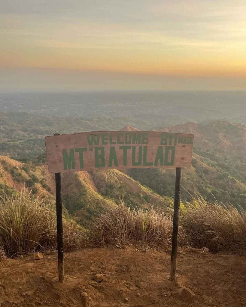
Mt. Batulao is a 4/9 difficulty grassland traverse in Nasugbu, Batangas, standing at 811 MASL with 12 sequential peaks. The full traverse takes 4 to 6 hours, costs around PHP 1,200 per person all-in, and as of 2026, a guide is mandatory for all hikers without exception.
Key Takeaways:
- Total registration fees for a full traverse are PHP 200 per person, collected across multiple checkpoints; guide fee is PHP 800 per group of up to 5 for a day hike.
- The dry season from November to May offers the best conditions, but weekend crowds peak heavily from December through April.
- The New Trail is recommended for beginners; the Old Trail adds steep rope sections rated up to 70 degrees and is better suited for experienced hikers.
- The defining feature is the sawtooth ridgeline — 90% of the trail is completely exposed, making heat management more important than fitness level.
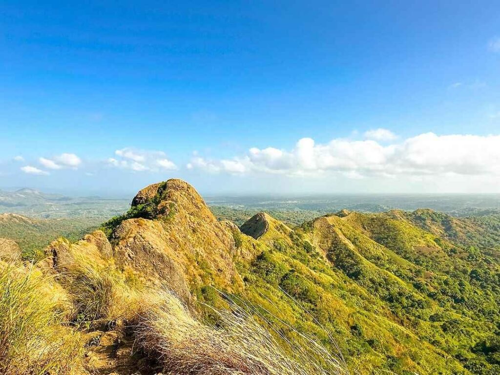
Table of Contents
Where Is Mt. Batulao Located?
Mt. Batulao sits in Nasugbu, Batangas, along the boundary between Batangas and Cavite provinces in Calabarzon. Mt. Batulao in Nasugbu, Batangas is one of the most accessible minor climbs near Manila, standing at 811 MASL.
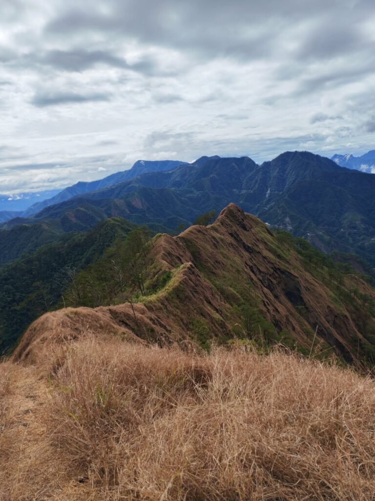
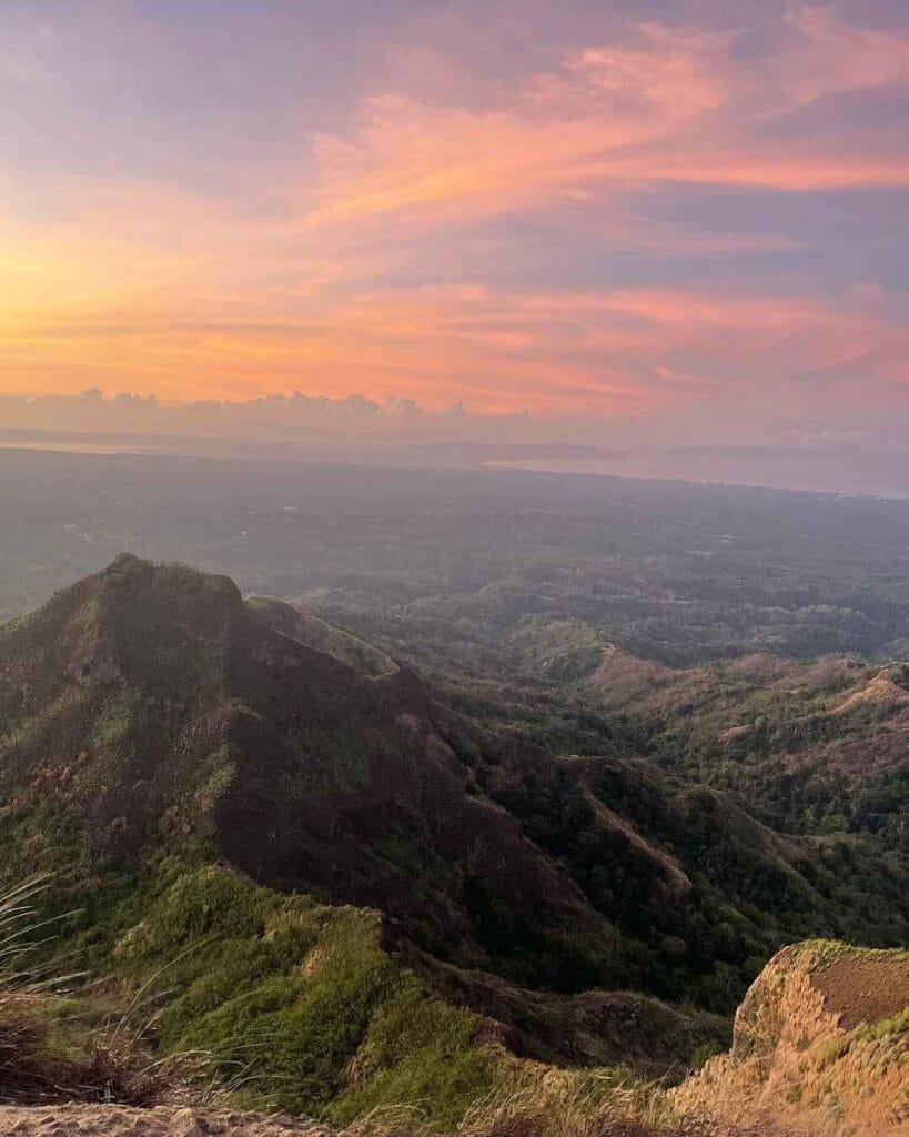
The mountain is a dormant andesitic stratovolcano that formed part of the northwestern rim of the Taal Caldera system. What makes it stand out visually from other mountains in Southern Luzon is the ridgeline. Unlike the symmetrical cone of Mayon, Batulao is defined by its dramatic sawtooth morphology — a series of 12 peaks formed by millions of years of erosion on this dormant stratovolcano.
The name “Batulao” is a portmanteau of two Tagalog words: bato (rock) and ilaw (light). Local oral tradition also links the name to a pre-colonial chieftain named Datu Lao who reportedly used the mountain’s slopes to defend against rival tribes.
From the Tagaytay ridge, you can actually see Mt. Batulao’s jagged profile to the west. That silhouette alone is enough to make you want to climb it.
How to Get to the Mt. Batulao Jump-off Point
The most direct and cost-effective route from Manila takes about 3 hours and uses public buses. No four-wheel-drive vehicles, no private arrangements required.
By Public Bus (Recommended)
Board a DLTB Co. or BSC provincial bus bound for Nasugbu or Balayan from the terminal near LRT Buendia Station in Pasay City, or from the Parañaque Integrated Terminal Exchange (PITX). The journey to the area starts on a DLTB bus bound for Nasugbu, Batangas. Current bus fare runs around PHP 169 one way. Tell the conductor to drop you off at KC Hillcrest Golf Club (formerly Evercrest) along the Tagaytay-Nasugbu Highway.
From the KC Hillcrest gate, take a tricycle to the jump-off for around PHP 40 per person. The tricycles queue right at the entrance, so you won’t have to hunt for one. Total travel time from Pasay to the trailhead is typically 3 to 3.5 hours if you catch an early bus.
By Private Vehicle
Mt. Batulao is around 80 kilometers from Manila. The drive takes approximately 2 hours and 30 minutes via the Cavite-Tagaytay-Batangas Expressway and the Nasugbu Highway. Parking at the jump-off costs PHP 100 for four-wheeled vehicles and PHP 25 for motorcycles.
Pre-Dawn Start Tip
I caught a 1:30 AM bus from Buendia on my May 2026 climb. That put me at KC Hillcrest by around 4:30 AM with enough time to walk to the trailhead and begin hiking before sunrise. If you want that sunrise summit, this is the schedule to follow.
For hikers who don’t want a midnight commute, the closest lodging to the jump-off is the KC Hillcrest Hotel and Golf Club, located right at Km. 72 along the Tagaytay-Nasugbu Highway. Guests have access to a 24-hour front desk and 24-hour check-in, and the hotel offers a pool and lounge. Advance booking is strongly recommended for peak season weekends (December to April) because golf tourists and hikers both compete for rooms.
Permits, Fees, and Guide Requirements at Mt. Batulao
Total cost for a full traverse is PHP 200 per person in registration fees, plus a mandatory guide fee of PHP 800 per group of up to 5.
Unlike national parks managed directly by the DENR [OUTBOUND LINK: DENR official website], Mt. Batulao’s trail crosses multiple parcels of privately owned land. This fragmented ownership is why fees are not collected in one lump sum but at separate checkpoints along the route.
2026 Registration Fee Breakdown
| Checkpoint | Fee (PHP) | What It Covers |
|---|---|---|
| Primary Jump-off Kiosk | PHP 140 | Barangay eco-fee and municipal tourism tax |
| Camp 8 (New Trail) | PHP 20 | Private land passage fee |
| Old Trail Descent Junction | PHP 40 | Traverse toll at trail boundary |
| Total (Full Traverse) | PHP 200 | Full circuit |
| Overnight Camping Fee | PHP 30 | Per person per night |
| Tent Rental (if needed) | PHP 350 | Per tent per night |
Bring exact change in small bills. Cash is king here. Do not rely on GCash or Maya. Signal can be spotty at the registration area, and guides prefer cash payment. Bring smaller bills (PHP 20s, PHP 50s, PHP 100s) for exact change at the toll gates or registration booths.
There are no separate rates for locals versus non-locals. The PHP 200 traverse fee applies uniformly to all Filipino residents and international tourists alike.
Mandatory Guide Policy
As of 2026, hiring a local guide is strictly mandatory for all hikers upon registration. In the past, hikers could just climb Batulao freely, but following several accidents and a need to regulate tourism, the local government now strictly enforces a mandatory guide policy.
The guide fee is PHP 800 for a group of up to 5 people. For an overnight camping expedition, the guide fee increases to PHP 1,200, covering the extended duration. Split across a full group of five, the day hike guide fee works out to PHP 160 per person — very reasonable for what you get.
The guides are assigned at the registration area and know every rope section, shortcut, and potentially confusing fork on the trail. The fee directly supports the families in Barangay Patutong Malaki, many of whom rely solely on guiding for income.
Registration Booth Hours
The primary registration booth officially opens at 5:00 AM. If you arrive before 5 AM for a pre-dawn start, you can begin hiking and register at the secondary checkpoints higher up the mountain: Camp 1 on the Old Trail or Camp 8 on the New Trail. These checkpoints are staffed around the clock by resident caretakers.
No Advance Booking Required
Mt. Batulao operates entirely on a walk-in basis. Reservation is not required. There is also no enforced daily hiker cap. On peak weekends, this means the trail can get genuinely overcrowded, so arriving early is not just a sunrise strategy — it’s also a crowd strategy.
For emergencies at the jump-off, you can also reach a local guide coordinator via +63 930 981 3075. Save the MDRRMO Nasugbu rescue lines before heading up: +63 917 508 9911 or +63 919 629 2599, landline (043) 233-1842. The PNP Nasugbu station is reachable at +63 927 500 1199. The national emergency hotline is 911.
What Is the Mt. Batulao Trail Like?
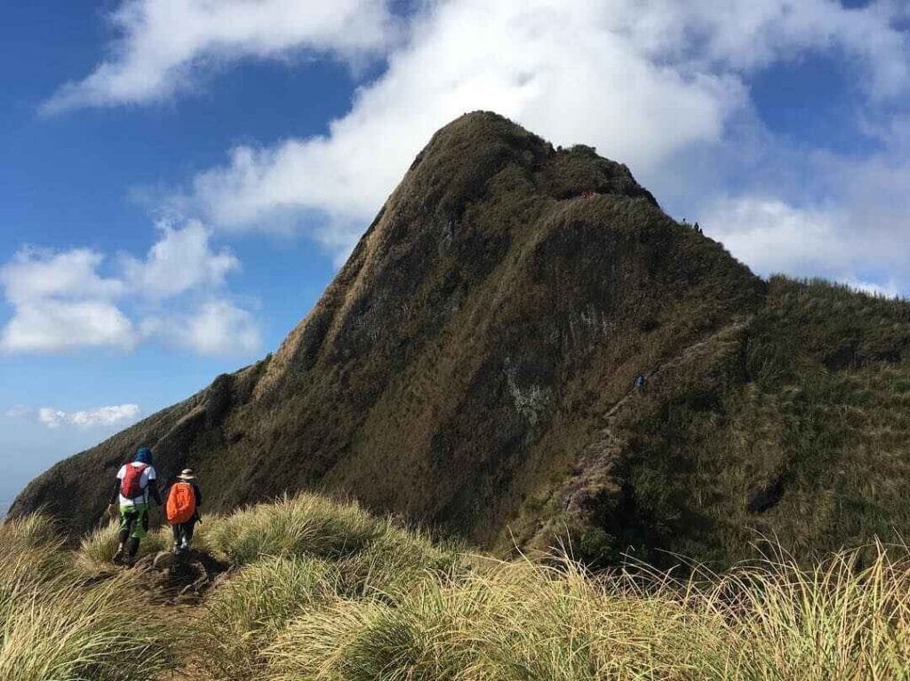
The real challenge isn’t the altitude — it’s the exposure. The trail is 90% open grassland, meaning you are directly exposed to the sun and the heat index often spikes higher than the actual air temperature.
Mt. Batulao has a total trail length of 12 kilometers and it takes around 5 to 6 hours to finish the climb depending on your pace. The trail begins at the KC Hillcrest area, passes through a short residential zone, and then splits into two distinct routes at a visible fork.
The New Trail (West) — Recommended for Beginners
The New Trail is the better option for first-timers and anyone prioritizing a steady, manageable ascent. The New Trail offers a more accessible and scenic route to the summit, making it a great option for first-timers and those seeking a less challenging climb. It winds through exposed grasslands, tagging peaks numbered 1 through 8 with wide switchbacks and generally forgiving inclines.
Camp 8 sits at 679 MASL and serves as the main rest stop and secondary registration checkpoint on this route. The numbered peaks let you track progress clearly — if you’re at Peak 5, you know exactly where you are.
Per-Stage Difficulty Scores (New Trail):
- Peaks 1 to 3 — 2/5: Gentle rolling terrain with wide, well-trodden paths. A warm-up, not a workout.
- Peaks 4 to 6 — 3/5: Moderate inclines begin. Exposed ridges start to narrow. Heat becomes a factor after 8 AM.
- Peaks 7 to 8 / Camp 8 — 3/5: Longest sustained climb on the New Trail. Rope assists at one or two points. Wind picks up noticeably.
- Peaks 9 to 11 (shared ridge) — 4/5: The sawtooth character fully kicks in. Paths narrow to under a meter on both sides. Physical drops into ravines visible below.
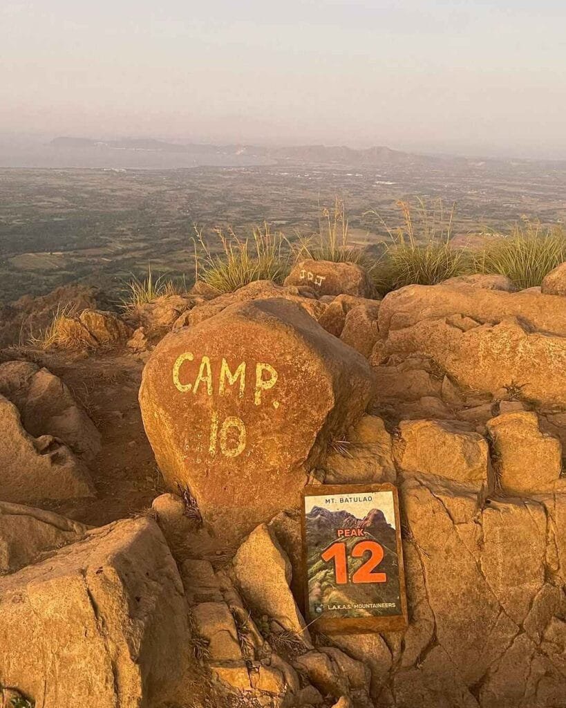
- Peak 12 / Summit — 4/5: Final push. A short, steep scramble rewards you with a 360-degree view that includes Taal Lake to the northeast and Balayan Bay to the southwest on a clear morning.
The Old Trail (East) — For Experienced Hikers
The Old Trail departs from the same fork and immediately descends into a brief shaded woodland before assaulting the eastern ridgeline. The defining feature is extreme inclines reaching 60 to 70 degrees, requiring the use of fixed nylon ropes to navigate loose soil and sheer rock faces.
Descending via the Old Trail is where most incidents happen. The combination of gravitational momentum and friable volcanic soil makes controlled descent hard without proper grip. Gloves are not optional here — the ropes will strip your palms otherwise.
Most recommended approach: Ascend via the New Trail, descend via the Old Trail. This order puts the technical rope sections on the descent, which is harder but safer than the reverse when your legs are fresher.
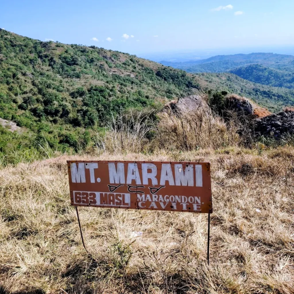
For more beginner-friendly climbs in the Cavite-Batangas area while you work up to a full Batulao traverse, the Mt. Marami trail in Maragondon, Cavite is a good starting point.
What I Would Do Differently Next Time
I climbed Batulao in May 2026 on a weekday, which was the right call. The trail was quiet enough to move at my own pace and I reached Peak 12 by 7:30 AM. Clear skies meant full views of Taal Lake from the summit — that view alone makes the whole drive worth it.
The rope section on the Old Trail descent was where things got interesting. My palms were already sweaty from the heat, and the rope has enough grit to leave marks if you grip it without gloves. Next time I’d bring light trekking gloves specifically for that section.
My honest disappointment was the fee structure. It’s not the total amount — PHP 200 is fair. It’s the number of times you stop, pull out your wallet, and wait for a receipt. I counted five separate payment interactions from start to finish. A single collection point at the trailhead would improve the experience significantly without changing the economics for the community.
I ate Batangas lomi at a small carinderia near the KC Hillcrest gate after the hike. It hit differently after 6 hours on a hot ridge. That’s the post-hike ritual on this mountain and I fully endorse it.
Best Time to Climb Mt. Batulao
November to May is the dry season and the best window for hiking Batulao. The trails are firm, views are sharp, and you won’t deal with slippery volcanic soil. For the Nasugbu trilogy of Batulao, Talamitam, and Apayang, the dry season is also when that multi-mountain circuit is most logistically practical.
The catch: dry season is also peak season. Holiday weekends from December to April bring the largest crowds. The real challenge on Batulao is the exposure, and hundreds of hikers on the narrow ridge genuinely slows pace and raises safety risks at the rope sections near Peaks 8 and 12. On packed weekends, the standard 6-hour traverse can stretch to 8 hours strictly due to queuing.
Weekday climbs in the dry season are the best of both worlds. Good weather, firm trails, minimal queuing. If you can only go on a weekend, arrive at the trailhead by 5:00 AM at the latest to get ahead of the bulk of climbers.
The rainy season from June to October makes the trail manageable but significantly more slippery. Check the forecast before heading out. The trail can be slippery during or after rain. The andesitic soil turns into a low-traction surface quickly, which is dangerous on the Old Trail descents.
Budget Breakdown for Climbing Mt. Batulao
| Expense | Cost (PHP) |
|---|---|
| Bus fare (Buendia/PITX to KC Hillcrest, one way) | PHP 169 |
| Tricycle (KC Hillcrest gate to jump-off) | PHP 40 |
| Registration fees (full traverse, all checkpoints) | PHP 200 |
| Guide fee (PHP 800 divided by 5 pax) | PHP 160 |
| Parking (private vehicle, 4-wheel) | PHP 100 |
| Water and snacks on trail (weekends only) | PHP 50 to 150 |
| Post-hike wash-up at jump-off | PHP 25 |
| Return bus fare | PHP 169 |
| Estimated Total (commuting, group of 5) | ~PHP 1,000 to 1,200 |
| Overnight camping fee (add-on) | PHP 30 |
| Tent rental (if no gear) | PHP 350 |
These figures match the “approximately PHP 1,200 per person” budget confirmed in current 2026 guides for this mountain. This guide covers the essential 2026 updates, including mandatory guide fees, the Old vs. New Trail loop, and a budget breakdown of approximately PHP 1,200 per person.
What to Pack for Mt. Batulao
| Item | Essential? |
|---|---|
| 3.0 liters of water minimum | Yes — no potable springs on the upper trail |
| Hiking boots with deep lug soles | Yes — critical for Old Trail loose soil descents |
| Long-sleeved UV-resistant shirt | Yes — 90% of trail is fully sun-exposed |
| Wide-brimmed hat with neck flap | Yes — primary defense against heat exhaustion |
| Sunscreen SPF 50+ | Yes |
| Trekking gloves | Yes — rope sections on Old Trail will damage bare palms |
| Headlamp with spare batteries | Yes — for pre-dawn starts |
| Energy snacks (trail mix, energy bars) | Yes |
| First-aid kit (personal) | Yes — no medical posts on trail |
| Raincoat or poncho | Recommended — weather shifts quickly |
| Trekking poles | Optional — helps on steep Old Trail descents |
| Cash in small bills (PHP 20s to 100s) | Yes — no digital payment at checkpoints |
On weekday climbs, vendors at Camp 1 and Camp 8 are absent. Carry everything you’ll need from the bottom. On peak weekends, fresh buko (coconut) goes for around PHP 50 and cold sodas for about PHP 35 at the rest huts — a genuine lifesaver in the midday heat.
Safety Tips for Climbing Mt. Batulao
Start before 6 AM. The ridgeline has zero shade and the heat index becomes severe by 9 AM. Every hour you delay the start is another hour of sun exposure with no cover.
Never step off the main trail path for photos. A hiker died in a fatal fall at Peak 8 in 2012 after stepping off the trail axis to take photographs. The drops on both sides of the sawtooth ridge are real and steep.
Carry 3.0 liters of water per person. The upper portions of Mt. Batulao have no safe natural water source. A small seasonal stream near Camp 1 is not reliable or safe to drink without advanced filtration, especially in dry months.
Signal is reliable. Unlike forested mountains, Batulao’s open ridge gives strong Globe and Smart coverage from Camp 1 upward. Both carriers maintain 4G/LTE at Camp 8 and strong signal at the summit. Emergency calls are viable from almost every point on the upper trail.
Do not use the Old Trail for descent if you have knee issues. The 60 to 70-degree descents are a genuine mechanical challenge for anyone with joint problems. The New Trail descent is significantly more forgiving.
Cash is king here. Do not rely on GCash or Maya at the checkpoints. Keep PHP 200 in small denominations accessible in a hip pocket rather than buried in your pack.
If you’re using Batulao as a stepping stone to longer, more technical Batangas climbs, Mt. Talamitam] and Mt. Lantik are the obvious next targets in the same region. For the Nasugbu area’s hidden fourth peak, Mt. Apayang is less crowded and pairs well with a Batulao traverse as a two-day itinerary.
Frequently Asked Questions About Mt. Batulao
Is Mt. Batulao good for beginner hikers?
Yes, Mt. Batulao is suitable for beginners, but with one important caveat: the difficulty is not in altitude but in heat exposure. Mt. Batulao in Nasugbu, Batangas is one of the most accessible minor climbs near Manila, standing at 811 MASL. Famous for its jagged sawtooth ridge and 12 distinct peaks, it offers a scenic 4 to 6-hour traverse suitable for beginners. Take the New Trail up, start before 6 AM, carry at least 3 liters of water, and the trail is very manageable for someone with basic fitness. The mandatory guide also removes most navigation risk for first-timers.
What is the difference between the old trail and new trail in Mt. Batulao?
The New Trail is a gradual, rolling ascent through open grassland via numbered Peaks 1 through 8, recommended for first-timers and groups who want a steady, lower-technical climb. The Old Trail is more aggressive, with 60 to 70-degree inclines and fixed nylon rope sections that demand upper body strength and precise footing. The recommended approach is to take the New Trail on the way up and the Old Trail on the way down. This order keeps the technical sections on descent when you have more experience of the mountain under your feet, while saving the harder rope work for when your legs are still relatively fresh.
How long does it take to hike Mt. Batulao?
Mt. Batulao has a total trail length of 12 kilometers and takes around 5 to 6 hours to finish depending on your pace. For a full traverse under uncrowded conditions, 6 hours is a realistic estimate for a moderate-pace group. On busy peak season weekends, mandatory queuing at the rope sections near Peaks 8 and 12 regularly pushes that to 8 hours. A solo weekday climber moving efficiently can finish in 4 to 4.5 hours.
Is a guide mandatory when climbing Mt. Batulao?
As of 2026, hiring a local guide is strictly mandatory for all hikers upon registration. This applies to everyone — experienced mountaineers, trail runners, and repeat visitors are all required to hire a guide. Following several accidents and a need to regulate tourism, the local government strictly enforces the mandatory guide policy. The guide fee is PHP 800 for a group of up to 5 hikers for a day climb, or PHP 1,200 for an overnight expedition. No exceptions are made at the jump-off.
What is the best time of year to climb Mt. Batulao?
The dry season from November to May is the best period for climbing Mt. Batulao. Trails are firm, visibility is sharp, and the Mt. Batulao summit view of Taal Lake is clearest during these months. For the best balance of good weather and manageable crowds, weekday climbs in November, early December, or late February hit the sweet spot. Avoid major Philippine holidays (New Year, Holy Week, and long weekends in January and February) unless you don’t mind sharing the sawtooth ridge with several hundred other hikers simultaneously.
Final Verdict: Should You Climb Mt. Batulao?
4 out of 5 for beginner and intermediate hikers looking for their first real ridge traverse.
Mt. Batulao delivers a genuinely distinct hiking experience that no other mountain within three hours of Manila can replicate — the rolling sawtooth peaks, the open-sky ridge with views of Taal Lake and Balayan Bay, and the physical rhythm of tagging 12 consecutive summits. The mandatory guide policy and standardized 2026 fees make the logistics cleaner than they used to be. The only friction worth calling out is the multi-checkpoint fee collection system, which slows the hike down in a way that feels unnecessary once you’re on the trail. Go on a weekday in the dry season, start before 6 AM, bring more water than you think you need, and Mt. Batulao will absolutely deliver.