
Mt. Pulag, the highest peak in Luzon at 2,926 MASL, is best climbed via the Ambangeg trail — a beginner-friendly, 4 to 5-hour route through pine forests, mossy sections, and open grasslands that rewards you with one of the Philippines’ most iconic sea of clouds. You need a pre-booked DENR permit, a valid medical certificate, and a mandatory local guide before you’re allowed to take a single step on the trail.
Mt. Pulag via Ambangeg Trail: Quick Guide
| Detail | Information |
|---|---|
| Mountain | Mt. Pulag (Playground of the Gods) |
| Location | Kabayan / Bokod, Benguet, Cordillera Administrative Region |
| Province | Benguet |
| Elevation | 2,926 MASL |
| Difficulty | 3 out of 9 — Beginner Friendly |
| Jump-off | Babadak (Ambangeg) Ranger Station, Bokod, Benguet |
| Best Season | November to April (Dry Season) |
| Trek Time | 4–5 hours to summit; 7–7.5 hours round trip |
| Registration | DENR Visitor Center, Ambangeg, Bokod, Benguet |
| Campsite | Camp 1 and Camp 2 (designated areas only; weekday camping only) |
Table of Contents
Where Is Mt. Pulag via Ambangeg Trail Located?
Mt. Pulag sits on the island of Luzon, straddling the borders of Benguet, Ifugao, and Nueva Vizcaya. The most common jump-off point is in Kabayan, Benguet, where the popular Ambangeg trail starts. The mountain is part of Mt. Pulag National Park, and it is classified as the highest peak in Luzon — and the 3rd highest mountain in the country, next to Mt. Apo and Mt. Dulang-Dulang.
Situated at Kabayan, Benguet, Mt. Pulag is a national park and, at the same time, an ancestral domain of various tribes; it is interesting to watch the delicate dance both the DENR and the Indigenous Peoples perform to keep this mountain alive and well.
The Ambangeg trail, specifically, starts from the Babadak Ranger Station in Bokod, Benguet — a separate barangay from Kabayan proper but accessed via the same Ambangeg junction on the Baguio–Kabayan road. Getting the geography right matters: your registration happens at Ambangeg DENR Visitor Center, and your actual hike begins a further 25–30 minutes uphill at the Babadak Ranger Station.
How to Get to the Mt. Pulag via Ambangeg Trail Jump-off Point
The jump-off at the Babadak Ranger Station is a two-stage journey from Baguio City — and you must also stop at the DENR Visitor Center before reaching it.
From Manila to Baguio City:
For 2026, the reliable bus options going north are Victory Liner and Genesis Transport (JoyBus). From Manila, ride a bus going to Baguio via Victory Liner or Genesis/Joy Bus, with terminals located at Pasay and Quezon City. Travel time from Manila to Baguio is approximately 4–7 hours.
From Baguio City to the DENR Visitor Center:
From Baguio, hail a taxicab going to the Old Slaughterhouse Terminal and tell the driver to drop you off at the van terminal bound to Kabayan (first trip leaves at 7:00 AM). Ask the van driver to drop you off near the DENR Visitor Center Station. Travel time from Baguio to the DENR Station is approximately 2–3 hours.
From the DENR Visitor Center to the Babadak Ranger Station (Trailhead):
Outside the DENR Station, there are motorcycle or “habal-habal” drivers who will bring you to the Babadak Ranger Station. Travel time is approximately 25–30 minutes. The usual habal-habal fare is ₱500 per person.
Chartered Vehicle Option:
For groups, the go-to option is the Monster Jeep — modified jeepneys featuring reinforced chassis, truck engines (often Isuzu or Mitsubishi), and aggressive tire treads. The round-trip hire of a jeepney ranges from ₱7,500 to ₱9,000 depending on the load and number of passengers. This is worth splitting among a group of 8–12 people and eliminates all the transfer hassle.
I climbed in February 2026 and our group had arranged a chartered van from Baguio that picked us up at the bus terminal early morning. We stopped for tapsilog at a carinderia near Bokod before reaching the DENR office — fueling up before registration is a smart move because the orientation process takes time.
Permits, Fees, and Guide Requirements at Mt. Pulag via Ambangeg Trail
All fees, permits, and a mandatory guide are non-negotiable — there are absolutely no walk-ins allowed.
Booking Your Permit:
First, secure your climb reservation via the DENR Mt. Pulag Office in advance — preferably a month or two before your planned trip. Strictly, no reservation means no climb. For peak season travel, lock in your spot at least 6 months in advance. Weekend slots now fill up 3 months in advance — book early.
Contact the DENR Mt. Pulag Office at 09127628844 / 09103010423 / 09106412678 / 09261626786.
Daily Trekker Limits:
Daily slots are limited to 500 trekkers per day. Hikers are advised to check and book in advance especially during weekends and holidays, when many climbers are expected.
Fees Breakdown:
DENR Environmental Fee: ₱250/person on weekdays (₱350 on weekends/holidays) for Philippine nationals. Additional admin fees apply. The mandatory guide fee is ₱1,200 per group of 1–5 persons, and entrance/green/LGU fees total approximately ₱600.
Medical Certificate:
Before you’re allowed to enter the mountain, you must present a “fit to climb” medical certificate stating you’re healthy enough for the ascent. Do not wait until you reach the jump-off point to get your clearance. While there is a small clinic near the DENR Visitor Center in Ambangeg, the queue on weekends can take up to 2 hours. Secure your medcert from your local doctor before leaving home.
Guide Requirement:
At the Babadak Ranger Station, you must hire a local guide (strictly mandated). Climbing Mt. Pulag without a guide is not an option. Guides are an integral part of the registration process, ensuring your safety during the ascent and descent.
Important 2026 Rule:
Climbing requires a mandatory medical certificate, a confirmed reservation, and strict adherence to the 2026 weekend camping ban. Camping is only allowed on weekdays. If you plan to camp overnight, do so on a weeknight.
Bring cash in small denominations — the ranger station does not have ATMs or reliable signal for e-wallets.
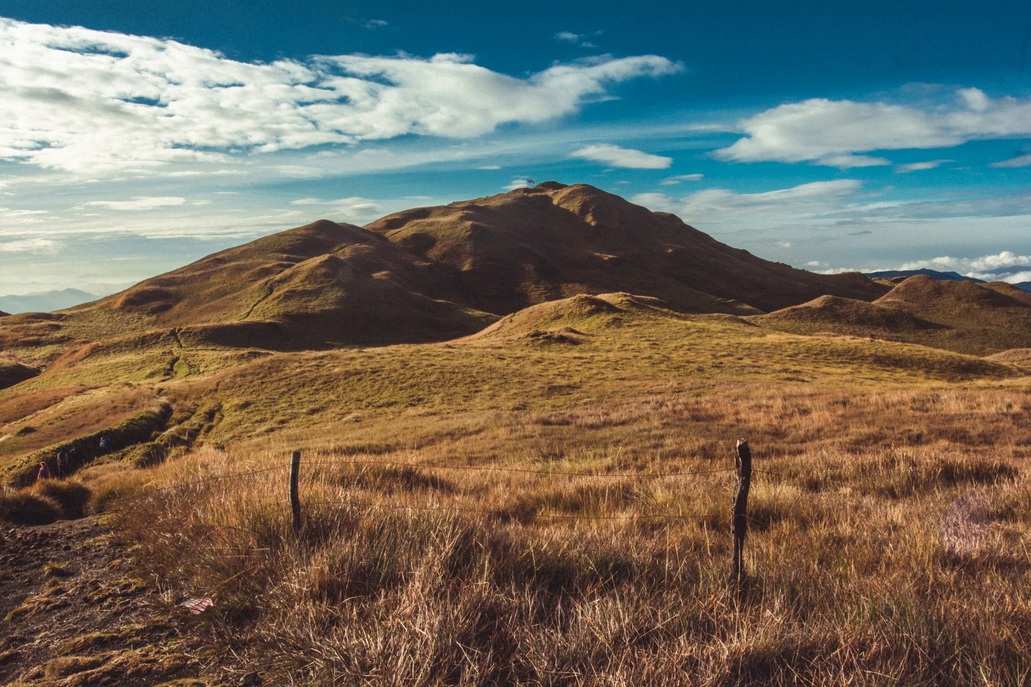
What Is the Mt. Pulag Ambangeg Trail Like?
The Ambangeg Trail is the most beginner-friendly route, often called the “Executive Trail.” It features a well-established path, gentle slopes, and a shorter trek of about 3 to 4 hours to the summit, depending on pace.
Trail Overview
The trail covers approximately 11.1 miles as an out-and-back route and takes an average of 6 hours 36 minutes to complete round trip. The elevation gain is 3,231 feet, which sounds significant — and you will feel it near the summit — but the gradient is gradual enough that steady plodding gets most people there.
Stage Breakdown
- Babadak Ranger Station → Camp 1: Roughly 1 hour on a wide, pine-shaded path with gentle inclines. This section smells like a Benguet Christmas card — cold air, pine resin, and damp soil underfoot.
- Camp 1 → Camp 2: Another 2 hours, where the trail transitions into the mossy forest section. The mossy forest starts after Camp 1 and continues until Camp 2. This is hands-down the most atmospheric stretch — think gnarled trees draped in green moss that muffles every sound.
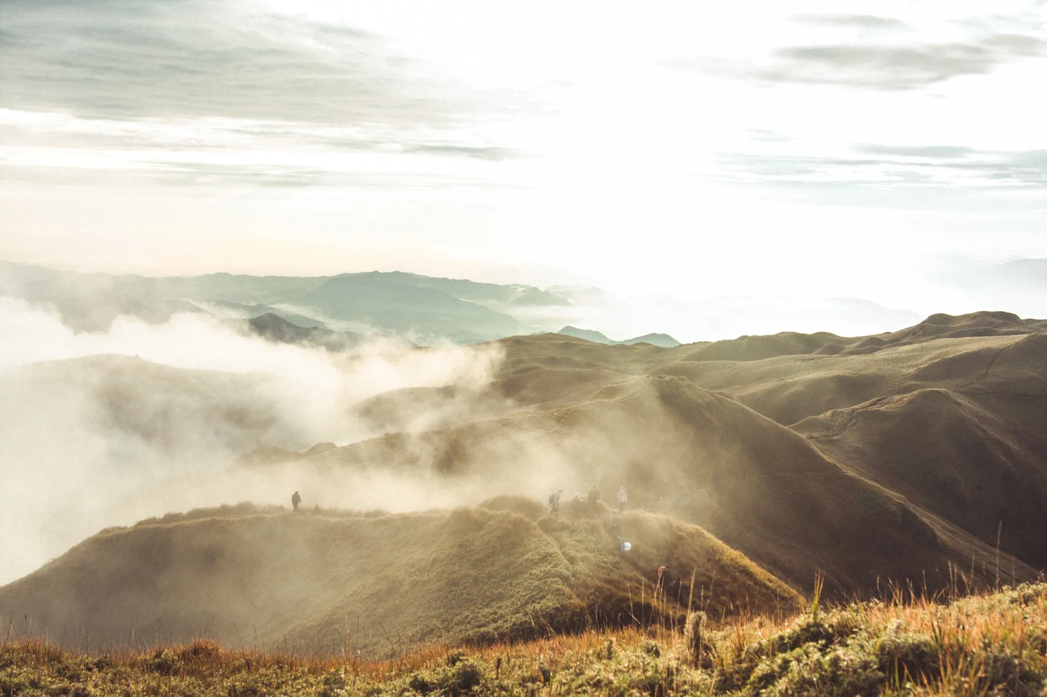
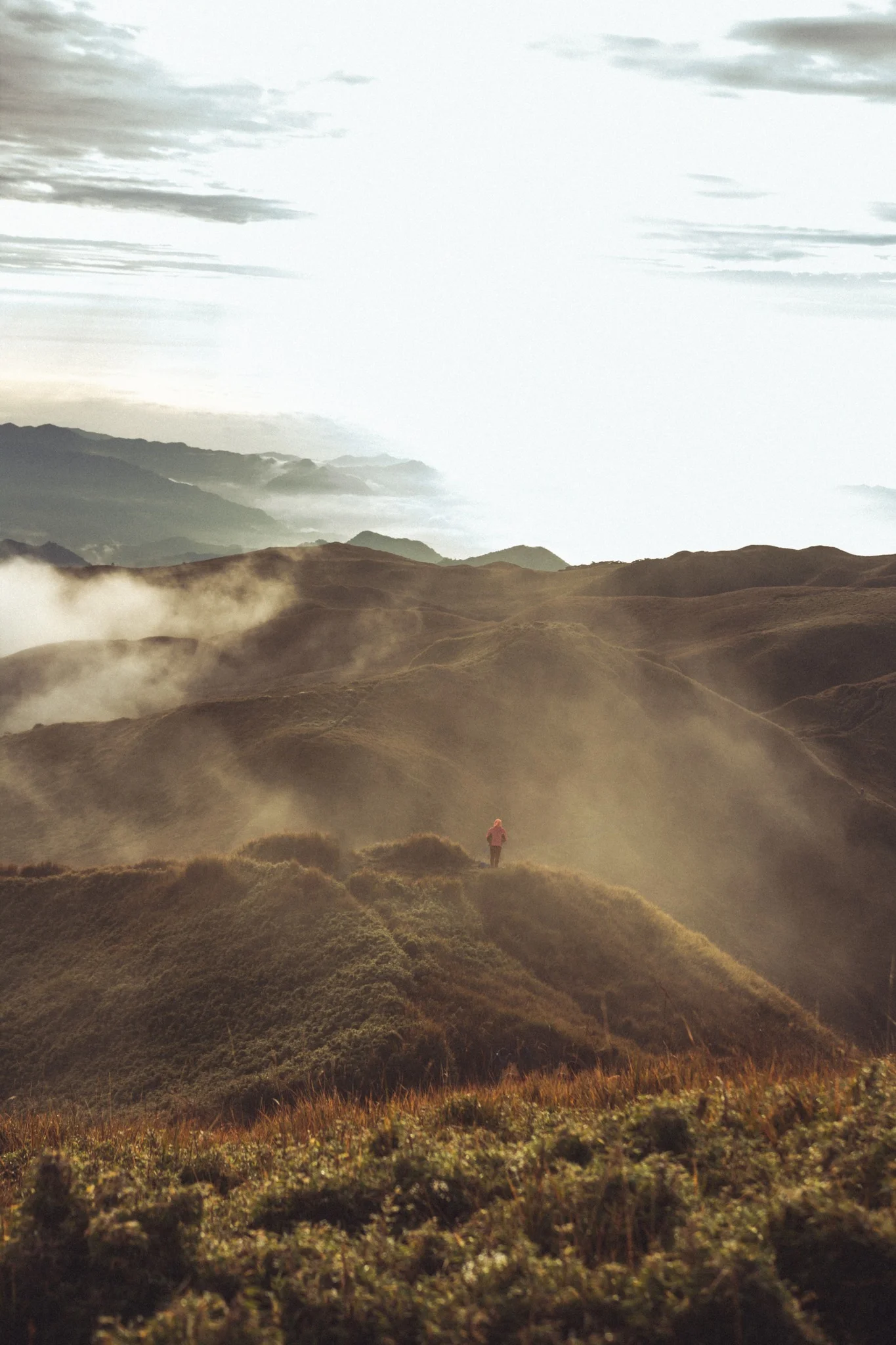
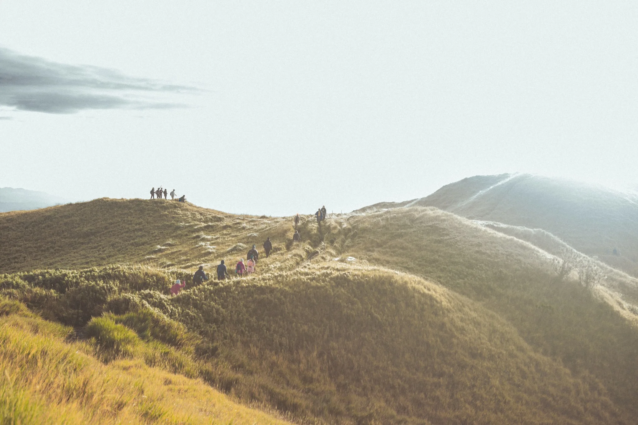
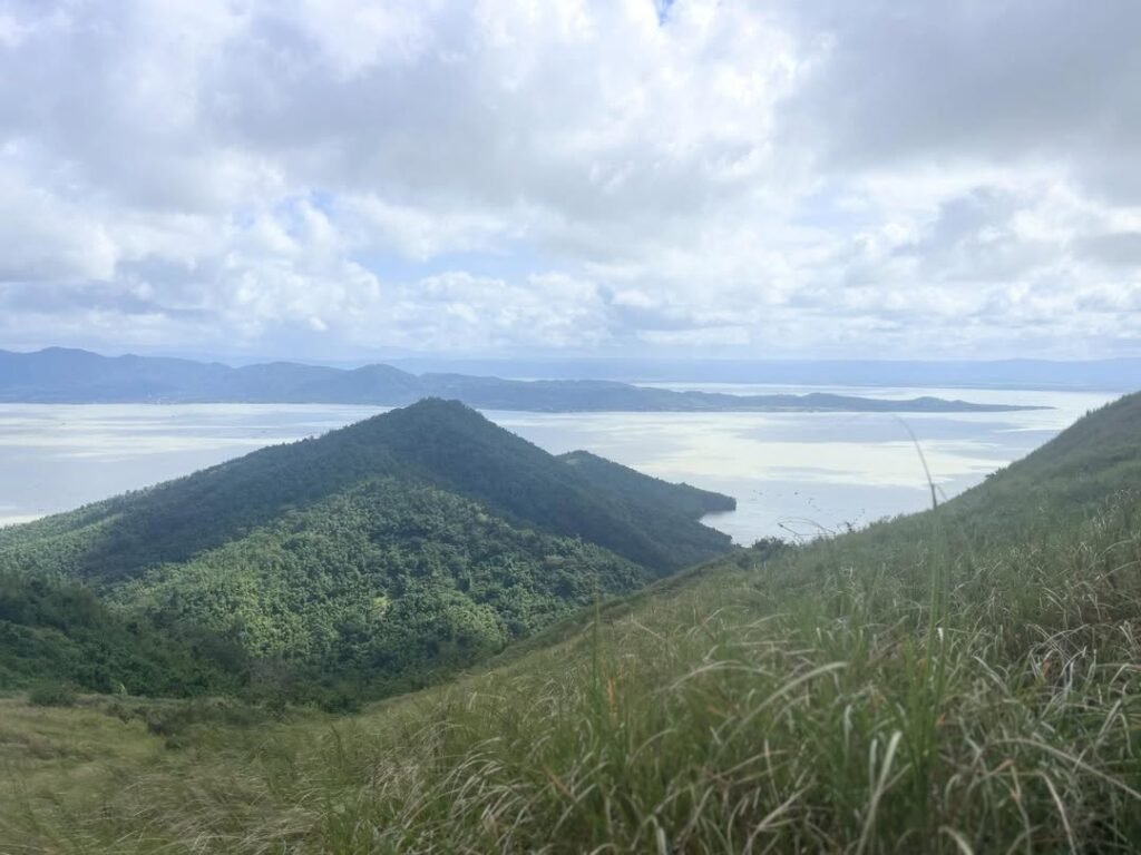
- Camp 2 → Summit: The final push, roughly 1 to 2 hours, exiting the treeline into open dwarf bamboo grasslands. At the summit, you find your spot among the dwarf bamboo facing east. The grass is knee-high, the air is thin, and the silence up there — before the crowds arrive — is remarkable.
- Descent: Hike to Camp 2 takes 4 to 6 hours depending on pace, with another 1–2 hours from Camp 2 to the summit. Descent is notably faster.
Trail Surface and Conditions
Mt. Pulag via Ambangeg is the most friendly trailhead, with moderate terrain that is mostly scenic, especially in the mossy forest and in the grasslands. The trail is wide and well-marked for most of the route. After rain, sections near Camp 1 turn slippery — trekking poles prevent a lot of the stumbles you’ll otherwise have on the descent.
The trail features a gradual ascent with well-maintained paths, and 2025 updates added new designated rest stops with trash bins to combat litter.
Water Sources
There are potable water sources 2–3 times along the way, but it is still advisable to bring enough water and personally treat it. Carry at least 2 liters from the ranger station — more if you run hot.
Is Mt. Pulag via Ambangeg Trail Good for Beginners?
Yes — the Ambangeg trail is the right starting point for any first or second-time high-altitude climber in the Philippines.
Ambangeg scores 3 out of 9 on the difficulty scale, making it beginner-friendly and earning it the “Executive Trail” label. The trail has no rope sections, river crossings, or boulder scrambles. However, the altitude — 2,926 MASL — means even fit hikers can feel breathless on the final grassland push.
Since this trail is very popular, people of all different experience levels do this hike. It may be hard for first-time hikers, so conditioning your body with cardio for at least 2 months before your actual hike is recommended.
If you want to build toward Pulag via Ambangeg, consider easier neighboring mountains first. Check out our guides on beginner-friendly hikes in Benguet or the Mt. Ulap trail in Itogon — both are excellent warm-up climbs.
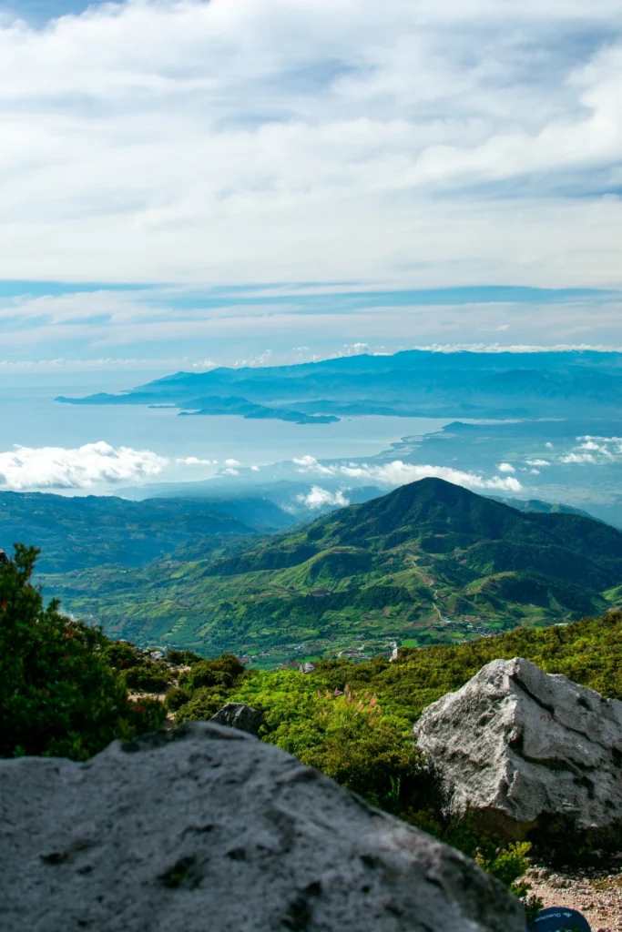
The Summit Experience at Mt. Pulag via Ambangeg Trail
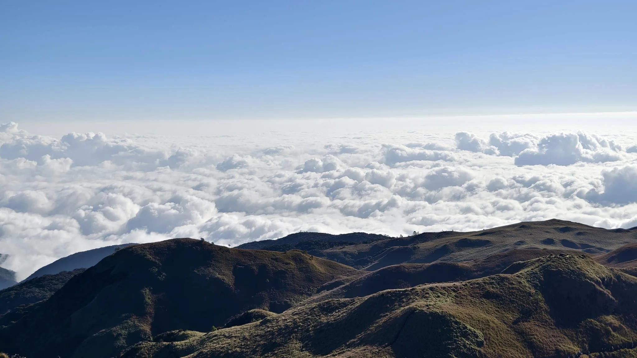
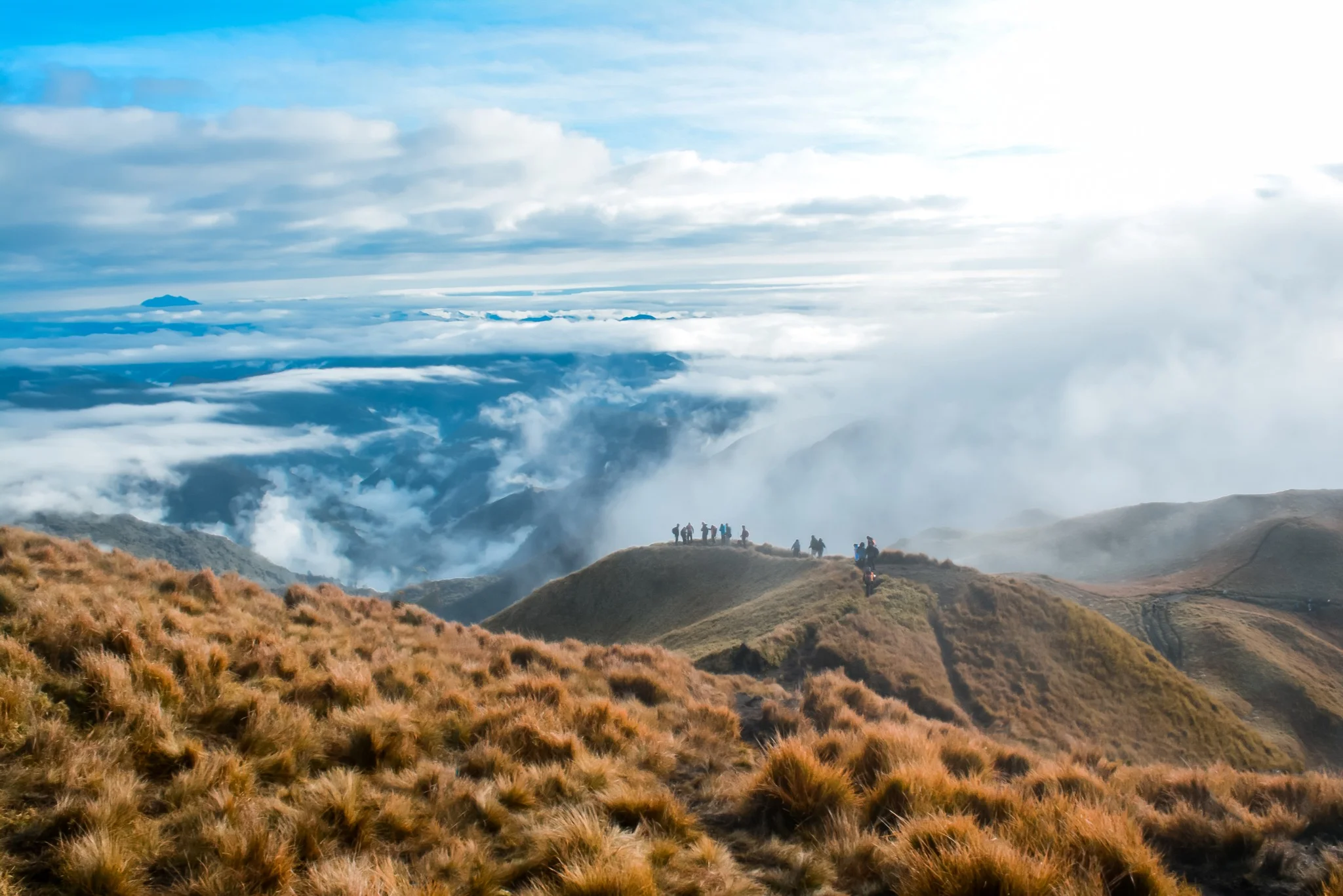
The summit of Mt. Pulag is not a dramatic rock pinnacle — it’s a wide, open ridge carpeted in dwarf bamboo grass, and that flatness is what makes it feel infinite.
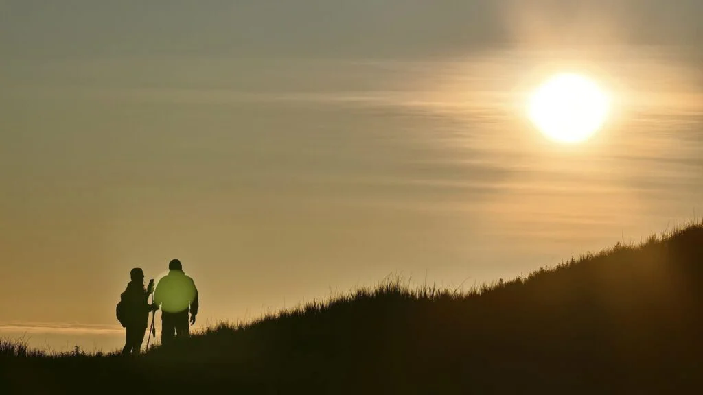
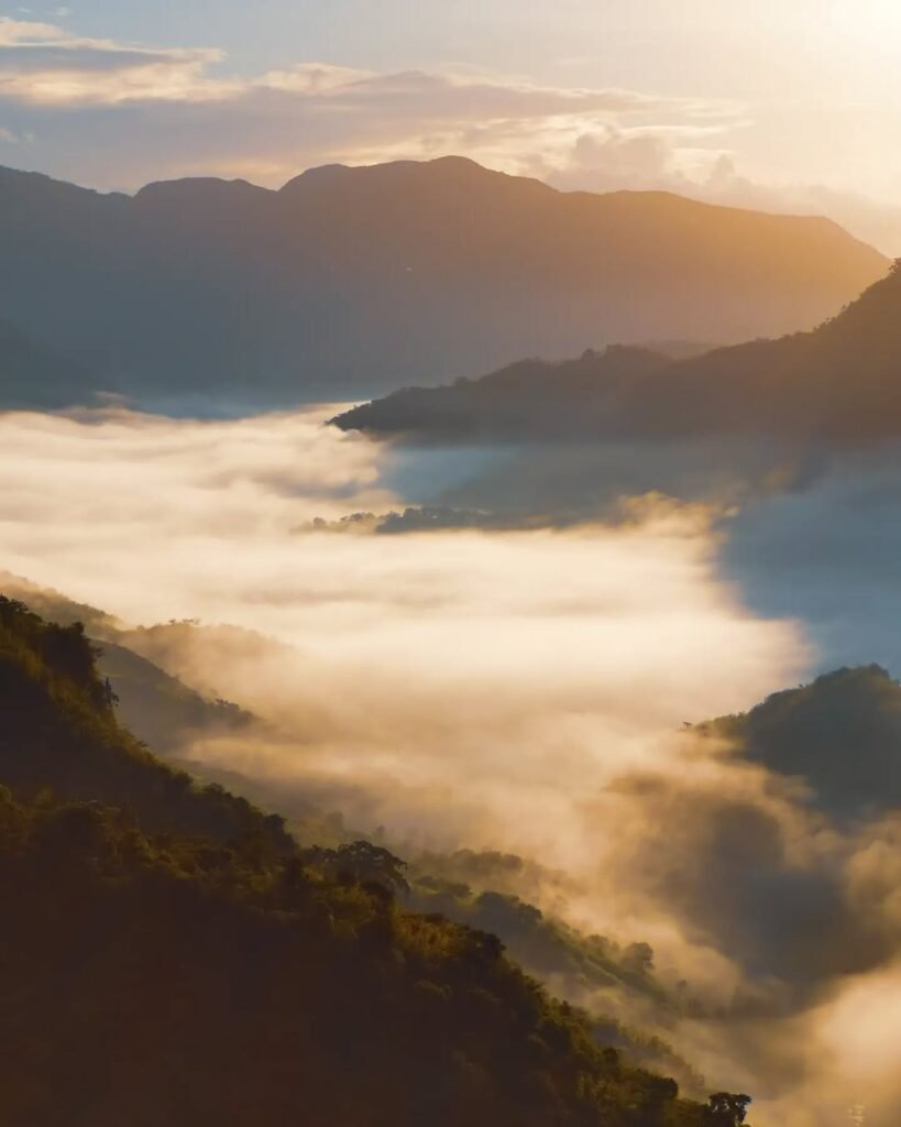
I reached the summit in February 2026 just as the sky was shifting from deep blue to amber. At first, nothing — just thick fog pressing in from all directions and a dozen headlamps blinking around me. Then, around 7:00 AM, the fog broke. Not gradually. It broke like a stage curtain being pulled aside, and beneath us was a complete, unbroken ocean of white cloud stretching to every horizon. That moment is why people climb this mountain multiple times.
The summit area itself holds a commemorative marker and enough flat space for several dozen people to sit comfortably. What the summit does not have: shelter from wind. Bring a windproof outer shell — even in February, the wind at the top felt like standing in front of an industrial freezer.

Sea of Clouds and Sunrise at Mt. Pulag via Ambangeg Trail
The Mt. Pulag sea of clouds is the defining experience of this climb — and it is entirely weather-dependent.
It is a blessing if it rains the night before your hike; most people hike Mount Pulag for its stunning views of a “sea of clouds.” Rain the previous night drops moisture into the valleys, which condenses into cloud layers by morning — exactly the conditions that create the effect. Sunrise from the summit is legendary — hikers gather early to secure a spot and watch the sun lift over the cloud layers, painting the peaks in gold and pink.
The dry season from December to February offers the best chance — approximately 85% probability of a clear sunrise during this window. The standard tactic is a 2:00 AM departure from the Babadak Ranger Station, targeting a 5:30–6:00 AM summit arrival before sunrise.
My honest caveat: we were packed in with a massive crowd on that February morning. The sea of clouds appeared, but it appeared with hundreds of other hikers. The experience was still spectacular — but not the solitary, meditative moment the photos suggest.
Best Time to Climb Mt. Pulag via Ambangeg Trail
The best season is from November to May during the dry season. During the rainy season, hikes are often cancelled, trails become muddy, and visibility is poor.
The best months to visit the trail are December through April. January and February specifically are peak months — the dry conditions and cold temperatures produce the most reliable sea of clouds. However, this is also when the trail is most crowded.
For a balance of good weather and fewer people, late April and early November are excellent choices. Weekdays are significantly less crowded than weekends — try going on a weekday if you can. Avoid the rainy season months of July through September entirely — trails become treacherous, and the DENR frequently closes the park.
Budget Breakdown for Climbing Mt. Pulag via Ambangeg Trail
| Expense | Estimated Cost (PHP) |
|---|---|
| Bus fare (Manila–Baguio, one way) | ₱500–₱850 |
| Transport (Baguio–DENR–Ranger Station, shared charter) | ₱800–₱1,500/person |
| DENR Environmental Fee (weekday) | ₱250/person |
| Admin & LGU Fees | ~₱100/person |
| Guide Fee | ₱1,200/group (1–5 pax) |
| Medical Certificate (if secured at Ambangeg) | ₱150 |
| Homestay at Babadak | ₱500/person |
| Food (all meals, 2D1N) | ₱400–₱600/person |
| Habal-habal (DENR to Ranger Station, one way) | ₱500/person |
| Miscellaneous (snacks, extra water) | ₱150–₱200 |
| Total Estimated Budget | ₱4,000–₱5,500/person |
Total transport from Manila to Baguio to Pulag costs approximately ₱4,000 covering bus and shared jeep portions. DIY trekkers who group up and share chartered vehicles can reduce per-head transport costs significantly.
What to Pack for Mt. Pulag via Ambangeg Trail
Mt. Pulag can experience extreme lows as cold as -5°C (23°F), particularly during early mornings; average temperature is about 10–15°C (50–59°F). Packing for cold is not optional.
| Item | Essential? |
|---|---|
| Thermal base layer (top and bottom) | ✅ Yes |
| Fleece mid-layer or down jacket | ✅ Yes |
| Windproof/waterproof outer shell | ✅ Yes |
| Thermal gloves | ✅ Yes |
| Wool or thermal beanie | ✅ Yes |
| Headlamp + extra batteries | ✅ Yes |
| Trekking poles | ✅ Yes |
| Sleeping bag (rated 0°C or below) | ✅ Yes (if camping) |
| Tent | ✅ Yes (if camping; rentals available) |
| Water bottles or hydration bladder (2L+) | ✅ Yes |
| Camp stove + gas canister | ✅ Yes (campfire strictly prohibited) |
| Dry bags or waterproof pack liner | ✅ Yes |
| Extra socks (wool preferred) | ✅ Yes |
| Sunscreen + sunglasses | ✅ Yes |
| First aid kit + personal medications | ✅ Yes |
| Trekking shoes (waterproof) | ✅ Yes |
| Snacks (energy bars, nuts, chocolate) | ✅ Yes |
| Trekking poles | Recommended |
| Neck gaiter / balaclava | Recommended |
| Portable power bank | Recommended |
Building a campfire is strictly prohibited. Visitors must bring their own camping stoves and cooking utensils. Camping is allowed only in designated campsites.
Stock up on food in Baguio City before the trip. Mini-stores are found near the Babadak Ranger Station, but bigger groups are advised to purchase in Baguio City as the stores cannot cater to larger groups.
Safety Tips for Climbing Mt. Pulag via Ambangeg Trail
Cold weather is the primary hazard. During the coldest months, the grassland and Babadak area experience frost — all visitors must come with proper clothing.
- Altitude sickness is real. Acclimatize at the DENR office (approximately 2,300m) for 1–2 hours. Hydrate with electrolytes and avoid alcohol. If you experience severe headache, dizziness, or nausea, descend immediately.
- No walk-ins, ever. There are absolutely no walk-ins. Pre-booking and a medical certificate are mandatory.
- Cash only. The ranger station has no ATMs and no reliable e-wallet signal. Bring exact amounts in small bills.
- Leave No Trace. All visitors must keep the park area clean and must carry out all trash and garbage.
- Night hiking requires a headlamp. Starting at 2:00 AM means you will be on trail in complete darkness — a headlamp with fresh batteries is non-negotiable.
- Acclimatize properly before your hike to avoid altitude sickness — dress warm as it can get almost freezing.
- For hikers interested in other challenging Benguet climbs after completing Pulag, check out Mt. Kabunian in Bakun or the Mt. Kotkot–Benguet traverse.
Frequently Asked Questions About Mt. Pulag via Ambangeg Trail
1. What is the Mt. Pulag height and why does it matter for the climb?
Mt. Pulag is the third-highest peak in the Philippines at 2,926 MASL, renowned for its sea of clouds and distinct ecological zones ranging from pine forests to dwarf bamboo grasslands. The elevation means thinner air — even fit hikers will breathe harder above 2,500 MASL, and altitude sickness is a genuine risk for people who arrive without acclimatization time.
2. How do I book a DENR permit for the Ambangeg trail, and how far in advance?
Secure your climb reservation via the DENR Mt. Pulag Office in advance — preferably 1–2 months before your planned trip. For peak season travel, lock in your slot at least 6 months in advance. No reservation means no climb — this is strictly enforced. Call the DENR Mt. Pulag Office directly at 09127628844 or 09103010423.
3. Can I hike Mt. Pulag via Ambangeg trail without a guide?
Climbing Mt. Pulag without a guide is not an option. Guides are an integral part of the registration process and ensure your safety during ascent and descent. Even for seasoned climbers, the presence of an experienced guide is mandatory. You hire your guide at the Babadak Ranger Station after completing DENR registration.
4. Is camping allowed at Mt. Pulag via the Ambangeg trail?
Camping is only allowed on weekdays, in line with the 2026 weekend camping ban. Camping is only permitted at designated sites. Fines up to ₱5,000 apply for violations. The designated camping areas at Camp 1 and Camp 2 offer excellent views and are better protected from extreme weather.
5. What is the best time to see the sea of clouds at Mt. Pulag?
Going early in the year — January or February — gives the best chance to reach the sea of clouds view. If clouds are your main goal, mornings after clear nights give the best chance to see the sea of clouds phenomenon. Arrive at the summit before sunrise — around 5:30–6:00 AM — for peak conditions.
Final Verdict: Should You Climb Mt. Pulag via Ambangeg Trail?
5 out of 5 for first-time high-altitude hikers in the Philippines. The Ambangeg trail gives you the full Mt. Pulag experience — the pine forests, the mossy tunnel, the grassland summit, and the sea of clouds — without requiring technical climbing skills. My only honest note: the crowding during peak weekends (especially January and February) is real and takes a small edge off the solitude, so book a weekday slot if your schedule allows. For a broader list of mountains to add to your Cordillera bucket list, head to our complete guide to mountains in the Philippines — and if you want something more challenging once you’ve conquered Pulag, the Mt. Kimat hiking guide is worth reading next.
Pingback: Travel Guide: Explore the Beauty of the Philippines with Exp – BizLinkBuilder
Thanks for sharing. I read many of your blog posts, cool, your blog is very good.
Hi, thanks for sharing the DIY. Do you now if there is a schedule trip from ranger station to baguio?
Thank you