Mt. Baruyen is a beginner-friendly day hike in Licuan-Baay, Abra, standing at 1,036 MASL with a difficulty rating of 3 out of 9 — doable in a single day from Metro Manila if you catch the 6:00 AM jeepney from Bangued. The summit rewards you with an almost surreal landscape that looks exactly like the Windows XP default wallpaper, all rolling green hills under a wide open sky. Getting there is the hardest part, and this guide will make sure you don’t miss your only shot at it.
Mt. Baruyen Quick Guide
| Detail | Info |
|---|---|
| Mountain | Mt. Baruyen (Baluyen) |
| Location | Licuan-Baay, Abra, Cordillera Administrative Region |
| Province | Abra |
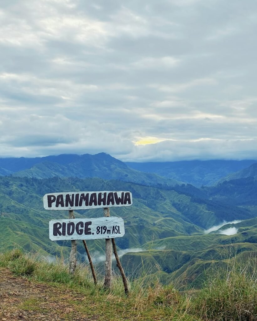
| Elevation | 1,036 MASL |
| Difficulty | 3 out of 9 (Minor Climb, Trail Class 1–2) |
| Jump-off | Sitio Bonglo, along Route 204 (Abra-Kalinga Road) |
| Best Season | November to May (dry season) |
| Trek Time | 1–2 hours to summit; 3–4 hours round trip |
| Registration | Mandatory at Sitio Bonglo registration hut |
| Campsite | Not the primary setup; recommended as a day hike only |
Table of Contents
Where Is Mt. Baruyen Located?
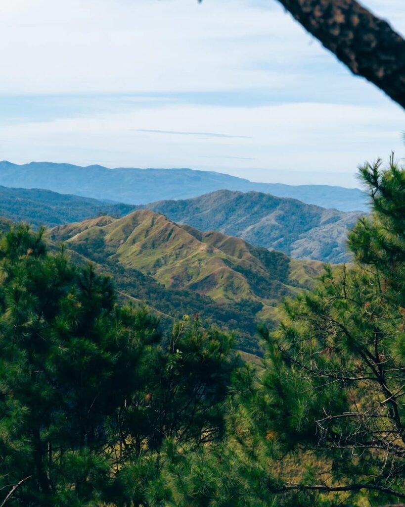
Mt. Baruyen sits inside the municipality of Licuan-Baay in the province of Abra, in the Cordillera Administrative Region of Northern Luzon. The jump-off point is at Sitio Bonglo, positioned along the Abra-Kalinga Road (Route 204), between Kilometer 459 and Kilometer 460. This places it deep inside the Cordillera mountain corridor — scenic, remote, and genuinely off the beaten tourist path.
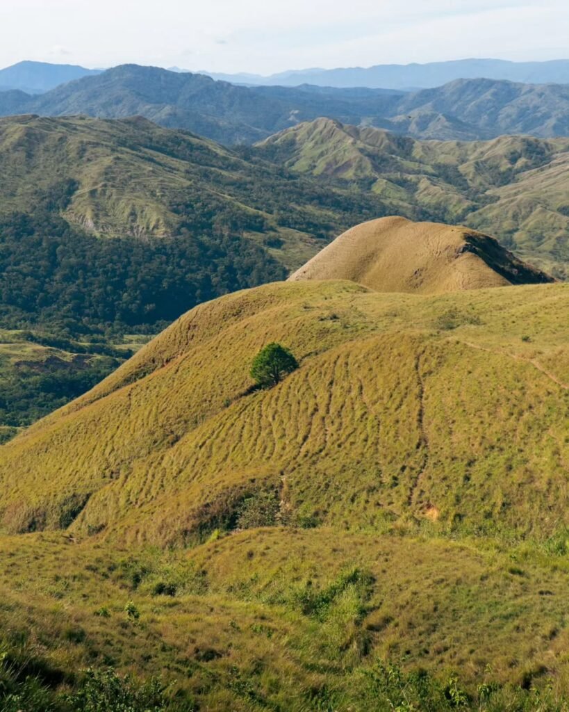
What makes the Mt. Baruyen location so striking is how abruptly the landscape opens up. You travel through winding mountain roads hemmed in by forest, and then suddenly the terrain shifts into sweeping grassland hills that seem to belong on another continent. The mountain is administered under the Licuan-Baay LGU, which also manages the registration system and guide assignments at the trailhead.
If you are planning a broader Abra trip, Mt. Baruyen pairs well with other highlights in the province. The Kaparkan Falls in Abra is another dramatic natural destination worth adding to your itinerary, and you can find a broader overview of Abra tourist spots and things to do here.
How to Get to the Mt. Baruyen Jump-off Point
Getting to the Mt. Baruyen jump-off is straightforward on paper and logistically demanding in practice — the commute is the single biggest challenge of this hike, and most first-timers underestimate it.
From Metro Manila, board a Partas bus bound for Bangued, Abra. The overnight trip takes 8 to 10 hours, and the Partas Deluxe fare runs approximately ₱1,100 one way (around ₱2,200 roundtrip). Book your seat in advance, especially on weekends. You will arrive at the Bangued Bus Terminal in the early morning, which works perfectly in your favor.
From Bangued, you need to reach Sitio Bonglo — roughly 40 to 50 kilometers away. There are two options. The first is the Malibcong-bound public jeepney, which departs from the Bangued Jeepney Terminal at exactly 6:00 AM. Miss this jeep and you have effectively missed your hike, because it is often the only morning trip bound for the Licuan-Baay direction. The second option is chartering a “Monster Jeep” — a locally modified 4×4 jeepney built for rough mountain roads — which gives your group full schedule control but costs more. For a group of five sharing the charter fee, the per-head cost becomes very manageable.
If you are driving your own vehicle, a 4×4 or high-clearance vehicle is the right call for this route. The jump-off at Sitio Bonglo is a roadside registration stop along Route 204, not a developed trailhead. There is no confirmed formal parking area, so coordinate with the barangay captain in advance if you are driving up. An off-road motorcycle is another option some local guides use.
The honest takeaway on transportation: I climbed Mt. Baruyen in May 2026, and the commute genuinely tested my patience more than the hike itself. Getting a group together specifically to charter a Monster Jeep is the smartest move you can make for this mountain. The flexibility it gives you — especially on the return trip — is worth every extra peso split among five people.

Permits, Fees, and Guide Requirements at Mt. Baruyen
Registration is mandatory for all hikers, conducted on-site at the Sitio Bonglo registration hut right at the jump-off. You do not need to visit any town hall before heading up — the process happens at the trailhead itself, between Km 459 and Km 460 on Route 204.
The environmental fee is ₱10 per person, collected by Licuan-Baay LGU staff at the registration hut. Bring small bills — ₱20, ₱50, or ₱100 denominations — because the staff rarely have change for larger notes. Cell signal along this stretch of Route 204 is intermittent at best, making GCash and PayMaya effectively useless at the registration point. Cash only.
A standard liability waiver must be signed before entry. As of 2026, no medical certificate is required for Mt. Baruyen. Walk-in registration is accepted for small groups of 1 to 5 hikers, but if your group is larger, coordinate with the Licuan-Baay Tourism Office in advance to guarantee that enough guides will be available.
Local guides are arranged at the kiosk near the Brgy Bonglo Arch. The official guide ratio is 1 guide for every 5 hikers. The guide fee is ₱500 per group. For advance coordination, contact Edgar, the Barangay Captain of Bonglo, at 09650815952. While the trail technically passes through grassland that looks open and navigable, a local guide is strongly recommended — the featureless terrain in the middle sections offers few reliable landmarks for someone who has never been there.

What Is the Mt. Baruyen Trail Like?
The Mt. Baruyen trail earns its Difficulty 3/9 rating honestly in terms of physical exertion — but the “real feel” of this hike depends almost entirely on what time you start and what the sun is doing overhead.
The Terrain
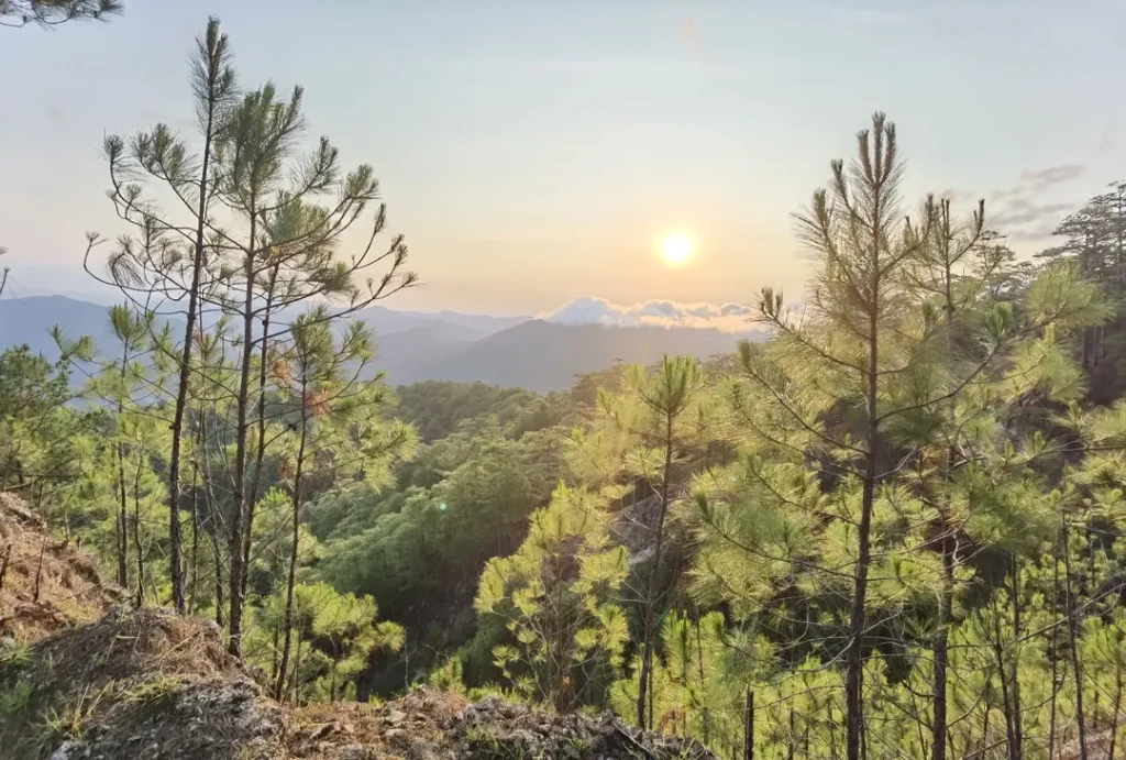
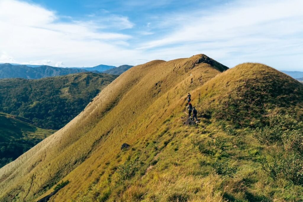
The trail starts at Sitio Bonglo and gains approximately +222 meters of elevation to reach the 1,036 MASL summit. Roughly 60 to 70 percent of the route is open grassland, which means virtually no shade for the majority of the hike. The first section offers a brief buffer of pine trees, but once you clear that, you are fully exposed.
The summit complex features two standout geological features: the Rock Garden and Lion’s Ledge. Both are sharp karst limestone formations that require careful footing. This is where gloves become genuinely useful — not for warmth, but for gripping rock as you scramble to the highest point.
Trail Stages
- Jump-off at Sitio Bonglo (Route 204): Register, sign waiver, pay ₱10 fee, meet your guide.
- Pine forest buffer: Short initial section with shade — enjoy it while it lasts.
- Open grassland traverse: The long, sun-exposed middle section where pace and hydration management matter most.
- Karst approach: The terrain transitions to limestone near the summit; footing becomes technical here.
- Rock Garden and Lion’s Ledge: The summit zone — scramble carefully, the views pay off immediately.
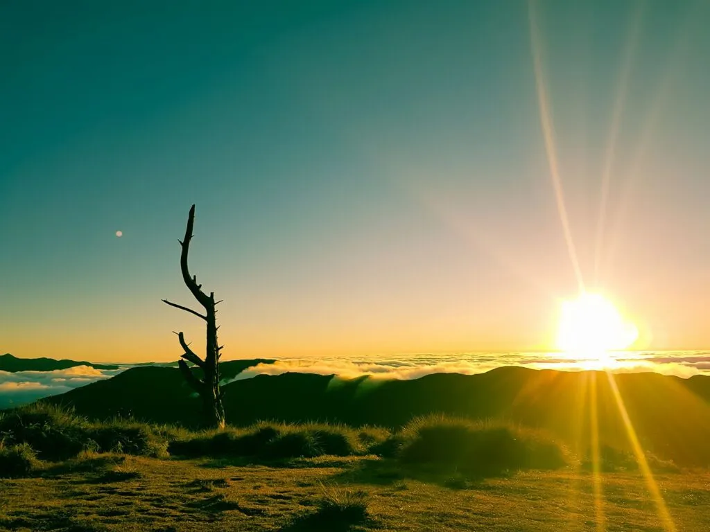
- Summit at 1,036 MASL: The Windows XP wallpaper moment. Rolling green hills in every direction, sky wide open.
What Nobody Tells You About the Middle Section
The cogon grass along the open grassland stretches is not just scenery — it is a hazard. Trekking pants are non-negotiable on this trail because cogon blades cut skin efficiently and without much drama. You will not feel the cuts immediately, but by the time you descend, your shins will tell the story if you wore shorts. I learned this from watching another hiker in our group discover it the hard way around the halfway mark.
Summit Experience
Standing at the top of Mt. Baruyen in May 2026 was the moment that made the entire commute worth it. The view is genuinely hard to describe without sounding like you are exaggerating — the landscape below the summit is a precise real-world replica of the Windows XP “Bliss” wallpaper, with soft green hills rolling into the distance under an almost offensively blue sky. It stops you mid-step. People in our group who had climbed several mountains before said they had not seen anything quite like it in the Philippines. The Rock Garden adds a textural contrast to the softness of the grasslands, and Lion’s Ledge gives you a vantage point that makes the whole scene feel cinematic.

Is Mt. Baruyen Good for Beginners?
Mt. Baruyen is an excellent beginner mountain with one important caveat: the logistics, not the trail, are where first-timers struggle. The Difficulty 3/9 rating accurately reflects the physical demand — the elevation gain is modest, the trail has no genuinely technical sections except the karst scramble near the summit, and the 1 to 2 hour summit time is well within reach for someone of average fitness.
The challenge is the heat exposure in the open grassland and the transport timing to and from the jump-off. A beginner who manages both — starts early, carries enough water, and secures the return jeepney’s contact number — will have an enjoyable and rewarding experience. For a broader look at mountains suited to new hikers, this [guide to beginner-friendly minor climbs in the Philippines](https://lakbaypinas.com/beginner-friendly-hikes-minor-climb-mountain/) is worth reading before you book your bus ticket.
Best Time to Climb Mt. Baruyen
The dry season from November to May is the best window for climbing Mt. Baruyen. During this period, the grasslands are at their most vivid green, trail conditions are stable, and the sky cooperates for summit views.
May is technically at the tail end of the dry season, and the heat is real — our climb in May 2026 had the grassland section feeling like a slow cooker by mid-morning. Start before 8:00 AM to finish the exposed sections before the worst of the midday heat sets in. Avoid hiking between 10:00 AM and 2:00 PM if you can help it, as the Difficulty 3 rating effectively increases due to heat stress during those hours.
The wet season (June to October) makes the grassland muddy and the karst slippery, which raises the actual risk level on what is otherwise a straightforward trail. The cogon grass also grows denser in the wet season, increasing the risk of cuts.
Budget Breakdown for Climbing Mt. Baruyen
| Expense | Cost (PHP) |
|---|---|
| Partas bus fare, Manila–Bangued (roundtrip) | ₱2,200 |
| Jeepney fare, Bangued–Sitio Bonglo (roundtrip) | ₱200–₱300 |
| Monster Jeep charter (split among 5 pax) | ₱200–₱300/head |
| Environmental fee | ₱10 |
| Guide fee (per group of up to 5) | ₱500 (₱100/head in a group of 5) |
| Tapsilog or food at jump-off / along the way | ₱80–₱150 |
| Water and trail snacks | ₱100–₱150 |
| Solo DIY Total (estimated) | ~₱3,500 |
| Group of 5 Total (estimated per head) | ~₱3,100 |
The tapsilog I had near the jump-off before the hike in May 2026 was a full meal for around ₱100 — rice, beef tapa, and a fried egg. It is not a restaurant; it is the kind of roadside setup that appears wherever there is mountain foot traffic. Eat before you register and start walking.
What to Pack for Mt. Baruyen
| Item | Essential? |
|---|---|
| 1.5–2 liters of water (minimum) | ✅ Yes — no water sources on trail |
| UV-blocking umbrella or wide-brim hat | ✅ Yes — 60–70% exposed terrain |
| Trekking pants (not shorts) | ✅ Yes — cogon grass cuts |
| Gloves (lightweight) | ✅ Yes — karst scrambling at summit |
| Closed-toe trail runners | ✅ Yes — superior to sandals on this trail |
| Sunscreen (SPF 50+) | ✅ Yes |
| Trail snacks / packed lunch | ✅ Yes |
| Small bills (₱20, ₱50, ₱100) | ✅ Yes — for fees; no digital payment signal |
| Trekking poles | Optional — helpful on descent |
| Rain jacket | Recommended in shoulder season |
| Camera or phone with full charge | ✅ Yes — the summit view demands it |
Leave the sandals at home. The combination of cogon grass, limestone karst, and dusty trail makes closed-toe shoes a practical necessity, not just a recommendation. Trail runners with grip work better here than heavy hiking boots.
Safety Tips for Climbing Mt. Baruyen
The trail is manageable, but these specific hazards on Mt. Baruyen are worth taking seriously.
Carry a minimum of 1.5 to 2 liters of water per person. There are zero water sources along the entire Mt. Baruyen trail. Running out of water on an exposed grassland with no shade and no resupply point is a genuinely dangerous situation, not just an uncomfortable one.
Start before 8:00 AM. The open grassland sections become punishing between 10:00 AM and 2:00 PM. An early start means you summit while the temperature is still reasonable and descend before the heat peaks.
Secure the return jeepney driver’s mobile number before you start hiking. Public jeeps from Malibcong passing through Sitio Bonglo on the way back to Bangued are sparse, and the last trip often passes through between 2:00 PM and 3:00 PM. Miss that window and stranding becomes a real possibility. Get the number at registration and coordinate your return time explicitly.
Wear full trekking pants, not shorts. The cogon grass along the grassland section cuts skin on contact. You will not feel it during the hike, but you will see the results on your shins when you get back.
Gloves for the summit karst. The Rock Garden and Lion’s Ledge involve hands-on scrambling over sharp limestone. Lightweight gloves protect your palms and give you better grip on the rock surface.
Frequently Asked Questions About Mt. Baruyen
Is Mt. Baruyen a day hike or can you camp there?
Mt. Baruyen is best experienced as a day hike. The entire round trip, including time at the summit, takes approximately 3 to 4 hours for a beginner at a steady pace. Camping is not the standard setup for this mountain, and the logistical challenge of the last jeepney window at 2:00–3:00 PM makes an overnight stay impractical without a private vehicle or pre-arranged transport.
Do I need a guide to climb Mt. Baruyen?
A local guide is strongly recommended, particularly for first-time visitors. Guides are arranged at the kiosk near the Brgy Bonglo Arch at the jump-off, at a rate of ₱500 per group of up to 5 hikers. The open grassland sections have minimal trail markings, and having a guide eliminates the risk of wandering off-route on featureless terrain. For advance booking, contact Brgy Captain Edgar at 09650815952.
Is there cell signal on the Mt. Baruyen trail?
Signal along Route 204 and the Sitio Bonglo registration area is intermittent, and on the trail itself it is effectively unreliable. Do not count on GCash, PayMaya, or mobile data during your hike. Bring cash in small denominations for all fees, and download offline maps before you leave Bangued.
What makes Mt. Baruyen worth the long commute from Manila?
The summit view is genuinely unlike anything else in the Philippines at this difficulty level. The landscape — wide rolling green hills, karst rock formations, and an open sky — is a real-world version of the Windows XP “Bliss” wallpaper, and that is not an exaggeration made for the internet. For a Difficulty 3/9 mountain, the reward-to-effort ratio on the trail itself is extremely high. The commute is the actual effort investment, and the summit pays it back in full.
How do I get back to Bangued from Mt. Baruyen after the hike?
Flag down a public jeepney from Malibcong passing through Sitio Bonglo on Route 204, or arrange for your chartered Monster Jeep driver to return at a set time. The last public jeep typically passes between 2:00 PM and 3:00 PM — confirm this with your guide on the day of your climb. Getting the driver’s mobile number before you start hiking is the single most important logistical step for your return.
Final Verdict: Should You Climb Mt. Baruyen?
4.5 out of 5 for beginner and casual hikers who have a full day and don’t mind a long bus ride. Mt. Baruyen delivers a summit experience that is genuinely out of proportion with its difficulty rating — the Windows XP grassland view, the limestone rock garden, and the sheer openness of the landscape make it one of the most visually striking easy climbs in Northern Luzon. The commute from Manila is the real climb, and if you treat the transportation logistics as seriously as the trail itself — early bus, 6:00 AM jeepney, water, and a return plan — you will have a day worth repeating.
For a broader look at what the Philippines mountain scene has to offer at all difficulty levels, the complete mountains of the Philippines travel guide is a solid starting point. And if Mt. Baruyen leaves you wanting more of Abra’s peaks, the Mt. Manmanoc guide — Abra’s highest summit is the natural next step up.