Cawag Hexa at a Glance (Quick Facts)
- Location: Subic, Zambales
- Jump-off Point: Sitio Cawag, Subic
- Elevation (Highest): Mt. Balingkilat (1,100+ MASL)
- Total Distance: 25km+
- Difficulty: 9/9 (Major Climb)
- Trail Class: 1-4 (Scrambling required)
- Time Required: 16 – 22 Hours (Day Hike)
- Peaks: Balingkilat, Bira-Bira, Naulaw, Dayungan, Cinco Picos, Redondo.
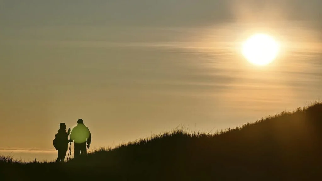
Surviving the Inferno
The Cawag Hexa (or Cawag Hexalogy) is a 9/9 difficulty major day hike in Subic, Zambales, traversing six peaks over 25+ kilometers. Known as “The Infernal Traverse,” it typically requires 16 to 22 hours to complete. Hikers face extreme heat from exposed ultramafic soil and zero shade, making this circuit suitable only for highly conditioned mountaineers.
They call it “The Infernal Traverse” for a reason.
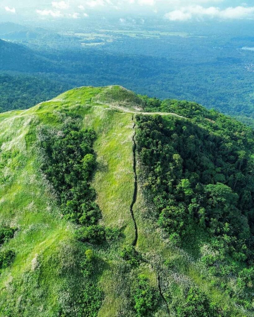
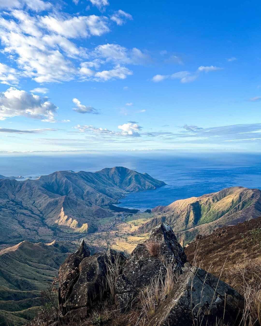
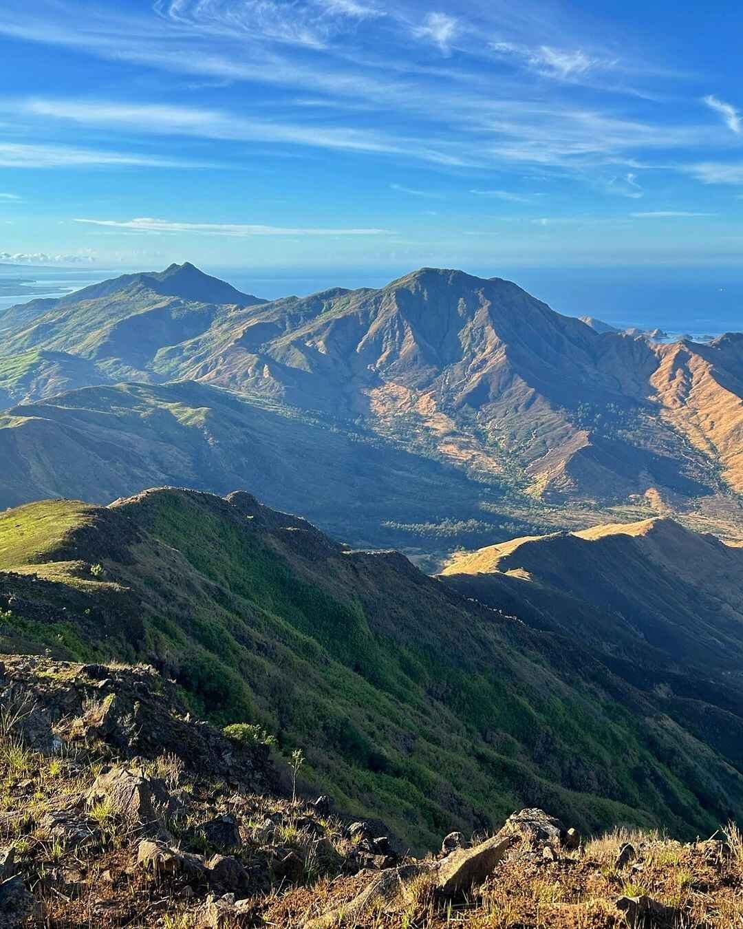
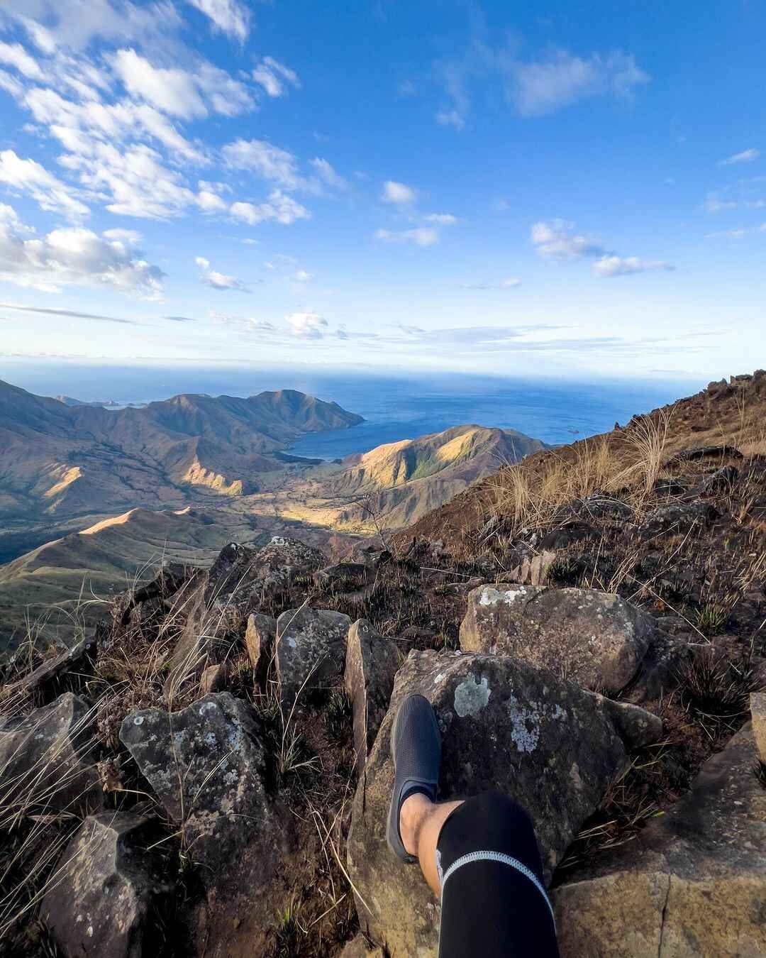
Standing on the ridge, the view is a cruel paradox. To your left, you have the stunning, calming blue waters of the West Philippine Sea and the white sands of Nagsasa Cove. It looks like paradise.
But right under your feet, you are walking on a geological frying pan. The trail traverses the Zambales Ophiolite Complex, a landscape dominated by reddish-brown ultramafic soil and metallic rocks. These rocks don’t just sit there; they absorb the sun’s energy and radiate it back up at you, creating a “convection oven” effect that cooks you from both above and below.
This is the brutal reality of the Cawag Hexa (formally the Cawag Hexalogy). While many visitors come for the beaches of Zambales, this expedition connects six punishing summits: Mt. Balingkilat, Mt. Bira-Bira, Mt. Naulaw, Mt. Dayungan, Mt. Cinco Picos, and Mt. Redondo. It is widely regarded by the local mountaineering community as one of the toughest day hikes in Luzon, often compared in endurance requirements to Mt. Tapulao’s 36km Challenge.
A Strict Warning for Beginners: I cannot stress this enough—this is not a beginner-friendly climb. It is rated 9/9 difficulty.
If you have only hiked minor peaks like Mt. Daraitan or Mt. Batulao, the Cawag Hexa will be a dangerous leap in difficulty. You will face:
25+ kilometers of trekking distance.
2,000+ meters of cumulative elevation gain.
Temperatures that frequently hit 40°C+ by noon with zero canopy cover.
Only attempt this if you have trained for heat endurance and are mentally prepared to be on your feet for up to 22 hours. For a broader look at the region, check our Ultimate Zambales Travel Guide.
Table of Contents
How to Get to Cawag Hexa (Manila to Zambales)
To reach Cawag Hexa from Manila, take a Victory Liner bus (Cubao, Pasay, or Caloocan) to Olongapo City (₱220–₱360, 3-4 hours). From the Victory Liner terminal, you must charter a jeepney or van to Sitio Cawag Chieftain’s Hall (approx. ₱400–₱600/head). Public transport does not service Cawag during the mandatory 1:00 AM start time.
Option A: Public Transport (DIY Commute)
The commute is straightforward, but the “last mile” requires coordination. Most hikers meet their teams at the Victory Liner Terminal in Olongapo.
Step 1: Manila to Olongapo City
Take a Victory Liner bus bound for Olongapo City via SCTEX. You can catch these from their terminals in Cubao, Pasay, or Caloocan.
-
Travel Time: 3 to 4 hours (depending on traffic).
-
Schedule: 24 hours (Buses depart roughly every hour).
-
Fare: ₱280–₱360 (Regular Aircon).
I highly recommend booking your ticket online in advance, especially for Friday night trips, as walk-in lines can get incredibly long.
Step 2: Olongapo to Sitio Cawag (The “Last Mile”)
This is the tricky part. Sitio Cawag is remote, and the Cawag Hexa requires a 1:00 AM or 2:00 AM start time. There are no public jeepneys running at this hour.
You have two choices here:
-
Chartered Jeepney (Recommended): Most organized groups pre-arrange a jeepney pick-up at the terminal. Expect to pay ₱2,500 – ₱3,500 per jeep (good for 10-14 pax), which splits down to roughly ₱250 – ₱350 per head one-way.
-
Tricycle (Solo/Small Group): You can hire a tricycle, but be warned about the “Zoning” issue. Sitio Cawag is considered “out of zone” for Olongapo city trikes. Drivers will often refuse or demand exorbitant “special trip” rates of ₱400 – ₱500 for a one-way ride.
The “Pain Point” Warning:
If you arrive at the Olongapo terminal at 11:00 PM without a pre-booked van or jeep, you are at the mercy of the tricycle drivers. I’ve seen hikers get stranded or ripped off here. Book your local transport in advance.
Option B: Private Vehicle
If you are driving, the route is much simpler. You will be driving mostly on expressways until you hit the Subic expanse.
-
Navigation App: Set Waze or Google Maps to “Sitio Cawag Settlement” or “Cawag Resettlement Area.”
-
Route: Take NLEX > SCTEX > Subic-Tipo Expressway. Exit at Subic and follow the coastal road towards the Hanjin Shipyard area.
-
Parking: There is safe parking available at the Sitio Cawag Chieftain’s Hall (Barangay Hall area).
-
Parking Fee: Usually ₱50 – ₱100 depending on the caretaker.
Transport Budget Summary (One-Way)
| Transport Mode | Route | Estimated Cost |
| Victory Liner Bus | Manila to Olongapo | ₱280 – ₱360 |
| Chartered Jeep | Olongapo to Cawag | ₱250 – ₱350 (shared) |
| Tricycle | Olongapo to Cawag | ₱400 – ₱500 (solo/pakyaw) |
| Private Tolls | NLEX/SCTEX (Class 1) | ~₱400 – ₱500 |
The Trail: Conquering the 6 Peaks
The Cawag Hexa trail traverses six distinct summits in the Zambales Mountain Range, covering over 25 kilometers of exposed terrain. The route is defined by “ultramafic” reddish-brown soil that absorbs and radiates solar heat, creating a “convection oven” effect. Hikers must navigate the precarious “Knife Edge” of Mt. Balingkilat, the stifling cogon grass of Mt. Naulaw, and the steep “Vertical Wall” of Mt. Dayungan, often under extreme temperatures.
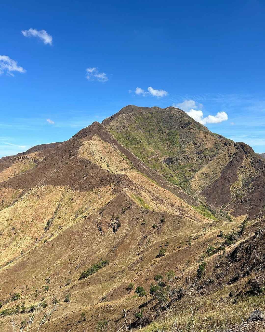
Peak 1: Mt. Balingkilat (The Gatekeeper)
This is the highest point of the trek at 1,100+ MASL and serves as the trail’s brutal “gatekeeper.” The assault starts immediately after the Cawag River crossing, pitching up into a relentless, rocky climb that we tackled in the pre-dawn darkness.
The name “Balingkilat” translates to “Mountain of Thunder,” and for good reason—it is a lightning magnet. You strictly need to summit by 5:30 AM to 6:00 AM to catch the sunrise and, more importantly, to clear the exposed peak before the heat (or afternoon thunderstorms) rolls in.
The final approach involves the famous “Knife Edge”, a narrow rocky ridge that drops sharply on both sides.
Peak 2 & 3: Mt. Bira-Bira & Mt. Naulaw (The Oven)
After descending the loose, slippery scree of Mt. Bira-Bira (also known as Nagsasa), you enter the most deceptive part of the hike: Mt. Naulaw.
This section is the “Furnace.” The trail weaves through rolling hills covered in dense cogon and talahib grass that stands over 2 meters tall.
My Personal Experience: I remember walking through Naulaw at around 9:00 AM, and it felt like the air had simply vanished. The tall grass acts as a wall, blocking every cooling breeze from the ocean, while the metallic soil cooks you from below. I had to deploy my silver trekking umbrella here just to survive the stagnant heat.
Peak 4: Mt. Dayungan (The Crux)
You will likely hit Mt. Dayungan between 11:00 AM and 12:00 PM—the hottest time of the day. This is the physical and psychological “crux” of the expedition.
Before the ascent, you’ll drop into a small depression with a seasonal river.
Critical Tip: Ask your guide immediately: “May tubig ba sa ilog?” (Is there water in the river?). If this source is dry (common in April/May), you must strictly ration your water for the next 4 hours.
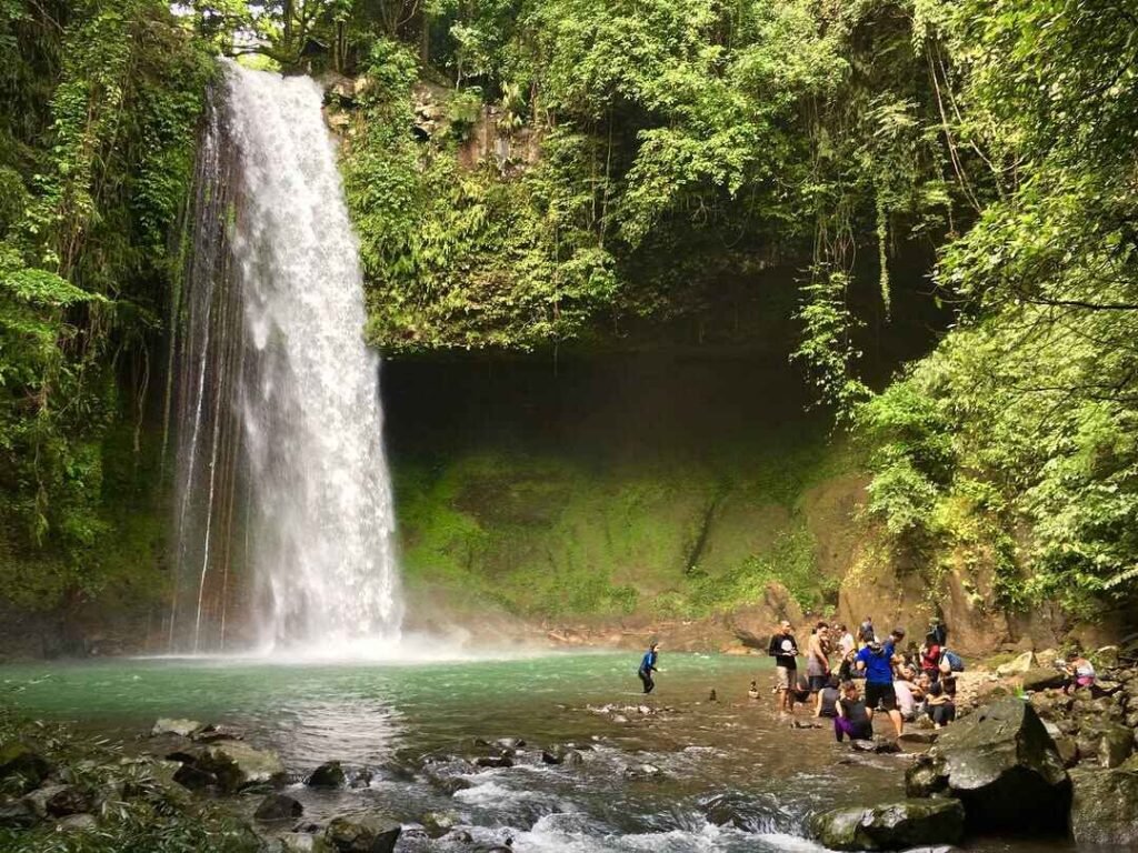
The climb up Dayungan features the “Vertical Wall,” a steep, scrambling section where you are practically clawing your way up rocks while fully exposed to the sun. It’s exhausting, but the view of Silanguin Cove from the top (approx. 935 MASL) is incredible. If you enjoy cove views, check out our Ultimate Guide to Anawangin Cove for a less strenuous adventure.
Peak 5 & 6: Mt. Cinco Picos & Mt. Redondo (The Mental Game)
By 2:00 PM, when you reach the junction for Mt. Cinco Picos (Peak 1), your legs will be screaming. The terrain here is rolling and deceptive; you’ll think you’re descending, only to be hit with another small uphill.
The final challenge is Mt. Redondo. Do not underestimate it. Even though it sits lower at 600+ MASL, the “Sawtooth” ridge is jagged and technical.
The Danger Zone: Many teams arrive here as the sun is setting. Descending Redondo in the dark is dangerous due to the sharp rocks and slick clay. Prepare your headlamps before you even start this final assault to avoid fumbling in the twilight.
Cawag Hexa Itinerary (Day Hike)
The standard Cawag Hexa itinerary requires a strict 01:30 AM start from Sitio Cawag to avoid the midday heat on the open ridges. Plan for a 16 to 18-hour trek, aiming to summit Mt. Balingkilat by 05:30 AM for sunrise. A mandatory cut-off time of 07:00 AM at Peak 1 is usually enforced by local guides to prevent heat exhaustion.
The Reality of “Island Time” vs. “Hiking Time”
This schedule is not a suggestion; it is a safety protocol. In my experience, for every hour you are late starting, you add two hours of suffering under the sun later in the day.
The timeline below assumes a moderate group pace with minimal breaks. If you are part of a fast trail running team, you might finish by 5:00 PM. However, large groups or beginners often drag this out until 10:00 PM or later.
Detailed Itinerary
| Time | Activity | Important Notes |
| 01:00 AM | Arrival at Sitio Cawag | Register at Chieftain’s Hall. Secure guides. |
| 01:30 AM | Start Trek | Cross the sandy Cawag River (flat terrain). |
| 03:00 AM | Kawayanan (Water Source) | CRITICAL: Fill all bottles here. This is the last reliable water for 5-7 hours. |
| 05:30 AM | Summit: Mt. Balingkilat | Watch sunrise. Breakfast. Strict Cut-off: 7:00 AM. |
| 06:30 AM | Start Descent to Bira-Bira | Steep, loose soil. Trekking poles are helpful here. |
| 08:00 AM | Summit: Mt. Bira-Bira | The heat begins. Open ridge trek starts. |
| 09:30 AM | Summit: Mt. Naulaw | Navigate through 2-meter tall cogon grass. |
| 10:30 AM | Water Source (River) | Early Lunch. Warning: This source may be dry in summer. |
| 11:30 AM | Assault Mt. Dayungan | The “Vertical Wall.” Steepest part of the day. |
| 12:30 PM | Summit: Mt. Dayungan | Quick photo ops. Don’t linger; it’s roasting hot. |
| 02:00 PM | Mt. Cinco Picos Junction | Rolling terrain. Fatigue usually sets in here. |
| 04:30 PM | Summit: Mt. Redondo | Final Peak. Prepare headlamps for descent. |
| 07:00 PM | Forest Line / Farmland | Exit the open ridge. Flat walk back to jump-off. |
| 08:00 PM | Finish @ Sitio Cawag | Log out. Shower at local houses (₱50). |
A Note on Pacing and “Hexits”
Pain Point Warning: The most dangerous mindset is “summit fever.” If you do not reach Mt. Balingkilat by 07:00 AM, your guide will likely advise you to abort the Hexa and take the “Hexit” (Hiking Exit) down to Nagsasa Cove or back to Cawag.
Listen to them. We have seen too many hikers collapse from heat stroke in the Naulaw-Dayungan sector because they pushed past the safe window.
Budget Breakdown
Prepare a budget of approximately ₱1,730 to ₱2,200 per person for a DIY Cawag Hexa expedition in 2026. The primary costs are roundtrip Victory Liner bus fares (₱720) and the shared chartered jeepney (₱500). Guide fees are mandatory and cost roughly ₱400 per person based on a 1:5 ratio. Bring extra cash, as there are zero ATMs in Sitio Cawag.
Estimated Expenses (Per Person)
This budget assumes you are traveling in a group of 10 to 14 hikers to maximize the shared cost of the rented jeepney. If you are going solo or in a smaller group (e.g., 2-3 pax), your transport cost per head will double or triple.
| Expense Item | Cost (Per Person) | Important Notes |
| Bus Fare (RT) | ₱720 | Victory Liner (Manila-Olongapo) via SCTEX. |
| Chartered Jeep | ₱500 | Shared cost. Standard rate is ₱2,500 – ₱3,500 per jeep. |
| Registration Fee | ₱60 | Paid upon arrival at the Chieftain’s Hall. |
| Guide Fee | ₱400 | Based on ₱2,000 group rate (Strict 1:5 ratio). |
| Shower Fee | ₱50 | Paid to local houses near the jump-off. |
| TOTAL ESTIMATE | ~₱1,730 | Excludes food, gear, and emergency funds. |
Money-Saving Tips & Hidden Costs
1. The “Last Mile” Logic: The chartered jeepney from Olongapo City to Sitio Cawag is the biggest variable. I strongly suggest joining a “joiner” group or coordinating with other hikers at the Victory Liner Terminal to split the ₱3,000+ jeep rental fee. Taking a tricycle alone will cost you ₱400-₱500 one way, blowing your budget.
2. The Guide Ratio Rule: The local association at Sitio Cawag is strict about the 1:5 Guide-to-Hiker ratio. If your group has 6 people, you will be required to hire two guides (Total ₱4,000), effectively doubling your individual guide cost. Plan your team size accordingly (multiples of 5 are best).
Pain Point Warning (Cash Only): Do not rely on GCash or ATMs once you leave Olongapo City. Signal in Sitio Cawag is spotty at best, and the local sari-sari stores often run out of change. Withdraw all the cash you need (including small bills for the ₱50 shower fee) before you hop on the jeep.
3. The “Hexit” Fund: I always advise carrying an extra ₱1,000 as an emergency fund. If you need to abort the hike at Mt. Balingkilat and descend to Nagsasa Cove, you will need to pay for a boat rental (approx. ₱500/head) to get back to Pundaquit. It’s better to have it and not need it.
6. Important Requirements & Guides
Hikers must register at the Sitio Cawag Chieftain’s Hall (Barangay Hall) prior to the hike. A local guide is mandatory due to the complex network of charcoal trails, with a strict guide-to-hiker ratio of 1:5. While no medical certificate is currently required, all participants must sign a liability waiver on-site.
Registration Protocol
Technically, Sitio Cawag accepts walk-in hikers. However, given the remote location and the need for a 1:00 AM start, I strongly recommend coordinating in advance if you are bringing a group larger than five.
You will log in at the Chieftain’s Hall (the main settlement building).
-
Registration Fee: ₱60 per person.
-
Waiver: You must sign a logbook acknowledging the risks of a 9/9 difficulty climb.
Mandatory Guide Policy
Do not attempt to “ninja” (hike without a guide) this mountain. The trail is intersected by dozens of confusing fork trails used by locals for charcoal making.
-
Ratio: 1 Guide for every 5 Hikers (Strictly enforced).
-
Rate: Approximately ₱2,000 – ₱2,500 per group for the full Hexalogy traverse.
-
Cultural Note: Most guides belong to the local Aeta indigenous community. They are incredibly strong and know every water source; treat them with respect and ensure they are well-fed during the hike.
Pain Point Warning: I have met hikers who tried to haggle the 1:5 ratio (e.g., 1 guide for 8 people) and were refused entry. The local association is firm on this for safety. If you are a group of 6, you will pay for two guides.
Local Rules & Environmental Safety
The environment here is fragile and volatile.
-
STRICT No Smoking: The ridges are covered in dry cogon grass and talahib. A single cigarette butt can trigger a massive grassfire, trapping hikers on the ridge.
-
Leave No Trace (LNT): There are no trash bins on the mountain. Pack out everything, including fruit peels (they do not decompose in the dry, rocky soil).
Coordinator Contact:
-
Chieftain / Local Coordinator: Mr. John (Subic Tourism): 0912-717-4300 or via the “Cawag Hexa Tour Guide“ Facebook Page. (Note: Mobile signal is weak in the area, so text or message well in advance).
What I Wish I Knew
Bring a silver trekking umbrella (Euroschirm or generic) to reflect the intense heat, as hats trap humidity. Prioritize electrolyte replacement using “Salt Stick” caps every hour to prevent cramps and Hyponatremia (water poisoning). Prepare mentally for the “Fake Finish” at Mt. Cinco Picos—the rolling hills are a psychological trap.
The “Silver Umbrella” Trick
Forget your bucket hat or cap. In the Cawag Hexa, the humidity is so high that wearing a hat traps heat around your head, making you feel faint.
I learned this the hard way: the only gear that actually works on the open ridges of Mt. Naulaw and Mt. Dayungan is a silver-coated trekking umbrella (brands like Euroschirm or locally available “Gross” umbrellas). The silver coating reflects the sun’s radiation, creating a portable microclimate that feels 5-10 degrees cooler than the ambient air. It allows the wind to hit your face while keeping the direct sun off your skin.
The “Salt Stick” Necessity
Pain Point Warning: I have seen strong hikers collapse here not from thirst, but from Hyponatremia.
This happens when you drink liters of plain water (to quench thirst) but fail to replace the salt you are sweating out, diluting your blood sodium levels. The result is nausea, confusion, and debilitating leg cramps.
-
My Protocol: I take one Salt Stick capsule (or any high-sodium electrolyte tablet) every 60 minutes, regardless of whether I feel thirsty.
-
The Sign: If your water sloshes in your stomach but you still feel thirsty, stop drinking water and take salt immediately.
The “Fake” Finish at Cinco Picos
The trail map says Mt. Cinco Picos is Peak 5. Your brain hears “Peak 5” and thinks, “Almost done!”
This is a lie. The traverse from the Cinco Picos junction to the base of Mt. Redondo is a series of rolling hills that feels endless. You will see a peak, climb it, and realize there are three more behind it. This section destroys morale because you expect a descent but keep getting hit with 50-meter ascents. Save a caffeine gel for this specific 2:00 PM slump—you will need the mental boost. If you want a shorter day hike with similar views, check out our guide on Mt. Mariglem.
Frequently Asked Questions (FAQ)
Water sources on the Cawag Hexa are unreliable during the dry season (March–May), so hikers should carry 4–5 liters. Mobile signal is intermittent, usually available only at high peaks like Mt. Balingkilat and Mt. Redondo. This is a 9/9 difficulty hike suitable only for experienced mountaineers, with a strict 7:00 AM cut-off time at the first summit.
Is there water available on the trail?
A: Do not rely on water sources here during summer. While there is a reliable pipe at “Kawayanan” (an hour from the start), the critical river source between Mt. Naulaw and Mt. Dayungan often dries up completely from March to May.
-
My Advice: I treat this as a “water carry” climb. I pack 4 to 5 liters of fluid (water + electrolyte mix) right from the jump-off at Sitio Cawag. Running out of water on the exposed Dayungan wall is a life-threatening scenario.
Is there mobile signal?
A: Signal is spotty and unreliable. You will likely get 4G/LTE bars (Smart/Globe) at the high points like Mt. Balingkilat and Mt. Redondo, allowing you to post that summit selfie.
-
The Dead Spots: Expect zero coverage in the deep valleys and along the lower ridges near Mt. Cinco Picos. Inform your family beforehand that you will be offline for most of the 16+ hour trek.
Can beginners hike Cawag Hexa?
A: Absolutely not. This is rated 9/9 Difficulty (Major Climb). If you have never hiked for 12 hours straight or experienced Class 4 scrambling, this trail will break you.
-
Alternative: If you are a beginner, try a “Twin Hike” of Mt. Balingkilat and Nagsasa Cove first. Do not attempt the full six-peak loop as your training ground.
What is the “Cut-off” time?
A: Local guides at Sitio Cawag strictly enforce a 7:00 AM cut-off at the summit of Mt. Balingkilat.
-
The Rule: If you haven’t reached the first peak by 7:00 AM, the heat index on the remaining five peaks will be too dangerous. You will be advised to abort the full loop.
What happens if I can’t finish? (The “Hexit”)
A: “Hexiting” is expensive and difficult.
-
Option 1 (Early Bail): If you quit at Mt. Balingkilat, you must descend the other side to Nagsasa Cove. You will then need to rent a boat (approx. ₱2,000+ per boat or ₱500/head) to get back to Pundaquit, followed by a tricycle ride back to Cawag to retrieve your things.
-
Option 2 (Point of No Return): Once you descend Mt. Bira-Bira and start the ridge to Mt. Naulaw, there are no easy exits. You are committed to walking the remaining 10+ hours to the finish line.
Conclusion: The Medal of Suffering
Completing the Cawag Hexa is the ultimate badge of honor for Philippine mountaineers. This 25-kilometer circuit demands extreme heat endurance, precise hydration planning, and mental fortitude. While the “Infernal Traverse” will strip you of your ego, the view of the West Philippine Sea from the final peak makes every blister worth it.
The Cawag Hexa is not the highest mountain in the Philippines, nor is it the most technical. But amongst the local climbing community in Zambales, it commands a unique kind of respect—fear mixed with awe.
I have climbed giants like Mt. Pulag and Mt. Apo, but the sheer, relentless heat of the Cawag ridges broke me down in a way those mountains never did. This isn’t just a hike; it is a crucible that tests how well you can function when your body is screaming for shade that simply doesn’t exist.
Final Advice for the Brave:
-
Respect the Heat: Train your body to endure thirst. Do not show up at Sitio Cawag fresh off the couch.
-
Plan Like a Pro: Secure your Victory Liner tickets and chartered jeep early. Logistics failure is the number one reason for a delayed start.
-
Check Your Ego: If you are lagging behind at Mt. Balingkilat, take the exit. The mountain will always be there next season.
When you finally stand on the summit of Mt. Redondo at 5:00 PM, battered and exhausted, looking back at the horseshoe of peaks you just conquered, you will understand. The pain is temporary, but the story of surviving the “Inferno” lasts forever.
Once you recover, consider treating yourself to a relaxing stay at Liwliwa Beach in San Felipe or a quiet boat ride at Mapanuepe Lake. You’ve earned it!
See you on the trail!