Mt. Kalisungan is a 760 MASL day hike in Calauan, Laguna, reachable from Manila in about two to three hours. The trail is 3.2–3.5 km one way, takes 2.5–3 hours to summit, and is officially rated difficulty 3/9. It looks easy on paper but punishes anyone who doesn’t prepare — bring at least 2–3 liters of water, start before 5:00 AM, and bring a guide, which is mandatory.
Mt. Kalisungan Quick Guide
| Detail | Info |
|---|---|
| Mountain | Mt. Kalisungan |
| Location | Barangay Lamot II, Calauan, Laguna |
| Province | Laguna (CALABARZON) |
| Elevation | 760 MASL |
| Difficulty | 3/9 (Minor Climb) |
| Jump-off Point | Brgy. Lamot II Barangay Hall, Calauan |
| Best Season | November to February (dry season) |
| Trek Time | 2.5–3 hrs ascent; 1.5–2 hrs descent |
| Registration | Mandatory at Barangay Hall |
| Campsite | Open grassland summit (overnight possible) |
Table of Contents
Where Is Mt. Kalisungan Located?
Mt. Kalisungan is a day hike in Barangay Lamot II, Calauan, Laguna. On paper it looks beginner-friendly: 760 MASL, difficulty 3/9, and around 4–5 hours total round trip.
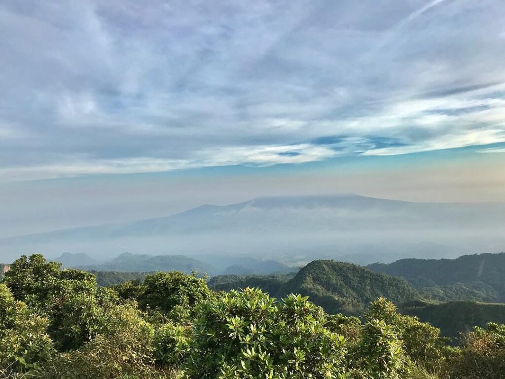
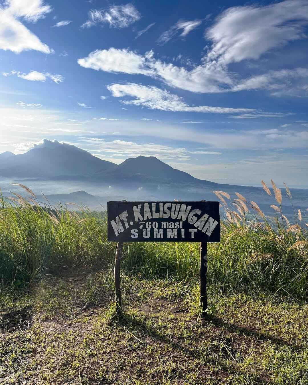
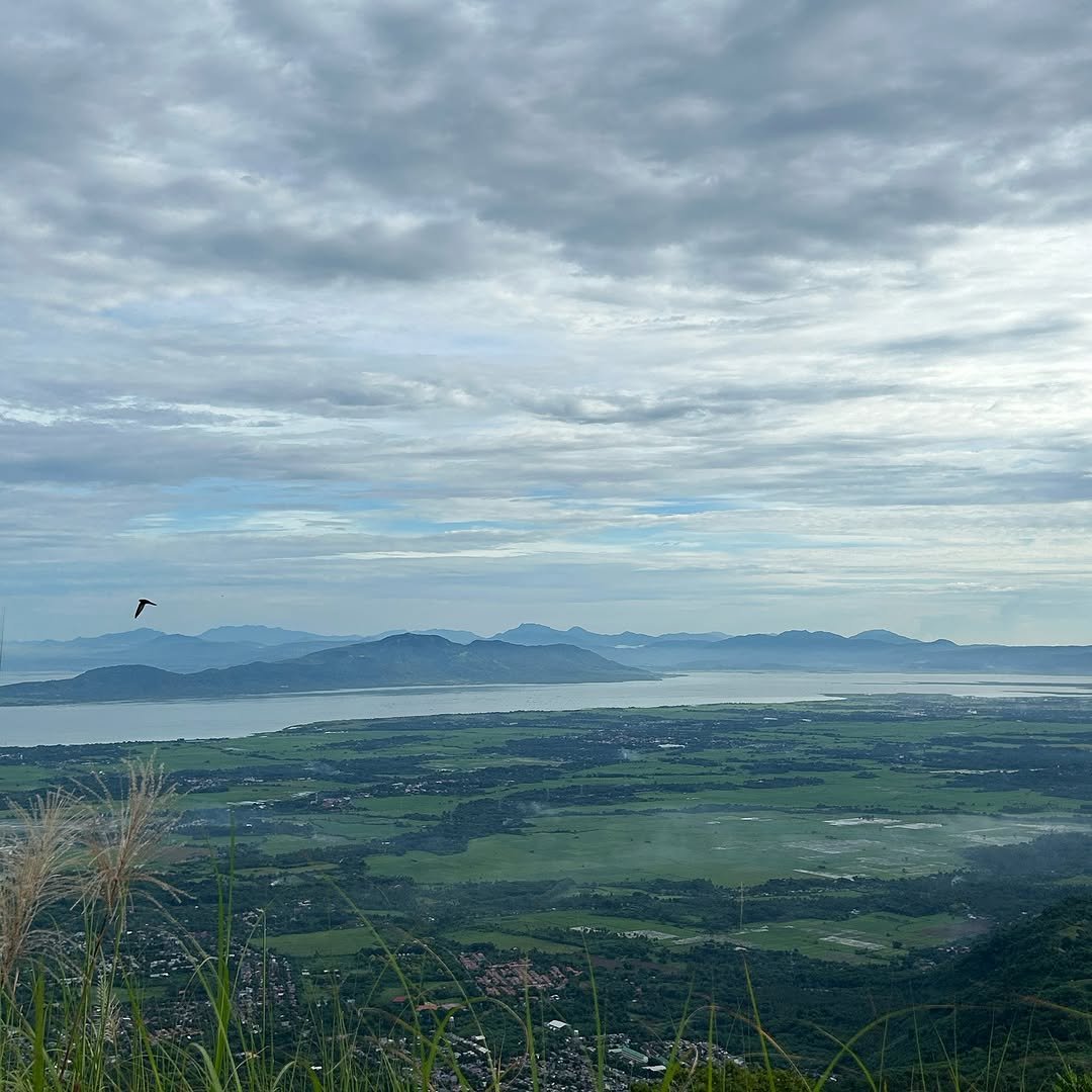
The mountain is one of the smaller mountains in the Southern Tagalog region, but it is prominent because it flanks the Banahaw Trilogy. That means from the summit you can see Mt. Banahaw, Mt. Cristobal, and Mt. Makiling all at once — a reward very few low-elevation peaks in Luzon can offer.
The mountain goes by many names. Some call it Mt. Calauan or Mt. Nagcarlan after the two towns it borders; others call it Mt. Lamot because it lies in Brgy. Lamot. Most hiking communities now use Mt. Kalisungan as the standard name.
The mountain sits at coordinates 14° 08.790N; 121° 20.683E, about 2 hours south of Manila by bus, making it one of the most accessible mountains near the capital for a quick day hike.
For a broader look at hiking options across the country, check out this guide to mountains in the Philippines.
How to Get to the Mt. Kalisungan Jump-off Point
Ride a Sta. Cruz, Laguna-bound bus from Buendia or PITX, get off at Masapang Junction / Duck Monument, then take a tricycle to Lamot II Barangay Hall.
Here is the step-by-step transport breakdown:
- Bus from Manila: Board a Jam Liner, HM Transport, Green Star, or DLTB bus bound for Sta. Cruz at LRT Buendia or PITX. Fare is roughly ₱100–₱130. Travel time is about 1.5–2 hours depending on traffic.
- Get off at Masapang Junction: This stop is also called the Duck Junction, owing to the large duck monument in the area, in the town of Victoria, Laguna.
- Tricycle to Lamot II: From Masapang Junction, charter a tricycle going to the Barangay Hall of Lamot Dos in the town of Calauan — a ride of about thirty minutes. Expect to pay ₱60–₱100 per tricycle.
I arrived at the jump-off just after 5:00 AM in June 2026, and there was already a small group of hikers registering. The barangay hall area is easy to identify — it is right beside the road, and guides are usually present in the early morning.
There is no dedicated parking area near the trailhead, but hikers driving private vehicles can park along the road near the barangay hall. Confirm parking arrangements directly with locals when you arrive.
Permits, Fees, and Guide Requirements at Mt. Kalisungan
The jump-off is at the Barangay Hall of Barangay Lamot II in Calauan, Laguna. Registration is mandatory, and hiking without a guide is prohibited. Advance reservation of a guide is strongly recommended.
The guide fee is ₱800 flat rate for up to 8 hikers, verified as of May 2026. The registration or environmental fee is ₱20–₱30 per person, paid in cash. Because barangay fees can change, verify the current rate with your guide or Lamot II before your hike.
A group of four splits the ₱800 guide fee to ₱200 per person — one of the best deals in Laguna hiking. Solo hikers pay the full ₱800, so joining a group or inviting friends makes a real difference to the budget.
The locals there are very friendly, and you can ask them to guide you up to the top of the mountain. Contact the Lamot II Barangay Hall in advance, especially on weekends, because guides can get fully booked.
DENR CALABARZON regional office page — for DENR environmental compliance rules applicable to protected areas near Calauan.
What Is the Mt. Kalisungan Trail Like?
On the actual trail, the steep slope, humid lower sections, sharp cogon grass, lack of water sources, and exposed summit heat can punish hikers who treat it like an easy walk. That sentence alone is the most useful thing I can tell you before you start.
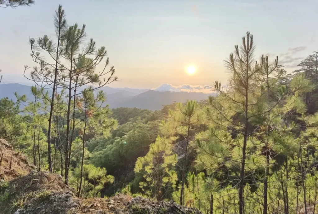
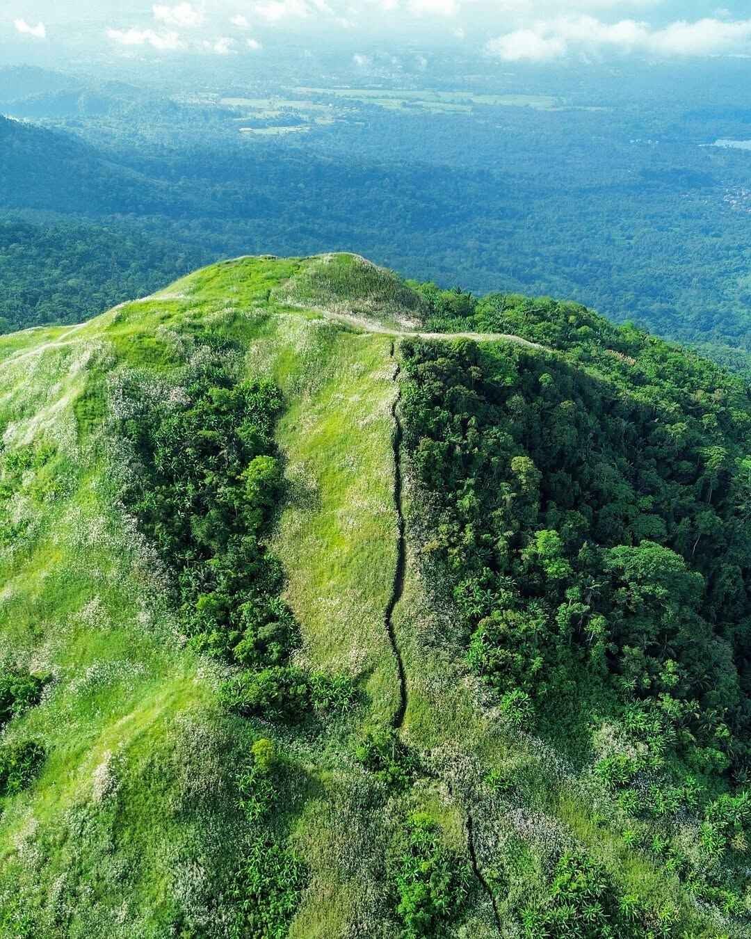
The mountain is part of the Laguna Volcanic Field, and the trail has packed earth, loose volcanic soil, rocks, organic debris, and muddy sections after rain. The route starts from the community side of Lamot II, passes through humid farm and forest sections, then climbs into a steep open grassland trail before reaching the white-cross summit.
Stage 1 — Community Farm Section (Jump-off to Forest Edge)
Difficulty: 2/5 — Flat to gently rising, wide farm paths. Good for warming up and catching your breath before the real climb.
The first part of the hike involves passing through muddy community trails where a few houses are dotted. Fruit trees like banana, mangoes, and coconuts are already present in the earlier parts of the hike.
You will observe a lot of fruits in the vicinity while trekking — banana plants, rambutan, dalandan, and coconut palm trees. You can eat bananas along the way, but make sure you have permission from the locals who are safekeeping the area.
Stage 2 — Forested Middle Section (Forest Edge to ~490 MASL)
Difficulty: 3/5 — Continuous ascent on increasingly steep forested trail. Humidity peaks here. No wind. This is where most unprepared hikers slow down hardest.
The trail starts easy at a farm, then moves onto a moderately steep trail all the way to the summit. Though forested, you’ll hardly feel any wind, making it a very uncomfortably humid hike.
At around 490+ MASL, the trail becomes flat to gradually ascending through a thick rainforest. Different species of plants surround the path, most of which obscure the route. Common burdocks are scattered along the trail, their fruits sticking to clothes.
I noticed the plant life along this section is surprisingly varied. Wild ferns cling to the soil beside the path. Wild coffee trees appear on the left side of the trail — a detail my guide pointed out unprompted. It reminded me that this mountain was once more densely forested than it looks from a distance.
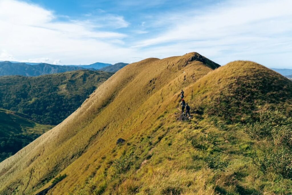
Stage 3 — Open Grassland Summit Assault (~490 MASL to Summit)
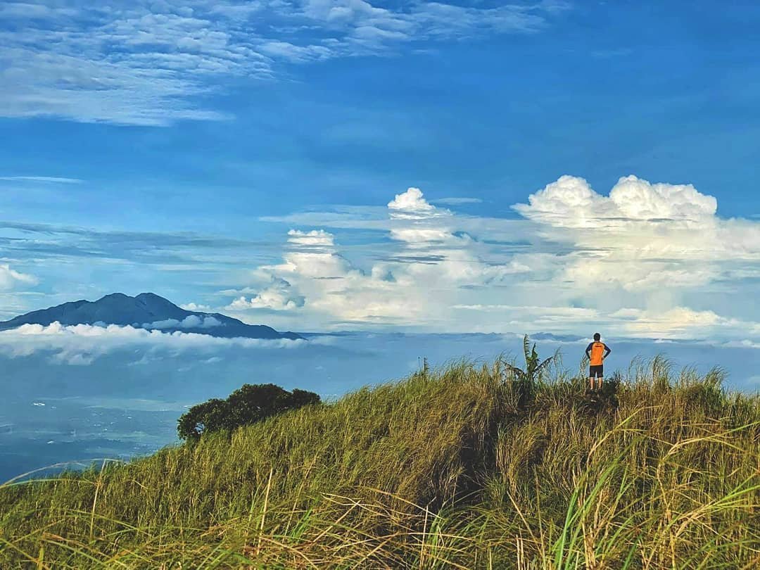
Difficulty: 4/5 — Exposed, steep, and relentless. No shade. Cogon grass edges are sharp. This section is where the mountain earns its reputation.
This final section is even steeper, composed of open grassland (predominantly cogon) and loose soil, with slopes averaging between 50 to 60 degrees of pure assault until the summit.
The hike is short, at around 3.2–3.5 km distance and roughly 564 meters of vertical displacement, but the climb is steep. The middle section has continuous inclines, and the final open grassland assault can feel brutal because it has no shade.
On the cloudy June morning I climbed, the lack of direct sun in that final grassland stretch was the only thing that made it manageable. On a clear, hot day — especially after 8:00 AM — that same section is genuinely draining. Your legs feel it most on the descent, where loose volcanic soil makes every step a negotiation.
After about 15 minutes into the climb, you will see a large mango tree beside an “ulingan” where you can rest and enjoy the first view of Laguna Lake. That mango tree is a good landmark. If you reach it and don’t feel winded, you are in decent shape for the summit.
Is Mt. Kalisungan Good for Beginners?
Mt. Kalisungan is beginner-friendly only for prepared beginners. The trail is short, but the steep incline, heat, cogon grass, and lack of water source can make it difficult for unprepared first-timers.
The official rating of 3/9 is accurate for the technical difficulty, but it does not capture how physically demanding the climb feels on a warm day. If you can walk uphill continuously for two to three hours without stopping frequently, you will be fine. If you get winded climbing four flights of stairs, do some prep first.
For a side-by-side comparison with other beginner options, this beginner-friendly hikes guide covers several accessible mountains near Manila.
Training plan before you attempt Mt. Kalisungan:
- 4 weeks out: Walk or jog 30 minutes daily. Add stair climbing — at least 10 flights, twice a day.
- 3 weeks out: Do 45-minute incline walks (treadmill at 8–10% grade or actual hills). Aim for 3 sessions per week.
- 2 weeks out: Add one longer walk of 8–10 km on flat terrain. Practice wearing your hiking shoes to break them in.
- 1 week out: Light activity only. Rest your legs. Hydrate well and sleep 7–8 hours the night before.
If you can complete a 45-minute incline walk without stopping, your legs are ready for Mt. Kalisungan.
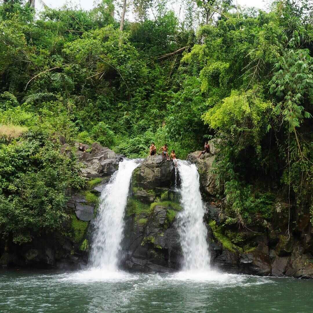
Bunga Falls Information
The unique charm of Mt. Kalisungan’s popular side trip, Bunga Falls, is that it is a twin falls — two waterfalls, almost identical, descending side by side. Named after the Bunga (betel nut) palms that used to grow in the area, this waterfall is just 600 meters away from its jump-off point and is also near the famed Underground Cemetery of Nagcarlan.
Bunga Falls stands 15 meters high and is located in Brgy. Bunga, Nagcarlan, Laguna. The walk from the parking area to the falls takes around 5–10 minutes.
Fees at Bunga Falls include a ₱5 entrance fee per person, ₱200 cottage rental, ₱30 parking fee per vehicle, and ₱40 water tube rental. Fees may have changed since that report — confirm on arrival.
There are no river crossings on the Mt. Kalisungan main trail itself. The trail is a dry ascent from start to finish. For hikers who want water immersion, Bunga Falls is the right place to go after coming down. It is roughly a 30–40 minute tricycle or jeepney ride from the Lamot II jump-off to the Nagcarlan area.
This guide to Majayjay Falls in Laguna is another waterfall option in the province worth adding to your Laguna day trip itinerary.
What Other Guides Get Wrong About Mt. Kalisungan
Most online guides describe Mt. Kalisungan as a simple beginner hike and leave it at that. Here is what they consistently miss or understate:
1. “Difficulty 3/9” does not mean easy. The 3/9 rating refers to technical complexity — it has no significant scrambles, ropes, or cliff faces. It does not rate cardiovascular effort. The near-vertical cogon grassland at the top is genuinely hard on the legs, particularly on the descent on loose soil.
2. The lack of water source is a serious hazard, not a footnote. There is no water source on the trail, so hikers must bring enough water from the start. Most guides mention this once. In practice, bringing less than 2 liters on a warm day — especially in a group moving at pace — means serious discomfort or worse.
3. The guide requirement is non-negotiable, not a suggestion. Several older blog posts say guides are “optional.” A guide is strictly mandatory for Mt. Kalisungan. Unguided hiking is prohibited. The trail has multiple forks and is genuinely easy to get lost on without a local who knows which path goes up.
4. The WWII history is deeper than most guides explain. There was a hole, at least 15–20 feet deep, dug right at the summit by strangers without the permission of the authorities. Local suspicion is that they were looking for treasure, given that Kalisungan was the Japanese soldiers’ last stand in Laguna in World War II. The white cross at the summit was not just a devotional marker — it was put there by locals after the war, a tangible act of community memory.
Best Time to Climb Mt. Kalisungan
The best months to climb Mt. Kalisungan are November through February, during the dry season (amihan).
Season-by-season breakdown:
- November–February (Dry Season / Amihan): Clear skies, cooler temperatures in the morning, and low chance of rain. Best visibility for summit views. Trail surfaces are firm. This is the safest and most comfortable window. Ideal for first-timers.
- March–May (Dry Season / Tag-init): Trails are dry but summit heat becomes intense by 8:00 AM. The exposed grassland final section is brutal under the summer sun. Start no later than 4:30 AM if you climb in this window.
- June–August (Wet Season / Habagat): It can be slippery on the way down, and rain makes conditions worse. The trail has muddy sections after rain. Trekking poles become essential. Summit views are often blocked by cloud cover.
- September–October (Typhoon Season): Avoid hiking during active weather systems. Even without a direct typhoon hit, heavy rains make the volcanic soil dangerously loose. Strong winds on the exposed grassland section are an additional hazard.
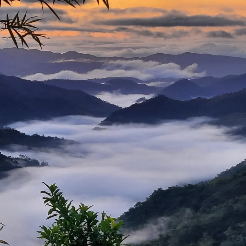
I climbed in June 2026 under cloudy skies. The cloud cover kept the summit cool, which was a lucky break. But the middle forest section was muddy in patches, and the descent required extra care on slick soil. Wet season climbing on Kalisungan works — but only with the right footwear and a slow, deliberate pace going down.
Budget Breakdown for Climbing Mt. Kalisungan
This is the Mt. Kalisungan budget for a solo hiker doing it DIY from Manila in 2026. Costs are in Philippine Pesos (PHP).
| Expense | Cost (PHP) |
|---|---|
| Bus fare (Manila to Masapang Junction, one way) | ₱100–₱130 |
| Tricycle (Masapang to Lamot II, one way) | ₱60–₱100 |
| Barangay registration / environmental fee | ₱20–₱30 |
| Guide fee (₱800 ÷ group size; full rate if solo) | ₱100–₱800 |
| Food at jump-off (e.g., hotsilog) | ₱60–₱120 |
| Water and snacks | ₱80–₱150 |
| Return tricycle + bus fare | ₱160–₱230 |
| Bunga Falls entrance (optional side trip) | ₱5–₱30 |
| Total (solo) | ₱485–₱1,460 |
| Total (group of 4, per person) | ₱280–₱680 |
Going with a barkada keeps costs low because the ₱800 guide fee is shareable up to 8 hikers. A group of eight pays only ₱100 per person for the guide alone.
I ate hotsilog at the jump-off before starting — it cost around ₱120, was freshly cooked, and was exactly the kind of filling, practical meal you want before a steep morning climb. There are small eateries and stores near the barangay hall where you can pick up food and additional water before heading out.
What to Pack for Mt. Kalisungan
| Item | Essential? |
|---|---|
| 2–3 liters of water | Yes — no water source on trail |
| Trekking poles | Strongly recommended |
| Trail running shoes or hiking boots | Yes — waterproof if wet season |
| Sun protection (cap, sunscreen, arm sleeves) | Yes — summit is fully exposed |
| Light rain jacket or poncho | Yes (June–October) |
| Snacks / energy food | Yes |
| Insect repellent | Yes — lower sections have mosquitoes |
| Headlamp or flashlight | Yes for early pre-dawn starts |
| First aid / blister kit | Yes |
| Extra dry clothes / towel | Recommended |
| Umbrella or foldable fan | Useful at exposed summit |
| Trekking gloves | Optional — cogon grass is sharp |
Trekking poles or bamboo sticks are available near the jump-off if you don’t own a pair. Ask your guide when you register.
Wear a dri-fit shirt, as you will be sweating heavily due to the humidity. Cotton stays wet and heavy — skip it entirely.


Safety Tips for Climbing Mt. Kalisungan
- Start between 4:30 AM and 5:00 AM to descend before the heat becomes punishing.
- Bring a guide without exception. There is no clear path in some sections, and it is easy to get lost.
- Hydrate before you feel thirsty. On a humid day, dehydration sets in faster than you expect. Drink 200–300 ml every 30 minutes of hiking.
- Wear closed-toe shoes with grip. The terrain is rated difficult in practice — mud and rocks and high grass demand solid footwear.
- Take the descent seriously. It is slippery on the way down. Lean back slightly, use poles, and take smaller steps on loose soil.
- Tell someone your itinerary. Share your plan and expected return time with a contact who isn’t hiking with you.
- Put insect repellent in your pocket, not your bag — the lower trail sections have mosquitoes.
- Do not pick fruit without asking. Fruit trees along the trail belong to local farming families. Asking first is both respectful and the expected norm.
Municipal tourism office of Calauan, Laguna — for current local ordinances and any updated hike regulations before your visit.

WWII History: The Japanese Last Stand on Mt. Kalisungan
Mt. Kalisungan has a special place in history as the final stand of the retreating Japanese soldiers in Laguna towards the end of World War II, in 1945–1946.
Mt. Kalisungan witnessed the twilight of Japanese occupation during WWII. Retreating Japanese soldiers took refuge in this mountain, which is situated between the towns of Calauan, Nagcarlan, and San Pablo City.
Afterwards, locals erected a white cross at the summit. It has become a local Holy Week custom to climb the mountain as part of the Stations of the Cross devotion — a tradition still practiced today.
There is local suspicion that strangers who once dug a large hole at the summit were looking for treasure, given that Kalisungan was the Japanese soldiers’ last stand in Laguna during World War II. No confirmed finds have ever been publicly documented.
Standing at that white cross in June 2026 — with cloudy skies rolling in from the direction of the Banahaw range — the weight of that history is hard to miss. The cross is modest in size, weathered, and practical. It marks a hilltop where people died and where people now rest and take photos. Both things can be true at once, and the mountain holds them without contradiction.
If you’re drawn to layered landscapes that pair natural scenery with historical depth, the broader Laguna region offers plenty. The Pagsanjan Falls and Laguna guide covers another Laguna landmark with its own colonial and wartime history. For lakes nearby, the guide to Yambo Lake in Nagcarlan is a good addition to your Laguna itinerary — it sits just a few kilometers from the Bunga Falls area.
Frequently Asked Questions About Mt. Kalisungan
1. Is Mt. Kalisungan safe for first-time hikers?
Mt. Kalisungan is beginner-friendly only for prepared beginners. The trail is short, but the steep incline, heat, cogon grass, and lack of a water source can make it difficult for unprepared first-timers. If you have done basic cardio training, start early, bring enough water, and go with a guide, it is a safe and achievable first hike.
2. How long does the Mt. Kalisungan hike take in total?
The ascent usually takes 2.5–3 hours, while the descent takes 1.5–2 hours. Most groups finish the full backtrail hike in around 4–5 hours. Add 30–45 minutes at the summit for rest and photos, and plan your day around a 5:00 AM start to be safely back down before midday heat.
3. Can I do the Mt. Kalisungan hike without a guide?
No. A guide is strictly mandatory for Mt. Kalisungan. Unguided hiking is prohibited. The trail has multiple forks, and without local knowledge, getting lost is a real risk. Book your guide in advance, especially on weekends when availability is limited.
4. What is the Mt. Kalisungan traverse option?
Mt. Kalisungan is usually climbed with Mt. Atimla for a twin day hike, and some groups have extended this into a longer route known as the “Laguna Penta” — covering Atimla, Kalisungan, Prinza, Imok, and Obabis. The Atimla–Kalisungan traverse is the most popular combination and is suited to hikers with at least a few minor climbs under their belt, not absolute first-timers.
5. What can I do after the Mt. Kalisungan hike?
For a simple day trip, pair Mt. Kalisungan with Bunga Twin Falls or a post-hike meal. For a longer Laguna itinerary, add Nagcarlan, the Seven Lakes, or Pansol hot springs. Bunga Falls is the most popular immediate add-on — it is close to the mountain and takes less than 10 minutes to reach on foot from its jump-off. After a sweaty descent, cold water is a strong argument for going.
Final Verdict: Should You Climb Mt. Kalisungan?
Mt. Kalisungan earns a 4 out of 5 for prepared beginner hikers who want a short, rewarding, historically significant day climb near Manila. Mt. Kalisungan is worth it if you want a scenic, accessible, and challenging Laguna day hike that can be done from Manila with an early start — it is short, but it is not something to under